



Hockley Heath, United Kingdom
Hockley Heath is a town of 1,604 people in England, United Kingdom.
Why visit Hockley Heath
Townapedia lists 7 museums and landmarks, 8 parks and trails, 11 places to eat and 6 places to stay in and around town.
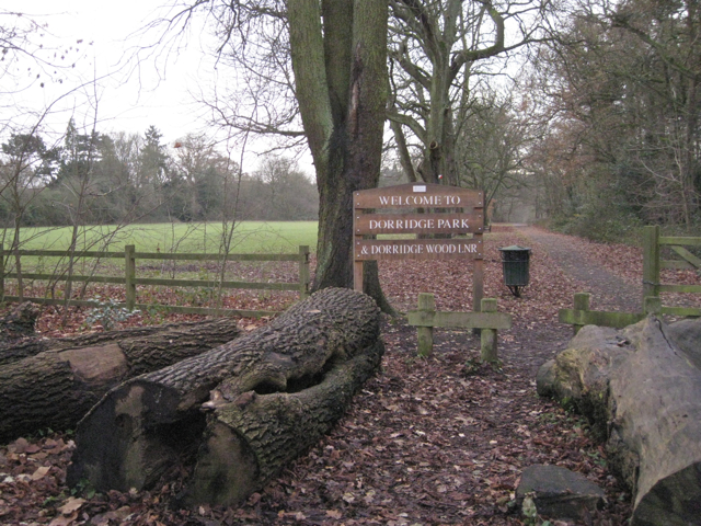
Highlights include Baddesley Clinton, Lord Archer's Obelisk, Dorridge Wood and Hillfield Park.
Weather in Hockley Heath
Forecast from MET Norway (CC BY 4.0). Full forecast
About Hockley Heath
Hockley Heath is a village and civil parish within the Metropolitan Borough of Solihull, West Midlands, England. The village is to the south of the West Midlands conurbation, 12 miles (19 km) south-east of Birmingham 5.5 miles (8.9 km) from Solihull town centre and 13 miles (21 km) north of Stratford-upon-Avon. Hockley Heath is in the Arden area and borders Warwickshire and the District of Stratford-on-Avon to the south, with some parts of the village on either side of the border. It incorporates the hamlet of Nuthurst, and has a history dating back to the year 705 AD as a wood owned by Worcester Cathedral.
From the Wikipedia article Hockley Heath (this version), under CC BY-SA 4.0.
Museums and landmarks7

Baddesley Clinton
Museum · 3.0 mi
Manor house in Warwickshire, England, UK

Packwood House
Monument and historic site · 1.4 mi
Grade I listed historic house museum in Warwick, United Kingdom
Obelisk At Umberslade Park
Monument and historic site · 0.8 mi
Obelisk in Tanworth-in-Arden, Stratford-on-Avon, Warwickshire, England, UK
Parks, trails and playgrounds8



Restaurants and cafes11
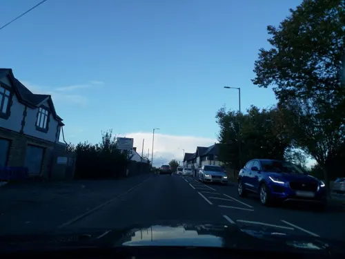
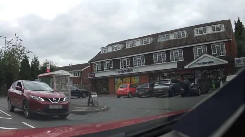
Nelson's Fish & Chips
Fast food · Fish And Chips
2366 Stratford Road, Solihull
Tu-Sa 12:00-14:00,16:30-21:00
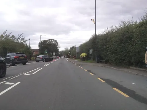
The Kam Shun
Fast food · Chinese
2362 Stratford Road, Solihull
Tu-Th,Su 17:00-22:00; Fr-Sa 17:00-22:30




Where to stay6

History
The area known as Nuthurst derives its name from the Anglo Saxon Hnuthyrste, meaning Nut Wood, a woodland that covered what is now Nuthurst, along with the hamlet of Illshaw Heath, within the larger Forest of Arden.
William Dugdale found no mention of a settlement before the reign of Henry III (1216–72) but it has been identified with the woodland 'aet Hnuthyrste' given with Shottery to Worcester Cathedral by Offa of Mercia c. 705. In 872 Werfryd, Bishop of Worcester, granted to Eanwulf, the Kings thane, land at Hnuthyrst for four lives, with reversion to the monastery of Stratford.
After the Norman Conquest the name usually appeared as Notehurst, but gradually reverted to its present and original spelling. It was part of Hampton-in-Arden, and 1/5 knight's fee in Nuthurst was held of Niel de Mowbray c. 1230 and of Roger de Mowbray in 1242. The overlordship descended in this family, being held by Roger de Mowbray at his death in 1297, and by John Mowbray, Duke of Norfolk, in 1432.
Read more of the history
The church at Nuthurst - at the time a curate chapel of Hampton in Arden - dates from at least 1216 and was dedicated to St Peter. A painting from 1820 shows the church in ruins and the only thing that remains of the church now is the graveyard and a ruined mortuary chapel dating from the 1800s. The church likely fell out of use because of the construction of the church of St Thomas in Hockley Heath, which was closer to the main road of the hamlet.
After the Mowbrays the manor passed to the Montforts, Hastings and then to the Trussells. It was Sir William Trussell, of Nuthurst who informed Edward II of his disposition in favour of his son. During the conflict against Edward II, Sir William Trussell found himself fighting the Despencer family, who were amongst their other titles, lords of the manor of nearby Solihull.
By the 18th century the manor had passed to the Archers of Umberslade Hall and the hamlet was briefly reoriented around its Umberslade area. The Umberslade estate sits on the border of Nuthurst and Tanworth in Arden and had been built for the Archer family in 1680. Lord Archer raised a 70 feet (21 m) limestone block obelisk on the estate in 1749. The reason for this is unclear, possibly to celebrate his elevation to the peerage or just, as was the fashion during that period, as a folly. However, according to local folklore it is said to mark the passing of a favoured horse, which is buried beneath it.
When local industrialist and politician, Mr G. F. Muntz became resident in Umberslade Hall he instigated the building of Umberslade Baptist church in Nuthurst and the adjoining Baptist school in 1876. The Baptist Church and Obelisk are now separated from Umberslade Hall by the M40 motorway to London, which controversially cuts through the Halls former grounds and the avenue of giant sequoiadendron which once marked the path between the two.
A country house called Nuthurst Grange was built in the settlement in 1882, once serving as home to Walter Higgs. It is now a luxury hotel and wedding venue.
The hamlet lies to the south of Hockley Heath, and borders Lapworth to the South East, and Tanworth-in-Arden to the southwest.
Hockley Heath first appeared in the 13th century. Originally the area north of Nuthurst was known as "Hocca's Hill" possibly named after a local Anglo Saxon chieftain or landowner. There are a number of other places across historic county Warwickshire with 'Hockley' in the name, including Hockley in the Jewellery Quarter, so it is possible that Hocca was an important landowner of the area. By 1280, Hockley Heath was known as "Huckeloweheath". By 1542, the single word was split and the village had become "Hokeley Heath". Due to its growth Hockley Heath eventually absorbed the settlement of Nuthurst at the south of the village.
By 1361 the Aylesbury family had settled in the area and constructed a large house called Aylesbury hall. The family were descended from the Aylesbury who represented Warwickshire in the parliament of Edward III.
Hockley Heath was originally part of the ecclesiastic parish of Tanworth-in-Arden. The village owes its first stage of independent development to the roads that cross through it, specifically the Stratford Road and Old Warwick Road, which allowed for the transportation of post through from London to Birmingham and beyond. Because of its position on the road between Oxford and Solihull with road links out towards Warwick and Worcester, Hockley Heath became a central distribution point for postal deliveries over a wide area. Because of this the village became a staging post on the old mail coach road from London to Birmingham. A large property called Hockley House was turned over to become a high end coaching inn, with another coaching inn opposite called the Nags Head, where post horses were kept. Queen Victoria stayed at Hockley House in 1837 prior to taking the throne, possibly on her way to visit nearby Packwood House. Hockley House was demolished in 1968 and housing now sits on the site. The Nags Head is still in operation as a restaurant.
By the 1760s the Aylesbury family would own Box Trees farm in the north of the village, which now gives its name to the Box Trees area between the village and the Blythe Valley Park area. By the mid 1800s further construction had been undertaken on Aylesbury Hall, rechristened Aylesbury House and remaining home to the Aylesbury family. It later became a hotel. The Aylesbury family were also prominent in neighboring Packwood, and many artefacts of the family are now in Packwood House and St Giles Church Packwood. In 2016 Aylesbury house suffered a devastating fire which destroyed much of the interior following a suspected arson attack. The property had recently been sold to a housing developer, who converted the shell of the property into luxury apartments, and built several additional properties in the surrounding grounds.
From the History section of Hockley Heath on Wikipedia, under CC BY-SA 4.0.
More about Hockley Heath
Education
Hockley Heath Primary Academy is situated on School Road, Hockley Heath, Solihull, West Midlands, B94 6RA
In 2020, The Real Schools Guide ranked Hockley Heath Primary Academy as the 9th best primary school in Solihull.
Local secondary schools include Tudor Grange Academy Solihull, Arden Academy, Henley-in-Arden School and St. Peter's Catholic School.
From the Wikipedia article Hockley Heath, under CC BY-SA 4.0.
Churches and places of worship7
Shopping2
Gas and EV charging1
Schools, colleges and libraries1
Map of Hockley Heath
43 places. The map loads OpenStreetMap tiles when you open it.
Getting there and nearby towns
Birmingham Airport (BHX) is the nearest airport with scheduled flights listed in OpenStreetMap, 7 miles away.
- Knowle 3 mi northeast, about 5 min by car
- Solihull 4 mi north, about 7 min by car
- Hampton in Arden 6 mi northeast, about 10 min by car
- Redditch 8 mi southwest, about 13 min by car
- Kenilworth 8 mi east, about 13 min by car
- Meriden 8 mi northeast, about 13 min by car
- Chelmsley Wood 9 mi north, about 14 min by car
- Birmingham 10 mi northwest, about 16 min by car
- Warwick 10 mi southeast, about 15 min by car
- Coventry 12 mi east, about 19 min by car
Drive times are estimates from straight-line distance, not routes.
Towns near Hockley Heath


Keep exploring
Local news
Headlines from INDB.
Reviews, tips and questions
Loading what members have shared...
Sources and licences
- GeoNames (CC BY 4.0): population, coordinates, regions and time zone
- Mapillary (see each image): photos
- OpenStreetMap contributors (ODbL 1.0): places, airports, map data
- Wikidata (CC0 1.0): elevation, founding date, time zone, website, landmarks and historic places
- Wikimedia Commons (see each image): photos
- Wikipedia (CC BY-SA 4.0): overview and history text
Photo credits
- Hockley Heath War Memorial 001, Argrogan, Public domain
- Hockley Heath - Harvester, David Stowell, CC BY-SA 2.0
- Hockley Heath - War Memorial at the Junction of the A3400 and the B4439 - 20210505105105, Fitzsimons, CC BY-SA 4.0
- Baddesley Clinton house north 2016, DeFacto, CC BY-SA 4.0
- Dorridge Park from Arden Drive, Robin Stott, CC BY-SA 2.0
- Knowle Church, Necrothesp at English Wikipedia, CC BY-SA 3.0
- Hockley Heath St Thomas 001, Argrogan, Public domain
- Street-level photo, southglos, CC BY-SA 4.0
- Street-level photo, southglos, CC BY-SA 4.0
- Street-level photo, southglos, CC BY-SA 4.0
- Street-level photo, southglos, CC BY-SA 4.0
- Street-level photo, laye, CC BY-SA 4.0
- Street-level photo, southglos, CC BY-SA 4.0
- Street-level photo, laye, CC BY-SA 4.0
- Street-level photo, southglos, CC BY-SA 4.0
- Street-level photo, laye, CC BY-SA 4.0
- Street-level photo, southglos, CC BY-SA 4.0

Page built November 10, 2026. Spotted a mistake? Tell us or suggest a place.