


Why visit Warwick
Townapedia lists 23 museums and landmarks, 37 parks and trails, 185 places to eat, 23 places to stay and 8 attractions in and around town.
Highlights include Castle Bridge, Loft Theatre, Market Hall Warwickshire Museum and Warwick Castle.
Weather in Warwick
Forecast from MET Norway (CC BY 4.0). Full forecast
About Warwick
Warwick is a market town, civil parish and the county town of Warwickshire in the Warwick District in England, adjacent to the River Avon. It is 9 miles (14 km) south of Coventry, and 19 miles (31 km) south-east of Birmingham. It is adjoined with Leamington Spa and Whitnash.
From the Wikipedia article Warwick (this version), under CC BY-SA 4.0.
Travel tips from other travellers: Warwick on Wikivoyage (CC BY-SA 4.0).
Photos of Warwick


Things to do8


Loft Theatre
Cinema and theater · 2.1 mi
Theatre in Leamington Spa, England

Portobello Bridge
Bridge · 1.1 mi
Road bridge in Royal Leamington Spa, Warwick, Warwickshire, England, UK

Remains Of Old Castle Bridge
Bridge
Bridge in Warwick, Warwick, Warwickshire, England, UK


Museums and landmarks23


Lord Leycester Hospital
Monument and historic site · 0.4 mi
56 High Street, Warwick

Fusilier Museum Warwick
Museum
Regimental museum in Warwick, England, United Kingdom

Royal Pump Rooms
Museum · 2.1 mi
Grade II listed building in Leamington Spa, Warwickshire, England, UK

St John's House Museum, Warwick
Museum
Museum in Warwickshire, England, UK



11 more on the map.
Parks, trails and playgrounds37


The Dell
Park · 1.8 mi
Urban park in Leamington Spa, Warwickshire, England

Victoria Park
Park · 1.6 mi
Park in Royal Leamington Spa, Warwickshire, England, UK

Royal Pump Room Gardens
Park · 2.0 mi
Open space in centre of Leamington Spa, Warwickshire, England, UK

The Jephson Gardens
Park · 2.2 mi
Park in Royal Leamington Spa, Warwickshire, England, UK



St. Nicholas' Park
Park
Park in the centre of the town of Warwick, England

25 more on the map.
Restaurants and cafes185
Boston Tea Party
Cafe · Coffee Shop · 2.0 mi
1 Clarendon Avenue, Leamington Spa
Mo-Th 08:30-16:30; Fr,Sa 08:30-17:00; Su 08:30-16:00

Tartine
Restaurant · Bistro · 2.0 mi
30 Regent Street, Leamington Spa
Mo-Th 10:00-23:00; Fr,Sa 10:00-24:00; Su,PH 11:00-16:00
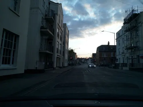
Thai Elephant
Restaurant · Thai · 1.9 mi
20 Regent Street, Leamington Spa
Mo-Su 17:30-22:30,12:00-15:00
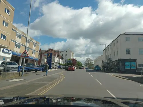
The Star and Garter
Bar and pub · 1.8 mi
Receipt places this on Warwick Street
4-6 Warwick Street, Leamington Spa
Mo-Sa 09:00-23:00; Su 09:00-21:00



Caffè Nero
Cafe · Coffee Shop
50 Brook Street, Warwick
Mo-Fr 07:00-18:30; Sa 07:00-18:00; Su 08:00-18:00
Caffè Nero
Cafe · Coffee Shop · 1.5 mi
Tachbrook Park Drive, Warwick
Mo-Fr 07:30-18:30; Sa 07:30-19:00; Su 08:00-18:00
173 more on the map.
History
Human activity on the site dates back to the Neolithic, when it appears there was a sizable settlement on the Warwick hilltop. Artifacts found include more than 30 shallow pits containing early Neolithic flints and pottery and a number of small post holes indicating rectangular buildings. These are believed to have been created by Early European Farmers, sometime between 4000 and 2351 BC. An arrowhead from the Bell Beaker culture was likewise found, believed to date from 2500 to 1700 BC.
Archaeological work on the site of Warwick School in 2017–2018 revealed the footings of a sizeable Roman barn from the 2nd century AD. Roman rule in Britain begin to break down with the Great Conspiracy in 367–368, the withdrawal of Roman troops from Britain from 383 to 406 and the barbarian raids of 408.
Warwick was continuously inhabited from the 5th century onwards. There are three alternative explanations for town's Old English name, Wæringwīc:
It may be composed of Wæring, which is a clan name or patronymic, and the suffix wīc, meaning a 'settlement characterised by extensive artisanal activity and trade';
Alternatively, it may be derived from wering, meaning a 'fortification'
Or it may reflect a 'weir,' the latter implying that the original settlement was located by a natural weir over the River Avon, possibly on the south side of the river, which offered easily cultivable land.
Read more of the history
The Anglo-Saxon Chronicle for the year 914 reports that the Anglo-Saxon Æthelflæd, Lady of the Mercians, daughter of king Alfred the Great and sister of king Edward the Elder of Wessex, built a burh or fortified dwelling there on a hilltop site overlooking the earlier riverside settlement, as one of ten to defend Mercia from the Vikings. Warwick was chosen as a site for the burh because the local outcrop of sandstone alongside the Avon provided an easily defensible position at a strategic site by the river crossing, with a good source of water and building material.
In the early 10th century, a shire was founded with Warwick as its county town. During the reign of Æthelstan (924-939) a royal mint was established at Warwick. This was one of two established in Warwickshire at the time, the other being at Tamworth. The Warwick mint continued until the mid-12th century. In 1016 the Danes invaded Mercia and burned down much of Warwick including a nunnery, which stood on the site of today's St Nicholas Church.
William the Conqueror founded Warwick Castle in 1068, while on his way to Yorkshire to deal with rebellion in the north. Building it involved pulling down four houses. The castle stood within the larger Anglo-Saxon burh and a new town wall was created close to the burh ramparts.
The prosperity of medieval Warwick rested on its status as an administrative and military centre, however it was poorly positioned from the point of view of trade, and was consequently never a commercial or industrial centre of more than local significance in medieval times. Medieval Warwick was controlled by various Earls of Warwick, mostly of the Beauchamp family. It became a walled town. It is unknown quite when the town wall was built, but references to it are found as early as the 12th century. It had mostly been demolished by the early 16th century.
Today the only remains are the east and west gatehouses, there was previously also a north gatehouse, but this was demolished. On the south side, the bridge over the Avon was said to fulfil the role of a gatehouse, and likely had a barrier. The west gate was first recorded in 1129, and had a chapel of St James above it, which was reconstructed in the 14th century and extensively restored in 1863–1865. The east gate was rebuilt in the 15th century with the Chapel of St Peter above it. It was rebuilt again in 1788 and was once used as part of The King's High School, but is now a holiday home.
The town's Priory was founded in around 1119 by Henry de Beaumont, the first Earl of Warwick. It was later destroyed during the Dissolution of the Monasteries in 1536, it stood on the site of the current Priory Park. Henry de Beaumont also founded the Hospital of St John near the east town gate. It is now the site of the 17th century St John's House. Relatively few medieval buildings survive in Warwick, however one of the most notable examples is the Lord Leycester Hospital on the High Street, whose oldest parts date from 1383. Warwick was not incorporated as a borough until 1545.
During the English Civil War, the town and castle were garrisoned for Parliament under Sir Edward Peyto. In 1642 the castle underwent a two-week siege by the Royalists commanded by the Earl of Northampton, however, the besiegers lacked any cannons powerful enough to damage the castle. The siege collapsed when, on hearing of the approach of the Earl of Essex to Southam, Lord Northampton marched his force away towards Worcester. Major John Bridges was appointed governor of the castle in 1643, and a garrison was maintained there with artillery and other stores until 1659, which at its height in 1645 consisted of 302 soldiers.
The mid-17th century saw the founding of Castle Hill Baptist Church, one of the oldest Baptist churches in the world.
Much of the medieval town centre was destroyed in the Great Fire of Warwick on 5 September 1694, which, within five hours destroyed 460 buildings and left 250 families homeless. Thus most of the town-centre buildings are of late 17th and early 18th-century origin, although some medieval timber-framed buildings survive, especially around the edges of the town centre.
From the History section of Warwick on Wikipedia, under CC BY-SA 4.0.
More about Warwick
Geography
The 17th-century antiquarian William Dugdale wrote that Warwick was "standing upon a rocky ascent from every side, and in a dry and fertile soil, having... rich and pleasant meadows on the south part... and... woodland on the north." Two factors have affected Warwick's built environment: the Great Fire of 1694 and the lack of industrialisation. In the 19th century, the widespread industrialisation of England largely passed Warwick by. One reason was that the town did not lie on important roads and the River Avon was not navigable as far as Warwick.
Suburbs of Warwick include Bridge End, Cliff Hill, Emscote, Woodloes Park, Forbes, Myton (connecting Warwick with Leamington Spa), Packmores, The Cape, The Percy, Warwick Gates, Chase Meadow and Myton Green. Warwick Gates is a housing estate and business park in Heathcote, south-east Warwick, which was built in the late 1990s. Although separated from Warwick town centre by open fields, Warwick Gates falls within the Warwick South and Bishops Tachbrook parish.
Economy
Due to its proximity to north–south and east–west motorway routes, many companies have a head office in the town. Since November 2004, National Grid UK has had its United Kingdom headquarters on the Warwick Technology Park south of the town near the A452 road. Phillips 66 and their petrol station group, JET, have an office on the Technology Park. Other businesses with head offices here include lingerie company Bravissimo. IBM, Wolseley UK and Volvo Group UK have bases on the Wedgnock Industrial Estate in the north of the town, near to the A46 trunk road. Other companies with regional headquarters in Warwick include Bridgestone, Calor Gas, Kantar and Delphi Automotive. In recent years several high-profile national and international companies have set up large office complexes in and around Warwick, notably National Grid and IBM. There is also an out-of-town retail park called Leamington Shopping Park (formerly The Shires Retail Park).
Arts and culture
Warwick hosts several annual festivals, including: the spoken word; classical and contemporary music; a folk festival; and a Victorian Evening, held in late November or early December. St. Mary's Church hosts a series of Early Music concerts, and the Bridge House Theatre hosts the Music-in-Round concerts. Warwick Chamber of Trade helps to promote the town for visitors, residents and businesses. The town is also famous for Warwick Castle, whose construction began in 1068. The town centre is also known for its mixture of Tudor and 17th-century buildings.
Education
Secondary schools in Warwick include Warwick School, an independent day and boarding school for boys. The King's High School For Girls is also independent, but Myton School and Aylesford School are state-run co-educational schools. Campion School and Trinity Catholic School in Leamington include parts of Warwick in their catchment areas. Warwick Preparatory School is an independent day school and nursery for boys aged 3–7 and girls 3–11. It is part of the Warwick Independent Schools Foundation, together with King's High School and Warwick School.
Warwick School is an independent school for boys which claims to be the oldest boys' school in England. The actual foundation date is unknown, although 914 has sometimes been quoted. For some years the school claimed that King Edward the Confessor (c. 1004–1066) chartered it, although there is no clear evidence for this and King Henry VIII re-founded it in 1545. Whatever the case, there has undoubtedly been a grammar school in the town of Warwick since before the Norman Conquest. Its present successor has occupied its current site south of the River Avon since 1879.
The nearest university is the University of Warwick, which is named after the county of Warwickshire, rather than the town, and is in fact situated several miles north of Warwick on the southern outskirts of Coventry.
From the Wikipedia article Warwick, under CC BY-SA 4.0.
Notable people from Warwick
 Walter Savage LandorEnglish writer, poet, and activist (1775–1864)Photo: J. Brown, Public domain
 Jessica CarterEnglish association football player (born 1997)Photo: Bryan Berlin, CC BY-SA 4.0
 Jordan KingBritish racing driverPhoto: Dutch Photo Agency, CC BY-SA 4.0
 Derek GardnerBritish designer (1931–2011)Photo: JP. Lelievre, CC BY-SA 4.0
 June TaborBritish singerPhoto: JuneTaborAndMartinSimpson.jpg :..., CC BY 2.0
 Lucy CollettEnglish glamour modelPhoto: See Li, CC BY 2.0
 John de Beauchamp, 1st Baron BeauchampEnglish nobleman (1316-1360)Photo: Wenceslaus Hollar, Public domain
 William LambeEnglish physician, and advocate for veganismPhoto: Unknown author, CC BY 4.0
- John Richard HicksBritish economist (1904-1989)
- William GreeneGovernor of the state of Rhode Island (1731-1809)
- George EvansAustralian explorer (1780–1852)
- Tommy ArkesdenEnglish footballer (1878-1921)
Born in Warwick, according to Wikidata (CC0). Each name links to its Wikipedia article.
Where to stay23
Churches and places of worship35
Shopping35
Gas and EV charging9
Schools, colleges and libraries28
St Patrick's Catholic Primary School
School · Roman Catholic · 2.0 mi
Cashmore Avenue, Leamington Spa
Healthcare16
Woodford Medical Aesthetics
Clinic and pharmacy · 2.0 mi
Waterloo Place, Leamington Spa
Map of Warwick
250 places. The map loads OpenStreetMap tiles when you open it.
Getting there and nearby towns
Birmingham Airport (BHX) is the nearest airport with scheduled flights listed in OpenStreetMap, 14 miles away.
- Kenilworth 5 mi north, about 7 min by car
- Stratford-upon-Avon 8 mi southwest, about 13 min by car
- Coventry 9 mi north, about 15 min by car
- Knowle 9 mi northwest, about 15 min by car
- Solihull 12 mi northwest, about 20 min by car
- Bedworth 14 mi north, about 23 min by car
- Chelmsley Wood 15 mi northwest, about 24 min by car
- Daventry 18 mi east, about 29 min by car
- Hartshill 18 mi north, about 30 min by car
- Birmingham 19 mi northwest, about 31 min by car
Drive times are estimates from straight-line distance, not routes.
Towns near Warwick


Keep exploring
Local news
Headlines from INDB.
Reviews, tips and questions
Loading what members have shared...
Sources and licences
- GeoNames (CC BY 4.0): population, coordinates, regions and time zone
- Mapillary (see each image): photos
- OpenStreetMap contributors (ODbL 1.0): places, airports, map data
- Wikidata (CC0 1.0): elevation, founding date, time zone, website, landmarks and historic places
- Wikimedia Commons (see each image): photos
- Wikipedia (CC BY-SA 4.0): overview and history text
Photo credits
- Warwick overview from the castle, David Alonso Pérez, CC BY-SA 2.0
- Smith St Warwick CV34, kitmasterbloke, CC BY 2.0
- 56 58, Smith Street, Warwick, J An, CC BY-SA 4.0
- 60, 62 Smith Street, Warwick, J An, CC BY-SA 4.0
- 76 Smith St, Warwick 1, Fitzsimons, CC BY-SA 4.0
- 55 Smith Street, Warwick, Fitzsimons, CC BY-SA 4.0
- 56,58 Smith St, Warwick, Fitzsimons, CC BY-SA 4.0
- 76 Smith St, Warwick 2, Fitzsimons, CC BY-SA 4.0
- 54 Smith St, Warwick, Fitzsimons, CC BY-SA 4.0
- 57 Smith St, Warwick 2, Fitzsimons, CC BY-SA 4.0
- 57 Smith St, Warwick 1, Fitzsimons, CC BY-SA 4.0
- Loft Theatre, Cls14 ( talk ), CC BY-SA 3.0
- Old Castle Bridge, Warwick, DeFacto, CC BY-SA 4.0
- Royal Spa Centre, Royal Leamington Spa, J An, CC BY-SA 4.0
- Warwick Castle May 2016, DeFacto, CC BY-SA 4.0
- St John's museum entrance 2, Fitzsimons, CC BY-SA 3.0
- Royal Pump Rooms and Baths, Leamington Spa, David Dixon, 4093142, David Dixon, CC BY-SA 2.0
- Jephson Memorial, Charlie629, CC BY 3.0
- All Saints' Church Leamington Spa, from the churchyard 2012, Pauldecates, CC BY-SA 3.0
- St John's House Museum, DeFacto, CC BY-SA 4.0
- PumpRoomGardens, David Stowell, CC BY-SA 2.0
- Guy's Cliffe House, Warwickshire depicted by Alexander Francis Lydon, Alexander Francis Lydon (1836-1917), Public domain
- Gurdwara Sahib Leamington & Warwick, Rwendland, CC BY-SA 3.0
- Lord Leycester Hospital -Warwick3, Misterweiss at English Wikipedia, Public domain
- St. Mary Immaculate Roman Catholic Church, Warwick, SteveBWalton, CC BY-SA 3.0
- St Michaels Hospital -from St Michaels Rd -18a08, Snowmanradio, CC BY-SA 4.0
- Warwick hospital lakin rd 4u07, Snowmanradio, CC BY-SA 3.0
- Nave, facing West, St Mark's Church, Leamington Spa, Mum's taxi, CC BY-SA 3.0
- Church Budbrooke, Fitzsimons, CC BY-SA 4.0
- New Bowling Green, Warwick, Fitzsimons, CC BY-SA 4.0
- Blackdown Hill, the site of Gaveston's Cross, Robert S Remie, CC BY-SA 4.0
- TheDellLeamington, Cls14 at English Wikipedia, CC BY-SA 3.0
- Gurdwara Sahib Leamington & Warwick, front, Rwendland, CC BY-SA 4.0
- Priory Park, Warwick, Robin Stott, CC BY-SA 2.0
- Warwickshire Museum, Elliott Brown derivative work: MrPanyGoff, CC BY 2.0
- Castle Bridge southern approach, Fitzsimons, CC BY-SA 3.0
- Portobello Bridge north side, Fitzsimons, CC BY-SA 4.0
- Hill Close Gardens Nov 2016 p03, RobJN, CC0
- Victoria Park Commonwealth Games, Sirhissofloxley, CC BY-SA 4.0
- Guy's Cliffe Walled Garden (41739291320), Amanda Slater from Coventry, West Midlands, UK, CC BY-SA 2.0
- The Mill Garden Warwick, Colin Craig, CC BY-SA 2.0
- Street-level photo, southglos, CC BY-SA 4.0
- Street-level photo, laye, CC BY-SA 4.0
- Street-level photo, milkfloat, CC BY-SA 4.0
- Street-level photo, laye, CC BY-SA 4.0
- Street-level photo, laye, CC BY-SA 4.0
- Street-level photo, laye, CC BY-SA 4.0
- Street-level photo, laye, CC BY-SA 4.0
- Street-level photo, laye, CC BY-SA 4.0
- Street-level photo, laye, CC BY-SA 4.0
- Street-level photo, laye, CC BY-SA 4.0
- Street-level photo, laye, CC BY-SA 4.0
- Street-level photo, milkfloat, CC BY-SA 4.0
- Street-level photo, laye, CC BY-SA 4.0
- Street-level photo, rob, CC BY-SA 4.0
- Street-level photo, milkfloat, CC BY-SA 4.0
- Street-level photo, laye, CC BY-SA 4.0
- Street-level photo, milkfloat, CC BY-SA 4.0
- Street-level photo, milkfloat, CC BY-SA 4.0
- Street-level photo, laye, CC BY-SA 4.0
- Street-level photo, laye, CC BY-SA 4.0
- Street-level photo, laye, CC BY-SA 4.0
- Street-level photo, laye, CC BY-SA 4.0
- Street-level photo, ebel, CC BY-SA 4.0
- Street-level photo, laye, CC BY-SA 4.0
- Street-level photo, adam2, CC BY-SA 4.0
- Street-level photo, laye, CC BY-SA 4.0


Page built November 10, 2026. Spotted a mistake? Tell us or suggest a place.