
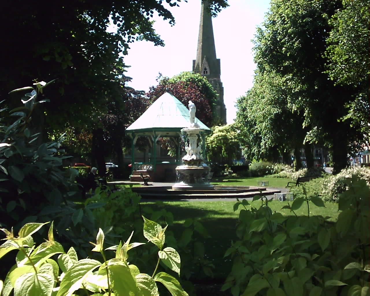


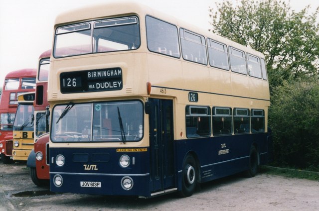
Redditch, United Kingdom
Redditch is a town of 87,847 people in England, United Kingdom, founded in April 10, 1964.
Why visit Redditch
Townapedia lists 19 museums and landmarks, 30 parks and trails, 153 places to eat, 10 places to stay and 7 attractions in and around town.
Highlights include Palace Theatre, Artrix, Forge Mill Needle Museum and Avoncroft Museum of Historic Buildings.
Weather in Redditch
Forecast from MET Norway (CC BY 4.0). Full forecast
About Redditch
Redditch is a town and non-metropolitan district with borough status in Worcestershire, England. In 2021, the town had a population of 81,637 and the district had a population of 87,037. In the 1800s, it became a centre for the needle and fishing tackle industry; by the end of the century,
From the Wikipedia article Redditch (this version), under CC BY-SA 4.0.
Travel tips from other travellers: Redditch on Wikivoyage (CC BY-SA 4.0).
Things to do7

Palace Theatre
Cinema and theater
Theatre in Redditch, Worcestershire, England, UK
Alcester Street, Redditch

Artrix
Cinema and theater · 5.0 mi
Arts centre in Bromsgrove, England



Museums and landmarks19

Forge Mill Needle Museum
Museum · 0.8 mi
Industry museum in Redditch, England
Mo-Su 10:00-16:00

Avoncroft Museum of Historic Buildings
Museum · 5.4 mi
Local independent museum in Bromsgrove, England, United Kingdom

Coughton Court
Museum · 5.2 mi
Grade I listed historic house museum in Stratford-on-Avon, United Kingdom


The Transport Museum, Wythall
Museum · 5.1 mi
Transport museum in Worcestershire, England, United Kingdom


Derelict Royal Observer Corps Monitoring Post - Redditch
Monument and historic site · 0.9 mi

7 more on the map.
Parks, trails and playgrounds30


Lickey Hills Country Park
Park · 5.6 mi
Country park in northern Worcestershire, England





18 more on the map.
Restaurants and cafes153





141 more on the map.
History
The first recorded mention of Redditch (La Rededich, thought to be a reference to the red clay of the nearby River Arrow) is in 1348, the year of the outbreak of the Black Death. During the Middle Ages, it became a centre of needle-making and later prominent industries were fish-hooks, fishing tackle, motorcycles and springs, the last of which was notably undertaken by Herbert Terry and Sons. Redditch was designated a new town on 10 April 1964, and the population increased dramatically from 32,000 in 1964 to over 70,000 by 1984. Housing developments such as Church Hill, Matchborough, Winyates, Greenlands, and Woodrow were created to accommodate a large overspill from the industrially expanding Birmingham. Redditch was built as a "flagship" town using new methods and new town planning: all the main roads (mostly new dual carriageways as well as a ring road for the town centre) were banked to reduce noise to the new housing estates, and the whole of Redditch was landscaped. Historically, much of present-day Redditch was located within Warwickshire, but it is now in its entirety administered as a part of Worcestershire.
Read more of the history
By the 21st century, needle-making and other traditional industries had been replaced by modern light industry and services, with Redditch also functioning as a dormitory town for Birmingham. The automotive retailer Halfords and engineering company GKN both have their headquarters in Redditch. Manufacturer of precious metal contacts, Samuel Taylor Ltd, has manufacturing plants within the town. Following the redevelopment of the flagship Kingfisher Shopping Centre in 2002, Redditch is undergoing an economic and cultural renaissance.
The town is home to several historical sites. The Forge Mill Needle Museum and the ruins of Bordesley Abbey are located in the north of the town, and the remains of a medieval moated settlement called Moons Moat are within the Church Hill estate.
From the History section of Redditch on Wikipedia, under CC BY-SA 4.0.
More about Redditch
Geography
Redditch is south of the West Midlands urban area. It is north of Evesham on the A435, which skirts it to the east. The main access routes are the A441 via junction 2 of the M42 Motorway, the A435 from junction 3 of the M42 and the A448 via junctions 4 or 5 of the M5. The Roman Road known as Icknield Street is prominent, running north to south through the eastern side of the town.
The Borough of Redditch is divided into several districts. To the south and east of the town are "New Town Districts" built in the 1970s and 1980s. To the west of the Borough are older "Former Village Districts" that dominate the south and west, such as Webheath and Headless Cross.
Since 2011, Redditch has participated in the Greater Birmingham & Solihull Local Enterprise Partnership along with neighbouring authorities Birmingham, Bromsgrove, Cannock Chase, East Staffordshire, Lichfield, Solihull, Tamworth and Wyre Forest.
Education
Redditch is one of the few areas of the country where the three-tier system of first, middle and high schools still exists. Students attend first school from the age of four, middle school from the age of nine and high school at the age of 13. Other areas of Worcestershire adopted this system at the same time as Redditch (in the 1970s), but many have reverted to the traditional 5–7 infant, 7–11 junior and 11-16/18 secondary schools.
Redditch currently has four high schools (RSA Academy Arrow Vale, Saint Augustine's Catholic High School, Tudor Grange Academy, Trinity High School) and six middle schools.
Heart of Worcestershire College (often referred to locally as "HOW College") is a large general further education college: one of its four campuses is in central Redditch; the other three are in Bromsgrove, Worcester and Malvern. The closest university is the University of Birmingham, 12.5 miles (20 km) to the north.
From the Wikipedia article Redditch, under CC BY-SA 4.0.
Notable people from Redditch
 Harry StylesEnglish singer, songwriter and actorPhoto: Raph_PH, CC BY 2.0
 Charles DanceEnglish actor (born 1946)Photo: Raph_PH, CC BY 4.0
 Russell BrookesBritish rally driver (1945-2019)Photo: Matthew Spencer - enormospenner, CC BY 2.0
 Hayley SimmondsBritish bicycle racerPhoto: Jérémy-Günther-Heinz Jähnick, CC BY-SA 3.0
 Deborah BonhamEnglish singer-songwriter and musicianPhoto: Brian Marks, CC BY 2.0
 Charlotte GilmartinBritish short track speed skaterPhoto: Voltmetro, CC BY-SA 4.0
 Claire CashmoreParalympic triathlete and swimmer (1988-)Photo: Allen Watkin, CC BY-SA 2.0
 Lee PageBritish snooker playerPhoto: Benutzer:Bill da Flute, CC BY-SA 3.0
- John BonhamEnglish drummer (1948–1980)
- Matthew SmithWelsh association football player (born 1999)
- Jody CraddockEnglish footballer (born 1975)
- Joe LolleyEnglish association football player (born 1992)
Born in Redditch, according to Wikidata (CC0). Each name links to its Wikipedia article.
Where to stay10
Churches and places of worship48
The Church of the Nativity of the Blessed Virgin Mary Studley
Church · Anglican · 3.6 mi
Roman Catholic Church of Saint Peter Paul and Elizabeth
Church · 5.3 mi
Shopping26
Gas and EV charging13
Schools, colleges and libraries49
St Augustine's Catholic High School & Sixth Form Centre
School · Roman Catholic · 2.2 mi
Stonepits Lane, Redditch
Healthcare11
Knights Pharmacy - Headless Cross
Clinic and pharmacy · 1.7 mi
434 Evesham Road, Redditch
Map of Redditch
250 places. The map loads OpenStreetMap tiles when you open it.
Getting there and nearby towns
Birmingham Airport (BHX) is the nearest airport with scheduled flights listed in OpenStreetMap, 13 miles away.
- Droitwich 9 mi west, about 15 min by car
- Bartley Green 9 mi north, about 15 min by car
- Solihull 10 mi northeast, about 16 min by car
- Knowle 10 mi northeast, about 17 min by car
- Birmingham 12 mi north, about 20 min by car
- Smethwick 13 mi north, about 21 min by car
- Stourbridge 13 mi northwest, about 21 min by car
- Stratford-upon-Avon 13 mi southeast, about 21 min by car
- Worcester 14 mi southwest, about 23 min by car
- Dudley 15 mi northwest, about 23 min by car
Drive times are estimates from straight-line distance, not routes.
Towns near Redditch


Keep exploring
Local news
Headlines from INDB.
Reviews, tips and questions
Loading what members have shared...
Sources and licences
- GeoNames (CC BY 4.0): population, coordinates, regions and time zone
- Mapillary (see each image): photos
- OpenStreetMap contributors (ODbL 1.0): places, airports, map data
- Wikidata (CC0 1.0): elevation, founding date, time zone, website, landmarks and historic places
- Wikimedia Commons (see each image): photos
- Wikipedia (CC BY-SA 4.0): overview and history text
Photo credits
- Redditch 015, Alan Marriott, CC BY 2.5
- Palace Theatre, Redditch, Elliott Brown, CC BY 2.0
- Artrix Bromsgrove 02, PicturePrince, CC BY-SA 4.0
- Avoncroft Windmill, Mike Goodwin, CC BY-SA 2.0
- Coughton Court, Unknown author, CC BY-SA 3.0
- Leyland fleetliner, John Carver, CC BY-SA 2.0
- ArrowValleyLake WaterTower, No machine-readable author provided. Fontles~commonswiki assumed (based on copyright claims)., CC BY-SA 2.5
- Lickey Hills, Phil Champion, CC BY-SA 2.0
- Church of St John the Baptist, Bromsgrove, Philip Halling, CC BY-SA 2.0
- Church of St Michael Cofton Hackett, Kenlloyd100, CC BY-SA 3.0
- Spernall St Leonards 012, Argrogan, Public domain
- Bordesley Abbey excavation, Penny Mayes, CC BY-SA 2.0
- Hewell, User:Leonig_Mig, CC BY-SA 3.0
- St Leonard's Beoley (32690142132), Amanda Slater from Coventry, West Midlands, UK, CC BY-SA 2.0
- Studley - panoramio (30), Tanya Dedyukhina, CC BY 3.0
- At Sambourne 2025 009 - Green Dragon, Photograph by Mike Peel ( www.mikepeel.net )., CC BY-SA 4.0
- Front Norgrove Court, Bowie18763, CC BY-SA 4.0
- Forge Mill, Needle Museum (34153709454), Amanda Slater from Coventry, West Midlands, UK, CC BY-SA 2.0
- Pope Benedict in Cofton Park, Woody, CC BY-SA 3.0
- The Green Man Walking - Sanders Park, Bromsgrove (28789797006), Elliott Brown from Birmingham, United Kingdom, CC BY-SA 2.0
- Street-level photo, southglos, CC BY-SA 4.0
- Street-level photo, southglos, CC BY-SA 4.0
- Street-level photo, southglos, CC BY-SA 4.0
- Street-level photo, southglos, CC BY-SA 4.0
- Street-level photo, mappo2, CC BY-SA 4.0
- Street-level photo, adam2, CC BY-SA 4.0
- Street-level photo, southglos, CC BY-SA 4.0
- Street-level photo, mappo2, CC BY-SA 4.0
- Street-level photo, bigfatfrog67, CC BY-SA 4.0
- Street-level photo, southglos, CC BY-SA 4.0
- Street-level photo, southglos, CC BY-SA 4.0
- Street-level photo, southglos, CC BY-SA 4.0
- Street-level photo, mappo2, CC BY-SA 4.0


Page built November 10, 2026. Spotted a mistake? Tell us or suggest a place.