


Hook Norton, United Kingdom
Hook Norton is a town of 1,919 people in England, United Kingdom.
Why visit Hook Norton
Townapedia lists 5 museums and landmarks, 8 parks and trails, 8 places to eat and 1 attraction in and around town.
Highlights include The Theatre Chipping Norton, Chipping Norton Museum, Rollright Stones and Heythrop Zoological Gardens.
Weather in Hook Norton
Forecast from MET Norway (CC BY 4.0). Full forecast
About Hook Norton
Hook Norton is a village and civil parish in Oxfordshire, England. It lies 4+1⁄2 miles (7 km) northeast of Chipping Norton, close to the Cotswold Hills. The 2011 Census recorded the parish's population as 2,117. The village is formed of four neighbourhoods: East End, Scotland End (in the west), Down End (in the centre) and Southrop (in the south).
From the Wikipedia article Hook Norton (this version), under CC BY-SA 4.0.
Things to do1
The Theatre Chipping Norton
Cinema and theater · 4.5 mi
Arts centre (theatre, cinema, gallery and music venue) in Chipping Norton, Oxfordshire, England
Museums and landmarks5
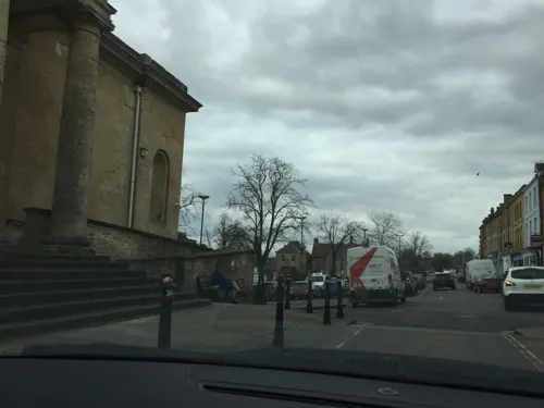
Chipping Norton Museum
Museum · 4.6 mi
Chipping Norton, Oxfordshire, England

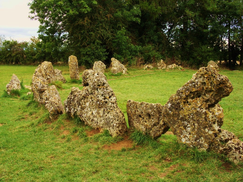
Rollright Stones
Monument and historic site · 4.0 mi
Neolithic stone complex in Oxfordshire, England, UK

Parks, trails and playgrounds8




Restaurants and cafes8




History
The Anglo-Saxon Chronicle records that a Viking army from Northampton raided the Hook Norton area in 913. The village had a parish church by 922. The Domesday Book records that in 1086 Hook Norton had 76 villagers and two mills. Leland noted c.1540 the existence of a deer park at Hook Norton which was owned by the king, Henry VIII. The park had previously belonged to a Chaucer and Charles Brandon, 1st Duke of Suffolk. By the 1800s it was "an ancient park, long-disused and forgotten."
Hook Norton had a clockmaker, Thomas Webb, who maintained the turret clock at St. Giles' parish church, Wigginton from 1788 until 1834. Webb was succeeded in his trade at Hook Norton by John Paine, who maintained the clock at Wigginton from 1835 until 1855. In 1840 Paine built a new turret clock for St. George's parish church, Brailes, Warwickshire.
Read more of the history
The former Banbury and Cheltenham Direct Railway, part of the Great Western Railway, served Hook Norton with a railway station at East End. British Railways closed the station in 1951 and closed the railway to all traffic in 1964. Tall stone pillars which supported two B&CDR viaducts can be seen in the valley to the south-east of the village. Near Hook Norton there were several ironstone quarries, evidence of which can still be seen. The Brymbo Ironworks, opened in 1899, had its own narrow gauge railway and was connected to the B&CDR at Council Hill Sidings, 3⁄4 mile (1.2 km) east of Hook Norton station. The Brymbo Ironworks closed in 1946 and was dismantled in 1948.
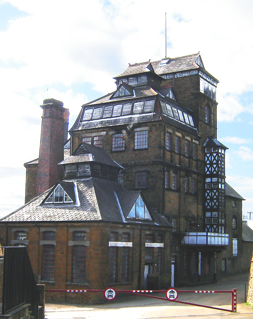
Hook Norton Brewery was founded in 1849 and is an important architectural example of a Victorian tower brewery, as well as containing a working Victorian steam engine. The village's 18th century hand-pumped fire engine, which was in use until 1896, is preserved in St. Peter's parish church.
From the History section of Hook Norton on Wikipedia, under CC BY-SA 4.0.
Notable people from Hook Norton
- Hood Hanway ChristianBritish Royal Navy admiral (1784-1849)
- Hugh Cloberry ChristianRoyal Navy officer during the American War of Independence and the French Revolutionary Wars (1747-1798)
- Katherine Ann Richards DuBoseAmerican poet
Born in Hook Norton, according to Wikidata (CC0). Each name links to its Wikipedia article.
Churches and places of worship9
Shopping1
Schools, colleges and libraries4
Great Rollright Church of England (Aided) Primary School
School · Anglican · 2.1 mi
Map of Hook Norton
36 places. The map loads OpenStreetMap tiles when you open it.
Getting there and nearby towns
Oxford Airport (OXF) is the nearest airport with scheduled flights listed in OpenStreetMap, 13 miles away.
- Lower Brailes 5 mi northwest, about 7 min by car
- Deddington 7 mi east, about 11 min by car
- Banbury 8 mi northeast, about 12 min by car
- Kings Sutton 9 mi east, about 14 min by car
- Stonesfield 10 mi south, about 16 min by car
- Kineton 11 mi north, about 18 min by car
- Stow on the Wold 11 mi southwest, about 18 min by car
- Ettington 11 mi northwest, about 18 min by car
- Blockley 12 mi west, about 19 min by car
- Witney 15 mi south, about 24 min by car
Drive times are estimates from straight-line distance, not routes.
Towns near Hook Norton


Keep exploring
Local news
Headlines from INDB.
Reviews, tips and questions
Loading what members have shared...
Sources and licences
- GeoNames (CC BY 4.0): population, coordinates, regions and time zone
- Mapillary (see each image): photos
- OpenStreetMap contributors (ODbL 1.0): places, airports, map data
- Wikidata (CC0 1.0): elevation, founding date, time zone, website, landmarks and historic places
- Wikimedia Commons (see each image): photos
- Wikipedia (CC BY-SA 4.0): overview and history text
Photo credits
- Hook norton brewery 1, Tarquin Binary, CC BY-SA 2.5
- The King's Men stone circle, Rollright Stones, Midnightblueowl at English Wikipedia, CC BY-SA 3.0
- Holy Trinity exterior, Chipping Norton, John Ward, CC BY-SA 2.0
- SouthNewington StPeterAV SSE, Motacilla, CC BY-SA 4.0
- Sibford School, John Moore, CC BY-SA 3.0
- Hook Norton Baptist Chapel, High Street, Hook Norton (NHLE Code 1369861) (April 2023) (6), User:Hassocks5489, CC0
- Street-level photo, laye, CC BY-SA 4.0
- Street-level photo, southglos, CC BY-SA 4.0
- Street-level photo, laye, CC BY-SA 4.0
- Street-level photo, laye, CC BY-SA 4.0
- Street-level photo, laye, CC BY-SA 4.0
- Street-level photo, editid, CC BY-SA 4.0
- Street-level photo, southglos, CC BY-SA 4.0
Page built November 10, 2026. Spotted a mistake? Tell us or suggest a place.