
Lower Brailes, United Kingdom
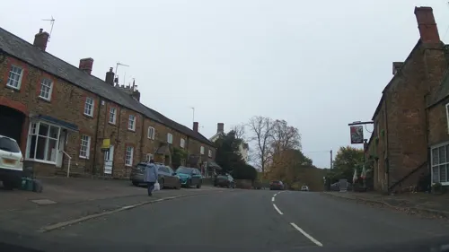
Lower Brailes is a town of 1,027 people in England, United Kingdom.
Why visit Lower Brailes
Townapedia lists 5 museums and landmarks, 2 parks and trails, 3 places to eat, 1 place to stay and 2 attractions in and around town.
Highlights include Castle Hill, Castle Hill Motte, Woodford Bottom and Lamb's Pool and Feldon Valley Golf Club.
Weather in Lower Brailes
Forecast from MET Norway (CC BY 4.0). Full forecast
About Lower Brailes
Brailes is a civil parish about 3 miles (5 km) east of Shipston-on-Stour in Warwickshire, England. It includes the two villages of Lower and Upper Brailes which are located in the north Cotswolds, but it is often referred to as one village as the two villages adjoin each other. The parish includes the village of Winderton about 1.5 miles (2.4 km) northeast of Brailes, and the deserted medieval village of Chelmscote about 3.5 miles (5.6 km) north of Brailes. The parish is bounded to the east by Ditchedge Lane and Beggars' Lane, which are a historic ridgeway that also forms part of the county boundary with Oxfordshire.
From the Wikipedia article Brailes (this version), under CC BY-SA 4.0.
Things to do2

Museums and landmarks5

Parks, trails and playgrounds2


Restaurants and cafes3
History
The name "Brailes" is thought to originate either from the Old Welsh breg-lis - "hill court" - or the Old English byrgels - "burial place". Castle Hill Motte in the middle of the village is a natural knoll that was made higher in the Norman era to form the motte of a motte-and-bailey castle. Its construction may have been ordered by Roger de Beaumont, who was Earl of Warwick from 1123–53. Earthworks of both the motte and the bailey survive, and the site is a Scheduled Monument.
Brailes was the home of William de Brailes, a 13th-century medieval painter of illuminated manuscripts. Of the many artists who painted such manuscripts, William is one of only two whose name has been recorded. It was also the birthplace of Thomas de Brayles (died c.1340), a senior judge and Crown official of the early fourteenth century, whose highest office was Chancellor of the Irish Exchequer. On the other side of Stocks Hill is Brailes House, the former home to the Sheldon family. The Sheldons have held the manor of Brailes since 1547. The Barbadian Methodist minister Francis George Godson was also born in the village.
From the History section of Brailes on Wikipedia, under CC BY-SA 4.0.
Where to stay1
Churches and places of worship4
Gas and EV charging1
Schools, colleges and libraries1
Map of Lower Brailes
19 places. The map loads OpenStreetMap tiles when you open it.
Getting there and nearby towns
Oxford Airport (OXF) is the nearest airport with scheduled flights listed in OpenStreetMap, 17 miles away.
- Banbury 9 mi east, about 14 min by car
- Stratford-upon-Avon 12 mi northwest, about 19 min by car
- Royal Leamington Spa 16 mi north, about 26 min by car
- Warwick 16 mi north, about 26 min by car
- Brackley 17 mi east, about 27 min by car
- Evesham 18 mi west, about 28 min by car
- Witney 19 mi south, about 30 min by car
- Kidlington 19 mi southeast, about 31 min by car
- Bicester 20 mi southeast, about 31 min by car
- Carterton 20 mi south, about 33 min by car
Drive times are estimates from straight-line distance, not routes.
Towns near Lower Brailes


Keep exploring
Local news
Headlines from INDB.
Reviews, tips and questions
Loading what members have shared...
Sources and licences
- GeoNames (CC BY 4.0): population, coordinates, regions and time zone
- Mapillary (see each image): photos
- OpenStreetMap contributors (ODbL 1.0): places, airports, map data
- Wikidata (CC0 1.0): elevation, founding date, time zone, website, landmarks and historic places
- Wikipedia (CC BY-SA 4.0): overview and history text
Photo credits
- Street-level photo, stuarth, CC BY-SA 4.0
- Street-level photo, southglos, CC BY-SA 4.0
- Street-level photo, southglos, CC BY-SA 4.0
- Street-level photo, southglos, CC BY-SA 4.0
- Street-level photo, southglos, CC BY-SA 4.0
- Street-level photo, southglos, CC BY-SA 4.0
- Street-level photo, southglos, CC BY-SA 4.0
Page built November 10, 2026. Spotted a mistake? Tell us or suggest a place.