


Why visit Horbury
Townapedia lists 10 museums and landmarks, 12 parks and trails, 108 places to eat, 3 places to stay and 2 attractions in and around town.
Highlights include Chantry Bridge, Theatre Royal, Wakefield, The Art House and Wakefield Museum.
Weather in Horbury
Forecast from MET Norway (CC BY 4.0). Full forecast
About Horbury
Horbury is a town in the City of Wakefield in West Yorkshire, England. Historically in the West Riding of Yorkshire, it is situated north of the River Calder about three miles (5 km) south west of Wakefield and two miles (3 km) to the south of Ossett. It includes the outlying areas of Horbury Bridge and Horbury Junction. At the 2001 census the Horbury and South Ossett ward of Wakefield Metropolitan District Council had a population of 10,002.
From the Wikipedia article Horbury (this version), under CC BY-SA 4.0.
Things to do2

Chantry Bridge
Bridge · 3.1 mi
Grade I listed bridge in Wakefield, West Yorkshire, England

Theatre Royal, Wakefield
Cinema and theater · 2.8 mi
Theatre in Wakefield, England
Museums and landmarks10


Wakefield Museum
Museum · 2.8 mi
Museum in Wakefield, West Yorkshire, United Kingdom

Hepworth Wakefield
Museum · 3.0 mi
Art gallery in West Yorkshire, England, United Kingdom
National Coal Mining Museum for England
Museum · 2.8 mi
Coal mining museum in Yorkshire, England, United Kingdom

Parks, trails and playgrounds12

Yorkshire Sculpture Park
Park · 3.2 mi
Sculpture park in West Bretton, Yorkshire, United Kingdom

Pugneys Country Park
Park · 2.3 mi
Country park in West Yorkshire, United Kingdom
Thornes Park
Park · 2.2 mi
Park in Wakefield, West Yorkshire, England, UK

The Secret Garden Soft Play Centre
Playground · 0.8 mi
223a Bridge Road, Wakefield

Restaurants and cafes108
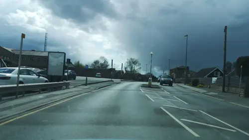
The Carpenters Arms
Bar and pub · Grill, Burger, Local, Dessert · 1.5 mi
Recently refurbished and reopened under new owners.
22 Bank Street, Ossett
Mo-Th 10:00-22:00; Fr-Sa 10:00-00:00; Su 10:00-22:00
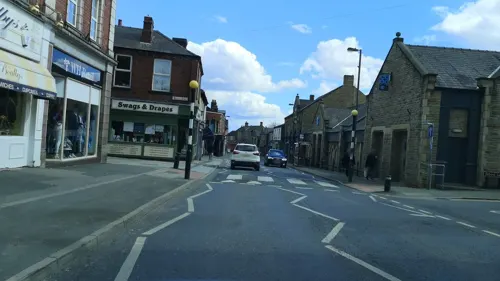
Bistro 42
Restaurant · Burger, Salad, Pasta, Sandwich, Sunday Roast, Ice Cream, Dessert, Brunch, Seafood, Chicken, Fish And Chips, Local
42 High Street, Wakefield
Tu-Th 12:00-22:30; Fr-Sa 12:00-23:30; Su 12:00-22:30
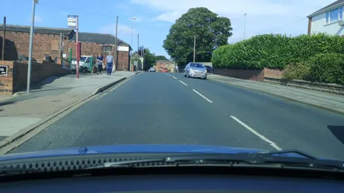
The Thorn Tree Pub & Kitchen
Bar and pub · Western, Tapas, Breakfast, Fish And Chips, Grill, Burger, Regional · 1.4 mi
15 Queen Street, Ossett
Tu-Th 12:00-23:00, Fr-Sa 12:00-00:00, Su 12:00-23:00
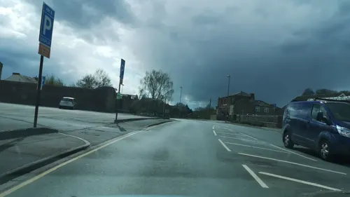
Bank Street Kitchen
Restaurant · Steak House, Burger, Chicken, Wings · 1.5 mi
3 Bank Street, Ossett
Tu-Th 12:00-21:00; Fr-Sa 12:00-22:00; Su 12:00-20:00


Cafe Vie The Bistro
Cafe · French, British, English · 1.5 mi
Thompsons Yard, New Street, Ossett
Mo-Su 09:00-15:00
Gracie's
Cafe · Sandwich, Salad, Breakfast, Coffee Shop · 1.5 mi
29 Bank Street, Ossett
Tu-Fr 08:30-15:00; Sa 09:00-14:00

Prop'ur Baa
Bar and pub · 1.5 mi
3 New Street, Ossett
Tu-Th 16:00-23:00; Fr-Sa 13:00-23:00; Su 14:00-22:00


Ossett Gyros
Restaurant · Greek · 1.5 mi
47 Bank Street, Ossett
Tu-Th 16:00-21:00, Fr-Sa 12:00-22:00,Su 12:00-21:00
96 more on the map.
History
The name Horbury is attested in 1086 as (H)orberie. It is derived from Old English horu 'dirty land' and burh (in its dative form byrig), which translates as 'filthy fortification' or 'stronghold on muddy land'. Other spellings include Orberie, Horbiry and Horberie. The name possibly referred to a fortification near an old fording point of the River Calder.
The settlement predates the Domesday Book of 1086 in which Horbury and Crigglestone, on the south side of the River Calder, were the only parts of the Manor of Wakefield not described as "waste". The survey recorded about 40 people and four ox-drawn ploughs in 'Orberie' and 'Crigeston' combined. About 400 acres (1.6 km2) of land were in cultivation and much woodland. Horbury had a church dating from about 1106 which was a daughter church of the church in Wakefield and possibly replaced an earlier Saxon church. The Norman church had a tower, nave and chancel.
The Manor of Wakefield was given by the crown to the Earls Warenne in 1106 and was held by them until 1359.
Sir Robert de Horbiry and Sir John de Horbiry were stewards to the Earl de Warenne, who granted Sir John the village of Horbury and its lands for life. After the death of Sir John de Horbury in 1306, it became one of the constituent 'graveships' of the Manor of Wakefield.
Read more of the history
The oldest surviving house in the town is Horbury Hall in Church Street, built by Ralph Amyas, deputy steward of the Manor of Wakefield. It has been dated by dendrochronology to 1474. Other old buildings include the tithe barn. The land in Horbury was divided into three great fields, Northfield, Southfield and Westfield, and remains of medieval ridge and furrow of strip cultivation are visible in Carr Lodge Park.
A wooden bridge spanned the River Calder on the road from Wakefield to Huddersfield in the 15th century. Money for its upkeep was left in local wills dated 1404 and 1492, a custom that continued into the 16th century. A stone-arched bridge that replaced the wooden structure in the 17th century lasted until it partly collapsed in 1918. A new bridge was completed in 1930 and was repaired in 1991 at a cost of £2 million. Horbury Bridge was flooded after heavy rain in 1946.
Wool spinning and cloth manufacture were important originally as cottage industries. At the start of the Industrial Revolution steam engines were installed at Race's Mill in Dudfleet and Foster's Mill on Engine Lane in 1795. Resistance to the implementation of new textile machinery and the factory system was shown when Luddites, who blamed the new factories for depriving weavers from earning a living in a time of widespread hunger and poverty, destroyed Fosters Mill.
Albion Mills and Millfield Mills were built in the 1870s. William Sykes's sports goods works, which became part of Slazengers, was established at about this time. Slazenger had four factories which produced sports equipment. Since the factories closed the name is preserved in Slazengers Sports and Social Club, which has facilities and floodlit grounds for many different sporting activities.
Charles Roberts (1831–1892) who described himself as a joiner, moved the Buffer and Wagon Works he had established on Ings Road, Wakefield to a site at Horbury Junction in 1873. Between 1901 and 1956 the company built 110,000 railway wagons of varying types and by 1945 Charles Roberts and Co.'s works covered 45 acres including the adjacent site of the Horbury Junction Iron Company which it had taken over in 1923. During the First World War the firm was among the first to employ women who were employed to forge shell covers. During the Second World War, the wagon works was used for armament manufacture, and made 1,300 Churchill tanks, half a million naval shells and one and a half million trench mortar bombs. The Horbury Junction Iron Company site was used to build tram bodies for Blackpool and Sheffield trams.
The works later became owned by Procor and then Bombardier Inc. The last vehicles constructed at the site were Bombardier Voyager trains, the plant closed in 2005; the engineering company Eddison & Wanless now occupies the site.
In 1905, Richard Sutcliffe (1849–1930), who had worked as part-time manager at Hartley Bank Colliery across the valley in Netherton, opened his Universal Works on the site of the old dye house mill on the Horbury-Wakefield boundary in 1905 and started to manufacture conveyor belts and mining machinery. In 1972 the company employed 742 people at its Horbury site.
From the History section of Horbury on Wikipedia, under CC BY-SA 4.0.
More about Horbury
Geography
Horbury encompasses the neighbourhoods of Horbury Bridge, named after the crossing of the River Calder and Horbury Junction, named after the railway junction. It covers an area of 1,162 acres (470 ha). The River Calder flows generally west to east in a wide valley across the south of the town alongside the Calder and Hebble Navigation which made the river navigable to Sowerby Bridge. The town centre is on a hill on the north side of the River Calder and most of the land slopes towards the river. The A642 Wakefield to Huddersfield road bypasses the town to the south of the town centre with a branch road to Horbury Junction. The B6128 goes through the town centre and connects with Ossett to the north. The M1 motorway passes to the east of the town with the nearest access at J40 A638 in Ossett.
Education
Horbury Town School on Tithe Barn Street was enlarged in 1789 but it is not known when it was built. By 1870 there were 113 pupils paying fees of 3d to 6d weekly. It closed in 1886. The "Gaskell School" was built on New Road in 1842 by Daniel Gaskell of Lupset Hall. It was used until 1887. St Peter's Church of England School was founded in 1849 close to the church. It was replaced by the present school in the early 1980s. In September 2010 St Peter's Junior School amalgamated with Clifton Infant School to form a new primary school. A new building is proposed to be built on the current St Peter's site with a completion date of September 2012.
Horbury Council School catering for all age groups on Northfield Lane was opened in 1913 becoming Horbury County Secondary Modern in 1952. The infant school remained on the site and the junior school moved to the Wesleyan School at Horbury Junction. In 1962 secondary pupils moved to a new school. The Northfield Lane school became Horbury County Junior School and Horbury County Infant School. After a fire in 2000 and a £1m upgrade the schools amalgamated, becoming Horbury Primary School in 2002.
Horbury Academy (formerly Horbury School) caters for pupils aged 11 to 16 in a new building completed in 2009 on the same site as the old one.
From the Wikipedia article Horbury, under CC BY-SA 4.0.
Notable people from Horbury
- Stan BarstowBritish writer (1928–2011)
- William BainesBritish composer and pianist
- John Shiltoncricketer (1861-1899)
- Thomas HoltAustralian pastoralist, company director and politician (1811–1888)
- Phillip HodsonEnglish cricketer and businessman
Born in Horbury, according to Wikidata (CC0). Each name links to its Wikipedia article.
Where to stay3
Churches and places of worship20
Shopping13
Gas and EV charging4
Schools, colleges and libraries16
Horbury Bridge Church of England Junior and Infant Academy
School · Anglican · 0.7 mi
Bridge Road, Wakefield
Ossett Southdale Church of England Voluntary Controlled Junior School
School · Anglican · 1.2 mi
Southdale Road, Ossett
Healthcare3
Map of Horbury
191 places. The map loads OpenStreetMap tiles when you open it.
Getting there and nearby towns
Leeds Bradford Airport (LBA) is the nearest airport with scheduled flights listed in OpenStreetMap, 15 miles away.
- Ossett 2 mi northwest, about 3 min by car
- Wakefield 3 mi northeast, about 5 min by car
- Lofthouse 5 mi northeast, about 9 min by car
- Mirfield 6 mi west, about 9 min by car
- Liversedge 6 mi northwest, about 10 min by car
- Leeds 9 mi north, about 15 min by car
- Huddersfield 9 mi west, about 15 min by car
- Pudsey 10 mi northwest, about 16 min by car
- Penistone 10 mi south, about 16 min by car
- Bradford 12 mi northwest, about 19 min by car
Drive times are estimates from straight-line distance, not routes.
Towns near Horbury


Keep exploring
Local news
Headlines from INDB.
Reviews, tips and questions
Loading what members have shared...
Sources and licences
- GeoNames (CC BY 4.0): population, coordinates, regions and time zone
- Mapillary (see each image): photos
- OpenStreetMap contributors (ODbL 1.0): places, airports, map data
- Wikidata (CC0 1.0): elevation, founding date, time zone, website, landmarks and historic places
- Wikimedia Commons (see each image): photos
- Wikipedia (CC BY-SA 4.0): overview and history text
Photo credits
- Horbury Town Hall and Library, J3Mrs ( talk )., CC BY-SA 3.0
- Tithe Barn Christian Centre, Horbury (4671700635), Tim Green from Bradford, CC BY 2.0
- Chantry Bridge, J3Mrs ( talk ), CC BY-SA 3.0
- RIMG11316, Stan walker, CC BY-SA 3.0
- Former Public Library, Wakefield, Anne Burgess, CC BY-SA 2.0
- Wakefield Museum 2015, Jill Jennings, CC BY-SA 4.0
- TheYorkshireSculpturePark(NigelHomer)Nov2005, Nigel Homer, CC BY-SA 2.0
- Chantry Bridge Chapel Wakefield West Yorkshire, circa 1342 - 1356. Built on the banks of the River Calder., Robhamhar, CC BY-SA 3.0
- Bretton Chapel, J3Mrs, CC BY-SA 3.0
- RIMG11191 1, Stan walker, CC BY-SA 3.0
- St John Calder Grove 005, Storye book, CC BY 3.0
- Holy Trinity, Ossett, Tim Green, CC BY 2.0
- St Mary, Horbury Junction (13365010483), Tim Green from Bradford, CC BY 2.0
- Bingley Arms, Horbury Bridge. Taken by Flickr user (14th October 2012), Flickr user:Tim Green aka atouch, CC BY 2.0
- Street-level photo, cuttlebug, CC BY-SA 4.0
- Street-level photo, cuttlebug, CC BY-SA 4.0
- Street-level photo, cuttlebug, CC BY-SA 4.0
- Street-level photo, cuttlebug, CC BY-SA 4.0
- Street-level photo, cuttlebug, CC BY-SA 4.0
- Street-level photo, cuttlebug, CC BY-SA 4.0
- Street-level photo, cuttlebug, CC BY-SA 4.0
- Street-level photo, cuttlebug, CC BY-SA 4.0
- Street-level photo, cuttlebug, CC BY-SA 4.0
- Street-level photo, cuttlebug, CC BY-SA 4.0
- Street-level photo, cuttlebug, CC BY-SA 4.0
- Street-level photo, cuttlebug, CC BY-SA 4.0
- Street-level photo, cuttlebug, CC BY-SA 4.0
- Street-level photo, southglos, CC BY-SA 4.0
- Street-level photo, cuttlebug, CC BY-SA 4.0


Page built November 10, 2026. Spotted a mistake? Tell us or suggest a place.