


Great Yarmouth, United Kingdom
Great Yarmouth is a town of 63,434 people in England, United Kingdom.
Why visit Great Yarmouth
Townapedia lists 33 museums and landmarks, 18 parks and trails, 279 places to eat, 58 places to stay and 19 attractions in and around town.
Highlights include Hippodrome, Britannia Pier, Time & Tide Museum and Joyland.
Weather in Great Yarmouth
Forecast from MET Norway (CC BY 4.0). Full forecast
About Great Yarmouth
Great Yarmouth, often called Yarmouth, is a seaside town which gives its name to the wider Borough of Great Yarmouth in Norfolk, England; it straddles the River Yare and is located 20 miles (32 km) east of Norwich. Its fishing industry, mainly for herring, shrank after the mid-20th century and has all but ended. North Sea oil from the 1960s supplied an oil rig industry that services offshore natural gas rigs; more recently, offshore wind power and other renewable energy industries have ensued. In 2021 the built up area had a population of 28,985.
From the Wikipedia article Great Yarmouth (this version), under CC BY-SA 4.0.
Travel tips from other travellers: Great Yarmouth on Wikivoyage (CC BY-SA 4.0).
Photos of Great Yarmouth


Things to do19

Hippodrome
Cinema and theater · 0.4 mi
Theatre in Great Yarmouth, England
Saint Georges Road, Great Yarmouth

Britannia Pier
Cinema and theater · 0.4 mi
Pier with a theatre in Great Yarmouth, England
Marine Parade, Great Yarmouth
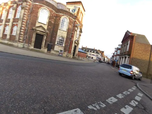

Winter Gardens
Cinema and theater · 0.7 mi
Seaside holiday pavilion and entertainment venue in Great Yarmouth, England
Marine Parade, Great Yarmouth


Breydon Viaduct
Bridge · 0.7 mi
Former bridge in Great Yarmouth, Norfolk, United Kingdom
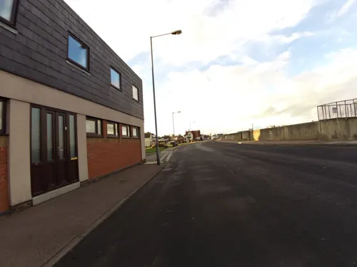
Gorleston Lighthouse
Lighthouse · 2.5 mi
Lighthouse in Great Yarmouth, Norfolk, England, UK
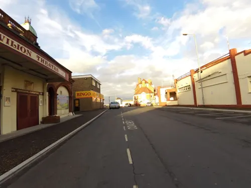
Gorleston Pavilion
Cinema and theater · 2.6 mi
Theatre in Gorleston-on-Sea, Great Yarmouth, England



Gorleston South Pier Lighthouse
Lighthouse · 2.5 mi
Lighthouse in Norfolk, England

Great Yarmouth Pleasure Beach
Monument and historic site · 1.0 mi
Historic amusement park in Norfolk, England
7 more on the map.
Museums and landmarks33
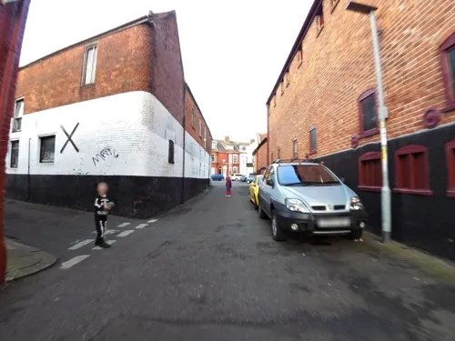
Time & Tide Museum
Museum · 0.5 mi
Blackfriars Road, Great Yarmouth
2025 Mar 31-2025 Nov 02: 10:00-16:30; 2025 Nov 03-2026 Mar 31:...

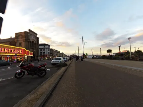
Joyland
Monument and historic site
Historic amusement park in Norfolk, England
Marine Parade, Great Yarmouth
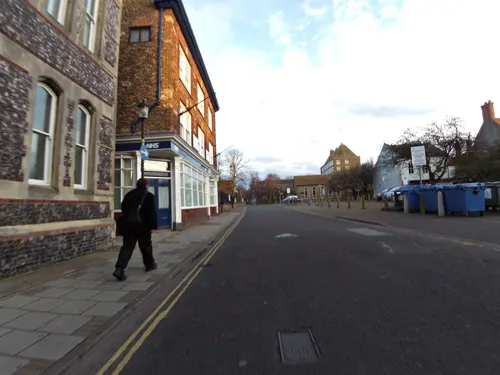

Caister Castle
Museum · 3.2 mi
Grade I listed castle in West Caister, United Kingdom

Time and Tide Museum
Museum · 0.5 mi
Museum dedicated to the maritime history of Great Yarmouth, Norfolk

Britannia Monument
Monument and historic site · 1.4 mi
Monument in Great Yarmouth, Norfolk, England, UK
HMS Gloucester
Monument and historic site · 3.4 mi
1654 Speaker-class frigate
Tolhouse Gaol
Museum
Grade I listed building in Great Yarmouth, Norfolk, England, UK
21 more on the map.
Parks, trails and playgrounds18





6 more on the map.
Restaurants and cafes279
Brewer's Fayre
Bar and pub · British · 0.7 mi
Runham Road, Great Yarmouth
Mo-Fr 06:30-23:00; Sa 07:00-23:00; Su 07:00-22:30



The William Adams
Bar and pub · 1.9 mi
176 High Street, Great Yarmouth
Mo,Tu,We,Th,Su 08:00-24:00; Fr,Sa 08:00-25:00


Costa
Cafe · Coffee Shop · 1.0 mi
Unit F1 Purley Court, Great Yarmouth
Mo-Su 09:00-19:00
267 more on the map.
History
Great Yarmouth (Gernemwa, Yernemuth) lies near the site of the Roman fort camp of Gariannonum at the mouth of the River Yare. Its situation having attracted fishermen from the Cinque Ports, a permanent settlement was made, and the town numbered 70 burgesses before the Norman Conquest. Henry I placed it under the rule of a reeve.
In 1101, the Church of St Nicholas was founded by Herbert de Losinga, the first Bishop of Norwich, and consecrated in 1119. This was to be the first of several priories founded in what was a wealthy trading centre of considerable importance. In 1208, King John granted a charter to Great Yarmouth. The charter gave his burgesses of Yarmouth general liberties according to the customs of Oxford, a gild merchant and weekly hustings, amplified by several later charters asserting the rights of the borough against Little Yarmouth and Gorleston. The town is bound to send to the sheriffs of Norwich every year "one hundred herrings, baked in twenty-four pasties", which the sheriffs are to deliver to the lord of the manor of East Carlton, who is then to convey them to the King.
Read more of the history
A hospital was founded in Great Yarmouth during the reign of Edward I by Thomas Fastolfe, father of Thomas Fastolf, Bishop of St David's. In 1551, a grammar school was founded, and the great hall of the old hospital was appropriated for its use. The school was closed from 1757 to 1860 but re-established by charity trustees and settled in new buildings in 1872.
In 1552, Edward VI granted a charter of admiralty jurisdiction, later confirmed and extended by James I. Elizabeth I came to Great Yarmouth in July 1578. In 1668 a charter from Charles II extended the borough boundaries to also include Little Yarmouth (also known as Southtown), which lay on the opposite bank of the Yare in the parish of Gorleston in Suffolk. In 1703 a new charter from Queen Anne replaced the two bailiffs by a mayor. In 1673, during the Third Anglo-Dutch War, the Zealand Expedition was assembled in the town. In 1702, the Fishermen's Hospital was founded. In the early 18th century, Yarmouth, as a thriving herring port, was vividly and admiringly described several times in Daniel Defoe's travel journals, in part as follows:
Yarmouth is an ancient town, much older than Norwich; and at present, tho' not standing on so much ground, yet better built; much more complete; for number of inhabitants, not much inferior; and for wealth, trade, and advantage of its situation, infinitely superior to Norwich.
It is plac'd on a peninsula between the River Yare and the sea; the two last lying parallel to one another, and the town in the middle: The river lies on the west-side of the town, and being grown very large and deep, by a conflux of all the rivers on this side of the county, forms the haven; and the town facing to the west also, and open to the river, makes the finest key in England, if not in Europe, not inferior even to that of Marseille itself.
The ships ride here so close, and as it were, keeping up one another, with their head-fasts on shore, that for half a mile [800 m] together, they go cross the stream with their bolsprits over the land, their bowes, or heads, touching the very wharf; so that one may walk from ship to ship as on a floating bridge, all along by the shore-side: The key reaching from the drawbridge almost to the south-gate, is so spacious and wide, that in some places 'tis near one hundred yards from the houses to the wharf. In this pleasant and agreeable range of houses are some very magnificent buildings, and among the rest, the custom-house and town-hall, and some merchants' houses, which look like little palaces, rather than the dwelling-houses of private men.
The greatest defect of this beautiful town, seems to be, that tho' it is very rich and encreasing in wealth and trade, and consequently in people, there is not room to enlarge the town by building; which would be certainly done much more than it is, but that the river on the land-side prescribes them, except at the north end without the gate....
In 1797, during the French Revolutionary Wars, the town was the main supply base for the North Sea Fleet. The fleet collected at the Yarmouth Roads, from whence it sailed to the decisive Battle of Camperdown against the Dutch fleet. In 1803, Captain George Manby was appointed barrack-master at Great Yarmouth; during his time in post he invented the Manby mortar.
Again in 1807, during the Napoleonic Wars, the collected fleet sailed from the roadstead to the Battle of Copenhagen.
From 1808 to 1814, the Admiralty in London could communicate with its ships in Yarmouth by a shutter telegraph chain. Ships were routinely anchored offshore during the Napoleonic Wars and the town served as a supply base for the Royal Navy. Part of an Ordnance Yard survives from this period on Southtown Road, probably designed by James Wyatt: a pair of roadside lodges (which originally housed senior officers) frame the entrance to the site, which contains a sizeable armoury of 1806, a small barracks block and other ancillary buildings. Originally the depot extended down to a wharf on the River Yare and was flanked by a pair of storehouses, but these and other buildings were destroyed in The Blitz.
A grander survival is the former Royal Naval Hospital designed by William Pilkington, begun in 1806 and opened in 1811. The hospital consisted of four two-storey pavilions set around a courtyard, with a colonnaded walkway linking them; each block contained eight wards. It served only briefly as a naval hospital, during the last years of the Napoleonic Wars, before being handed over to the Army for use as barracks. In the early 1860s, however, it reverted to medical use, being reopened as a naval psychiatric hospital. It continued to serve in this capacity until 1958, when the premises were transferred to the NHS. After its closure in 1993, the buildings were turned into private residences.
From the History section of Great Yarmouth on Wikipedia, under CC BY-SA 4.0.
More about Great Yarmouth
Geography
Great Yarmouth is located on a 3.1-mile (5.0 km) spit of land between the North Sea and River Yare. It features historic rows of houses in narrow streets and a main tourist sector on the seafront. It is linked to Gorleston, Cobholm and Southtown by Haven Bridge and to the A47 and A149 by Breydon Bridge. The urban area covers 8.3 sq mi (21 km2) and according to the Office for National Statistics (ONS) in 2002 had a population of 47,288. It is the main town in the Borough of Great Yarmouth.
The ONS identifies a Great Yarmouth urban area as having a population of 68,317, which includes the sub-areas of Caister-on-Sea (population 8,756) and Great Yarmouth (population 58,032). The wider Great Yarmouth borough had a population of around 92,500, which increased to 97,277 at the 2011 United Kingdom census. Ethnically, Great Yarmouth was 92.8 per cent White British, with the next biggest ethnic demographic being Other White at 3.5 per cent – Eastern Europeans in the main.
From the Wikipedia article Great Yarmouth, under CC BY-SA 4.0.
Notable people from Great Yarmouth
 Anna SewellEnglish novelistPhoto: Unknown author Unknown author, Public domain
 Matthew MacfadyenEnglish actor (born 1974)Photo: Greg2600, CC BY-SA 2.0
 Jack CardiffBritish cinematographer, director and photographer (1914-2009)Photo: Not known. Cardiff family have given..., CC BY-SA 3.0
 Hannah SpearrittBritish singer and actressPhoto: Roger Murmann, CC BY 2.0
 James PagetBritish scientist (1814–1899)Photo: Unknown author Unknown author, CC BY 4.0
 Dawson TurnerEnglish banker, botanist and antiquary (1775-1858)Photo: Unknown author Unknown author, Public domain
 Francis Turner PalgraveEnglish poet and critic (1824–1897)Photo: Elliott & Fry, Public domain
 William HovellBritish explorer (1786-1875)Photo: Oswald H. Allen, Public domain
 Walter TammasBritish tug of war competitor (1870–1952)Photo: Unknown photographer in 1912, Public domain
- Willoughby SmithBritish engineer (1828–1891)
- Mike MacDowelEnglish racing driver
- Rebecca NurseConvicted of witchcraft during the Salem witch trials (1621-1692)
Born in Great Yarmouth, according to Wikidata (CC0). Each name links to its Wikipedia article.
Where to stay58
Churches and places of worship18
Shopping59
Gas and EV charging11
Schools, colleges and libraries18
St Mary and St Peter Catholic Primary School
School · Roman Catholic · 1.9 mi
East Anglian Way, Great Yarmouth
St Nicholas Priory Church of England Voluntary Aided Primary School
School · Anglican
St Nicholas Road, Great Yarmouth
Healthcare10
Map of Great Yarmouth
250 places. The map loads OpenStreetMap tiles when you open it.
Getting there and nearby towns
Norwich Airport (NWI) is the nearest airport with scheduled flights listed in OpenStreetMap, 19 miles away.
- Bradwell 3 mi southwest, about 4 min by car
- Lowestoft 9 mi south, about 15 min by car
- Beccles 12 mi southwest, about 20 min by car
- Norwich 18 mi west, about 29 min by car
- North Walsham 21 mi northwest, about 33 min by car
- Bowthorpe 22 mi west, about 35 min by car
- Diss 31 mi southwest, about 49 min by car
- Attleborough 31 mi west, about 49 min by car
- East Dereham 34 mi west, about 54 min by car
- Ipswich 45 mi southwest, about 1 h 15 min by car
Drive times are estimates from straight-line distance, not routes.
Towns near Great Yarmouth


Keep exploring
Local news
Headlines from INDB.
Reviews, tips and questions
Loading what members have shared...
Sources and licences
- GeoNames (CC BY 4.0): population, coordinates, regions and time zone
- Mapillary (see each image): photos
- OpenStreetMap contributors (ODbL 1.0): places, airports, map data
- Wikidata (CC0 1.0): elevation, founding date, time zone, website, landmarks and historic places
- Wikimedia Commons (see each image): photos
- Wikipedia (CC BY-SA 4.0): overview and history text
Photo credits
- Great Yarmouth collage2, This file was derived from: File:Great Yarmouth - panoramio (11).jpg File:Cmglee Great Yarmouth Empire Atlantis.jpg File:Great Yarmouth Town Hall - geograph.org.uk - 2151014.jpg File:-2020-08-17 Anna..., CC BY-SA 4.0
- Great Yarmouth Regent Road, Romazur, CC BY-SA 4.0
- City wall tower great yarmouth, Secretlondon, CC BY-SA 4.0
- -2015-06-17 Troll Cart Public house, Regent Road, Great Yarmouth, Peter Holmes, CC BY-SA 2.0
- City wall in Great Yarmouth, Secretlondon, CC BY-SA 4.0
- -2019-09-21 East along Prince’s Road, Great Yarmouth, Evelyn Simak, CC BY-SA 2.0
- -2019-09-21 Terraced houses, Nelson Road North, Great Yarmouth (1), Evelyn Simak, CC BY-SA 2.0
- -2019-09-21 Seashells Guest House, Nelson Road North, Great Yarmouth, Evelyn Simak, CC BY-SA 2.0
- Breydon Viaduct Postcard, Unknown author Unknown author, Public domain
- Haven Bridge Lifted, Norfolkadam, CC BY-SA 3.0
- Great Yarmouth aerial image - Joyland - Norfolk UK coast (15077852071), John Fielding from Norwich, UK, CC BY 2.0
- Great Yarmouth Greyfriars, JohnArmagh, CC BY-SA 3.0
- Lynn Grove Academy, Jack1956, CC0
- Great Yarmouth Royal Hotel - panoramio, Tanya Dedyukhina, CC BY 3.0
- St Mary's Catholic Church, Regent Road, Great Yarmouth, Norfolk, allen watkin from London, England, CC BY-SA 2.0
- -2018-11-13 The Barking Smack public house, Marine Parade, Great Yarmouth, Norfolk, Evelyn Simak, CC BY-SA 2.0
- Troll Cart Great Yarmouth 19 July 2013, cheeseladder, CC BY 3.0
- Sir Christopher Cockerall Building, Jking32165, CC BY 3.0
- -2018-11-13 Hippodrome Circus, St George's Road, Great Yarmouth, Evelyn Simak, CC BY-SA 2.0
- -2009-09-12 Looking along the Britannia Pier, Great Yarmouth (1), Kolforn ( Kolforn ) I'd appreciate if you could mail me ([email protected]) if you want to use this picture out of the Wikimedia project scope. This file is licensed under the Creative Commons..., CC BY-SA 4.0
- Winter Gardens, Great Yarmouth, TaleynaFletcher, CC BY-SA 4.0
- Breydon Bridge over the River Yare - 2024-09-12, Amanda Slater, CC BY-SA 2.0
- Caister Castle 1, Paul Reynolds from UK, CC BY 2.0
- Street-level photo, smsm1, CC BY-SA 4.0
- Street-level photo, RCCL, CC BY-SA 4.0
- Street-level photo, adam2, CC BY-SA 4.0
- Street-level photo, smsm1, CC BY-SA 4.0
- Street-level photo, smsm1, CC BY-SA 4.0
- Street-level photo, smsm1, CC BY-SA 4.0
- Street-level photo, adam2, CC BY-SA 4.0
- Street-level photo, RCCL, CC BY-SA 4.0
- Street-level photo, smsm1, CC BY-SA 4.0
- Street-level photo, smsm1, CC BY-SA 4.0
- Street-level photo, smsm1, CC BY-SA 4.0


Page built November 10, 2026. Spotted a mistake? Tell us or suggest a place.