


Lowestoft, United Kingdom
Lowestoft is a town of 71,327 people in England, United Kingdom.
Why visit Lowestoft
Townapedia lists 10 museums and landmarks, 20 parks and trails, 135 places to eat, 8 places to stay and 9 attractions in and around town.
Highlights include The Seagull, Marina Theatre, Lowestoft Maritime Museum and East Anglia Transport Museum.
Weather in Lowestoft
Forecast from MET Norway (CC BY 4.0). Full forecast
About Lowestoft
Lowestoft ( LOH-(ih)-stoft, LOH-stəf) is a coastal town and civil parish in the East Suffolk district of Suffolk, England. As the most easterly UK settlement, it is 38 miles (61 km) north-east of Ipswich and 22 miles (35 km) south-east of Norwich, and the main town in its district. Its development grew with the fishing industry and as a seaside resort with wide sandy beaches. As fishing declined, oil and gas exploitation in the North Sea in the 1960s took over.
From the Wikipedia article Lowestoft (this version), under CC BY-SA 4.0.
Travel tips from other travellers: Lowestoft on Wikivoyage (CC BY-SA 4.0).
Photos of Lowestoft


Things to do9

The Seagull
Cinema and theater · 1.5 mi
Theatre and cinema in Pakefield, Lowestoft, Suffolk, England
Morton Road, Lowestoft

Marina Theatre
Cinema and theater · 0.4 mi
Theatre and cinema in Lowestoft, Suffolk, England

Pleasurewood Hills
Monument and historic site · 2.2 mi
Amusement park in Lowestoft, eastern UK


Lowestoft Lighthouse
Lighthouse · 0.8 mi
Lighthouse in Waveney, Suffolk, England, UK
Pakefield Lighthouse
Lighthouse · 2.8 mi
19th century lighthouse near Pakefield, a suburb of Lowestoft in Suffolk, England

Museums and landmarks10

Lowestoft Maritime Museum
Museum · 0.9 mi
Maritime museum in Lowestoft, United Kingdom
May-Oct 10:00-17:00

East Anglia Transport Museum
Museum · 3.2 mi
British open-air transport museum

Carlton Colville Scouts Memorial
Monument and historic site · 2.8 mi
Memorial in Carlton Colville, Waveney, Suffolk, England, UK

Lowestoft Arts Centre
Museum · 0.4 mi
13 Saint Peters Street, Lowestoft
Th-Fr 11:00-15:00; Sa 11:00-16:00
MV Probe
Monument and historic site · 1.5 mi
Built as motor minesweeper of the MMS ll class. HMS MMS 1086, MS Franklin Roosevelt.
Parks, trails and playgrounds20

Carlton and Oulton Marshes
Park · 2.6 mi
Suffolk Wildlife Trust nature reserve


Gunton Warren and Corton Woods
Park · 1.8 mi
Suffolk Wildlife Trust nature reserve





Lowestoft Cruising Club
Marina and boat launch · 1.5 mi
Off Harbour Road, Lowestoft
8 more on the map.
Restaurants and cafes135
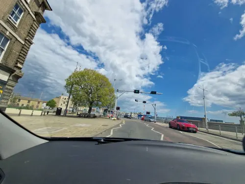
JoJo’s Kitchen & Bar
Restaurant · Burger
Royal Thoroughfare, Lowestoft
We-Su 09:00-22:00; Fr,Sa 09:00-23:00
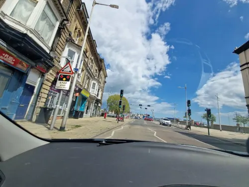
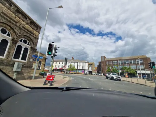
The Joseph Conrad
Bar and pub
18-32 Station Square, Lowestoft
Mo-Th 08:00-00:00; Fr-Sa 08:00-01:00; Su 08:00-00:00


Lowestoft Tandoori
Restaurant · Indian · 0.7 mi
176 High Street, Lowestoft
Tu-Su 16:30-23:30; PH 16:30-23:30
Sgt. Peppers
Restaurant · Burger · 0.6 mi
167-168 High Street, Lowestoft
Mo-Fr 17:00-23:00; Sa-Su 16:00-23:00
Well Well Well The Bath House
Restaurant · Spanish · 0.6 mi
8 Waterloo Road, Lowestoft
We-Sa 09:00-15:00,18:00-23:00; Su 09:00-15:30


123 more on the map.
History
Some of the earliest signs of settlement in Britain have been found in Lowestoft. Flint tools discovered in 2005 in the cliffs at Pakefield, south Lowestoft, show that humans inhabited the area as far back as 700,000 years.
Habitation occurred in the Neolithic, Bronze and Iron ages and in the Roman and Saxon times. Several finds have been made at a Saxon cemetery at Bloodmoor Hill in south Lowestoft.
The place name derives from a Norse personal name, Hlothver, and toft, an Old Norse word for homestead. Over time, it has been spelled Lothnwistoft, Lothuwistoft, Lestoffe, Laistoe, Loystoft and Laystoft.
The 1086 Domesday Book gives Lothuwistoft village some 16 households in three families, with ten smallholders and three slaves. The manor formed part of the king's holding in the Hundred of Lothingland, worth about four geld in tax income. Roger Bigod was the tenant in chief. The lost village of Akethorpe may have lain close by.
In the Middle Ages, Lowestoft became an important fishing town that came to challenge its neighbour, Great Yarmouth. The trade, particularly for herring, continued as the town's main identity into the 20th century.
Read more of the history
In the First English Civil War Lowestoft's sympathies were Royalist partly due to her commercial rivalry with the Parliamentarian Great Yarmouth and in 1643 was seized by Royalist sympathisers, who were defeated and captured by Eastern Association troops led by Oliver Cromwell, the only civil war battle in Suffolk. The naval Battle of Lowestoft in June 1665 was the first in the Second Anglo-Dutch War. Held 40 miles (64 km) off the coast, it was a victory for the English.
Lowestoft Porcelain Factory, from 1757 to 1802, was in production for longer than any English soft-paste porcelain manufacturer other than Royal Worcester and Royal Crown Derby, producing domestic pots, teapots and jugs. It stood on the site of an existing pottery or brick kiln and was later used as a brewery and malt kiln. Most of its remaining buildings were demolished in 1955.
Sir Samuel Morton Peto's arrival in 19th-century Lowestoft brought a change in the town's fortunes, including its fishing industry. To help stimulate this, Peto was given the task of building a line for the Lowestoft Railway and Harbour Company, connecting with Reedham and the city of Norwich. This had a profound impact on the town's industrial development – its fishing fleets could sell to markets further inland, and other industries such as engineering gained from increased trade with the continent. Peto's railway enabled Lowestoft to become a flourishing seaside holiday resort; much of Peto's seaside resort in south Lowestoft still exists, including the Grade II listed Kirkley Cliff and Wellington Esplanade terraces.
During World War I, Lowestoft was bombarded by the German Navy on 24 April 1916 in conjunction with the Easter Rising. The port was a major naval base during the war, including for armed trawlers such as Ethel & Millie and Nelson used to combat German U-boat actions in the North Sea such as that of 15 August 1917. In World War II the town was heavily bombed by the Luftwaffe for its engineering industry and role as a naval base. It is sometimes placed among the UK's most heavily bombed towns per head of population. The Royal Naval Patrol Service was mobilised in August 1939, mainly by trawlermen and fishermen of the Royal Naval Reserve. Its depot, HMS Europa, was also known locally as the Sparrow's Nest.
From the History section of Lowestoft on Wikipedia, under CC BY-SA 4.0.
More about Lowestoft
Geography
Lowestoft, the easternmost town in the United Kingdom, lies on the North Sea coast. The town is divided by Lake Lothing, which forms the inner part of Lowestoft Harbour and gives access via Oulton Broad and Oulton Dyke to the River Waveney and the Broads. The northern half is on the island of Lothingland.
Lowestoft is mainly low-lying, with hilly areas in the north and high points of 20–30 m (66–98 ft) above sea level. The rock beneath is crag-sand with overlying sand and glacial till deposits with gravel, with the crag exposed at coastal cliffs such as Pakefield's. Areas around Lake Lothing feature alluvium silt; some marshland remains west of Oulton Broad. The sandy beaches south of the harbour have Blue Flag status. To the north of the harbour is an area of old sand dunes known as the Denes, along with more beaches and Ness Point, the easternmost point of the UK.
Lowestoft has been subject to periodic flooding, notably in January 1953, when a North Sea swell driven by low pressure and an extreme high tide swept away many earlier sea defences and deluged most of the southern town. Heavy rain caused flash flooding in the town in September 2006. In December 2013, a storm surge caused severe flooding of Lowestoft and its suburbs.
Economy
Originally based on fishing and engineering, the economy of Lowestoft has declined over the years. Although the tourism sector has grown, the major employers in the town are the wholesale and retail sector, with 18 per cent of employment.
Service industries, including health, social care and education are significant employers, while manufacturing employs about 10 per cent of the workforce.
Employment can vary seasonally due to the importance of tourism to the economy. In early 2011, around 10 per cent of the working population of the town claimed Jobseekers Allowance.
Until the mid-1960s, fishing was seen as Lowestoft's main industry, although from the 1930s the percentage so employed directly and in trades associated with fishing was actually only about 10 per cent. Fleets of drifters and trawlers caught fish such as herring, cod and plaice. Catches have diminished since the 1960s and although 100 boats remained by the 1980s, there are now only a few small boats operating out of Lowestoft, with no large trawlers. By 2011 just three traders remained at the town's fish market, which is under threat of closure due to redevelopment of the port. The Centre for Environment, Fisheries and Aquaculture Science (CEFAS), a large fisheries research centre that is a part of Defra, is still located in Lowestoft.
Arts and culture
The town has three theatres: the Marina, the Players (Lowestoft) and The Seagull. The 800-seat Marina, operated as a charitable trust, was restored and refurbished in 2012 and its cinema upgraded to digital in 2013. The Royal Philharmonic Orchestra has played regularly at the Marina Theatre since 2005.
Lowestoft Museum, which holds a collection of Lowestoft Porcelain and artifacts describing the town's history, is in Nicholas Everett Park in Oulton Broad. There are some small museums in Sparrow's Nest Park in the north of the town, including the Lowestoft War Memorial Museum, the Maritime Museum and the Royal Naval Patrol Service Museum. The Heritage Workshop Centre is also located there. The Mincarlo, the last surviving sidewinder trawler of the Lowestoft fishing fleet, can be visited at Lowestoft Harbour. The East Anglia Transport Museum holds a collection of buses, trams and trolleybuses in Carlton Colville.
Lowestoft retains several narrow lanes with steps running steeply seawards, known locally as "scores". They were used by fishermen and smugglers and now feature in an annual charity race. The borough church, dedicated to St Margaret, is a Grade I listed building. In the town centre is Our Lady Star of the Sea Church, a Grade II listed building in the Arts and Crafts style and the most easterly Catholic church in the British Isles.
Education
Lowestoft has several primary and high schools, including four 11–16 high schools: Benjamin Britten Academy, Ormiston Denes Academy, East Point Academy and Pakefield High School. After reorganisation, all eight middle schools in the town closed in 2011 and Pakefield High School opened. Post-16 education is provided at Lowestoft Sixth Form College, which opened in September 2011 as part of the reorganisation, and at East Coast College (Lowestoft Campus), which offers a range of academic and vocational courses.
East Coast College (Lowestoft Campus) provides some higher education courses through an affiliation to the University of Suffolk. Degrees were initially validated by the University of East Anglia and the University of Essex but are now validated by the University of Suffolk. The college also has courses in boat building and some to support the offshore and maritime industries that are major employers in the town. Other adult education courses are run by the County Council from a base at the town library.
From the Wikipedia article Lowestoft, under CC BY-SA 4.0.
Notable people from Lowestoft
 Benjamin BrittenEnglish composer, conductor, and pianist (1913-1976)Photo: Szalay Zoltán, CC BY-SA 3.0
 Thomas NasheEnglish Elizabethan pamphleteer and poetPhoto: Unknown, Public domain
 Dennis RobertsonBritish economist (1890–1963)Photo: Unknown photographer, Public domain
 Anthony OgogoEnglish boxer and professional wrestlerPhoto: KMcWrestling Photography, CC BY-SA 4.0
 Reece RitchieBritish actor (born 1986)Photo: Sidewalks Entertainment, CC BY 3.0
 Fiammetta WilsonBritish astronomer (1864-1920)Photo: Lafayette, Public domain
 Thomas CrispFirst World War posthumous Victoria Cross recipient (1876–1917)Photo: not identified, Public domain
 Charles Francis Massey SwynnertonBritish naturalist (1877-1938)Photo: Unknown author Unknown author, Public domain
- Wilbur SootBritish Twitch streamer, YouTuber, and musician
- Richard MoneyEnglish football player and manager (born 1955)
- Lil' ChrisEnglish singer and television presenter (1990–2015)
- George DavisonEnglish photographer (1854-1930)
Born in Lowestoft, according to Wikidata (CC0). Each name links to its Wikipedia article.
Where to stay8
Churches and places of worship23
Saint Luke's Church Centre
Church · Anglican · 1.5 mi
62 Homefield Avenue, Lowestoft
Shopping31
Gas and EV charging5
Schools, colleges and libraries19
St Mary's Roman Catholic Primary School
School · Roman Catholic · 1.0 mi
Kirkley Cliff Road, Lowestoft
Healthcare8
East Coast Community Healthcare CIC
Clinic and pharmacy
Battery Green Road, Lowestoft
Map of Lowestoft
250 places. The map loads OpenStreetMap tiles when you open it.
Getting there and nearby towns
Norwich Airport (NWI) is the nearest airport with scheduled flights listed in OpenStreetMap, 24 miles away.
- Bradwell 7 mi north, about 11 min by car
- Beccles 8 mi west, about 13 min by car
- Norwich 22 mi northwest, about 35 min by car
- Bowthorpe 25 mi northwest, about 40 min by car
- Diss 28 mi west, about 45 min by car
- North Walsham 28 mi northwest, about 46 min by car
- Attleborough 31 mi west, about 50 min by car
- Woodbridge 32 mi southwest, about 52 min by car
- Kesgrave 36 mi southwest, about 58 min by car
- Ipswich 38 mi southwest, about 1 h by car
Drive times are estimates from straight-line distance, not routes.
Towns near Lowestoft


Keep exploring
Local news
Headlines from INDB.
Reviews, tips and questions
Loading what members have shared...
Sources and licences
- GeoNames (CC BY 4.0): population, coordinates, regions and time zone
- Mapillary (see each image): photos
- OpenStreetMap contributors (ODbL 1.0): places, airports, map data
- Wikidata (CC0 1.0): elevation, founding date, time zone, website, landmarks and historic places
- Wikimedia Commons (see each image): photos
- Wikipedia (CC BY-SA 4.0): overview and history text
Photo credits
- Harbour Inn, Lowestoft 13th June 2009, Stavros1, CC BY 3.0
- Natwest Bank, Lowestoft, Sirpecangum, CC BY-SA 4.0
- Old Post Office, Lowestoft, MessHF, CC BY-SA 4.0
- Lowestoft Victorian Post Office, kitmasterbloke, CC BY 2.0
- Lowestoft Telephone Exchange building with Kittiwake nesting sites - 54486943327, kitmasterbloke, CC BY 2.0
- Lowestoft Telephone Exchange building with Kittiwake nesting sites - 54487786426, kitmasterbloke, CC BY 2.0
- EiiR 1958 cipher on Lowestoft telephone exchange, kitmasterbloke, CC BY 2.0
- Lowestoft Telephone Exchange building with Kittiwake nesting sites - 54488140130, kitmasterbloke, CC BY 2.0
- Lowestoft Telephone Exchange building with Kittiwake nesting sites - 54488141115, kitmasterbloke, CC BY 2.0
- Seagull Theatre Façade, Jack1956, CC0
- Lowestoft Maritime Museum 2016, Jack1956, CC0
- London Trolleybus & Tram at EATM, No machine-readable author provided. Spsmiler assumed (based on copyright claims)., Public domain
- Carlton Marshes 7, Dudley Miles, CC BY-SA 4.0
- Gunton Meadow 4, Dudley Miles, CC BY-SA 4.0
- Gunton Warren 9, Dudley Miles, CC BY-SA 4.0
- Gunton Wood 1, Dudley Miles, CC BY-SA 4.0
- Leathes Ham 4, Dudley Miles, CC BY-SA 4.0
- Lowestoft - Church of St Margaret, Geoff Pick, CC BY-SA 2.0
- The Marina Theatre, Lowestoft, Suffolk, UK, Tim Parkinson, CC BY 2.0
- Lowestoft Sixth Form College, Sixthform, CC BY-SA 3.0
- Kittiwakes nesting on a Victorian building and nearby lamposts - 54487786526, kitmasterbloke, CC BY 2.0
- Kittiwakes nesting on a Victorian building and nearby lamposts, kitmasterbloke, CC BY 2.0
- Pleasurewood Hills aerial image - Suffolk UK - 05 (14788781765), John Fielding from Norwich, UK, CC BY 2.0
- 2024-09-11 Lowestoft, Ness Point Euroscope - 04, amandabhslater, CC BY-SA 2.0
- Street-level photo, smsm1, CC BY-SA 4.0
- Street-level photo, edloach, CC BY-SA 4.0
- Street-level photo, edloach, CC BY-SA 4.0
- Street-level photo, smsm1, CC BY-SA 4.0
- Street-level photo, smsm1, CC BY-SA 4.0
- Street-level photo, edloach, CC BY-SA 4.0
- Street-level photo, edloach, CC BY-SA 4.0
- Street-level photo, smsm1, CC BY-SA 4.0


Page built November 10, 2026. Spotted a mistake? Tell us or suggest a place.