


Hucknall, United Kingdom
Hucknall is a town of 29,728 people in England, United Kingdom.
Why visit Hucknall
Townapedia lists 18 museums and landmarks, 22 parks and trails, 93 places to eat, 1 place to stay and 5 attractions in and around town.
Highlights include The Arc Cinema, Newstead Abbey, Papplewick Pumping Station and Bestwood Country Park.
Weather in Hucknall
Forecast from MET Norway (CC BY 4.0). Full forecast
About Hucknall
Hucknall () is a market town in the Ashfield district of Nottinghamshire, England, 7 miles (11 km) north of Nottingham, 7 miles (11 km) southeast of Kirkby-in-Ashfield, 9 miles (14 km) from Mansfield and 10 miles (16 km) south of Sutton-in-Ashfield.
From the Wikipedia article Hucknall (this version), under CC BY-SA 4.0.
Travel tips from other travellers: Hucknall on Wikivoyage (CC BY-SA 4.0).
Things to do5


Museums and landmarks18

Newstead Abbey
Museum · 3.1 mi
Historic house museum, home of Lord Byron, in Nottinghamshire, England, UK

Papplewick Pumping Station
Museum · 3.5 mi
Architectural structure and museum in Papplewick, Gedling, England, United Kingdom



Hucknall No.1 Colliery 1861-1943
Monument and historic site
Part of Hucknall Mining Memorial
Hucknall No.2 Colliery 1865-1986
Monument and historic site
Part of Hucknall Mining Memorial
Linby Colliery 1873-1988
Monument and historic site
Part of Hucknall Mining Memorial
Miners' Statue
Monument and historic site
Bronze sculpture of coal miner standing on a Davy lamp, part of Hucknall Mining Memorial
6 more on the map.
Parks, trails and playgrounds22





10 more on the map.
Restaurants and cafes93
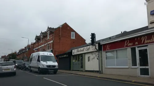
The Pilgrim Oak
Bar and pub · 0.4 mi
44-46 High Street, Nottingham
Mo,Tu,We,Th,Su 08:00-24:00; Fr 08:00-24:30; Sa 08:00-25:00
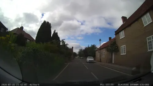
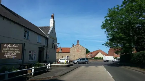
Griffin's Head
Bar and pub · 1.6 mi
Moor Road, Nottingham
Mo-We 12:00-22:00; Th,Su 12:00-23:00; Fr,Sa 12:00-12:00

LR’s Cafe and Kitchen
Cafe · Sandwich · 0.8 mi
17 Washdyke Lane, Nottingham
Mo-Fr 08:00-14:00; Sa 09:00-13:00


Cassidy's Kitchen
Cafe
149 Watnall Road, Nottingham
Mo-Sa 07:00-15:00, Su 08:00-13:00

81 more on the map.
History
Hucknall was once a thriving market town. Its focal point is the Church of St Mary Magdalene, next to the town's market square.
The church was built by the Anglo-Saxons and completed after the Norman Conquest, though its medieval chancel, nave, north aisle and tower were much restored and enlarged in the Victorian period. In 1872 a south aisle was added and in 1887 unusually long transepts, while the rest of the building apart from the tower was thoroughly restored. The top tower stage and the south porch are 14th-century. There are 25 stained-glass windows by Charles Eamer Kempe, installed mostly in the 1880s, and a modest memorial to Lord Byron.
From 1295 until 1915, the town was known as Hucknall Torkard, taken from Torcard, the name of a dominant landowning family. Signs of the earlier name can be seen on some older buildings.
Read more of the history
During the 19th and 20th centuries, coal was discovered and mined heavily throughout the Leen Valley, which includes Hucknall. This brought wealth to the town and three railway lines. The first was the Midland Railway (later LMS) line from Nottingham to Mansfield and Worksop, which closed to passengers on 12 October 1964, though partly remained as a freight route serving collieries at Hucknall, Linby and Annesley. The Hucknall station on this line was known as Hucknall Byron in its latter years. In the 1990s the line was reopened to passengers in stages as the Robin Hood Line, the section through Hucknall in 1993, with a new station on the site of the old "Byron", though simply called Hucknall. The second was the Great Northern Railway (later LNER) route up the Leen Valley and on to Shirebrook, serving many of the same places as the Midland south of Annesley. It closed to passengers on 14 September 1931, but remained in freight use until 25 March 1968. The station on this line was known as Hucknall Town. The third was the Great Central Railway (also LNER), the last main line built from the north of England to London, which opened on 15 March 1899. The stretch through Hucknall closed fully on 5 September 1966, but Hucknall Central station had closed earlier, on 4 March 1963.
From 1894 until 1974 Hucknall was the seat of Hucknall Urban District Council. With the abolition of the UDC, local government was transferred to Ashfield.
In 1956 the Church of St Peter and St Paul, Hucknall was built to serve western parts of Hucknall.
The Hucknall Tourism and Regeneration Group has a mission statement to "help Hucknall regain its position as a strong, viable town, attract visitors to the town, to help increase its economy and to raise awareness of our heritage to both visitors and residents."
The Hucknall Tourism and Regeneration Group (HTRG) was inaugurated in 2002. It consists of people from all aspects of Hucknall life, who have a desire to help regenerate the town, primarily through tourism, after the devastating loss of the mining industry and large portions of the textile industry. Members of the group include residents, business owners, volunteer workers and councillors. HTRG works with other well-established organisations such as the Hucknall Round Table, the Rotary Club of Hucknall, Hucknall Heritage Society, the Eric Coates Society, St Mary Magdalene Church, Ashfield District Council, Nottinghamshire County Council, Hucknall Library and volunteer organisations, to prevent duplication of work and ensure the town is working together.
The group seeks opportunities to promote the town through radio interviews, newspaper coverage, street exhibitions, events, leaflets and posters. Heritage trails have been designed, one for the town centre and a 20-mile (32 km) circular trail. To complement these trails, leaflets have been produced and free guided walks/bus tours take place throughout the spring and summer months.
The town centre was pedestrianised in 2017, and an inner relief road opened from Annesley Road through to Station Road.
From the History section of Hucknall on Wikipedia, under CC BY-SA 4.0.
More about Hucknall
Geography
Hucknall is on the west bank of the Leen Valley, on land which rises from the Trent Valley in the south and extends northwards to Kirkby-in-Ashfield. The Whyburn Brook flows through the town centre. Farleys Brook marks its southern boundary. Due to the mass amount of housing and industrial estates along the southside of the town. Hucknall is contiguous with the wider City of Nottingham with the suburbs of Bulwell and Bestwood Village to the south and southeast.
The town's highest point is Long Hill, at 460 ft (140 m) above sea level, with views over the city and Trent Valley, which descends to 22–24 metres (72–79 ft) AOD, flowing just beyond most of the city centre.
The town is surrounded by farmland or parkland. To the north-west lie Misk Hills and Annesley. To the north-east of the town are the villages of Linby and Papplewick, and beyond these two, Newstead Abbey and its grounds, once the residence of Lord Byron. To the west lies Eastwood, birthplace of D. H. Lawrence and an inspiration for many of his novels and short stories. To the east of the town is Bestwood Country Park.
Economy
Hucknall's Tesco superstore opened in 2003, creating a number of jobs for the town. In 2008, the store was extended to convert it to Tesco Extra. A Tesco Express store was opened in early January 2009 in Annesley Road.
Other shop branches in Hucknall include Card Warehouse, Argos, B&M Bargains, Home Bargains, Bird's Bakery, Boots, Peacocks, Specsavers, Iceland, Aldi, Lidl, Co-Operative Food, and Sainsbury's. Independent local retailers include Branson's DIY store and Aquatic centre, Lawrence Severn and Son Ltd, butchers,, a garden centre with cafe Keycraft on Watnall Road and SP Electronics computer services.
Lloyds formally had a branch in the High Street; NatWest, HSBC and Yorkshire customers now have limited service via the Post Office.
Hucknall has a Friday Market in the newly pedestrianised High Street. Ashfield District Council has additionally more recently agreed to run a Saturday market.
When Costa Coffee opened a branch in Hucknall High Street in 2014, its local job advertisement attracted over 1,300 applicants. A new branch of McDonald's opened in November 2019, at a cost of £1,000,000, after the firm had appealed against a planning committee ban on grounds of noise, anti-social behaviour, smells and litter.
Arts and culture
The Hucknall and Linby Mining Community Brass Band formed in late 2008 after players from the Newstead Abbey Brass Band sought autonomy. It is conducted by Paul Whyley. At the time, the town lacked a band after Hucknall and Linby Miners' Welfare Band moved out to become Newstead Brass. It plays a parish-church concert every Christmas, and around the local area throughout the year.
The Byron Cinema, an Art Deco building designed by the local architect Alfred J Thraves, opened on 2 November 1936. It originally boasted a sweeping, curved façade of Thraves' favoured sandstock bricks and Portland stone, with a vertical tower to the right of centre, faced in cream terracotta tiles. Much was also made in the cinema's publicity of a canopy "provided to protect our patrons during bad weather."
Education
The National Academy was founded in 1788 by Frederick Ward and originally located at the southern end of Annesley Road. It relocated in the 1970s to a new build still on Annesley Road but at the north end of the town, near the roundabout of the B6011 road. The National School has a large science block with 10 labs and an astro-turf playing area, both opened in 2004 by Princess Anne. The school has an eco-friendly building.
The Holgate Academy is on Hillcrest Drive in Beauvale, to the west of the bypass.
Holy Cross Catholic Voluntary Academy is in Leen Mills Lane, next to Leen Mills Primary School. It is a feeder primary school to Christ The King Academy in Arnold. It was voted third best school in Nottinghamshire in 2014 and in 2015.
Hucknall Sixth Form Centre was on Portland Road, near the Byron Bingo Club (Now the Arc Cinema), and housed the sixth form provision for The National Academy The Holgate Academy and Queen Elizabeth's Academy. It was closed at the end of the 2025 academic year, with The Holgate Academy and The National Academy getting their own on-site Sixth Form. The building was previously home to New College Nottingham.
From the Wikipedia article Hucknall, under CC BY-SA 4.0.
Notable people from Hucknall
 George GunnCricket player of England. (1879-1958)Photo: Unknown (photo studio of Charles and..., Public domain
- Paris LeesBritish journalist and activist for transgender rights
- Eric CoatesBritish composer (1886–1957)
- Enoch WestEnglish footballer (1886-1965)
- Freya ChristieBritish female tennis player
- John GunnEnglish cricketer (1876-1963)
- Ben CauntBritish boxer (1815-1861)
- Fred FisherBritish footballer (1910-1955)
- John ColemanEnglish association football player, born 1946
- Robin BaileyBritish actor (1919-1999)
- Steve BlatherwickEnglish footballer and manager (born 1973)
- George DruryEnglish footballer (1914-1972)
Born in Hucknall, according to Wikidata (CC0). Each name links to its Wikipedia article.
Where to stay1
Churches and places of worship33
Church of St. Mary the Virgin and All Souls, Bulwell
Church · 2.3 mi
Shopping13
Gas and EV charging2
Schools, colleges and libraries19
Holy Cross Primary Catholic Voluntary Academy
School · Roman Catholic · 0.8 mi
Leen Mills Lane, Nottingham
Hucknall National Church of England Primary School
School · Anglican · 0.6 mi
Montague Road, Nottingham
Linby-Cum-Papplewick Church of England Primary School
School · Anglican · 1.6 mi
Quarry Lane, Nottingham
Healthcare8
Hucknall & District Orthopaedic Clinic
Clinic and pharmacy
Derbyshire Lane, Nottingham
Map of Hucknall
214 places. The map loads OpenStreetMap tiles when you open it.
Getting there and nearby towns
Nottingham City Airport (NQT) is the nearest airport with scheduled flights listed in OpenStreetMap, 9 miles away.
- Kimberley 4 mi southwest, about 7 min by car
- Kirkby in Ashfield 5 mi north, about 8 min by car
- Nottingham 6 mi south, about 9 min by car
- Pinxton 6 mi northwest, about 10 min by car
- Mansfield 7 mi north, about 11 min by car
- Ripley 8 mi west, about 13 min by car
- Stapleford 9 mi south, about 14 min by car
- Mansfield Woodhouse 9 mi north, about 15 min by car
- Shirebrook 12 mi north, about 19 min by car
- Derby 14 mi southwest, about 22 min by car
Drive times are estimates from straight-line distance, not routes.
Towns near Hucknall


Keep exploring
Local news
Headlines from INDB.
Reviews, tips and questions
Loading what members have shared...
Sources and licences
- GeoNames (CC BY 4.0): population, coordinates, regions and time zone
- Mapillary (see each image): photos
- OpenStreetMap contributors (ODbL 1.0): places, airports, map data
- Wikidata (CC0 1.0): elevation, founding date, time zone, website, landmarks and historic places
- Wikimedia Commons (see each image): photos
- Wikipedia (CC BY-SA 4.0): overview and history text
Photo credits
- 1965 Bristol MW6G ECW B45F, DNU20C, The General Livery, Cream Blue Two-Tone, Preserved Classic Bus, Hucknall Destination, Matthew Black, CC BY-SA 2.0
- Newstead Abbey (4974019812), brianfagan from Nottingham, United Kingdom, CC BY 2.0
- Annesley Old Church, Nottinghamshire (1), Enchufla Con Clave, CC BY-SA 4.0
- Hucknall Church St Mary Magdalene, Phil Evans, CC BY-SA 2.0
- Bestwood Country-park vista 6512, ClemRutter, CC BY-SA 4.0
- Linby Top Cross, Veggiebacon, CC BY-SA 4.0
- Papplewick pumping station, packing flat, Chris Allen, CC BY-SA 2.0
- Street-level photo, adam2, CC BY-SA 4.0
- Street-level photo, adam2, CC BY-SA 4.0
- Street-level photo, adam2, CC BY-SA 4.0
- Street-level photo, adam2, CC BY-SA 4.0
- Street-level photo, adam2, CC BY-SA 4.0
- Street-level photo, adam2, CC BY-SA 4.0
- Street-level photo, adam2, CC BY-SA 4.0
- Street-level photo, adam2, CC BY-SA 4.0
- Street-level photo, adam2, CC BY-SA 4.0
- Street-level photo, adam2, CC BY-SA 4.0
- Street-level photo, sk53, CC BY-SA 4.0
- Street-level photo, southglos, CC BY-SA 4.0
- Street-level photo, adam2, CC BY-SA 4.0
- Street-level photo, sk53, CC BY-SA 4.0
- Street-level photo, adam2, CC BY-SA 4.0
- Street-level photo, tallguy, CC BY-SA 4.0
- Street-level photo, southglos, CC BY-SA 4.0
- Street-level photo, adam2, CC BY-SA 4.0
- Street-level photo, adam2, CC BY-SA 4.0
- Street-level photo, adam2, CC BY-SA 4.0
Page built November 10, 2026. Spotted a mistake? Tell us or suggest a place.