


Whittlesey, United Kingdom
Whittlesey is a town of 12,745 people in England, United Kingdom.
Why visit Whittlesey
Townapedia lists 6 museums and landmarks, 5 parks and trails, 30 places to eat and 2 places to stay in and around town.
Highlights include Whittlesey Museum, Must Farm Bronze Age settlement, Lattersey and Lattersey LNR.
Weather in Whittlesey
Forecast from MET Norway (CC BY 4.0). Full forecast
About Whittlesey
Whittlesey (also Whittlesea) is an historic market town and civil parish in the Fenland district of Cambridgeshire, England. Whittlesey is 6 miles (10 km) east of Peterborough. In 2021 the built-up area had a population of 13,823. The population of the parish was 17,667 at the 2021 Census.
From the Wikipedia article Whittlesey (this version), under CC BY-SA 4.0.
Museums and landmarks6

Whittlesey Museum
Museum
Museum in Whittlesey, Cambridgeshire, England, UK
Market Street, Peterborough
Fr-Su 14:30-16:30; Sa 10:00-12:00

Must Farm Bronze Age settlement
Monument and historic site · 2.0 mi
Bronze Age site in Cambridgeshire, England

Flag Fen
Monument and historic site · 2.7 mi
Archaeological open-air museum in Peterborough, Cambridgeshire, England, UK
Parks, trails and playgrounds5




Restaurants and cafes30
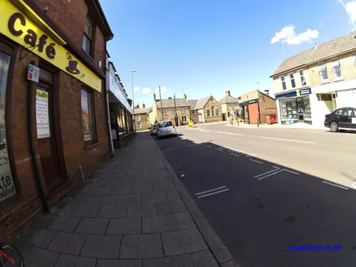
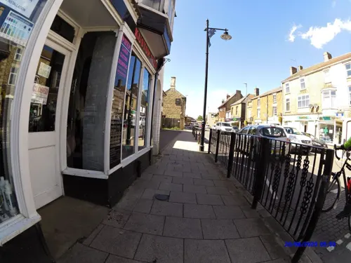
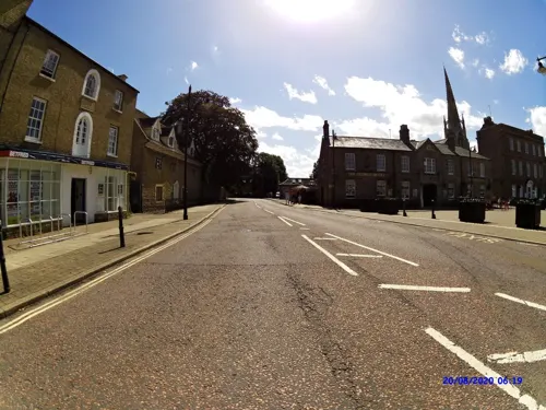

18 more on the map.
Where to stay2


History
Before the fens were drained, Whittlesey was an island of dry ground surrounded by them. Excavations of nearby Flag Fen indicate thriving local settlements as far back as 1000 BCE. At Must Farm quarry, a Bronze Age settlement is described as "Britain's Pompeii" due to its relatively good condition. In 2016 it was being excavated by the University of Cambridge's Cambridge Archaeological Unit. At Must Farm at least five homes of 3,000 years in age have been found, along with Britain's most complete prehistoric wooden wheel, dating back to the late Bronze Age.
Whittlesey was linked to Peterborough in the west and March in the east by the Roman Fen Causeway, probably built in the 1st century CE. Roman artefacts have been recovered at nearby Eldernell, and a Roman skeleton was discovered in the nearby village of Eastrea during construction of its village hall in 2010.
The town's two parishes of St Mary's and St Andrew's belonged to the abbeys in Thorney and Ely respectively until the Dissolution of the Monasteries about 1540. Despite the proximity of Peterborough, Whittlesey is in the Diocese of Ely.
Read more of the history
Nearby Whittlesey Mere was a substantial lake surrounded by marsh until it was drained in 1851. According to the traveller Celia Fiennes, who saw it in 1697, the mere was "3-mile broad and six-mile long. In the midst is a little island where a great store of Wildfowle breed.... The ground is all wett and marshy but there are severall little Channells runs into it which by boats people go up to this place; when you enter the mouth of the Mer it looks formidable and its often very dangerous by reason of sudden winds that will rise like Hurricanes...." The town is still accessible by water, being connected to the River Nene by King's Dyke, which forms part of the Nene/Ouse Navigation. Moorings can be found at Ashline Lock, alongside the Manor Leisure Centre's cricket and football pitches.
Whittlesey was significant for its brickyards, around which the former hamlet of King's Dyke was based for much of the 20th century, although only one now remains, following the closure of the Saxon brickworks in 2011.
The local clay soil was also used to make cob boundary walls during a period in which there was a brick tax. Some examples of these roofed walls still stand today and are claimed to be unique in Fenland, certain sections of Whittlesey's "Mud Walls" were given Grade II Listed status in 2021, and given further formal protection by local council in 2026.
Whittlesey had a large number of public houses. In 1797, a local farmer noted in his diary, "They like drinking better than fighting in Whittlesea." Among the public houses that have closed are the Plough, the Letter A, the Letter C, the Queen Adelaide, the Old Crown, the King's Head, the Morton Folk and the White Horse, many of which are now private residences.
Whittlesey was an important trade route in the late Bronze Age (about 1100–800 BCE). Evidence for this was found at the archaeological site of Must Farm, where log boats, roundhouses, bowls with food in them, and the most complete wooden wheel were housed.
In 1832, Whittlesey, then spelt Whittlesea, was ravaged by the second cholera epidemic, along with nearby Peterborough. According to a diary entry of Mrs Thomas Shaftoe Robertson, manageress of the Lincoln Theatre Circuit, "What a gap in my journal! April to November! But better not record such a summer as I have passed. God deliver me from such another. What suffering, what anguish, and loss! Whittlesea! Shall I ever have the idea of entering that place again? The cholera there raged in all its fury. I was numbered amongst its victims, and, false or true, was certainly dreadfully ill. All Peterborough was in a languishing state. Mr Walker, the surgeon, behaved most kindly, and never charged me a shilling."
A year later this entry was amended: "Let me correct this error. The year after he sent me in a bill of £5 14s 6d." The Lincoln Theatre Circuit also included at various times Whittlesey, Wisbech, Boston and other nearby towns.
St Mary's Church contains 15th-century work, but most of the building is later. It has one of the largest buttressed spires in Cambridgeshire. The spire is 171 feet (52 metres) high. The church also contains a chapel, which was restored in 1862 as a memorial to Sir Harry Smith. St Mary's is a Grade I listed building.
St Andrew's Church originally dates back to the 13th and 14 centuries, with a major restoration taking place in 1872. The church, featuring a three-storeyed west tower with an eastern clock face, blends the Perpendicular and Decorated Gothic architectural styles of the 13th to 15th centuries. St Andrew's is listed Grade II*.
Both churches still see active use, each with a separate congregation.
The market is held in the Market Place every Friday. The right to hold a weekly market was first granted in 1715, although there have been several periods since in which the market did not function, for example from the late 1700s until about 1850.
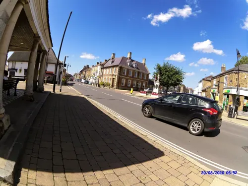
In the centre of the Market Place is the Buttercross, dating back to 1680. Originally a place for people to sell goods, the structure was considered useless in the 1800s and only saved from demolition when a local businessman donated some slate tiles for the roof. Latterly it served as a bus shelter, until the bus services were relocated from the Market Place to a purpose-built terminal in Grosvenor Road.
From the History section of Whittlesey on Wikipedia, under CC BY-SA 4.0.
More about Whittlesey
Geography
Whittlesey is between Peterborough, 6 miles (10 km) to the west, and March, 11 miles (18 km) to the east. It is bordered to the north by the River Nene and to the south by Whittlesey Dyke. Historically, it was connected with Peterborough and March by the Roman Fen Causeway of the first century CE, a route roughly followed by the modern A605.
To the north of Whittlesey is a recorded Ramsar site, a protected wetland. There is also Morton's Leam, which is an SSSI of notable diversity. To the south-east is Lattersey Nature Reserve.
Arts and culture
Whittlesey Summer Festival fills much of the centre each September. Attractions have included a classic car display, an Italian food stall, fairground rides, a steam engine, and in 2009, a flying display by a Hawker Hurricane of the Battle of Britain Memorial Flight. An art competition for students of Sir Harry Smith Community College runs during the festival, with a display at Whittlesey Christian Church. At the 2009 festival local people raised £10,000 for bushfire victims in Whittlesea, Victoria, Australia.
From 2011 to 2015, there was rivalry between the supermarket chains Tesco and Sainsbury's to build on neighbouring sites in Eastrea Road. Dubbed "Supermarket Gate" in the press, the dispute was resolved when Sainsbury's won approval in June 2015 for its scheme for a supermarket, business park and country park. Plans for over 400 houses on an adjacent site, construction of which began in late 2014, caused concern about extra traffic on the A605. The Sainsbury's store never went ahead, however, and instead, a new Aldi store was opened on Eastrea Road in June 2023.
Close to the King's Dyke brickworks stand three 80-metre wind turbines, the largest on-shore turbines in England. They power the McCains chips plant.
Whittlesey Museum, located in the Old Town Hall, records the natural and cultural heritage of the town and surrounding area.
Education
The town has a secondary school, Sir Harry Smith Community College, which opened in 1953 on the site of Whittlesey Workhouse, and three primary schools (New Road Primary, Alderman Jacobs, Park Lane Primary) Park Lane, Sir Harry Smith Community College and New Road Primary are a part of the ASPIRE alliance. There is another primary school in neighbouring Coates.
From the Wikipedia article Whittlesey, under CC BY-SA 4.0.
Notable people from Whittlesey
 Sir Harry Smith, 1st BaronetBritish Army generalPhoto: Unknown author Unknown author, Public domain
 Ron AshmanEnglish footballer (1926–2004)Photo: Eskil Malmberg, Public domain
- L. P. HartleyBritish novelist and short story writer (1895–1972)
- Garry ButterworthEnglish footballer (born 1969)
- Gary DightonBritish cyclist (1968-2015)
- Robert George ScottEnglish military officer (1857–1918); recipient of the Victoria Cross
- Owen MedlockEnglish footballer (1938-2021)
- David ProudEnglish actor
- Ron JacobsEnglish rugby union player and administrator
Born in Whittlesey, according to Wikidata (CC0). Each name links to its Wikipedia article.
Churches and places of worship7
Shopping5
Gas and EV charging2
Schools, colleges and libraries5
Healthcare1
Map of Whittlesey
63 places. The map loads OpenStreetMap tiles when you open it.
Getting there and nearby towns
Cambridge City Airport (CBG) is the nearest airport with scheduled flights listed in OpenStreetMap, 27 miles away.
- Peterborough 5 mi west, about 8 min by car
- Wisbech 14 mi northeast, about 23 min by car
- Cambridge 27 mi southeast, about 43 min by car
- Bedford 33 mi southwest, about 52 min by car
- Northampton 38 mi southwest, about 1 h by car
- Leicester 42 mi west, about 1 h 15 min by car
- Milton Keynes 44 mi southwest, about 1 h 15 min by car
- Luton 48 mi south, about 1 h 15 min by car
- Lincoln 49 mi north, about 1 h 15 min by car
- Nottingham 51 mi northwest, about 1 h 15 min by car
Drive times are estimates from straight-line distance, not routes.
Towns near Whittlesey


Keep exploring
Local news
Headlines from INDB.
Reviews, tips and questions
Loading what members have shared...
Sources and licences
- GeoNames (CC BY 4.0): population, coordinates, regions and time zone
- Mapillary (see each image): photos
- OpenStreetMap contributors (ODbL 1.0): places, airports, map data
- Wikidata (CC0 1.0): elevation, founding date, time zone, website, landmarks and historic places
- Wikimedia Commons (see each image): photos
- Wikipedia (CC BY-SA 4.0): overview and history text
Photo credits
- Whittlesey Town Hall June 2012, Chalkietom, CC BY-SA 4.0
- Must Farm CL3 4817 (26447110732), Dr._Colleen_Morgan from York, UK, CC BY 2.0
- Sir Harry Smith Community College, Chalkietom, CC BY-SA 4.0
- Street-level photo, smsm1, CC BY-SA 4.0
- Street-level photo, smsm1, CC BY-SA 4.0
- Street-level photo, smsm1, CC BY-SA 4.0
- Street-level photo, smsm1, CC BY-SA 4.0
- Street-level photo, smsm1, CC BY-SA 4.0
- Street-level photo, smsm1, CC BY-SA 4.0
- Street-level photo, smsm1, CC BY-SA 4.0
- Street-level photo, smsm1, CC BY-SA 4.0
- Street-level photo, smsm1, CC BY-SA 4.0
- Street-level photo, smsm1, CC BY-SA 4.0
- Street-level photo, smsm1, CC BY-SA 4.0
- Street-level photo, smsm1, CC BY-SA 4.0
- Street-level photo, smsm1, CC BY-SA 4.0
Page built November 10, 2026. Spotted a mistake? Tell us or suggest a place.