


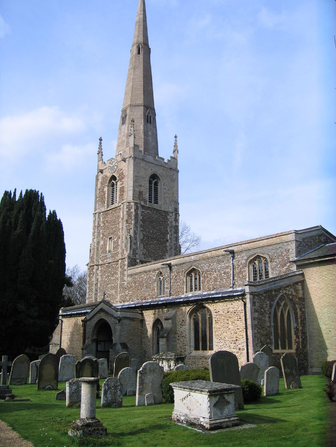

Saint Ives, United Kingdom
Saint Ives is a town of 16,815 people in England, United Kingdom.
Why visit Saint Ives
Townapedia lists 17 museums and landmarks, 25 parks and trails, 65 places to eat and 9 places to stay in and around town.
Highlights include Norris Museum, Oliver Cromwell, Fen Drayton Lakes and Godmanchester Nature Reserve.
Weather in Saint Ives
Forecast from MET Norway (CC BY 4.0). Full forecast
About Saint Ives
St Ives is a medieval market town and civil parish in the Huntingdonshire district of Cambridgeshire, England. It is located on the River Great Ouse, and there is a historic stone bridge dating from 1425. The bridge has an unusual chapel incorporated into the structure. The nearby Quayside offers pleasing views of the river and the bridge.
From the Wikipedia article St Ives, Cambridgeshire (this version), under CC BY-SA 4.0.
Photos of Saint Ives


Museums and landmarks17


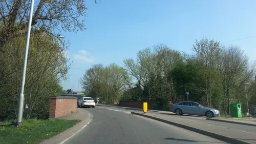



Swavesey Priory
Monument and historic site · 3.6 mi
Priory in Swavesey, South Cambridgeshire, England, UK
'The Molehill'
Monument and historic site · 2.0 mi
Concrete dome anti-aircraft emplacement. No public access.
Low Hill bowl barrow
Monument and historic site · 2.1 mi
The mound of Low Hill barrow, preserved as a prominent earthwork, stands 1m high and covers an area approximately 30m in diameter. Its...
5 more on the map.
Parks, trails and playgrounds25
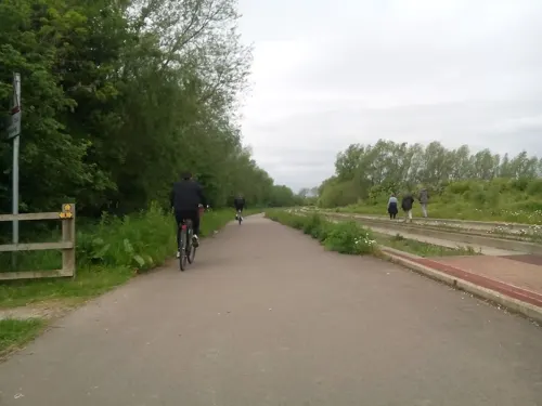
Fen Drayton Lakes
Park · 2.4 mi
RSPB nature reserve in the United Kingdom

Godmanchester Nature Reserve
Park · 3.3 mi
Nature reserve in the United Kingdom

Hemingford Grey Meadow
Park · 2.2 mi
Nature reserve in Hemingford Grey, Huntingdonshire, Cambridgeshire, England, UK

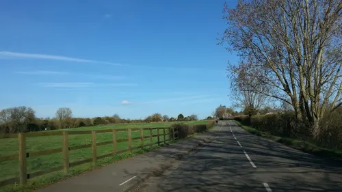
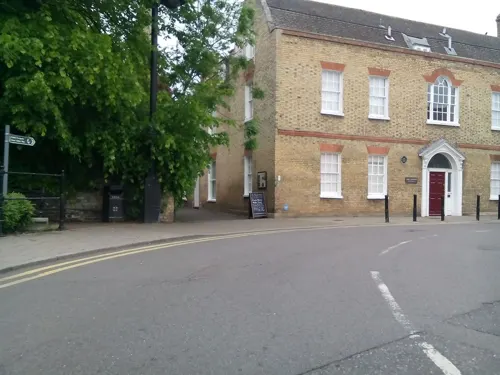

Jones Boatyard
Marina and boat launch · 1.1 mi
Facilities available: Approximately 160 fixed and floating moorings, mostly serviced with electricity, Shower block, Chemical waste...
Low Road, St Ives




13 more on the map.
Restaurants and cafes65
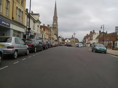
Ivo Lounge
Restaurant · British · 0.7 mi
9/10 Sheepmarket, St Ives
Su-Th 09:00-23:00; Fr-Sa 09:00-24:00




St Ives Dhaba
Restaurant · Indian · 0.6 mi
21 Bridge Street, St Ives
Su-Th 17:30-22:00; Fr-Sa 17:30-22:30


53 more on the map.
Where to stay9



History
St Ives was founded on the north bank of the wide River Great Ouse between Huntingdon and Ely, probably in the fifth or sixth century CE. There had been some Roman activity in the area, but the settlement that became St Ives originated in Anglo-Saxon times. It developed because it was possible to ford the river there; any more easterly crossing point would not have been practicable. The settlement was originally known as "Slepe", implying a muddy area. At that time and later, the area was virtually one large forest.
Read more of the history
Little and Werba, writing in 1974, stated that "The site of the ford, of which a trace remains at the bottom of Church Street, was well upstream of the present bridge". This point of view is supported by the foundation of a Saxon church at the location of the present All Saints Church, suggesting that this was then the centre of the settlement. Burn-Murdoch, writing in 2009 argues that the straight track that became London Road "leads straight to the river bank and so must have been going to a river crossing of some kind... so the Saxon river crossing was probably either a ford or a ferry" at the location of the present-day bridge... Upstream at Slepe itself the river is deep and narrow with a muddy bottom, making it very difficult to ford..." He continues, "Crossing the river at Slepe [would have been] only half the battle: you also need to get across the wide expanse of the flood plain. The meadows on the south side of the river still flood regularly and are then impassable for days or weeks afterwards because of the mud left on them..." and there is no evidence of a Saxon causeway there.
Whatever the exact location of the ford, Slepe became important as it was the lowest convenient crossing of the River Great Ouse; it was an important waypoint for traffic between the Eastern Counties and London. River traffic too developed, although navigation on the river was difficult until major improvements were made much later, in the 17th century.
The legend of St Ivo relates that Slepe received a surprising visitation about a century after it had been established. One morning a tall, dignified man carrying a bishop's crozier and accompanied by two companions, forded the river Great Ouse and announced to the villagers that his name was Ivo, and that he was a missionary. He added that he had been ordered by God to travel to Slepe where he was to make his home and preach the gospel in the surrounding area. The eleventh-century chronicler Goscelin of St Bertin wrote that Ivo was a Persian archbishop, and this claim has been repeated in later reports. Ivo remained at Slepe and eventually died there in the seventh century.
In the tenth century, Ramsey Abbey was founded and in 986, the Manor of Slepe, which by that time was an extensive property, was bequeathed to the Abbey. In the year 1001 CE, a peasant ploughing a field discovered a stone coffin containing a complete human skeleton. It was taken back to the church at Slepe, and declared by the Abbot Eadnoth, to be the remains of Ivo. At the time it was a lucrative matter for an Abbey to possess the bones of a saint, as wealthy pilgrims were attracted to the location. The relics were claimed to have healing properties. The editors of the Dictionary of Christian Biography describe the legend of Ivo as utterly improbable, "and the monks of Ramsey must be held responsible for the legend. Their abbey had been newly built and needed relics; a consecrated spot was wanted for a daughter-house [at Slepe]".
Ivo was a Cornish saint. Suggestions of a Persian link came about when Withman, Abbot of Ramsey, heard in the Holy Land of a Persian bishop named Ivo; subsequently the link to the Fenland Ivo was written down by Goscelin of St Bertin. The tradition is completely spurious. There is a seaside town in Cornwall named St Ives. That name derives from a holy woman named Ia of Cornwall and has no connection with the Cambridgeshire town's name.
Nevertheless, Slepe became an important destination for pilgrims, and in time the name used for the settlement became "Saint Ives". The presence of the remains gave Slepe considerable prestige. Ramsey Abbey had been established in AD974 with a charter from King Edgar, and the community at Slepe was made subordinate to Ramsey Abbey. The significance of Ivo's remains meant that the community at Slepe became referred to as St Ives. About 1001 CE Abbot Eadnoth had Ivo's remains moved to Ramsey, but by that time the name St Ives had become the usual name for the town that had originated as Slepe.
Slepe was listed in the Hundred of Hurstingstone in Huntingdonshire in the Domesday Book. It states that
In St Ives, the Abbot of Ramsey had 20 hides to the geld [taxable]. [There is] land for 24 ploughs, and he had land for 2 ploughs in demesne, apart from the aforementioned hides. There are now 3 ploughs in demesne and 39 villains and 12 smallholders who have 20 [or 6?] ploughs. There is a church and a priest, and 60 acres of meadow [and] woodland pasture 1 league and a half broad. Value before 1066 was £20 and now £16. Three of the Abbot's men, Everard, Ingelrann and Pleines, have 4 hides of this land, and 3½ ploughs. 5 villagers and 6 smallholders with 3 ploughs. [They have] the church and the priest. Value 45s. Eustace claims 2½ ploughs. Note: merged from differing translations of the original text in Latin.
Burn-Murdoch explains that "A hide was an area of land, probably about 120 acres. Land "in lordship" was cultivated by the lord of the manor as his own Home Farm.
Villeins and borderers were different kinds of peasant. A league was probably about one and a half miles. The Eustace who claims some of the land was the sheriff of Huntingdonshire.
From the History section of St Ives, Cambridgeshire on Wikipedia, under CC BY-SA 4.0.
More about Saint Ives
Geography
The Saxon village of Slepe was located where the present-day All Saints Church stands. Parts of the church date from the 12th century, and Burn-Murdoch suggests that a Saxon church preceded it. Village residents would have farmed the sloping land lying to the north of that point. The present-day London Road south of the river leads straight to the river bank, and this implies a river crossing. This is likely to have been a ford, but there may also have been a ferry. The river is wide and shallow, with a gravel bottom, making it ideal for a ford, in contrast to the muddy bottom at Slepe itself. As this was a convenient river-crossing, onward travel routes radiated to Ramsey, Somersham and Needingworth.
The geology of St Ives is that a thick band of Oxford clay dominates to the north west, but a small branch of Ampthill clay exists immediately north of the town, and more broadly to the east. At the end of the ice age, meltwater brought boulders and stones down the Ouse Valley and formed extensive gravel deposits in the region.
Economy
There is a twice-weekly street market in the town centre (on Mondays and Fridays), and it is slightly enhanced on the May and August Bank Holidays. There is also a Farmers' Market on the first and third Saturday every month.
St. Ives Carnival and Music Festival 2025 is planned for July and a Michaelmas Fair has been organised.
St Ives retains its traditional feel, with regular markets every Monday and Friday, plus a twice-monthly farmers’ market. There’s an excellent small art gallery (VK Gallery), which features works by established contemporary artists and new talents, while the independent shops increasingly promote sustainability. Recent openings include the Explore Zero Waste refill shop and the Filling Station — the latter is a craft beer shop and taproom that allows customers to refill US-style one- and two-litre beer growlers with their beer of choice (there are more than 200 to try).
Arts and culture
The Norris Museum was founded by Herbert Norris, who left his lifetime's collection of Huntingdonshire relics to the people of St Ives when he died in 1931. The Norris Museum holds a collection on local history, including a number of books written by its former curator, Bob Burn-Murdoch.
The museum was reopened in August 2017, following a £1.5m refurbishment and expansion; since 2020 its director has been Claire Hardy, and it is managed by the Norris Management Trust Group, made up of members of St Ives Town Council and the Friends of the Norris Museum.
Each year the town hosts a free 2-day carnival and music festival which was launched in 1999, as part of the committee set up for the millennium.
There are two leisure facilities: St Ives Leisure Centre, operated by One Leisure and an outdoor centre, also operated by One Leisure.
St Ives also has a Rugby club on Somersham Road, and a non-league football club, St Ives Town F.C., which plays at Westwood Road.
St Ives Rowing Club was formed in 1865, was once captained by John Goldie and has had a number of members who have competed at Olympic and Commonwealth championships.
There is a swimming club and an 18-hole championship golf course.
Education
St Ives has a main secondary school, St Ivo Academy and four primary schools: Eastfield, Thorndown, Westfield and Wheatfields.
From the Wikipedia article St Ives, Cambridgeshire, under CC BY-SA 4.0.
Notable people from Saint Ives
 Samuel Jackson PrattBritish writerPhoto: Thomas Lawrence, Public domain
 Jeffery DayBritish flying ace and poet (1896–1918)Photo: Jeffery Day, Public domain
- John RuddyEnglish association football player (born 1986)
- Walter Warwick SawyerBritish mathematician (1911-2008)
- Kieran Adamsfootball player (born 1977)
- Josh DawkinBritish footballer (born 1992)
- Hugh Anthony CleggBritish doctor (1900-1983)
- Claude GoldieEnglish rower
- Humphrey WarrenBritish rower (1910-1978)
- David ClementiBritish banker
- Herbert LookerConservative MP for South-East Essex (1924-29)
- George William Burdett Clarerecipient of the Victoria Cross
Born in Saint Ives, according to Wikidata (CC0). Each name links to its Wikipedia article.
Churches and places of worship18
Jamia Masjid St Ives Mosque
Place of worship · Sunni · 0.6 mi
22 Needingworth Road, St Ives
Shopping12
Gas and EV charging3
Schools, colleges and libraries12
Healthcare5
Map of Saint Ives
166 places. The map loads OpenStreetMap tiles when you open it.
Getting there and nearby towns
Cambridge City Airport (CBG) is the nearest airport with scheduled flights listed in OpenStreetMap, 14 miles away.
- Saint Neots 11 mi southwest, about 18 min by car
- Cambridge 12 mi southeast, about 20 min by car
- Whittlesey 16 mi north, about 25 min by car
- Sandy 17 mi southwest, about 27 min by car
- Peterborough 18 mi northwest, about 29 min by car
- Bedford 21 mi southwest, about 34 min by car
- Wisbech 25 mi northeast, about 40 min by car
- Stamford 28 mi northwest, about 45 min by car
- Luton 34 mi southwest, about 55 min by car
- Northampton 35 mi west, about 56 min by car
Drive times are estimates from straight-line distance, not routes.
Towns near Saint Ives


Keep exploring
Local news
Headlines from INDB.
Reviews, tips and questions
Loading what members have shared...
Sources and licences
- GeoNames (CC BY 4.0): population, coordinates, regions and time zone
- Mapillary (see each image): photos
- OpenStreetMap contributors (ODbL 1.0): places, airports, map data
- Wikidata (CC0 1.0): elevation, founding date, time zone, website, landmarks and historic places
- Wikimedia Commons (see each image): photos
- Wikipedia (CC BY-SA 4.0): overview and history text
Photo credits
- St Ives Cromwell statue, Unknown author, Public domain
- Godmanchester Nature Reserve, Island Lake 2 cropped, Dudley Miles, CC BY-SA 4.0
- Hemingford Grey Meadow 4, Dudley Miles, CC BY-SA 4.0
- Cmglee St Ives Market Hill, Cmglee, CC BY-SA 3.0
- Hemingford Abbots church, Smb1001, CC BY-SA 3.0
- Cmglee Houghton Mill, Cmglee, CC BY-SA 3.0
- St Ives Golden Lion Hotel, MalBarrows, CC BY-SA 4.0
- The Church at Hemingford Grey, Jason Ballard, CC BY 2.0
- St Ives - Robin Hood, MalBarrows, CC BY-SA 4.0
- St Ives - Nelsons Head, MalBarrows, CC BY-SA 4.0
- St Ives White Hart public houes, MalBarrows, CC BY-SA 4.0
- Godmanchester to St Ives 158 The Norris Library and Museum, St Ives (21916232124), Peter O'Connor aka anemoneprojectors, CC BY-SA 2.0
- St Ives Priory Wall 2004 05 31, David Bartlett, CC BY-SA 2.0
- WRG Gravestone, Slepe6, CC BY-SA 4.0
- Pelican-crossing-pushbutton (Medium), Aswiseman, CC BY-SA 4.0
- Oliver Cromwell, St Ives - 539283, Keith Evans, CC BY-SA 2.0
- Godmanchester to St Ives 134 Chapel of St Ledger, St Ives (22467589641), Peter O'Connor aka anemoneprojectors, CC BY-SA 2.0
- Godmanchester to St Ives 090 The Manor House gardens, Hemingford Grey (22164131578), Peter O'Connor aka anemoneprojectors, CC BY-SA 2.0
- Godmanchester to St Ives 198 Houghton Meadows (22653366042), Peter O'Connor aka anemoneprojectors, CC BY-SA 2.0
- Street-level photo, adam2, CC BY-SA 4.0
- Street-level photo, cyclestreets, CC BY-SA 4.0
- Street-level photo, cyclestreets, CC BY-SA 4.0
- Street-level photo, adam2, CC BY-SA 4.0
- Street-level photo, cyclestreets, CC BY-SA 4.0
- Street-level photo, adam2, CC BY-SA 4.0
- Street-level photo, adam2, CC BY-SA 4.0
- Street-level photo, adam2, CC BY-SA 4.0
- Street-level photo, cyclestreets, CC BY-SA 4.0
- Street-level photo, adam2, CC BY-SA 4.0
- Street-level photo, cyclestreets, CC BY-SA 4.0
- Street-level photo, cyclestreets, CC BY-SA 4.0
- Street-level photo, adam2, CC BY-SA 4.0
- Street-level photo, adam2, CC BY-SA 4.0
- Street-level photo, cyclestreets, CC BY-SA 4.0
- Street-level photo, cyclestreets, CC BY-SA 4.0
- Street-level photo, cyclestreets, CC BY-SA 4.0
- Street-level photo, cyclestreets, CC BY-SA 4.0
- Street-level photo, cyclestreets, CC BY-SA 4.0
- Street-level photo, adam2, CC BY-SA 4.0
- Street-level photo, adam2, CC BY-SA 4.0
- Street-level photo, cyclestreets, CC BY-SA 4.0
- Street-level photo, coljay72, CC BY-SA 4.0
- Street-level photo, adam2, CC BY-SA 4.0

Page built November 10, 2026. Spotted a mistake? Tell us or suggest a place.