


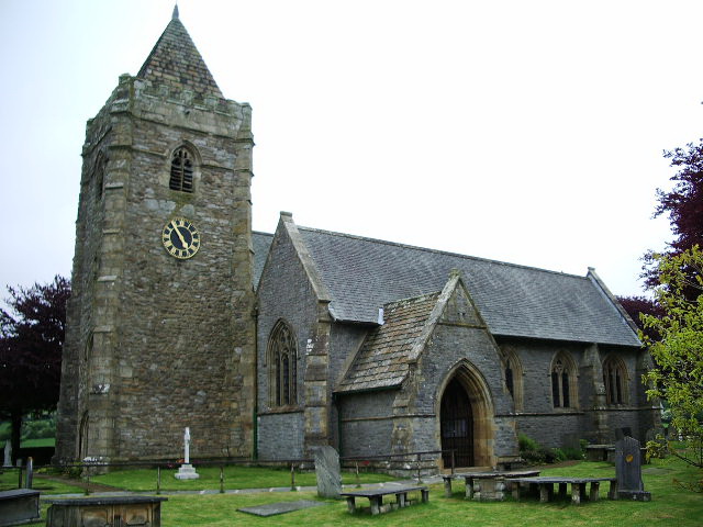


Why visit Ingleton
Townapedia lists 4 museums and landmarks, 1 park or trail, 17 places to eat, 14 places to stay and 12 attractions in and around town.
Highlights include Ingleton Viaduct, White Scar Caves and White Scar Cave.
Weather in Ingleton
Forecast from MET Norway (CC BY 4.0). Full forecast
About Ingleton
Ingleton is a village and civil parish in North Yorkshire, England. The village is 17 miles (27 km) from Kendal and 17 miles (27 km) from Lancaster on the western side of the Pennines. It is 9 miles (14 km) from Settle. The River Doe and the River Twiss meet to form the source of the River Greta, a tributary of the River Lune.
From the Wikipedia article Ingleton, North Yorkshire (this version), under CC BY-SA 4.0.
Photos of Ingleton

Things to do12

White Scar Caves
Monument and historic site · 1.4 mi
Cave in United Kingdom




Museums and landmarks4


Parks, trails and playgrounds1

Restaurants and cafes17
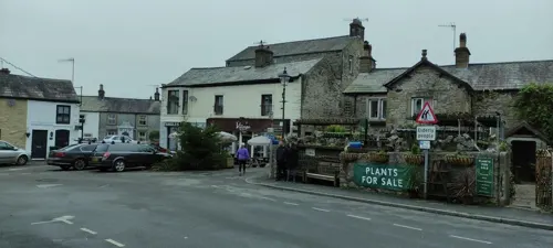
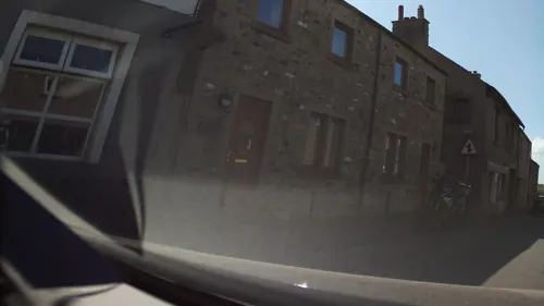
Masons Freehouse
Bar and pub · 0.5 mi
New Road, Ingleton
Mo-Fr 14:00-23:00, Sa 12:00-21:00, Su 12:00-20:00
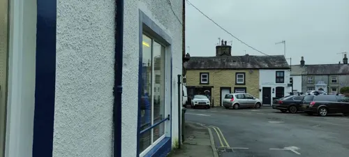
The Village Kitchen
Cafe · Sandwich, Cake, Salad
8-10 The Square, Carnforth
Mo,We-Sa 07:00-17:00; Su 09:00-17:00

5 more on the map.
History
Ingleton and the surrounding area was settled in the Iron Age by the Brigantes, who built a hill fort on top of Ingleborough with walls 0.6 miles (1 km) in circumference. It is thought that the Romans defeated the Brigantes in battle and built a fort alongside the hill fort. The valley was crossed by Roman roads as Ingleton was a strategic river crossing. By the 12th century the Normans had built a church in the village.
The name Ingleton derives from the Old English ingeltūn meaning 'settlement by a peak'.
Willian Lowther (1574–1641) of Ingleton Hall was Lord of the manor, Justice of the Peace for the West Riding and had seven children. His son Richard (1602–1645) inherited the manor and two sons joined the church. His daughter Frances (1612–1665) married John Walker who leased the Ingleton Colleries, and Elizabeth (1615–?) married Anthony Bouch on 23 January 1633 and mortgaged Ingleton Manor.
Read more of the history
Richard Lowther (Collonell [sic], governor of Pontefract) and his son Gerrard were on the losing Royalist side at the Civil War siege of Pontefract Castle in 1645, and later at Newark. The war ended and his father dead, Gerrard was fined by the new government for his delinquency, and entered into a series of agreements to pay the debt and court appearances to maintain the estate. The Lord of Manor title had passed to Anthony Bouch by 1665, and the coal rights passed to the Walker family after a settlement in the chancery court in 1678.
The Ingleton Coalfield was worked for 400 years. It is about 6 miles long by 4 miles wide and extends into the neighbouring parishes of Burton in Lonsdale and Thornton-in-Lonsdale. The coalfield terminates at the South Craven fault. The coal measures are shallow and represent the lowest layers in the Pennine coal measures sequence. The earliest coal mining occurred along the River Greta where Four Foot and Six Foot seams outcrop. Most deep mining was at New Ingleton Pit, sunk in 1913. Its sinking led to the discovery of the Ten Foot seam (house and steam coal) at 127 yards, and the Nine Foot seam (steam and house coal) at 134 yards. Beneath them are the Four Foot seam (house, gas and coking coal) at 233 yards, the Three Foot seam (house and gas coal) at 236 yards and the Six Foot seam (steam and house coal) at 260 yards. Commercially viable deposits of fireclay lay under the Three Foot seam and pottery clay beneath the Six Foot seam was used to make Ingleton Bricks.
Coal was delivered by horse and cart. Ingleton and Bentham Moors were enclosed in 1767. Plans were drawn up in 1780 to connect Ingleton to the Leeds & Liverpool Canal via Clapham, Settle and Foulridge, Colne but it never progressed. Boys and girls as young as four worked the collieries in the 1780, first as 'messengers' and from six, underground, as 'trailers', pulling coal tubs. The last mine was closed in 1940.
Ingleton Mill was built in 1791 by four partners who also had built a mill in Clapham in 1786. The partners – George Armitstead, a cotton spinner, Ephraim Ellis, William Petty and Thomas Wigglesworth – bought the barn beside the old corn mill and built the mill. They obtained iron for its construction from Kirkstall Forge. They ran a joiner's shop, smithy and cotton mill. It was sold in 1807 and used to spin flax by John Coates, before reverting to cotton spinning in 1837. (National Building Register:63815: .)
From the History section of Ingleton, North Yorkshire on Wikipedia, under CC BY-SA 4.0.
More about Ingleton
Geography
The civil parish of Ingleton is extensive, stretching from Blea Moor near Wold Fell (SD793847) in the north to Newby Moor (SD704698) in the south. The north of the parish follows the county boundary with Lancashire to Whernside (SD739816). From here it follows the ridge south-west to West Fell and down to Thornton Force on the River Twiss, and thence along the river, and the River Greta to Fourlands Hill (SD698713). The east of the parish follows the watershed of the River Ure, a headwater of the River Humber, and the River Ribble to Grove Head where it is only 200m from the Pennine Way, it drops to the B6255 road and the River Ribble at the milepost at SD793816. The boundary follows the Ribble through Ribblehead, then takes the ridge through Park Fell and Simon Fell to Ingleborough. It passes due south over Ingleborough Common to Newbury Moss, descending to Cold Cotes on the old road at SD722712. Ingleborough is 2,373 feet (723 m) high.
Economy
Tourism, mostly from walking and caving, accounts for most of the economic activity of the village, especially in spring and summer. There are craft businesses, such as pottery.
Of two quarries in the parish, Ingleton Quarry, owned by Hanson Aggregates, is active and extracts Ordivician greywacke for roadstone but Meal Bank Quarry that extracted Carboniferous limestone and possessed an early Hoffman kiln is no longer active.
In 1933 an open-air swimming pool was constructed by volunteers, with materials supplied by the New Ingleton Colliery. The European (Objective 5b) Community Fund, the National Lottery and private donations have been used to improve and modernise the pool.
Education
It is a partner in 'The Three Peaks Family of Schools', a grouping of secondary schools, primary schools and middle schools, serving North Craven. A small school, it teaches pupils from Nursery (ages 3–4) until Year Six (10–11).
This was once a first school until the re-organisation on 31 August 2012. The pupils transferred to the adjacent Ingleton Middle School after year 5, at the age of ten. They remained here until 13 when the transferred to the upper school in Settle. The Middle School buildings are now used as a Community Information Centre which is run as a not-for-profit organisation. The playing fields have been sold. Settle Middle school buildings were transferred to Settle College to provide the extra capacity needed for two extra year groups.
Students from Ingleton transfer at the age of eleven to the receiving secondary schools, Settle College and Queen Elizabeth School, Kirkby Lonsdale. After secondary education pupils can either stay on to sixth form or transfer to a local college such Kendal College, Lancaster or Morecambe College.
From the Wikipedia article Ingleton, North Yorkshire, under CC BY-SA 4.0.
Notable people from Ingleton

Born in Ingleton, according to Wikidata (CC0). Each name links to its Wikipedia article.
Where to stay14
Churches and places of worship9
Shopping8
Gas and EV charging1
Schools, colleges and libraries2
Healthcare1
Map of Ingleton
69 places. The map loads OpenStreetMap tiles when you open it.
Getting there and nearby towns
Walney Aerodrome (BWF) is the nearest airport with scheduled flights listed in OpenStreetMap, 32 miles away.
- High Bentham 3 mi southwest, about 5 min by car
- Kirkby Lonsdale 6 mi northwest, about 10 min by car
- Silverdale 14 mi west, about 23 min by car
- Hellifield 14 mi southeast, about 23 min by car
- Lancaster 15 mi southwest, about 25 min by car
- Kendal 16 mi northwest, about 26 min by car
- Morecambe 17 mi west, about 27 min by car
- Heysham 19 mi southwest, about 30 min by car
- Clitheroe 20 mi south, about 32 min by car
- Barnoldswick 20 mi southeast, about 32 min by car
Drive times are estimates from straight-line distance, not routes.
Towns near Ingleton


Keep exploring
Local news
Headlines from INDB.
Reviews, tips and questions
Loading what members have shared...
Sources and licences
- GeoNames (CC BY 4.0): population, coordinates, regions and time zone
- Mapillary (see each image): photos
- OpenStreetMap contributors (ODbL 1.0): places, airports, map data
- Wikidata (CC0 1.0): elevation, founding date, time zone, website, landmarks and historic places
- Wikimedia Commons (see each image): photos
- Wikipedia (CC BY-SA 4.0): overview and history text
Photo credits
- The viaduct in Ingleton, Yorkshire, Ben Gamble, CC BY-SA 2.0
- St Margaret's Church, High Bentham, Alexander P Kapp, CC BY-SA 2.0
- Ingleton Church of St Mary the Virgin, Simon Armstrong, CC BY-SA 3.0
- St Oswald's Church, Thornton in Lonsdale, Alexander P Kapp, CC BY-SA 2.0
- THREE CHEST TOMBS IN CHURCHYARD TO SOUTH OF ENTRANCE TO CHURCH OF ST MARY 2, Barrie Price, CC BY-SA 4.0
- THREE CHEST TOMBS IN CHURCHYARD TO SOUTH OF ENTRANCE TO CHURCH OF ST MARY 3, Barrie Price, CC BY-SA 4.0
- THREE CHEST TOMBS IN CHURCHYARD TO SOUTH OF ENTRANCE TO CHURCH OF ST MARY, Barrie Price, CC BY-SA 4.0
- THREE CHEST TOMBS IN CHURCHYARD TO SOUTH OF ENTRANCE TO CHURCH OF ST MARY 5, Barrie Price, CC BY-SA 4.0
- THREE CHEST TOMBS IN CHURCHYARD TO SOUTH OF ENTRANCE TO CHURCH OF ST MARY 4, Barrie Price, CC BY-SA 4.0
- INGLETON VIADUCT, Barrie Price, CC BY-SA 4.0
- Beezley Falls - panoramio, Keith Ruffles, CC BY 3.0
- Above Thornton Force - panoramio, Keith Ruffles, CC BY 3.0
- The Dales from White Scar Cave - panoramio, Keith Ruffles, CC BY 3.0
- Street-level photo, jethro10, CC BY-SA 4.0
- Street-level photo, jethro10, CC BY-SA 4.0
- Street-level photo, jethro10, CC BY-SA 4.0
- Street-level photo, southglos, CC BY-SA 4.0
- Street-level photo, jethro10, CC BY-SA 4.0
- Street-level photo, blind_leader, CC BY-SA 4.0
- Street-level photo, jethro10, CC BY-SA 4.0
- Street-level photo, blind_leader, CC BY-SA 4.0
- Street-level photo, jethro10, CC BY-SA 4.0
- Street-level photo, jethro10, CC BY-SA 4.0
- Street-level photo, jethro10, CC BY-SA 4.0
- Street-level photo, jethro10, CC BY-SA 4.0
- Street-level photo, jethro10, CC BY-SA 4.0
- Street-level photo, mainlymazza, CC BY-SA 4.0
- Street-level photo, mainlymazza, CC BY-SA 4.0
- Street-level photo, southglos, CC BY-SA 4.0
- Street-level photo, southglos, CC BY-SA 4.0
- Street-level photo, jethro10, CC BY-SA 4.0
- Street-level photo, jethro10, CC BY-SA 4.0
- Street-level photo, jethro10, CC BY-SA 4.0
- Street-level photo, jethro10, CC BY-SA 4.0
- Street-level photo, jethro10, CC BY-SA 4.0
- Street-level photo, jethro10, CC BY-SA 4.0
- Street-level photo, mainlymazza, CC BY-SA 4.0
- Street-level photo, blind_leader, CC BY-SA 4.0


Page built November 10, 2026. Spotted a mistake? Tell us or suggest a place.