



Why visit Kendal
Townapedia lists 19 museums and landmarks, 16 parks and trails, 126 places to eat, 12 places to stay and 5 attractions in and around town.
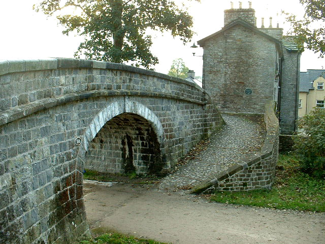
Highlights include Change Bridge Over Former Lancaster-Kendal Canal, Lake District Farm Shop, Abbot Hall Art Gallery and Kendal Museum.
Weather in Kendal
Forecast from MET Norway (CC BY 4.0). Full forecast
About Kendal
Kendal, once Kirkby in Kendal or Kirkby Kendal, is a market town and civil parish in the Westmorland and Furness area of Cumbria, England, just outside the Lake District. It lies within the River Kent's dale, from which its name is derived.
From the Wikipedia article Kendal (this version), under CC BY-SA 4.0.
Travel tips from other travellers: Kendal on Wikivoyage (CC BY-SA 4.0).
Photos of Kendal


Things to do5

Change Bridge Over Former Lancaster-Kendal Canal
Bridge · 0.6 mi
Bridge in Kendal, Westmorland and Furness, Cumbria, England, UK



Museums and landmarks19

Abbot Hall Art Gallery
Museum
Grade I listed art museum in Kendal, United Kingdom
Church Walk, Kendal
We-Sa 10:00-16:00


Sizergh Castle
Museum · 3.1 mi
Grade I listed historic house museum in South Lakeland, United Kingdom



Museum of Lakeland Life
Museum
Local museum in Kendal, Westmorland and Furness, Cumbria, England, UK

7 more on the map.
Parks, trails and playgrounds16




4 more on the map.
Restaurants and cafes126
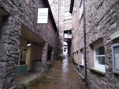
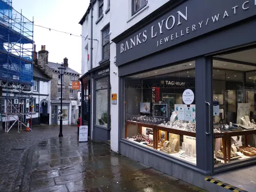
Fold Coffee
Cafe · Cake, Coffee Shop · 0.5 mi
Beezon Road, Kendal
Mo-Fr 07:30-14:30; Sa-Su 08:30-14:30
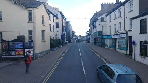
La Luna
Restaurant · Regional
129 Highgate, Kendal
Tu-Fr 11:30-14:15,17:30-21:15; Sa 11:30-14:15,18:00-21:30

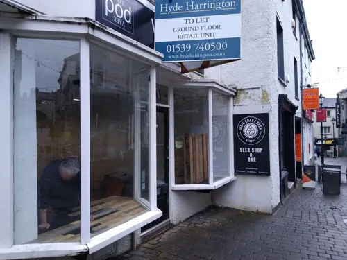
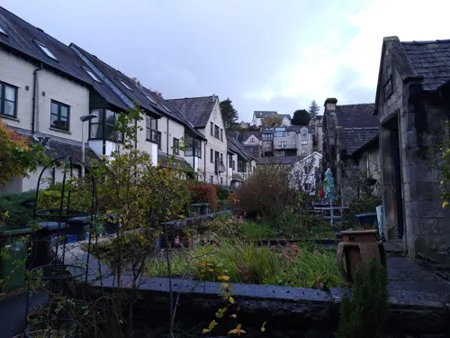

114 more on the map.
History
A chartered market town, the centre of Kendal has formed round a high street with alleyways, known locally as yards, off to either side. The main industry in those times was the manufacture of woollen goods, whose importance is reflected in the town's coat of arms and in its Latin motto Pannus mihi panis (Cloth is my bread.) "Kendal Green" was a hard-wearing, wool-based fabric specific to the local manufacturing process. It was supposedly sported by the Kendalian archers instrumental in the English victory over the French at the Battle of Agincourt. Kendal Green was also worn by slaves in the Americas and appears in songs and literature from that time. Shakespeare notes it as the colour of clothing worn by foresters (Henry IV, Part 1).
Read more of the history
Kendal Castle has a long history as a stronghold, built on the site of several successive castles. The earliest was a Norman motte and bailey (located on the west side of the town), when the settlement went under the name of Kirkbie Strickland. The most recent is from the late 12th century, as the castle of the Barony of Kendal, the part of Westmorland ruled from here. The castle is best known as the home of the Parr family, as heirs of these barons. They inherited it through marriage in the reign of Edward III of England. Rumours still circulate that King Henry VIII's sixth wife Catherine Parr was born at Kendal Castle, but the evidence available leaves this unlikely: by her time the castle was beyond repair and her father was already based in Blackfriars, London, at the court of King Henry VIII.
A Roman fort stood about 2 miles south of today's town centre, at a site later known as Watercrook. It was built about AD 90, originally in timber, rebuilt with stone about 130, in the reign of Hadrian. The fort was abandoned for about 20 years during the Antonine re-occupation of Scotland. It was rebuilt in the reign of Marcus Aurelius and occupied until about 270 – probably the last time it served military purposes. What remains of the stone structure is now buried under a field. Many Roman artefacts from the site may be found in the Kendal Museum.
Early travellers to Kendal complained of eight miles of "nothing but a confused mixture of Rockes and Boggs." Riding horseback was the fastest form of travel, as the road was "no better than the roughest fell tracks on high ground and spongy, miry tracks in the vales."
It became clear it was unjust and beyond the power of a thinly scattered rural population to maintain a road used for through traffic. "Whereas the road is very ruinous, and some parts thereof almost impassable and could not, by the ordinary course appointed by the Laws then in being for repairing the highways, be amended and kept in good repair, unless some further provision was made." In 1703, by Order of the Quarter Sessions of the Barony of Kendall, the surveyors of highways were to make the roads good and sufficient for the passage of coaches, carts and carriages. In 1753 the Keighley and Kendal Turnpike brought a stage coach service from Yorkshire as far as Kendal.
Kendal is known for Kendal mint cake, a glucose-based confectionery reputedly discovered accidentally by Joseph Wiper during a search for a clear glacier mint.
Used on numerous expeditions to mountaintops (including Mount Everest and K2) and both poles of the Earth, its popularity is mainly due to the very astute decision of the original manufacturer's great-nephew to market it as an energy food and supply it to Ernest Shackleton's 1914–1917 Trans-Antarctic Expedition.
By the time the business was sold to a competitor, Romney's, in 1987, there were several rival mint-cake producers; some of these businesses are still in business.
Snuff manufacture in Kendal dates from 1792, when Kendal resident Thomas Harrison returned from learning its production in Glasgow, Scotland. He brought with him 50 tons of second-hand equipment, all carried on horseback. Pipe tobacco and other tobacco products were added later to the firm's production. Ownership of the firm passed to a son-in-law, Samuel Gawith, whose eponymic firm Samuel Gawith & Co. remains in business. After Gawith's death in 1865, the firm passed to his two eldest sons, being administered initially by trustees, including Henry Hoggarth, and John Thomas Illingworth.
Illingworth left the firm in 1867 to start his own firm, which remained in business until the 1980s. The youngest son of Samuel Gawith subsequently teamed with Henry Hoggarth to form Gawith Hoggarth TT, Ltd. Both firms continue in business in Kendal, producing snuffs and tobacco products used around the world. Samuel Gawith and Company holds the distinction of employing the oldest piece of industrial equipment still in use in the world: a device manufactured in the 1750s.
The Maude, Wilson & Crewdsons Bank was established in "Farrers House", Stramongate in 1788. Joseph Maude, Christopher Wilson and Thomas Crewdson were the original partners. In 1792 they moved into specially constructed premises at No 69, Highgate. The Wilson family, who lived at Abbot Hall, withdrew in 1826 at a time of the paper panic of 1825 caused by a run on the banks. Under the style of W D Crewdson & Sons, the remaining family continued until the amalgamation in 1840 with John Wakefield & Sons founded by John Wakefield. The bank was eventually bought out by Barclays.
From the History section of Kendal on Wikipedia, under CC BY-SA 4.0.
More about Kendal
Geography
Kendal stands on the River Kent, and is mostly ringed by low hills: Scout Scar to the west, Potter Fell to the north, and Benson Knott and Helm Hill to the east. To the south the River Kent winds through rolling dairy- and sheep-farming terrain before reaching the sea at Morecambe Bay around Arnside. Although Kendal is near the Lake District National Park, formed in 1951, it does not lie within the park's boundaries. Kendal's location surrounded by numerous rural villages makes it an important commercial centre for a wide area. It has been dubbed "The Gateway to the Lakes".
Kendal has a marine west-coast climate, category Cfb on the Köppen Climate Classification. It has moderately warm summers and mild winters with precipitation at all times of year. In July and August the average daily maximum and minimum are 19 and 11 °C (66 and 52 °F) respectively. The corresponding ones in January and February are 6 and 1 °C (43 and 34 °F).
Economy
Kendal's early prosperity was based largely on cloth manufacture. In the 19th century it became a centre for the manufacture of snuff and shoes – the K Shoes company remained a major employer in the town until its factory closed in 2003. There are still several industries based in the town, such as Gilbert Gilkes & Gordon (manufacturers of pumps and turbines), James Cropper paper makers (based in Burneside, who make, at no profit, the paper for the Remembrance poppies for the Royal British Legion), Mardix (switchgear), Lakeland, and Kendal Nutricare, which has a facility for making baby milk in the north of the town. Tourism is now a major employer, but there is also a significant IT and design sector, enabled by increased broadband availability.
On 26 February 2003, Kendal was granted Fairtrade Town status.
Education
The Queen Katherine School, on Appleby Road, is a secondary school with academy status. The school also has a sixth form.
Kirkbie Kendal School, formed from a merger of Kendal Grammar School & Kendal High School is a secondary school Business and Enterprise College serving the area. It operates as a foundation school with academy status. Its former pupils include the historian David Starkey.
Kendal College provides further and higher education courses and the training for employers.
From the Wikipedia article Kendal, under CC BY-SA 4.0.
Notable people from Kendal
 Catherine Parrsixth wife of Henry VIII of England; final queen consort of the House of TudorPhoto: anonymous, Public domain
 Steve HogarthEnglish singerPhoto: Anne-Marie Forker, CC BY-SA 4.0
 James KnoxBritish cyclistPhoto: Jérémy-Günther-Heinz Jähnick, CC BY-SA 3.0
 Thomas ShawBritish cleric and traveller; (1694-1751)Photo: Unknown author, CC BY 4.0
 Richard BraithwaiteEnglish poetPhoto: Artist: George Clint, 1770-1854,..., Public domain
 Richard BaronBritish botanist and geologist (1847-1907)Photo: Frank Vassen from Brussels, Belgium, CC BY 2.0
 Joseph Bevan BraithwaiteEnglish Quaker ministerPhoto: Unknown author Unknown author, Public domain
- Arthur EddingtonBritish astrophysicist (1882-1944)
- William HudsonBritish botanist and apothecary (1730–1793)
- Ephraim ChambersEnglish writer and encyclopaedist
- David StarkeyBritish constitutional historian
- Desmond BagleyBritish writer (1923-1983)
Born in Kendal, according to Wikidata (CC0). Each name links to its Wikipedia article.
Where to stay12
Churches and places of worship20
The Church of Jesus Christ of Latter-day Saints
Church · Latter Day Saints
Sandes Avenue, Kendal
Shopping54
Gas and EV charging3
Schools, colleges and libraries16
Healthcare9
Map of Kendal
250 places. The map loads OpenStreetMap tiles when you open it.
Getting there and nearby towns
Walney Aerodrome (BWF) is the nearest airport with scheduled flights listed in OpenStreetMap, 25 miles away.
- Ulverston 17 mi southwest, about 27 min by car
- Penrith 23 mi north, about 38 min by car
- Poulton-le-Fylde 35 mi south, about 57 min by car
- Blackpool 37 mi south, about 1 h by car
- Whitehaven 37 mi northwest, about 59 min by car
- Preston 39 mi south, about 1 h by car
- Workington 39 mi northwest, about 1 h by car
- Skipton 39 mi southeast, about 1 h by car
- Blackburn 41 mi south, about 1 h by car
- Burnley 42 mi southeast, about 1 h 15 min by car
Drive times are estimates from straight-line distance, not routes.
Towns near Kendal


Keep exploring
Local news
Headlines from INDB.
Reviews, tips and questions
Loading what members have shared...
Sources and licences
- GeoNames (CC BY 4.0): population, coordinates, regions and time zone
- Mapillary (see each image): photos
- OpenStreetMap contributors (ODbL 1.0): places, airports, map data
- Wikidata (CC0 1.0): elevation, founding date, time zone, website, landmarks and historic places
- Wikimedia Commons (see each image): photos
- Wikipedia (CC BY-SA 4.0): overview and history text
Photo credits
- Kendal Town Hall, Dave Bevis, CC BY-SA 2.0
- Kendal Bank - panoramio, flipflopnick, CC BY-SA 3.0
- Tesco Express convenience store in Kendal, Curran2, CC0
- HSBC, Kendal, Kenneth Allen, CC BY-SA 2.0
- Turning bridge Kendal, David Medcalf, CC BY-SA 2.0
- Abbott Hall Art Gallery, Kendal, Jhsteel, CC BY-SA 3.0
- Kendal Museum entrance, Geni, CC BY-SA 4.0
- Sizergh Castle 01, Ian Knox, CC BY-SA 2.0
- St Mark's Church, Natland, Alexander P Kapp, CC BY-SA 2.0
- St George's Church, Kendal, Humphrey Bolton, CC BY-SA 2.0
- Kendal Castle at sunset, Tom Richardson, CC BY-SA 2.0
- Holy Trinity Church, Kendal (6947), Nilfanion, CC BY-SA 4.0
- Watercrook Farm and the River Kent, "Karl and Ali", CC BY-SA 2.0
- Ring o' Bells, Kendal, David Dixon, CC BY-SA 2.0
- Kendal Castle From Above, Sept 2015, Anglovirtual, CC BY-SA 3.0
- Church of the Holy Trinity, Kendal, Cumbria, England, KJP1, CC BY-SA 4.0
- Street-level photo, jethro10, CC BY-SA 4.0
- Street-level photo, skifans, CC BY-SA 4.0
- Street-level photo, jethro10, CC BY-SA 4.0
- Street-level photo, jethro10, CC BY-SA 4.0
- Street-level photo, skifans, CC BY-SA 4.0
- Street-level photo, skifans, CC BY-SA 4.0
- Street-level photo, skifans, CC BY-SA 4.0
- Street-level photo, skifans, CC BY-SA 4.0
- Street-level photo, jethro10, CC BY-SA 4.0
- Street-level photo, skifans, CC BY-SA 4.0
- Street-level photo, IpswichEdits, CC BY-SA 4.0
- Street-level photo, adam2, CC BY-SA 4.0
- Street-level photo, jethro10, CC BY-SA 4.0
- Street-level photo, jethro10, CC BY-SA 4.0
- Street-level photo, jethro10, CC BY-SA 4.0
- Street-level photo, jethro10, CC BY-SA 4.0
- Street-level photo, jethro10, CC BY-SA 4.0
- Street-level photo, skifans, CC BY-SA 4.0
- Street-level photo, skifans, CC BY-SA 4.0
- Street-level photo, skifans, CC BY-SA 4.0
- Street-level photo, skifans, CC BY-SA 4.0
- Street-level photo, skifans, CC BY-SA 4.0
- Street-level photo, skifans, CC BY-SA 4.0
- Street-level photo, skifans, CC BY-SA 4.0


Page built November 10, 2026. Spotted a mistake? Tell us or suggest a place.