


Why visit Keadby
Townapedia lists 4 parks and trails, 3 places to eat and 2 attractions in and around town.
Highlights include Baths Hall, Keadby Bridge, Atkinsons Warren and Brumby Wood.
Weather in Keadby
Forecast from MET Norway (CC BY 4.0). Full forecast
About Keadby
Keadby is a small village and former civil parish, now in the parish of Keadby with Althorpe, in the North Lincolnshire district, in the ceremonial county of Lincolnshire, England. It is situated just off the A18, west of Scunthorpe, and on the west bank of the River Trent. The civil parish of Keadby with Althorpe had a population at the 2011 census of 1,930.
From the Wikipedia article Keadby (this version), under CC BY-SA 4.0.
Things to do2

Baths Hall
Cinema and theater · 3.3 mi
Theatre and arts centre in Scunthorpe, England, originally public swimming baths

Keadby Bridge
Bridge · 0.6 mi
Grade II listed bascule bridge in Gunness, and Keadby with Althorpe, North Lincolnshire, Lincolnshire, England, UK
Parks, trails and playgrounds4

Atkinsons Warren
Park · 3.0 mi
Nature reserve in Lincolnshire, England
Central Park
Park · 3.0 mi
Park in Scunthorpe, North Lincolnshire, England
Restaurants and cafes3
Churches and places of worship3
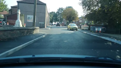

St John the Baptist's Church, Burringham
Church · 1.5 mi
Grade II listed church in Burringham, North Lincolnshire, Lincolnshire, England, UK
History
The place-name 'Keadby' is first attested in 1185, where it appears as Ketebi in the Records of the Templars in England. The name means "Keti's by", 'Keti' being an Old Danish name and 'by' meaning a village or homestead in Old Scandinavian.
Keadby's economic significance lies in that it was chosen as the destination for the Stainforth and Keadby Canal, opened in 1802. The canal is now mostly a leisure waterway for pleasure boaters, with Keadby being at the "end of the line". There is a lock between the canal and the tidal River Trent. At Keadby are the Keadby Power Stations, and 'Port Services', a small port for inward-bound timber and scrap metal.
The village was served by the South Yorkshire Railway. A railway station served the village until the late 1870s-80s. When it was closed, another station opened at Althorpe instead. This is the closest one to the village.
In 1951 the parish of Keadby had a population of 627. On 1 April 1958 the parish was abolished and merged with Althorpe to form "Keadby with Althorpe".
From the History section of Keadby on Wikipedia, under CC BY-SA 4.0.
Schools, colleges and libraries2
Gunness and Burringham Church of England Primary School
School · Anglican · 0.7 mi
Burringham Road, Scunthorpe
Map of Keadby
14 places. The map loads OpenStreetMap tiles when you open it.
Getting there and nearby towns
Humberside Airport (HUY) is the nearest airport with scheduled flights listed in OpenStreetMap, 16 miles away.
- Scunthorpe 4 mi east, about 6 min by car
- Thorne 9 mi west, about 15 min by car
- Goole 9 mi northwest, about 15 min by car
- Scawby 9 mi southeast, about 15 min by car
- Winteringham 9 mi northeast, about 14 min by car
- Brough 12 mi northeast, about 19 min by car
- Armthorpe 13 mi west, about 22 min by car
- Kirk Sandall 14 mi west, about 22 min by car
- Barton upon Humber 14 mi northeast, about 22 min by car
- Gainsborough 15 mi south, about 23 min by car
Drive times are estimates from straight-line distance, not routes.
Towns near Keadby


Keep exploring
Local news
Headlines from INDB.
Reviews, tips and questions
Loading what members have shared...
Sources and licences
- GeoNames (CC BY 4.0): population, coordinates, regions and time zone
- Mapillary (see each image): photos
- OpenStreetMap contributors (ODbL 1.0): places, airports, map data
- Wikidata (CC0 1.0): elevation, founding date, time zone, website, landmarks and historic places
- Wikimedia Commons (see each image): photos
- Wikipedia (CC BY-SA 4.0): overview and history text
Photo credits
- Keadby Bridge, The original uploader was Asterion at English Wikipedia ., CC BY-SA 2.5
- Side View of The Front Entrance of The Baths Hall, Bathshall, CC BY-SA 3.0
- Street-level photo, cuttlebug, CC BY-SA 4.0
- Street-level photo, cuttlebug, CC BY-SA 4.0
- Street-level photo, cuttlebug, CC BY-SA 4.0
- Street-level photo, cuttlebug, CC BY-SA 4.0
Page built November 10, 2026. Spotted a mistake? Tell us or suggest a place.