


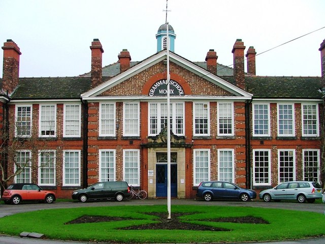


Why visit Goole
Townapedia lists 10 museums and landmarks, 10 parks and trails, 49 places to eat, 1 place to stay and 6 attractions in and around town.
Highlights include Boothferry Bridge, Junction (Theatre/Cinema), Goole Museum and Viking Marine.
Weather in Goole
Forecast from MET Norway (CC BY 4.0). Full forecast
About Goole
Goole is a port town and civil parish on the River Ouse in the East Riding of Yorkshire, England. The town's historic county is the West Riding of Yorkshire.
From the Wikipedia article Goole (this version), under CC BY-SA 4.0.
Things to do6

Boothferry Bridge
Bridge · 1.7 mi
Bridge in Airmyn and Howden, East Riding of Yorkshire, England
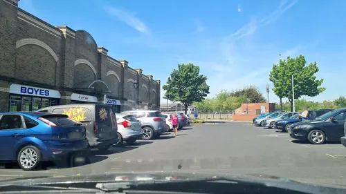

Goole railway swing bridge
Bridge · 1.6 mi
Bridge in Goole, East Riding of Yorkshire, England, UK
Ouse Bridge
Bridge · 1.7 mi
Motorway bridge near Goole, East Riding of Yorkshire, England, UK

Theatre Royal, Goole
Cinema and theater · 0.4 mi
Former theatre in Goole, England (1883-1915), later converted to a shop/garage
Museums and landmarks10

Goole Museum
Museum
Carlisle Street, Goole
Tu-Fr 10:00-12:00,12:30-17:00; Sa 09:00-12:00,12:30-16:00; PH off

Viking Marine
Monument and historic site · 0.5 mi
Albert Street, Goole
Mo-Fr 09:00-16:00; Sa 10:00-14:00
Howden War Memorial
Monument and historic site · 3.0 mi
War memorial in Howden, East Riding of Yorkshire, England, UK
Parks, trails and playgrounds10





Restaurants and cafes49

The Percy Arms
Bar and pub · 1.4 mi
High Street, Goole
Mo-Th 11:30-23:00;Fr-Sa 11:30-00:00;Su 11:45-22:00

Mr NessuNo
Restaurant · Italian, Pizza
46-48 Aire Street, Goole
Clifton Hotel & Chinese Restaurant
Restaurant · Chinese
155 Boothferry Road, Goole


37 more on the map.
History
Goole is first attested in 1306, as Gull Lewth (where lewth means 'barn', from Old Norse hlaða), and then 1362 as Gulle in Houke' (referring to the nearby, and then more significant, village of Hook). The name is first attested in its shorter, modern form, from the 1530s. It comes from the Middle English word goule (or an Old English ancestor), meaning 'a channel made by a stream'. The word has sometimes been taken to imply that Goole is named after an open sewer, but there is no strong basis for this. There were no sewers in the area in that etymological period but there were many land drains because of the flat terrain: cf.: "gully".
The Dutch civil engineer Cornelius Vermuyden diverted the River Don northwards to the River Ouse in 1626–1629 in order to drain the marshland of Hatfield Chase at the behest of King Charles I. It made the new lower Don – known as the Dutch River – navigable for barges so that coal from the South Yorkshire Coalfield could be transported to the new confluence for transfer to seagoing vessels. There the engineers built a new wooden bridge – rebuilt in iron in the 1890s and now known as the Dutch River Bridge – to the east of which a new village called 'Goole' formed.
Read more of the history
In the 1820s the Aire and Calder Navigation company proposed development of a new canal to transport coal from the existing broad canal from Knottingley in the northern sector of the coalfield in 1826. Once it reached Goole the company proposed development of a new floating dock capable of handling larger sea-going vessels. Chief engineer Thomas Hamond Bartholomew was instructed to build the canal, docks and an associated company town to house both the dock workers and visiting seamen. Bartholomew commissioned civil engineer and builder Sir Edward Banks company to construct part of the canal and the eight transshipment docks and to lay out the associated new town to the west of the existing wooden bridge. The Banks Arms Hotel on Aire Street – today known as the Lowther Hotel – was in 1824 the first building constructed in what was known as New Goole; The Macintosh Arms public house on the same street took its name from engineer Hugh Macintosh.
When Goole port opened on 20 July 1826 it was a new community of about 450 people. Now it is a 200 year old town with about 18,000 inhabitants.
William Hamond Bartholomew succeeded his father T. H. Bartholomew in 1853 and in 1863 introduced the Tom Pudding system of compartment boats, which could carry around 40 long tons (41,000 kg) of coal. On reaching the docks the barges were lifted by large hoists, from which they could be discharged direct into seagoing ships, a system so successful that it competed against rail until 1985.
From the History section of Goole on Wikipedia, under CC BY-SA 4.0.
More about Goole
Economy
Goole has a modestly-sized town centre with many high street shops, independent retailers and public houses. The main shopping area is Wesley Square, off Boothferry Road (which has been pedestrianised around the main shopping area). There is a modern retail development in the town centre, a leisure centre next to the docks and the Goole and District Hospital, to the north of the town. A theatre and cinema, 'Junction', opened in 2009.
Education
Goole has several primary schools as well as Goole High School, and a special education school, Riverside School, that caters for 2–19 year olds. There are further education colleges in Selby, York, Scunthorpe, and Bishop Burton. Goole College was closed in 2021 and is now being used as a temporary Gym while Goole Leisure Centre is redeveloped.
From the Wikipedia article Goole, under CC BY-SA 4.0.
Notable people from Goole
 Nigel AdamsBritish politician (born 1966)Photo: Simon Dawson / No 10 Downing Street, CC BY 2.0
 Nicky FeatherstoneBritish footballer (born 1988)Photo: Poolie22, CC BY-SA 4.0
 Ian SmithEnglish comedianPhoto: Bryan Berlin, CC BY-SA 4.0
- Gavin BryarsEnglish composer and double bassist
- Thomas BeattieEnglish footballer (born 1986)
- Jamie NoonEnglish rugby union footballer
- John KayeFootballer (born 1940)
- Ian DavidsonEnglish footballer born 1947
- Jimmy MannEnglish footballer (born 1952)
- Arthur AtkinsonEnglish footballer (1909-1983)
- Charles McDermottEnglish footballer
- Bob ToddEnglish professional footballer (born 1949)
Born in Goole, according to Wikidata (CC0). Each name links to its Wikipedia article.
Where to stay1
Churches and places of worship13
Shopping10
Gas and EV charging1
Schools, colleges and libraries10
Healthcare5
Map of Goole
115 places. The map loads OpenStreetMap tiles when you open it.
Getting there and nearby towns
Humberside Airport (HUY) is the nearest airport with scheduled flights listed in OpenStreetMap, 24 miles away.
- Thorne 7 mi southwest, about 12 min by car
- Selby 10 mi northwest, about 15 min by car
- Kirk Sandall 13 mi southwest, about 20 min by car
- Doncaster 16 mi southwest, about 26 min by car
- Knottingley 16 mi west, about 25 min by car
- South Elmsall 18 mi southwest, about 29 min by car
- York 19 mi northwest, about 31 min by car
- Kippax 21 mi west, about 33 min by car
- Kingston upon Hull 22 mi east, about 36 min by car
- Mexborough 22 mi southwest, about 36 min by car
Drive times are estimates from straight-line distance, not routes.
Towns near Goole


Keep exploring
Local news
Headlines from INDB.
Reviews, tips and questions
Loading what members have shared...
Sources and licences
- GeoNames (CC BY 4.0): population, coordinates, regions and time zone
- Mapillary (see each image): photos
- OpenStreetMap contributors (ODbL 1.0): places, airports, map data
- Wikidata (CC0 1.0): elevation, founding date, time zone, website, landmarks and historic places
- Wikimedia Commons (see each image): photos
- Wikipedia (CC BY-SA 4.0): overview and history text
Photo credits
- Boothferry Road, Goole, David Locke, CC BY 2.0
- Church of St Mary the Virgin Hook, Bill Henderson, CC BY-SA 2.0
- Howden Minster, James@hopgrove at English Wikipedia, Public domain
- Goole High School, Mick Garratt, CC BY-SA 2.0
- St Peters Church Laxton 1, Bill Henderson, CC BY-SA 2.0
- Boothferry Bridge 2, bernard bradley, CC BY-SA 2.0
- Street-level photo, rskedgell, CC BY-SA 4.0
- Street-level photo, rskedgell, CC BY-SA 4.0
- Street-level photo, mappo2, CC BY-SA 4.0
- Street-level photo, mappo2, CC BY-SA 4.0
- Street-level photo, mappo2, CC BY-SA 4.0
- Street-level photo, mappo2, CC BY-SA 4.0
- Street-level photo, mappo2, CC BY-SA 4.0
- Street-level photo, mappo2, CC BY-SA 4.0
- Street-level photo, rskedgell, CC BY-SA 4.0
- Street-level photo, rskedgell, CC BY-SA 4.0
Page built November 10, 2026. Spotted a mistake? Tell us or suggest a place.