
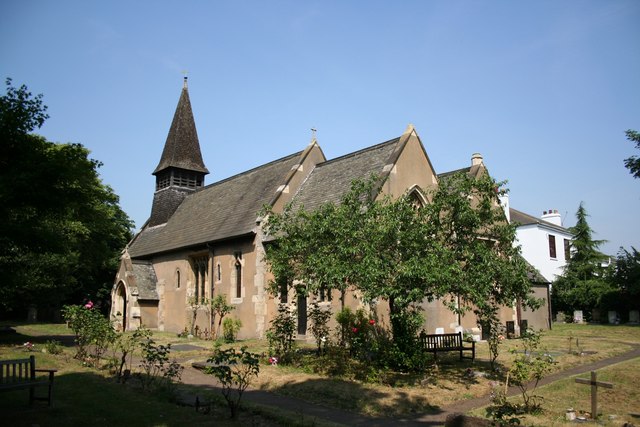


Armthorpe, United Kingdom
Armthorpe is a town of 12,911 people in England, United Kingdom.
Why visit Armthorpe
Townapedia lists 2 museums and landmarks, 8 parks and trails, 10 places to eat and 1 place to stay in and around town.
Highlights include Danum Gallery, Library and Museum, South Yorkshire Aircraft Museum, Potteric Carr Nature Reserve and Yorkshire Wildlife Park.
Weather in Armthorpe
Forecast from MET Norway (CC BY 4.0). Full forecast
About Armthorpe
Armthorpe is a large suburban village and civil parish in the City of Doncaster, South Yorkshire, England. Historically within the West Riding of Yorkshire, it had a population of 12,630, increasing to 14,457 at the 2011 Census.
From the Wikipedia article Armthorpe (this version), under CC BY-SA 4.0.
Museums and landmarks2

Danum Gallery, Library and Museum
Museum · 3.2 mi
Museum in Doncaster, United Kingdom

South Yorkshire Aircraft Museum
Museum · 2.7 mi
Aviation museum in Doncaster, South Yorkshire, United Kingdom
Parks, trails and playgrounds8

Potteric Carr Nature Reserve
Park · 3.3 mi
Nature reserve in South Yorkshire, England


Sandall Park
Park · 1.6 mi
Park in Doncaster, South Yorkshire, England
Town Fields
Park · 2.8 mi
Park in Doncaster, South Yorkshire, England



Restaurants and cafes10



Subway
Fast food · Sandwich · 1.5 mi
Unit 1 Eden Field Road, Doncaster
Mo-Sa 09:00-21:30; Su 09:00-16:30
Where to stay1
History
The settlement of Armthorpe was first recorded in 1086 as 'Ernulfestorp', showing the influence of the Vikings on the region. Its probable origination means outlying farmstead or hamlet (from the Old Scandinavian - thorp) of a man named Earnwulf or Arnulfr.
The remains of a Roman village and farm were found on Nutwell Lane and through the centuries Armthorpe was known for its rich farming activities. To some extent the rich crop farming heritage continues today and the area between Armthorpe and the M18 motorway is still dedicated to farming.
Armthorpe (Ernulfestorp) was recorded in the Domesday Book as being the property of the monks of Roche Abbey near Maltby, who had a grange there at which an official resided who managed this part of the estates of the establishment and who was sometimes a brother of the house: they had also an officer called their forester. The parish comprised 3,810 acres (15.4 km2) and included the farm of Holm-Wood. The village at this time consisted mainly of scattered houses.
Read more of the history
During the late 19th and for most of the 20th century Armthorpe became known for its Coal mining and a deep seam Colliery was sunk; the pit was named Markham Main. The mining increased the local population dramatically and whole new housing estates were constructed to house the mining workers. These housing estates were famous for their architectural layout. From the air you can see that the houses are formed into rings or crescents, similar examples can be seen in Rossington.
After the closure of the mine 1996 the area went through deep depression. The old colliery site is now a large housing estate, with a thriving community with parks and tracks for walking and cycling to the local wood.
From the History section of Armthorpe on Wikipedia, under CC BY-SA 4.0.
Notable people from Armthorpe
 Kevin KeeganEnglish footballer and manager (1951–2026)Photo: Unknown author Unknown author, Public domain
 Nick FletcherBritish politicianPhoto: Richard Townshend, CC BY 3.0
- Mick BatesEnglish footballer (1947–2021)
- Steve SpriggsEnglish footballer (born 1956)
- Edward NesfieldEnglish cricketer (1900-1987)
- Kevin WoodEnglish association footballer (1929-2012)
Born in Armthorpe, according to Wikidata (CC0). Each name links to its Wikipedia article.
Churches and places of worship5
Shopping6
Gas and EV charging2
Schools, colleges and libraries9
Healthcare1
Map of Armthorpe
44 places. The map loads OpenStreetMap tiles when you open it.
Getting there and nearby towns
Humberside Airport (HUY) is the nearest airport with scheduled flights listed in OpenStreetMap, 29 miles away.
- Kirk Sandall 2 mi north, about 3 min by car
- Doncaster 3 mi west, about 5 min by car
- Thorne 6 mi northeast, about 10 min by car
- Conisbrough 8 mi southwest, about 13 min by car
- Maltby 10 mi southwest, about 16 min by car
- South Elmsall 10 mi northwest, about 16 min by car
- Mexborough 10 mi west, about 16 min by car
- Bolton upon Dearne 11 mi west, about 18 min by car
- Wath upon Dearne 12 mi west, about 20 min by car
- Rotherham 14 mi southwest, about 23 min by car
Drive times are estimates from straight-line distance, not routes.
Towns near Armthorpe


Keep exploring
Local news
Headlines from INDB.
Reviews, tips and questions
Loading what members have shared...
Sources and licences
- GeoNames (CC BY 4.0): population, coordinates, regions and time zone
- Mapillary (see each image): photos
- OpenStreetMap contributors (ODbL 1.0): places, airports, map data
- Wikidata (CC0 1.0): elevation, founding date, time zone, website, landmarks and historic places
- Wikimedia Commons (see each image): photos
- Wikipedia (CC BY-SA 4.0): overview and history text
Photo credits
- Armthorpe - Saint Mary and Saint Leonartd's Church, Richard Croft, CC BY-SA 2.0
- Doncaster Museum, Marasmusine (Janine Timiney), Public domain
- Potteric Carr Bridges over Mother Drain, Dave Taylor, CC BY-SA 2.0
- St Oswald church Doncaster 1096606270, Alan from Doncaster, UK; uplaoad by Herrick 12:02, 1 September 2007 (UTC), CC BY-SA 2.0
- Reims F150G G-AVAA at South Yorkshire Aircraft Museum 2020-08-07 (50365239067), Alan Wilson from Peterborough, Cambs, UK, CC BY-SA 2.0
- Yorkshire Wildlife Park - Baboon Reserve, Graham Hogg, CC BY-SA 2.0
- Christ Church, Doncaster, Jonathan Thacker, CC BY-SA 2.0
- Street-level photo, lamaar639, CC BY-SA 4.0
- Street-level photo, cuttlebug, CC BY-SA 4.0
- Street-level photo, cuttlebug, CC BY-SA 4.0

Page built November 10, 2026. Spotted a mistake? Tell us or suggest a place.