


Why visit Kempsey
Townapedia lists 6 museums and landmarks, 2 parks and trails, 8 places to eat and 2 places to stay in and around town.
Highlights include Museum of Royal Worcester and The Commandery.
Weather in Kempsey
Forecast from MET Norway (CC BY 4.0). Full forecast
About Kempsey
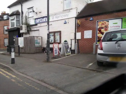
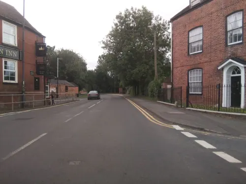
Kempsey is a village and civil parish in the Malvern Hills District in the county of Worcestershire, England. It is bounded by the River Severn on the west, and the A38 main road runs through it and is about 3 miles (5 km) south of Worcester. The parish population was 4,358 in 2021.
From the Wikipedia article Kempsey, Worcestershire (this version), under CC BY-SA 4.0.
Museums and landmarks6

Museum of Royal Worcester
Museum · 3.3 mi
Ceramics museum in Worcester, England

The Commandery
Museum · 3.4 mi
Grade I listed building and museum in Worcester, United Kingdom

Whittington Tump
Monument and historic site · 2.5 mi
Mound in central Worcestershire, England


Parks, trails and playgrounds2

Restaurants and cafes8

Where to stay2


History
According to 'Kempsey Collection' page 9, a piece of iron dated 1500-800 BC was dug up in the Court Meadow area, and is now in the Foregate Museum, Worcester. At that time the River Severn was tidal at Kempsey, and there was extensive marshland and forest in the Severn valley.
An Iron Age promontory fort can be found by the Severn at Kempsey.
A Roman milestone dedicated to the Emperor Constantine the Great (AD 307 – 337) was found in about 1818 when ground was being levelled for a vegetable garden for Court House, opposite the west gate of the churchyard. According to O'Neil, this was probably not its original position as the nearest Roman road was about one mile (2 km) away. It could have previously been used as masonry for the Bishop's Palace due to the lack of suitable building stone in Kempsey.
The Victoria County History entry describes this as "an inscription found some years before 1818, lying in two pieces with other stones 4 feet (1.2 m) deep in the west wall of the kitchen garden of the parsonage farm, north-west of the church. Many of the other stones were cemented together and formed some kind of ancient foundation; whether the inscription was one of these, is not recorded. It is itself a flat slab of freestone, 33 inches (840 mm) high by 20 inches (510 mm) wide, and is now in the Worcester Museum. It reads as follows:
Read more of the history
'Emperor Valerius Constantinus, pious, fortunate, unconquerable, Augustus.'
"Probably the commencement of the inscription is lost; it may have begun IMP. CAES FL. Imp(eratori) Cs(ari) Fl(avio). Flavius Valerius Constantinus was Constantine the Great, and this stone was presumably set up in his reign (A.D. 308-337). It appears to be a milestone, or rather a road-stone, of the type common in the fourth century, in which the mileage was often omitted - though here it might have been broken off. But it might conceivably be no more than an honorary slab."
The stone is from the Oolites of the Cotswold Hills. It is 3 feet (910 mm) high, 19+1⁄2 inches (500 mm) broad and 7+1⁄2 inches (190 mm) thick.
According to Dr. J.K. St. Joseph, writing in The Journal of Roman Studies, in a section on Roman Villas, "At Kempsey (SO 848485), four miles south of Worcester, two rectangular ditched enclosures seem to belong to the same class" (i.e. Villa enclosures having slightly curved sides). "One, which measures about 250 ft. by 100 ft., has a single entrance in the middle of the short eastern side, while two of the sides are curved, the southern being bowed inwards."
There are three possible Roman roads through and near Kempsey. One may have run along Old Road South, entering the oldest area of the village where a Roman camp might have been, and exiting possibly along Lyf's Lane (although Lyf was a Saxon chief) and continuing to the Roman settlement at Worcester.
The second runs along the side of the present M5 motorway north by Holdings Lane to Taylor's Lane, where it enters St Peter the Great, Worcester.
The third, Green Street, connects Kempsey Common with the centre of the village, crossing the second Roman road mentioned above at Palmer's Cross.
Pottery, brooches and a coin from the time of the Emperor Nero were found in burial cists dug out of the gravel beds north of the church.
The Celtic tribe that lived around Kempsey in Roman times were the Dobunni.
From the History section of Kempsey, Worcestershire on Wikipedia, under CC BY-SA 4.0.
Churches and places of worship4
Gas and EV charging1
Schools, colleges and libraries2
Map of Kempsey
25 places. The map loads OpenStreetMap tiles when you open it.
Getting there and nearby towns
Gloucestershire Airport (GLO) is the nearest airport with scheduled flights listed in OpenStreetMap, 17 miles away.
- Worcester 3 mi north, about 6 min by car
- Great Malvern 5 mi southwest, about 8 min by car
- Upton upon Severn 5 mi south, about 9 min by car
- Lower Broadheath 6 mi northwest, about 9 min by car
- Hallow 6 mi north, about 10 min by car
- Eckington 7 mi southeast, about 11 min by car
- Droitwich 9 mi north, about 15 min by car
- Bredon 9 mi southeast, about 14 min by car
- Tewkesbury 10 mi south, about 17 min by car
- Evesham 12 mi east, about 19 min by car
Drive times are estimates from straight-line distance, not routes.
Towns near Kempsey


Keep exploring
Local news
Headlines from INDB.
Reviews, tips and questions
Loading what members have shared...
Sources and licences
- GeoNames (CC BY 4.0): population, coordinates, regions and time zone
- Mapillary (see each image): photos
- OpenStreetMap contributors (ODbL 1.0): places, airports, map data
- Wikidata (CC0 1.0): elevation, founding date, time zone, website, landmarks and historic places
- Wikimedia Commons (see each image): photos
- Wikipedia (CC BY-SA 4.0): overview and history text
Photo credits
- St Mary Magdalene's Church, Croome D'Abitot 2016 001, Photograph by Mike Peel ( www.mikepeel.net )., CC BY-SA 4.0
- Stanbrook Abbey Exterior, Amanda Retreats, CC BY-SA 3.0
- Stanbrook Abbey Church, Wass, Yorkshire - Feilden Clegg and Bradley Studios ® Tim Crocker (30695438266), The National Churches Trust, CC BY 2.0
- Collections of the Museum of Royal Worcester (3), Seth Whales, CC BY-SA 4.0
- Cart in "The Commandery" - panoramio, ingawh, CC BY-SA 3.0
- Sunset Whittington Tump fro The Firs - panoramio, Kevin Woodcock, CC BY 3.0
- Street-level photo, southglos, CC BY-SA 4.0
- Street-level photo, laye, CC BY-SA 4.0
- Street-level photo, southglos, CC BY-SA 4.0
- Street-level photo, southglos, CC BY-SA 4.0
- Street-level photo, southglos, CC BY-SA 4.0
- Street-level photo, southglos, CC BY-SA 4.0
- Street-level photo, southglos, CC BY-SA 4.0
Page built November 10, 2026. Spotted a mistake? Tell us or suggest a place.