


Kingston upon Thames, United Kingdom
Kingston upon Thames is a town of 10,001 people in England, United Kingdom.
Why visit Kingston upon Thames
Townapedia lists 47 museums and landmarks, 109 parks and trails, 179 places to eat, 19 places to stay and 17 attractions in and around town.
Highlights include Rose Theatre, Hampton Court Bridge, Ham House and Strawberry Hill House.
Weather in Kingston upon Thames
Forecast from MET Norway (CC BY 4.0). Full forecast
About Kingston upon Thames
Kingston upon Thames, colloquially known as Kingston, is a town in the Royal Borough of Kingston upon Thames, south-west London, England. It is situated on the River Thames, 10 miles (16 km) south-west of Charing Cross. It is an ancient market town, notable as the place where some Saxon kings were crowned.
From the Wikipedia article Kingston upon Thames (this version), under CC BY-SA 4.0.
Photos of Kingston upon Thames

Things to do17


Hampton Court Bridge
Bridge · 2.0 mi
Bridge in London and Surrey, England

Kingston Bridge
Bridge · 0.5 mi
Road bridge at Kingston upon Thames in south west London, England, UK

Kingston Railway Bridge
Bridge · 0.5 mi
Arch bridge in Kingston upon Thames, London

Richmond Bridge
Bridge · 3.1 mi
18th-century bridge in London, England

Richmond Lock and Footbridge
Bridge · 3.5 mi
Lock and pedestrian bridge, situated on the River Thames in south west London

Richmond Railway Bridge
Bridge · 3.3 mi
Grade II listed steel bridge in London Borough of Richmond upon Thames, United Kingdom
Rose Theatre, Kingston
Cinema and theater · 0.5 mi
Theatre in Kingston-upon-Thames, London, England

The Karsino
Cinema and theater · 2.4 mi
Hotel and entertainment centre on Tagg's Island, Richmond, London


Esher Theatre
Cinema and theater · 4.1 mi
Theatre in Esher, Elmbridge, Surrey, England
5 more on the map.
Museums and landmarks47


Strawberry Hill House
Monument and historic site · 2.4 mi
Villa and house museum in Twickenham, London, United Kingdom
268 Waldegrave Road, Twickenham
Mo-Su 11:00-16:00; Th off; Fr off; Sa off


Kingston Museum
Museum
History museum in Wheatfield Way, Kingston upon Thames, United Kingdom
Mo-We,Su off; Th-Sa 10:00-17:00


Hampton Court Palace
Monument and historic site · 1.8 mi
Historic royal palace in Richmond, Greater London


Garrick's Temple to Shakespeare
Monument and historic site · 2.7 mi
Folly in Hampton, London



Thames Ditton farmers market
Monument and historic site · 2.2 mi
High Street, Thames Ditton
Sa 09:00-13:00
Hampton Wick War Memorial
Monument and historic site · 0.6 mi
War memorial in London
35 more on the map.
Parks, trails and playgrounds109


Castle Hill, Chessington
Park · 3.8 mi
Local Nature Reserve in London



Cigarette Island Park
Park · 2.0 mi
Park in Surrey opposite Hampton Court
Carlisle Park
Park · 3.0 mi
Park in London Borough of Richmond upon Thames, United Kingdom

97 more on the map.
Restaurants and cafes179
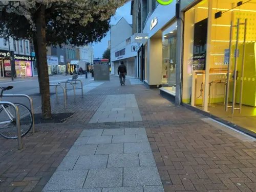
Starbucks
Cafe · Coffee Shop
91 Clarence Street, Kingston upon Thames
Mo-Sa 06:00-21:00; Su 06:30-21:00
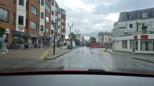
The Coronation Hall
Bar and pub · 1.3 mi
7 St. Mark's Hill, Surbiton
Mo,Th-Su 08:00-01:00; Tu-We 08:00-24:00
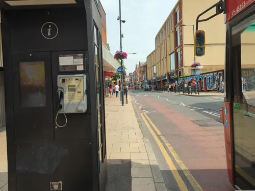
Caffè Nero
Cafe · Coffee Shop · 0.4 mi
13 Eden Walk, Kingston upon Thames
Mo-Fr 07:00-18:30; Sa 07:30-18:30; Su 08:30-18:00
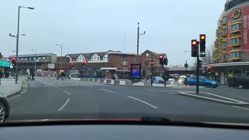
PizzaExpress
Restaurant · Pizza
Clarence Street, Kingston upon Thames
Mo-Sa 11:30-22:00; Su 12:00-22:00

The Druids Head
Bar and pub · 0.5 mi
3 Market Place, Kingston upon Thames
Mo-Th 11:00-23:00; Fr 11:00-01:00; Sa 10:00-01:00; Su 10:00-23:00

Nero Express
Cafe · Coffee Shop · 1.4 mi
Victoria Road, Surbiton
Mo-Fr 05:30-19:00; Sa 06:30-19:00; Su 07:30-17:00

Bibimbap & Chimaik
Restaurant · Korean · 2.0 mi
160 High Street, New Malden
Mo-Sa 11:00-23:00; Su 11:00-21:00
Caffè Nero
Cafe · Coffee Shop · 2.0 mi
46 Broad Street, Teddington
Mo-Fr 07:00-18:00; Sa-Su 07:30-18:00
Charm
Restaurant · Thai · 1.7 mi
86 High Street, Teddington
Tu-Sa 12:00-14:30,18:00-23:00; Su 12:00-22:00
Comptoir Libanais
Restaurant · Lebanese · 0.5 mi
2A Kingston Riverside, Kingston upon Thames
Mo-Th 11:00-22:00; Fr-Sa 11:00-22:30; Su 11:00-20:00
167 more on the map.
History
The first surviving record of Kingston is from AD 838 as the site of a meeting between King Egbert of Wessex and Ceolnoth, Archbishop of Canterbury. Kingston lay on the boundary between the ancient kingdoms of Wessex and Mercia, until in the early tenth century when King Æthelstan united both to create the kingdom of England. According to the Anglo-Saxon Chronicle, two tenth-century kings were consecrated in Kingston: Æthelstan (925), and Æthelred the Unready (978). There are certain other kings who are said to have been crowned there, but for whom the evidence (including the writings of Florence of Worcester and Ralph de Diceto) is less substantial: Edward the Elder (902), Edmund I (939), Eadred (946), Eadwig (956), Edgar the Peaceful (c. 960) and Edward the Martyr (975). It was later thought that the coronations were conducted in the Chapel of St Mary, which collapsed in 1730. Tradition dating to the 18th century holds that a large stone recovered from the ruins played a part in the coronations. It was initially used as a mounting block, but in 1850 it was moved to a more dignified place in the market before finally being moved to its current location in the grounds of the Guildhall.
Read more of the history
From Medieval times Shrovetide Football was played annually at Kingston upon Thames and in surrounding towns including Richmond and Twickenham. The windows of the houses and shops were boarded up and from 12 noon the inhabitants would kick several balls around the town before retiring to the public houses. The last game was played in 1866, by which time the urban development of the town meant it caused too much damage and the custom was outlawed.
Kingston upon Thames formed an ancient parish in the Kingston hundred of Surrey. The parish of Kingston upon Thames covered a large area including numerous chapelries and townships which subsequently became separate parishes, including Hook, Kew, New Malden, Petersham, Richmond, Surbiton, Thames Ditton and East Molesey.
Kingston was a royal manor. It was granted various charters allowing it the right to hold markets and fairs, with the oldest surviving charter being from King John in 1208. A subsequent charter in 1441 formally incorporated the town as a borough.
The borough covered a much smaller area than the ancient parish, although as new parishes were split off the borough and parish eventually became identical in 1894. The borough was reformed to become a municipal borough in 1836 under the Municipal Corporations Act 1835, becoming the Municipal Borough of Kingston-upon-Thames. It had been long been known as a royal borough through custom; its right to the title was formally confirmed by George V in 1927. Kingston upon Thames was the seat of Surrey County Council from 1893, when it moved from Newington to a new headquarters at County Hall. The county council remained based at County Hall until 2020, despite Kingston having been removed from its administrative area in 1965.
In 1965, Greater London was created and the old municipal borough was abolished. Its former area was merged with that of the Municipal Borough of Surbiton and the Municipal Borough of Malden and Coombe, to form the London Borough of Kingston upon Thames. At the request of Kingston upon Thames London Borough Council another royal charter was granted by Queen Elizabeth II entitling it to continue using the title "Royal Borough of Kingston upon Thames" for the new borough.
By 1839 it contained these chapelries, curacies or ecclesiastical parishes which eventually became civil parishes in their own right:
It follows from the above list of chapelries and the hamlet of Hook, frequently listed in the medieval age that, well before the Conquest, the ancient parish was the Kingston hundred (of Surrey). There soon was a southern exception to this. By the 1086 snapshot of the Domesday Book, Long Ditton (which included exclave Tolworth east of Hook hamlet) had a fully-fledged church likely gaining its independence around that time as recorded throughout the high medieval age and onwards. Thus, in the grant of Kingston church and Long Ditton church to Merton Priory, soon after its foundation in 1117, Long Ditton does not appear as a chapelry of Kingston.
The residual Church of England ecclesiastical parish essentially divides sixfold:
St Luke - 1 church - between railway and the Kingston Academy/Wolsey park
Kingston upon Thames, St John the Evangelist - Penrhyn Road & The Grove southern area - 1 church
Kingston was built at the first crossing point of the Thames upstream from London Bridge and a bridge still exists at the same site. It was this 'great bridge' that gave it its early importance in the 13th century. Kingston was occupied by the Romans, and later it was either a royal residence or a royal demesne. There is a record of a council held there in 838, at which Egbert of Wessex, King of Wessex, and his son Ethelwulf of Wessex were present. In the Domesday Book it was held by William the Conqueror. Its domesday assets were: a church, five mills, four fisheries worth 10s, 27 ploughs, 40 acres (16 ha) of meadow, woodland worth six hogs. It rendered £31 10s (£31.50).
In 1730, the chapel containing the royal effigies collapsed, burying the sexton, who was digging a grave, the sexton's daughter and another person. The daughter survived this accident and was her father's successor as sexton. Kingston sent members to early Parliaments, until a petition by the inhabitants prayed to be relieved from the burden. Another chapel, the collegiate chapel of St Mary Magdalene, The Lovekyn Chapel, still exists. It was founded in 1309 by a former mayor of London, Edward Lovekyn. It is the only private chantry chapel to survive the Reformation.
From the History section of Kingston upon Thames on Wikipedia, under CC BY-SA 4.0.
More about Kingston upon Thames
Geography
Kingston is 3 miles (5 km) south-east of Twickenham, 5 miles (8 km) north-east of Walton-on-Thames, and 6 miles (10 km) north-west of Sutton.
Economy
Kingston has many pubs and restaurants and several public houses in the centre have become restaurants or bars. The more traditional pubs tend to be in the northern part of the town (Canbury). The Druid's Head is notable as one of the first taverns to make syllabub, the famous dessert, in the 18th century. There are several Chinese, Indian, Thai and Italian restaurants.
The local newspapers are the weekly Surrey Comet, which celebrated its 150th year in 2004, and the Kingston Guardian.
In 2010 retail footprint research, Kingston ranked 25th in terms of retail expenditure in the UK at £810 million, equal to Covent Garden and just ahead of Southampton. This puts it as generating the fifth highest level of retail sales in Greater London, passing Croydon, with just four West End alternatives ahead. In 2005, Kingston was 24th with £864 million, and 3rd in London. In a 2015 study by CACI, Kingston was ranked 28th in the UK in the Hot 100 Retail Locations - and the second highest in Greater London after Croydon. In 2018, Kingston was ranked joint 5th in the UK by Knight Frank in the "High Street Investment Ranking", only bettered by Cambridge, Bath, Chichester and Reading.
Arts and culture
A notable dramatic arts venue is the Rose Theatre, opened on 16 January 2008 and seating about 900 people. The audience are arranged around the semi-circular stage. All Saints Church is host to classical choral and music concerts mostly on Saturdays and houses a Frobenius organ. There are a number of choral societies including the Kingston Orpheus Choir and the Kingston Choral Society, an amateur symphony orchestra the Kingston Philharmonia, and the Kingston and District Chamber Music Society. A number of annual festivals are organised by the Council and Kingston Arts Council including Kingston Readers' Festival, Think-in-Kingston and the Festival of the Voice. Kingston University runs the Stanley Picker Gallery and Kingston Museum has a changing gallery on the first floor. A regular singing group at the Rose Theatre caters to schools and families.
Education
Kingston is the location of Kingston University and Kingston College. Primary schools in the town include Latchmere School, Fernhill School, St Luke's School, King Athelstan School and St Agatha's Catholic Primary School. Secondary schools in the town include The Kingston Academy, Tiffin School, Tiffin Girls' School and Kingston Grammar School, all of which have large catchment areas across Greater London and Surrey.
The growth and development of Kingston Polytechnic, and its transformation into Kingston University in 1992, has made Kingston a university town.
From the Wikipedia article Kingston upon Thames, under CC BY-SA 4.0.
Notable people from Kingston upon Thames
 John GalsworthyEnglish novelist and playwright (1867–1933)Photo: Unknown author, Public domain
 Declan RiceEnglish footballer (born 1999)Photo: Bryan Berlin, CC BY-SA 4.0
 Steven WilsonEnglish musician, songwriter and record producerPhoto: Selbymay, CC BY 4.0
 Jonny Lee MillerBritish actorPhoto: Martin Kraft, CC BY-SA 3.0
 Ingrid NewkirkBritish-American animal rights advocate, author & activistPhoto: David Shankbone, CC BY-SA 3.0
 Nell Tiger FreeEnglish actressPhoto: Amy Martin Photography, CC BY-SA 4.0
 Nicky MorganBritish politicianPhoto: ©House of Lords / photography by Roger Harris, CC BY 3.0
 Donald CampbellEnglish racecar driver and land & water speed record holder (1921-1967)Photo: William Belknap, Jr., Public domain
- Luke ShawEnglish association football player (born 1995)
- Eadweard MuybridgeEnglish-American photographer (1830–1904)
- John ClelandBritish writer (1709-1789)
- Lucie SilvasBritish singer
Born in Kingston upon Thames, according to Wikidata (CC0). Each name links to its Wikipedia article.
Where to stay19
DoubleTree by Hilton Kingston Upon Thames
Motel and hotel · 0.4 mi
1 Skerne Road, Kingston upon Thames
Churches and places of worship82
Saint Mark's Parish Church of South Teddington and Hampton Wick
Church · Anglican · 1.2 mi
St. Mark's Road, Teddington
Teddington Baptist Church
Church · Baptist · 2.0 mi
Church Road, Teddington
Shopping89
Gas and EV charging11
Schools, colleges and libraries49
St Agatha's Catholic Primary School
School · Roman Catholic · 0.7 mi
St Agatha's Drive, Kingston upon Thames
Our Lady Immaculate Catholic Primary School
School · Roman Catholic · 2.1 mi
399 Ewell Road, Surbiton
Healthcare42
Map of Kingston upon Thames
250 places. The map loads OpenStreetMap tiles when you open it.
Getting there and nearby towns
Heathrow Airport (LHR) is the nearest airport with scheduled flights listed in OpenStreetMap, 8 miles away.
- Hampton 3 mi west, about 5 min by car
- Hook 3 mi south, about 5 min by car
- Worcester Park 3 mi southeast, about 5 min by car
- Richmond 3 mi north, about 5 min by car
- Chessington 3 mi south, about 6 min by car
- Hanworth 4 mi west, about 6 min by car
- Isleworth 5 mi northwest, about 8 min by car
- Barnes 5 mi northeast, about 8 min by car
- Kew 5 mi north, about 8 min by car
- Sunbury-on-Thames 5 mi west, about 8 min by car
Drive times are estimates from straight-line distance, not routes.
Towns near Kingston upon Thames


Keep exploring
Local news
Headlines from INDB.
Reviews, tips and questions
Loading what members have shared...
Sources and licences
- GeoNames (CC BY 4.0): population, coordinates, regions and time zone
- Mapillary (see each image): photos
- OpenStreetMap contributors (ODbL 1.0): places, airports, map data
- Wikidata (CC0 1.0): elevation, founding date, time zone, website, landmarks and historic places
- Wikimedia Commons (see each image): photos
- Wikipedia (CC BY-SA 4.0): overview and history text
Photo credits
- Kingston Market Square, Kreepin Deth, CC BY 3.0
- Metrobus bus 537 (YN03 WRG) 2003 Scania CN94UB OmniCity, Kingston Upon Thames bus station, route X26, 7 May 2011, Dr Neil Clifton (original file), cropped by User:Ultra7, CC BY-SA 2.0
- Hampton Court Bridge 1, Unknown author, CC BY-SA 2.5
- Kingston Bridge2, Unknown author, Public domain
- Kingston Railway Bridge, Motmit at English Wikipedia ( Original text: Motmit ( talk ) ), CC BY-SA 3.0
- Richmond 018 Richmond Bridge TT panorama, Amandajm, CC BY-SA 3.0
- Richmond Lock from Isleworth,Middx looking SE, Unknown author, CC BY-SA 3.0
- Richmond Railway Bridge 333r1, Patche99z, CC BY 3.0
- The Karsino, Adam37, CC BY-SA 4.0
- Twickenham Bridge312-315b, Patche99z, CC BY 3.0
- Strawberry Hill House from garden in 2012 after restoration, Chiswick Chap, CC BY-SA 3.0
- Exterior of Kingston Museum, Zoopraxiscope, CC BY-SA 4.0
- Hampton Court Palace (3), Ricardalovesmonuments, CC BY-SA 4.0
- Garrick's Temple south view, Maxwell Hamilton, CC BY 2.0
- BushyParkAutumn, Ojw at English Wikipedia, CC BY-SA 3.0
- HamptonCourtParkTrees, Ojw, CC BY-SA 3.0
- Elmbridge Meadows, Kingston, Dudley Miles, CC BY-SA 3.0
- Teddington Methodist Church, Robert Smith, CC BY-SA 4.0
- Ham Christian Centre, KenBailey, CC BY-SA 4.0
- All Hallows Parish Church in Twickenham, Maxwell Hamilton, CC BY 2.0
- The Rose Theatre, Kingston, London, Jim Linwood from London, CC BY 2.0
- CornationStone KingstonUponThames, Jmonica, CC BY-SA 4.0
- Kingston, All Saints church, from the churchyard, AndyScott, CC BY-SA 4.0
- Cassel Hospital, Ham Common, KenBailey, CC BY-SA 3.0
- Holy Cross School 2, Mx. Granger, CC0
- The Lensbury, Teddington, Matt Brown, CC BY 2.0
- Landmark arts centre, Stevekeiretsu, CC BY-SA 4.0
- A department store, Kingston upon Thames. - panoramio, brian gillman, CC BY 3.0
- The Druid's Head Pub, Kingston-upon-Thames - London. (16204869201), Jim Linwood from London, CC BY 2.0
- St Peter and St Paul, Teddington, ChristianSW, CC0
- Mitre Hotel and Mute Swan, Stevekeiretsu, CC BY-SA 4.0
- Kingston library (5482745902), JuliaC2006 from Rochester, UK, CC BY 2.0
- Kings Arms Hotel, Hampton Court 01, Jonathan Cardy, CC BY-SA 4.0
- St Luke's church, Kingston, Stevekeiretsu, CC BY-SA 4.0
- The Park Hotel, Teddington, London (2008), Jim Linwood from London, CC BY 2.0
- Teddington Carnegie Library, Jonathan Cardy, CC BY-SA 4.0
- Kingston Hill, Dorich House Museum, AndyScott, CC BY-SA 4.0
- Ham House, London, Stevekeiretsu, CC BY-SA 4.0
- St Mark’s, Teddington, ChristianSW, CC0
- Coronation Stone, Kingston-upon-Thames (2), Hellodavey1902, CC BY-SA 4.0
- Entrance to Edith Gardens Local Nature Reserve, Dudley Miles, CC BY-SA 3.0
- Bonesgate Open Space 6, Dudley Miles, CC BY-SA 3.0
- Bonesgate Stream in Castle Hill, Chessington, Dudley Miles, CC BY-SA 3.0
- Clattern Bridge Kingston. (39599957415), Loco Steve from Bromley , UK, CC BY-SA 2.0
- Street-level photo, alexanderar, CC BY-SA 4.0
- Street-level photo, inanov, CC BY-SA 4.0
- Street-level photo, alexanderar, CC BY-SA 4.0
- Street-level photo, inanov, CC BY-SA 4.0
- Street-level photo, inanov, CC BY-SA 4.0
- Street-level photo, inanov, CC BY-SA 4.0
- Street-level photo, alexanderar, CC BY-SA 4.0
- Street-level photo, alexanderar, CC BY-SA 4.0
- Street-level photo, alexanderar, CC BY-SA 4.0
- Street-level photo, alexanderar, CC BY-SA 4.0
- Street-level photo, alexanderar, CC BY-SA 4.0
- Street-level photo, alexanderar, CC BY-SA 4.0
- Street-level photo, alexanderar, CC BY-SA 4.0
- Street-level photo, alexanderar, CC BY-SA 4.0
- Street-level photo, alexanderar, CC BY-SA 4.0
- Street-level photo, alexanderar, CC BY-SA 4.0
- Street-level photo, alexanderar, CC BY-SA 4.0
- Street-level photo, alexanderar, CC BY-SA 4.0
- Street-level photo, alexanderar, CC BY-SA 4.0
- Street-level photo, inanov, CC BY-SA 4.0
- Street-level photo, inanov, CC BY-SA 4.0
- Street-level photo, inanov, CC BY-SA 4.0


Page built November 10, 2026. Spotted a mistake? Tell us or suggest a place.