


Richmond, United Kingdom
Richmond is a town of 21,469 people in England, United Kingdom, founded in 1501.
Why visit Richmond
Townapedia lists 84 museums and landmarks, 87 parks and trails, 166 places to eat, 19 places to stay and 17 attractions in and around town.
Highlights include Odeon, Kew Bridge, Ham House and Kew Palace.
Weather in Richmond
Forecast from MET Norway (CC BY 4.0). Full forecast
About Richmond
Richmond is a town in south-west London, 8.2 miles (13.2 km) west-southwest of Charing Cross. It stands on the River Thames, and features many parks and open spaces, including Richmond Park, and many protected conservation areas, which include much of Richmond Hill. A specific Act of Parliament protects the scenic view of the River Thames from Richmond.
From the Wikipedia article Richmond, London (this version), under CC BY-SA 4.0.
Photos of Richmond


Things to do17


Kingston Bridge
Bridge · 3.5 mi
Road bridge at Kingston upon Thames in south west London, England, UK

Kingston Railway Bridge
Bridge · 3.3 mi
Arch bridge in Kingston upon Thames, London

Richmond Theatre
Cinema and theater
Little Green, Richmond

Teddington Lock Footbridges
Bridge · 2.3 mi
Two footbridges on the River Thames in London

The Exchange, Twickenham
Cinema and theater · 1.3 mi
Theatre and arts venue in the London Borough of Richmond upon Thames


Normansfield Theatre
Cinema and theater · 3.0 mi
Theatre in London, England, UK
5 more on the map.
Museums and landmarks84

Ham House
Monument and historic site · 1.3 mi
Historic house museum in Ham, London Borough of Richmond upon Thames, England, UK
Mo-Su 12:00-16:00; PH off

Kew Palace
Monument and historic site · 1.6 mi
Grade I listed historic house museum in London Borough of Richmond upon Thames, United Kingdom
Apr 03-Sep 24 11:00-18:00


Museum of Richmond
Museum
Museum in Richmond, London, United Kingdom
Whittaker Avenue, Richmond
Mo,Su off; Tu-Fr 11:00-17:00; Sa 10:00-16:00

Orleans House Gallery
Museum · 1.1 mi
Building and art gallery in Twickenham, London Borough of Richmond upon Thames, England, United Kingdom
Riverside, Twickenham
Tu-Su 10:00-17:00

Eel Pie Island Museum
Museum · 1.2 mi
Music museum in Twickenham, Richmond upon Thames, London, England, UK
1-3 Richmond Road, Twickenham
Th-Su 12:00-18:00

World Rugby Museum
Museum · 1.6 mi
Whitton Road, Twickenham
Tu-Sa 10:00-17:00; Su 11:00-17:00; PH 11:00-17:00


King Henry VIII's Mound
Monument and historic site · 1.3 mi
Mound in Richmond Park, London Borough of Richmond upon Thames, UK

Emery Walker's House
Museum · 3.4 mi
House in London Borough of Hammersmith and Fulham, London, England, UK
Hampton Wick War Memorial
Monument and historic site · 3.5 mi
War memorial in London
72 more on the map.
Parks, trails and playgrounds87


Marble Hill Park
Park · 0.9 mi
Parkland in Twickenham, in the London Borough of Richmond upon Thames, England, UK


Crane Park Island
Park · 3.4 mi
Island in the London Borough of Richmond upon Thames, England, UK



East Sheen Common
Park · 1.3 mi
Public space in East Sheen, London, England
Barn Elms
Park · 3.4 mi
Open space in Barnes in the London Borough of Richmond upon Thames

Brentford Dock Marina
Marina and boat launch · 1.4 mi
Cranford Park
Park · 3.2 mi
Park in London Borough of Hillingdon, United Kingdom
75 more on the map.
Restaurants and cafes166
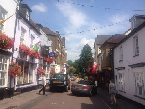
Rosie Chai
Cafe · Coffee Shop, Lebanese, Wrap, Tea · 1.3 mi
13 Church Street, Twickenham
Mo-Sa 09:30-17:30, Su 09:30-18:00


The William Webb Ellis
Bar and pub · 1.4 mi
24 London Road, Twickenham
Mo-Su 08:00-24:00; Fr,Sa 00:00-00:30,08:00-24:00
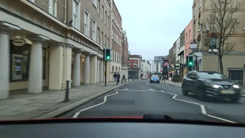
Bill's
Restaurant · British
1-3 Hill Rise, Richmond
Mo-Th 08:00-21:00; Fr-Sa 08:00-22:00; Su,PH 09:00-21:00
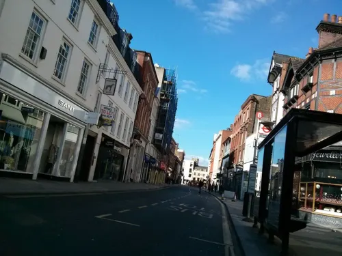
Blank Street Coffee
Cafe · Coffee Shop
28 George Street, Richmond
Mo-Fr 07:00-18:00; Sa-Su 08:00-18:00
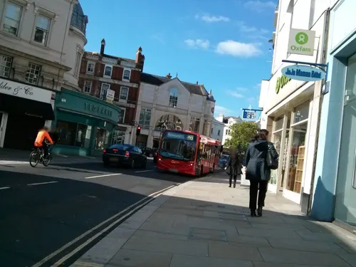



154 more on the map.
History
The area was known in the medieval period as Shene, a name first recorded (as Sceon) in the 10th century, and which survives in the neighbouring districts of East Sheen (also known as Sheen) and North Sheen. The manor entered royal hands, and the manor house eventually became known as Sheen Palace, before being largely destroyed by fire in 1497. Henry VII rebuilt it and in 1501 named it Richmond Palace, in allusion to his earldom of Richmond and his ancestral honour of Richmond in Yorkshire. The associated settlement took the same name, although for some years the two names were often used in conjunction (for example, "Shene otherwise called Richemount").
Henry I lived briefly in the King's house in "Sheanes". In 1299, Edward I, the "Hammer of the Scots", took his whole court to the manor house at Sheen, a little east of the bridge and on the riverside, and it thus became a royal residence; William Wallace was executed in London in 1305, and it was in Sheen that the Commissioners from Scotland went down on their knees before Edward.
Read more of the history
Edward II, following his defeat by the Scots at the Battle of Bannockburn in 1314, founded a monastery for Carmelites at Sheen. When the boy-king Edward III came to the throne in 1327, he gave the manor to his mother Isabella. Edward later spent over £2,000 on improvements but, in the middle of the work, Edward himself died at the manor, in 1377. Richard II was the first English king to make Sheen his main residence, which he did in 1383. Twelve years later, Richard was so distraught at the death of his wife Anne of Bohemia at the age of 28 that, according to the 16th-century English chronicler Raphael Holinshed, he "caused it [the manor] to be thrown down and defaced; whereas the former kings of this land, being wearie of the citie, used customarily thither to resort as to a place of pleasure, and serving highly to their recreation". It was rebuilt between 1414 and 1422, but destroyed by fire in 1497.
Following that fire, Henry VII built a new residence at Sheen, and in 1501 he named it Richmond Palace. The theatre company to which Shakespeare belonged performed some plays there during the reign of Elizabeth I. As Queen, Elizabeth spent much of her time at Richmond, as she enjoyed hunting stags in the "Newe Parke of Richmonde" (now Old Deer Park). She died at the palace on 24 March 1603. The palace was no longer in residential use after 1649 but, in 1688, James II ordered its partial reconstruction, this time as a royal nursery. The bulk of the palace had decayed by 1779, but surviving structures include the Wardrobe, Trumpeters' House (built around 1700), and the Gate House, built in 1501. All three are listed at Grade I by Historic England.
Beyond the grounds of the old palace, Richmond remained mostly agricultural land until the 18th century. White Lodge, in the middle of what is now Richmond Park, was built as a hunting lodge for George II, and during this period the number of large houses in their own grounds – such as Asgill House and Pembroke Lodge – increased significantly. These were followed by the building of further important houses, including Downe House, Wick House and The Wick on Richmond Hill, as this area became an increasingly fashionable place in which to live. Richmond Bridge was completed in 1777 to replace a ferry crossing that connected Richmond town centre on the east bank with its neighbouring district of East Twickenham. Today, this bridge, together with the well-preserved Georgian terraces that surround Richmond Green and line Richmond Hill to its crest, now has listed building status.
As Richmond continued to prosper and expand during the 19th century, much luxurious housing was built on the streets that line Richmond Hill, as well as shops in the town centre to serve the increasing population. In July 1892, the Corporation formed a joint-stock company, the Richmond (Surrey) Electric Light and Power Company, and this wired the town for electricity by around 1896.
Like many other large towns in Britain, Richmond lost many young people who fought in the First and Second World Wars. They are commemorated at the Richmond War Memorial, which now commemorates both wars and was installed in 1921 at the end of Whittaker Avenue, between the Old Town Hall and the Riverside. In the Second World War, 97 people were killed in air raids, which also resulted in the demolition of 297 houses.
From the History section of Richmond, London on Wikipedia, under CC BY-SA 4.0.
More about Richmond
Geography
Richmond sits opposite East Twickenham on what is technically the south bank of the River Thames but, because of the bends of the river, the town is immediately north and north-east of its nearest stretch of river. The Thames curves around the town, and then Kew, in its course; starting from Petersham, it returns to a more direct west–east direction.
The river is still tidal at Richmond, so, to allow major passenger and goods traffic to continue to operate during low tide, a half-tide lock was opened in 1894 and is used when the adjacent weir is in position. This weir ensures that there is always a minimum depth of water of 5 ft 8 in (1.73 m) toward the middle of the river between Richmond and Teddington, whatever the state of the tide. At the lock and weir there is a footbridge across the river.
Economy
The London Borough of Richmond upon Thames, with Richmond North and Richmond South as two of its wards, has the least poverty in London. The town of Richmond has the largest commercial centre in the borough and is classified as a major centre according to the London Plan. It is an established up-market shopping destination. Its compact centre has approximately 50,000 m2 of retail floor-space that is largely focused on George Street, The Quadrant and Hill Street. It comprises almost exclusively high street chains, the largest of which are Marks & Spencer, Boots, Tesco Metro and Waitrose. The remaining town centre stores are largely single units.
Mostly independent businesses line the narrow alleyways running off George Street towards Richmond Green and up Richmond Hill, and there is a farmers' market in Heron Square on Saturdays. Richmond has one large stand-alone supermarket, Sainsbury's, with parking for 420 cars, to the east of the town near North Sheen railway station. There are shops, restaurants and cafes on the crest of Richmond Hill lining Friars Stile Road, as well as along Kew Road towards the Botanic Gardens, and on Sheen Road.
From the Wikipedia article Richmond, London, under CC BY-SA 4.0.
Notable people from Richmond
 Arthur CayleyEnglish mathematician (1821-1895)Photo: Herbert Beraud (1845–1896), Public domain
 John Turner17th Prime Minister of Canada (1929–2020)Photo: United Press International, Public domain
 Bernard Freyberg, 1st Baron Freybergmilitary leader, viceroy, Victoria Cross (1889-1963)Photo: Archives New Zealand, CC BY-SA 2.0
- Ronald ColmanBritish actor (1891–1958)
- Clive SinclairEnglish entrepreneur and inventor (1940–2021)
- Celia JohnsonEnglish actress (1908–1982)
- Anna ChancellorEnglish actress
- Mike ParkesEnglish racing driver (1931-1977)
- Sidney Herbert, 1st Baron Herbert of LeaBritish politician (1810-1861)
- Alfred BeamishEnglish tennis player (1879–1944)
- Reginald DennyBritish actor, aviator and businessman (1891–1967)
- Banesh HoffmannAmerican mathematician and physicist (1906-1986)
Born in Richmond, according to Wikidata (CC0). Each name links to its Wikipedia article.
Where to stay19
Churches and places of worship81
Grove Gardens Chapel
Church · Anglican · 0.9 mi
Lower Grove Road, Richmond
Shopping81
Gas and EV charging15
Schools, colleges and libraries41
Christ's Church of England Comprehensive Secondary School
School · Anglican · 0.8 mi
Queens Road, Richmond
Healthcare32
Dumlers Pharmacy
Clinic and pharmacy · 1.4 mi
495-497 Upper Richmond Road West, London
Map of Richmond
250 places. The map loads OpenStreetMap tiles when you open it.
Getting there and nearby towns
Heathrow Airport (LHR) is the nearest airport with scheduled flights listed in OpenStreetMap, 6 miles away.
- Sunbury-on-Thames 6 mi southwest, about 10 min by car
- Worcester Park 6 mi southeast, about 10 min by car
- Sudbury 7 mi north, about 10 min by car
- Walton-on-Thames 7 mi southwest, about 11 min by car
- West Drayton 7 mi west, about 12 min by car
- Stanwell 7 mi west, about 12 min by car
- London 8 mi northeast, about 14 min by car
- City of Westminster 8 mi east, about 12 min by car
- Harrow 8 mi north, about 13 min by car
- Sutton 9 mi southeast, about 14 min by car
Drive times are estimates from straight-line distance, not routes.
Towns near Richmond


Keep exploring
Local news
Headlines from INDB.
Reviews, tips and questions
Loading what members have shared...
Sources and licences
- GeoNames (CC BY 4.0): population, coordinates, regions and time zone
- Mapillary (see each image): photos
- OpenStreetMap contributors (ODbL 1.0): places, airports, map data
- Wikidata (CC0 1.0): elevation, founding date, time zone, website, landmarks and historic places
- Wikimedia Commons (see each image): photos
- Wikipedia (CC BY-SA 4.0): overview and history text
Photo credits
- Richmond Riverside, London - Sept 2008, Diliff, CC BY-SA 3.0
- 8 and 9, Richmond Green, Robert-brook, CC0
- Richmond Green 5260-6s, Patche99z, CC BY-SA 3.0
- GOC Richmond 009 Portland Terrace (14614905443), Peter O'Connor aka anemoneprojectors, CC BY-SA 2.0
- The Green, Richmond-14591539271, AnemoneProjectors ( talk ) ( Flickr ), CC BY-SA 2.0
- Sunset on Richmond Green 2025-07-06, Matt Brown, CC BY 4.0
- Building on The Green, Richmond, Robert-brook, CC0
- Richmond Green, London (2), Brit in Seoul, CC BY-SA 4.0
- Kew Bridge in London 2007 Sept 21, Patche99z, CC BY 3.0
- Kingston Bridge2, Unknown author, Public domain
- Kingston Railway Bridge, Motmit at English Wikipedia ( Original text: Motmit ( talk ) ), CC BY-SA 3.0
- TeddBridge, Motmit, CC BY-SA 3.0
- Ham House, London, Stevekeiretsu, CC BY-SA 4.0
- Kew Palace (5942717068), xlibber, CC BY 2.0
- Museum of Richmond interior 2024-05-08, Matt Brown, CC BY 2.0
- Orleans House Gallery, Matt Brown, CC BY 2.0
- The Eel Pie Island Museum, Twickenham - London. (35192973221), Jim Linwood from London, CC BY 2.0
- London - April 2009 (3496483619), Cristian Bortes from Cluj-Napoca, Romania, CC BY 2.0
- River Crane in Crane Park 2, Dudley Miles, CC BY-SA 3.0
- Crane Park Island Nature Reserve, Twickenham, London. (3350016620), Jim Linwood from London, CC BY 2.0
- Pesthouse Common Open Space, Richmond (14989254591), Loz Pycock from London, UK, CC BY-SA 2.0
- Kew Baptist Church, Robert Smith, CC BY-SA 4.0
- Twickenham Methodist Church, Robert Smith, CC BY-SA 3.0
- The Exchange, Twickenham, Robert Smith, CC BY-SA 4.0
- Twickenham Stadium aerial view 2014, brewbooks from near Seattle, USA; cropped by Blackcat, CC BY-SA 2.0
- Marble Hill House-River(south)front, Chris McKenna ( user:Thryduulf ), CC BY-SA 4.0
- The Barn Church, Kew, Robert Smith, CC BY-SA 3.0
- Royal College Of Midwives Picket The West Middlesex Hospital, Isleworth - London, Jim Linwood from London, CC BY 2.0
- Sport of Empire and the World Gallery, Algernon Rutter, CC BY-SA 4.0
- THE OLD SHIP YOUNGS BREWERY RICHMOND LONDON SEP 2012 (8057698098), calflier001, CC BY-SA 2.0
- Attila The Hungarian Barman Doing His Thing Hilton London Syon Park, Jack Oughton, CC BY-SA 3.0
- Syon Park Lake, Russ Hamer, CC BY-SA 3.0
- St Stephen's Church, Ruxi, CC BY-SA 3.0
- The White Swan Public House (4673170016), Maxwell Hamilton from Greater London, England United Kingdom, CC BY 2.0
- Fox, Twickenham, TW1 (6156387826), Ewan Munro from London, UK, CC BY-SA 2.0
- Richmond lending library (36446003082), JuliaC2006 from Rochester, UK, CC BY 2.0
- King William's Temple, Kew Gardens (3997546741), Rob Young from United Kingdom, CC BY 2.0
- Dome building, Richmond, Stevekeiretsu, CC BY-SA 4.0
- The Odeon Cinema Richmond-upon-Thames - panoramio, Maxwell Hamilton, CC BY-SA 3.0
- Grove Gardens Chapel northwest, Cewjones01, CC BY-SA 4.0
- Twickenham library (29734891863), JuliaC2006 from Rochester, UK, CC BY 2.0
- St Paul's CofE Primary School, Brentford (panorama), ZeevoX, CC BY-SA 4.0
- The William Webb Ellis Pub In Twickenham - London. (21975208412), Jim Linwood from London, CC BY 2.0
- The Alligator's Mouth Childrens' Bookshop In Richmond-upon-Thames - London. (18587129974), Jim Linwood from London, CC BY 2.0
- London - April 2009 (3496487723), Cristian Bortes from Cluj-Napoca, Romania, CC BY 2.0
- St Lawrence's Church, Brentford, London, Jim Linwood, CC BY 2.0
- Isleworth, Gumley House, AndyScott, CC BY-SA 4.0
- Richmond Theatre ceiling and chandelier, Gts-tg, CC BY-SA 4.0
- GOC Richmond 213 Orange Tree Theatre, Richmond (14700706386), Peter O'Connor aka anemoneprojectors, CC BY-SA 2.0
- St Anne Kew Green 4879crop, Patche99z, CC BY-SA 3.0
- Street-level photo, tomasmalmsten, CC BY-SA 4.0
- Street-level photo, peterneubauer, CC BY-SA 4.0
- Street-level photo, ecatmur, CC BY-SA 4.0
- Street-level photo, ecatmur, CC BY-SA 4.0
- Street-level photo, ecatmur, CC BY-SA 4.0
- Street-level photo, ecatmur, CC BY-SA 4.0
- Street-level photo, alexanderar, CC BY-SA 4.0
- Street-level photo, alexanderar, CC BY-SA 4.0
- Street-level photo, alexanderar, CC BY-SA 4.0
- Street-level photo, alexanderar, CC BY-SA 4.0
- Street-level photo, alexanderar, CC BY-SA 4.0
- Street-level photo, alexanderar, CC BY-SA 4.0
- Street-level photo, tomasmalmsten, CC BY-SA 4.0
- Street-level photo, tomasmalmsten, CC BY-SA 4.0
- Street-level photo, tomasmalmsten, CC BY-SA 4.0
- Street-level photo, tomasmalmsten, CC BY-SA 4.0
- Street-level photo, milhouse, CC BY-SA 4.0


Page built November 10, 2026. Spotted a mistake? Tell us or suggest a place.