


Barnes, United Kingdom
Barnes is a town of 21,218 people in England, United Kingdom, founded in 1955.
Why visit Barnes
Townapedia lists 78 museums and landmarks, 81 parks and trails, 186 places to eat, 8 places to stay and 27 attractions in and around town.
Highlights include Eventim Apollo, Hammersmith Bridge, William Morris Society and Chiswick House.
Weather in Barnes
Forecast from MET Norway (CC BY 4.0). Full forecast
About Barnes
Barnes () is a district in the London Borough of Richmond upon Thames in south-west London, England. It is centred 5.8 miles (9.3 km) west south-west of Charing Cross in a bend of the River Thames.
From the Wikipedia article Barnes, London (this version), under CC BY-SA 4.0.
Photos of Barnes


Things to do27


Barons Court Theatre
Cinema and theater · 2.1 mi
Pub theatre in West Kensington, London

Bush Theatre
Cinema and theater · 2.4 mi
Theatre in Shepherd's Bush, London, England


Fulham Railway Bridge
Bridge · 1.7 mi
Truss bridge that crosses the River Thames in London, which carries both trains and pedestrians


London Butterfly House
Zoo and aquarium · 3.0 mi
Zoo in Middlesex, England

Old Shepherd’s Bush Library
Cinema and theater · 2.4 mi
Former library in London, now home to the Bush Theatre

Orange Tree Theatre
Cinema and theater · 2.4 mi
Theatre in Richmond, London, England


Kew Railway Bridge
Bridge · 1.5 mi
Bridge across the River Thames in London, UK
15 more on the map.
Museums and landmarks78


Hogarth's House
Museum · 1.0 mi
Hogarth Lane, London
Tu-Su 12:00-17:00; PH 12:00-17:00; Dec 24-26 off; Jan 01 off; easter off

Bolan's Rock Shrine
Monument and historic site · 0.7 mi
Memorial in Barnes, London

Bromhead Memorial
Monument and historic site · 1.9 mi
War memorial in Richmond Cemetery, London

Kilmorey Mausoleum
Monument and historic site · 3.3 mi
Mausoleum in St Margarets, London

London Museum of Water and Steam
Museum · 2.1 mi
Museum in London, United Kingdom

Museum of Richmond
Museum · 2.7 mi
Museum in Richmond, London, United Kingdom

Musical Museum
Museum · 2.2 mi
Music museum in London, United Kingdom

Burton Mausoleum
Monument and historic site · 0.7 mi
Grade II* listed mausoleum in the form of a Bedouin tent carved to resemble draping canvas. Houses the coffins of Sir Richard and Lady...
61 North Worple Way, London
King Henry VIII's Mound
Monument and historic site · 2.8 mi
Mound in Richmond Park, London Borough of Richmond upon Thames, UK
66 more on the map.
Parks, trails and playgrounds81


Gunnersbury Park
Park · 2.5 mi
Park in the London Borough of Hounslow, United Kingdom


Marble Hill Park
Park · 3.3 mi
Parkland in Twickenham, in the London Borough of Richmond upon Thames, England, UK


East Sheen Common
Park · 1.7 mi
Public space in East Sheen, London, England

69 more on the map.
Restaurants and cafes186

The Crown and Anchor
Bar and pub · Burger, Fish And Chips, Wings · 1.5 mi
374 Chiswick High Road, London
Mo-Sa 12:00-23:00; Su 12:00-22:00

Duke's Head
Bar and pub · 1.4 mi
8 Lower Richmond Road, London
Mo-Th 12:00-24:00; Fr,Sa 12:00-01:00; Su 12:00-22:30

The Half Moon
Bar and pub · 1.3 mi
93 Lower Richmond Road, London
Mo-Th 11:00-23:00; Fr,Sa 11:00-01:00; Su 11:00-23:00

The Old Pack Horse
Bar and pub · 1.5 mi
434 Chiswick High Road, London
Mo-Th,Sa 12:00-24:00; Fr 12:00-26:00; Su 12:00-23:00

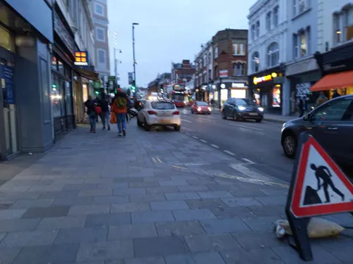
Caffè Nero
Cafe · Coffee Shop · 1.6 mi
132 Putney High Street, London
Mo-Fr 07:00-18:00; Sa 07:30-18:00; Su 08:00-17:30

George and Devonshire
Bar and pub · 0.9 mi
Dating back to 1650, the George & Devonshire in Chiswick serves up a slice of history alongside its fabulous food and drink
8 Burlington Lane, London
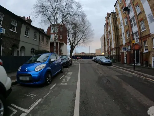
Kuyamoto
Restaurant · Japanese · 1.6 mi
"Sushi & bento"
470 Chiswick High Road, London
Mo-We 12:00-15:00,17:00-22:00; Th-Sa 12:00-15:00,17:00-22:30; Su...
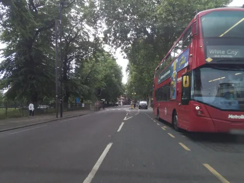
Caffè Nero
Cafe · Coffee Shop · 1.5 mi
386 Chiswick High Road, London
Mo-Fr 06:30-19:00; Sa 07:00-19:00; Su 07:30-18:30
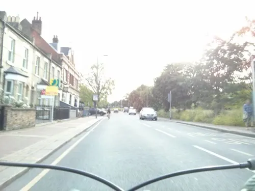
Calowries
Cafe · Burger, Cafe, Coffee, Smoothies · 1.0 mi
178 Lower Richmond Road, London
Mo 11:30-15:00, Tu-Th 11:30-21:00, Fr-Sa 11:30-22:00, Su 11:30-21:00
Creams
Ice cream · Ice Cream · 1.6 mi
104 Putney High Street, London
Su-Th 12:00-23:00; Fr,Sa 12:00-24:00

Awesome Thai
Restaurant · Thai
68 Church Road, London
Mo-Th 18:00-23:00; Fr-Sa 12:00-15:00,18:00-23:00; Su 12:00-22:00
174 more on the map.
History
The name Barnes derives from the Old English bere-ærn meaning barn. The name was later pluralised.
Barnes appears in Domesday Book (which was completed in 1086) as "Berne". It was held by the Canons of St Paul of London when its assets were: eight hides, paying tax with Mortlake; six ploughlands, 20 acres (81,000 m2) of meadow. It rendered (in total) to its feudal system overlords £7 per year.
In 1889, Barnes became part of the Municipal Borough of Barnes. In 1965, that borough was abolished and Barnes became part of the London Borough of Richmond upon Thames.
The original Norman chapel of St Mary's, Barnes' village church, was built at some point between 1100 and 1150, and was subsequently extended in the early 13th century. In 1215, immediately after confirming the sealing of Magna Carta, Stephen Langton, the Archbishop of Canterbury, stopped on the river at Barnes to dedicate St Mary's church. The church was added to in 1485 and in 1786. After a major fire in 1978 destroyed the Victorian and Edwardian additions to the building, restoration work was completed in 1984.
Read more of the history
Some of the oldest riverside housing in London is to be found on The Terrace, a road lined with Georgian mansions which runs along the west bend of the river. Construction of these mansions began as early as 1720. The classical composer Gustav Holst and the ballet dancer and choreographer Ninette de Valois lived in houses on this stretch, both of which have corresponding blue plaques. The Terrace also has an original red brick police station, built in 1891. It has been remodelled as flats but still preserves the original features.
The pink-fronted Rose House at 70 Barnes High Street, facing the area's pond, dates to the 17th century, while Milbourne House facing the Green, the oldest in the area with parts dating to the 16th century, once belonged to the writer Henry Fielding. The park of Barn Elms, formerly the manor house of Barnes, for long the parish's chief property and now an open space and playing field, is home to one of the oldest and largest plane trees in London, one of the Great Trees of London.
The Grade II listed Barnes Railway Bridge, originally constructed in 1849 by Joseph Locke, dominates the view of the river from the Terrace.
Castelnau, in north Barnes and on the banks of the river, has a small church, Holy Trinity. The area between Castelnau and Lonsdale Road contains a 1930s council estate (including roads such as Nowell Road, Stillingfleet Road and Washington Road), mostly consisting of "Boot houses", constructed by the Henry Boot company.
From the History section of Barnes, London on Wikipedia, under CC BY-SA 4.0.
More about Barnes
Geography
Barnes is in south-west London, bounded to the west, north, and east by a meander in the River Thames.
Barnes is not on the London Underground network. However, it is served directly by two National Rail stations, both of which are in London fare zone 3:
Both stations are served exclusively by trains operated by South Western Railway (SWR), with trains terminating in Central London at Waterloo via Clapham Junction. Trains from Barnes and Barnes Bridge both run eastwards, providing Barnes with a direct connection to Chiswick, Brentford and Hounslow. Barnes railway station is also served by trains running southwest towards Teddington and Kingston.
The nearest other railway stations are at Putney and Mortlake.
There are London Underground connections in neighbouring Hammersmith, where two stations serve four lines: the Circle and Hammersmith & City lines and the District and Piccadilly lines. From Hammersmith, there are direct connections to the City and the West End. There are also direct connections to Heathrow Airport, Ealing, the East End and Rayners Lane.
From the Wikipedia article Barnes, London, under CC BY-SA 4.0.
Notable people from Barnes
 Peter MayhewBritish-American actorPhoto: Florida Supercon, CC BY 2.0
 Alice MeynellEnglish publisher, editor, writer, poet, activist (1847–1922)Photo: Published by Herder, MO, USA, Public domain
 Sir Richard Hoare, 2nd BaronetArchaeologist and antiquarian (1758-1838)Photo: Prince Hoare, Public domain
 Michael EdwardsBritish literary scholarPhoto: Le Commissaire, CC BY-SA 4.0
 Brian GilbertEnglish tennis playerPhoto: Agence Rol, Public domain
 John CareyBritish literary criticPhoto: Freddie Phillips, CC BY 2.0
 Jimmy EdwardsBritish comedy actorPhoto: CHRIS SHAW, CC BY-SA 3.0
 Tania Mathiaspolitician in the United Kingdom (born 1964)Photo: Tania Mathias, CC BY-SA 4.0
 L. E. BaynesEnglish aeronautical engineerPhoto: Unknown author Unknown author, CC BY-SA 4.0
 Martin Dunbar-Nasmithrecipient of the Victoria Cross (1883-1965)Photo: Ambrose McEvoy, Public domain
- Lynne Reid BanksBritish writer (1929–2024)
- Gillian AyresBritish artist (1930-2018)
Born in Barnes, according to Wikidata (CC0). Each name links to its Wikipedia article.
Where to stay8
Churches and places of worship71
All Saints Church, Putney Common
Church · Anglican · 1.0 mi
Putney Common, London
Shopping92
Gas and EV charging20
Schools, colleges and libraries50
Our Lady of Victories Catholic Primary School
School · Roman Catholic · 1.3 mi
1 Clarendon Drive, London
Healthcare34
Map of Barnes
250 places. The map loads OpenStreetMap tiles when you open it.
Getting there and nearby towns
Heathrow Airport (LHR) is the nearest airport with scheduled flights listed in OpenStreetMap, 9 miles away.
- Kew 2 mi west, about 3 min by car
- Richmond 3 mi west, about 4 min by car
- Brentford 3 mi west, about 4 min by car
- Isleworth 4 mi west, about 7 min by car
- Harlesden 4 mi north, about 7 min by car
- City of Westminster 5 mi east, about 8 min by car
- London 6 mi northeast, about 9 min by car
- Hanworth 6 mi southwest, about 10 min by car
- Holborn 6 mi northeast, about 10 min by car
- Islington 8 mi northeast, about 12 min by car
Drive times are estimates from straight-line distance, not routes.
Towns near Barnes


Keep exploring
Local news
Headlines from INDB.
Reviews, tips and questions
Loading what members have shared...
Sources and licences
- GeoNames (CC BY 4.0): population, coordinates, regions and time zone
- Mapillary (see each image): photos
- OpenStreetMap contributors (ODbL 1.0): places, airports, map data
- Wikidata (CC0 1.0): elevation, founding date, time zone, website, landmarks and historic places
- Wikimedia Commons (see each image): photos
- Wikipedia (CC BY-SA 4.0): overview and history text
Photo credits
- Barnes from Bridge, Sunil060902, CC BY-SA 3.0
- Hamptons International Sales Barnes, Abbottscountrywide, CC BY-SA 4.0
- Hamptons International Lettings Barnes, Hamptonsinternational, CC BY-SA 4.0
- Old Essex House, Barnes 03, Edwardx, CC BY-SA 3.0
- Old Essex House, Barnes 04, Edwardx, CC BY-SA 3.0
- Old Essex House, Barnes 02, Edwardx, CC BY-SA 3.0
- Old Essex House, Barnes 01, Edwardx, CC BY-SA 3.0
- Sun Inn, Barnes 08, Edwardx, CC BY-SA 3.0
- Sun Inn, Barnes 04, Edwardx, CC BY-SA 3.0
- Sun Inn, Barnes 07, Edwardx, CC BY-SA 3.0
- Sun Inn, Barnes 06, Edwardx, CC BY-SA 3.0
- Sun Inn, Barnes 05, Edwardx, CC BY-SA 3.0
- Sun Inn, Barnes 02, Edwardx, CC BY-SA 3.0
- Sun Inn, Barnes 03, Edwardx, CC BY-SA 3.0
- Sun Inn, Barnes 01, Edwardx, CC BY-SA 3.0
- The Sun Inn, Barnes 2026-05-06, Matt Brown, CC BY 4.0
- Police stop and search in Barnes, Matt Brown, CC BY 2.0
- 15-17 Church Road, Barnes - 2023-01-21, The wub, CC BY-SA 4.0
- Henry Fielding - Milbourne House Barnes Green Station Road Barnes London SW13 0LW, Spudgun67, CC BY-SA 4.0
- Coach & Horses pub, Barnes - 2023-01-21, The wub, CC BY-SA 4.0
- The Sun Inn, Barnes, Ethan Doyle White, CC BY-SA 4.0
- Hammersmith Bridge 1, London, UK - April 2012, Diliff, CC BY-SA 3.0
- Chiswick-Bridge-15-540-3, Patche99z, Public domain
- FulhamRailwayBridge, Graeme Kerr, CC BY 2.5
- Kew Bridge in London 2007 Sept 21, Patche99z, CC BY 3.0
- Passmore Edwards Library Shepherds Bush, Alex Williams, CC BY-SA 3.0
- Marc Bolan's Rock Shrine - 1 - 2023-01-21, The wub, CC BY-SA 4.0
- Bromhead memorial with wreaths, Robert Smith, CC BY-SA 4.0
- Entrance to The Kilmorey Mausoleum, Maxwell Hamilton, CC BY 2.0
- London Museum of Water & Steam entrance, Smurfy, CC0
- Museum of Richmond interior 2024-05-08, Matt Brown, CC BY 2.0
- The Musical Museum, Brentford, London., Jim Linwood, CC BY 2.0
- Gunnersbury Park Museum, Brentford, Hounslow, London, England-26Feb2012, tpholland, CC BY 2.0
- London - April 2009 (3496483619), Cristian Bortes from Cluj-Napoca, Romania, CC BY 2.0
- Richmond Deer Park Obelisk, Amanda Slater from Coventry, West Midlands, UK, CC BY-SA 2.0
- All Saints Church, Putney, London - Diliff, Diliff, CC BY-SA 3.0
- Chiswick House from SE, Michael Coppins, CC BY-SA 4.0
- St Paul's School Front Entrance, Alex.muller, CC BY 3.0
- Hammersmith Apollo 2008 06 19, Alex.muller, CC BY-SA 3.0
- All Saints Church, Fulham, London - Diliff, Diliff, CC BY-SA 3.0
- ALWF Theatre - main image, Arts Educational Schools London, CC BY-SA 4.0
- Bishops-park, Peter Damian, CC BY-SA 3.0
- Charing Cross Hospital in London, spring 2013 (15), Chmee2, CC BY-SA 3.0
- King's House Sports Ground, Mx. Granger, CC0
- Fulham Palace, Michael Coppins, CC BY-SA 4.0
- Hogarths house 5832, Unknown author, Public domain
- Kelmscott House, Bernard Burns, CC BY-SA 3.0
- The Barn Church, Kew, Robert Smith, CC BY-SA 3.0
- Half Moon, Putney 01, Edwardx, CC BY-SA 4.0
- George and Devonshire, Chiswick, W4 (4794395278), Ewan Munro from London, UK, CC BY-SA 2.0
- Old Pack Horse, Chiswick, W4 (2446507593), Ewan Munro from London, UK, CC BY-SA 2.0
- St Nicholas church Chiswick 806r, Patche99z, Public domain
- Duke's Head, Putney 02, Edwardx, CC BY-SA 3.0
- Bricklayers Arms, Putney, SW15, Ewan Munro from London, UK, CC BY-SA 2.0
- Barnes Methodist Church - 2023-01-21, The wub, CC BY-SA 4.0
- Church of St Paul, Hammersmith, Bernard Burns, CC BY-SA 3.0
- Polish Church of the Evangelist, Putney 01, Edwardx, CC BY-SA 3.0
- Ravenscourt Baptist Church 02, Edward Hands, CC BY-SA 4.0
- Crown and Anchor, Chiswick, W4 (4802177647), Ewan Munro from London, UK, CC BY-SA 2.0
- London Wetland Centre Building, Barnes, UK - Diliff, Diliff, CC BY-SA 3.0
- Butterfly at Syon House, Keven Law from Los Angeles, USA, CC BY-SA 2.0
- Curtains Up, Barons Court, W14 (19120034783), Ewan Munro from London, UK, CC BY-SA 2.0
- Bush Theatre - Passmore Edwards plaque - 7 Uxbridge Road London W12 8LJ, Spudgun67, CC BY-SA 4.0
- GOC Richmond 213 Orange Tree Theatre, Richmond (14700706386), Peter O'Connor aka anemoneprojectors, CC BY-SA 2.0
- Turnham Green, London Borough of Hounslow, W4 (2445299278), Ewan Munro from London, UK, CC BY-SA 2.0
- Ealing-Common-old-drinking-fountain-DMS-01, DMS, CC BY-SA 3.0
- Street-level photo, milhouse, CC BY-SA 4.0
- Street-level photo, HandyHat, CC BY-SA 4.0
- Street-level photo, athuler, CC BY-SA 4.0
- Street-level photo, ecatmur, CC BY-SA 4.0
- Street-level photo, JTX, CC BY-SA 4.0
- Street-level photo, milhouse, CC BY-SA 4.0
- Street-level photo, southglos, CC BY-SA 4.0
- Street-level photo, modielnadi, CC BY-SA 4.0
- Street-level photo, milhouse, CC BY-SA 4.0
- Street-level photo, IpswichEdits, CC BY-SA 4.0
- Street-level photo, southglos, CC BY-SA 4.0
- Street-level photo, modielnadi, CC BY-SA 4.0
- Street-level photo, milhouse, CC BY-SA 4.0
- Street-level photo, southglos, CC BY-SA 4.0
- Street-level photo, southglos, CC BY-SA 4.0
- Street-level photo, southglos, CC BY-SA 4.0
- Street-level photo, IpswichEdits, CC BY-SA 4.0
- Street-level photo, modielnadi, CC BY-SA 4.0
- Street-level photo, IpswichEdits, CC BY-SA 4.0
- Street-level photo, modielnadi, CC BY-SA 4.0
- Street-level photo, southglos, CC BY-SA 4.0
- Street-level photo, southglos, CC BY-SA 4.0
- Street-level photo, IpswichEdits, CC BY-SA 4.0
- Street-level photo, southglos, CC BY-SA 4.0
- Street-level photo, modielnadi, CC BY-SA 4.0
- Street-level photo, modielnadi, CC BY-SA 4.0
- Street-level photo, domdomegg, CC BY-SA 4.0


Page built November 10, 2026. Spotted a mistake? Tell us or suggest a place.