


Why visit Kew
Townapedia lists 104 museums and landmarks, 87 parks and trails, 170 places to eat, 17 places to stay and 20 attractions in and around town.
Highlights include Richmond Theatre, Orange Tree Theatre, Kew Palace and London Museum of Water and Steam.
Weather in Kew
Forecast from MET Norway (CC BY 4.0). Full forecast
About Kew
Kew () is a district in the London Borough of Richmond upon Thames. Its population at the 2011 census was 11,436. Kew is the location of the Royal Botanic Gardens ("Kew Gardens"), now a World Heritage Site, which includes Kew Palace. Kew is also the home of important historical documents such as Domesday Book, which is held at The National Archives.
From the Wikipedia article Kew (this version), under CC BY-SA 4.0.
Photos of Kew


Things to do20

Richmond Theatre
Cinema and theater · 1.5 mi
Theatre built in 1899 in Richmond, London, England
Little Green, Richmond

Orange Tree Theatre
Cinema and theater · 1.3 mi
Theatre in Richmond, London, England
53 Kew Road, London

Bush Theatre
Cinema and theater · 3.1 mi
Theatre in Shepherd's Bush, London, England

Hammersmith Apollo
Cinema and theater · 2.8 mi
Music and entertainment venue in Hammersmith, London, England, UK


King's Theatre, Hammersmith
Cinema and theater · 3.0 mi
Former theatre in Hammersmith, London, England

London Butterfly House
Zoo and aquarium · 1.3 mi
Zoo in Middlesex, England

Old Shepherd’s Bush Library
Cinema and theater · 3.1 mi
Former library in London, now home to the Bush Theatre

Q Theatre
Cinema and theater · 0.5 mi
Former theatre and cinema in Chiswick, Hounslow, London, England

Richmond Bridge
Bridge · 1.9 mi
18th-century bridge in London, England

Richmond Lock and Footbridge
Bridge · 1.9 mi
Lock and pedestrian bridge, situated on the River Thames in south west London

Richmond Railway Bridge
Bridge · 1.9 mi
Grade II listed steel bridge in London Borough of Richmond upon Thames, United Kingdom
8 more on the map.
Museums and landmarks104

Kew Palace
Monument and historic site · 0.4 mi
Grade I listed historic house museum in London Borough of Richmond upon Thames, United Kingdom
Apr 03-Sep 24 11:00-18:00

London Museum of Water and Steam
Museum · 0.5 mi
Museum in London, United Kingdom
Green Dragon Lane, London
Th-Su 10:00-16:00; Jul 22-Aug 28 We 10:00-16:00; SH 10:00-16:00


Hogarth's House
Museum · 1.4 mi
Hogarth Lane, London
Tu-Su 12:00-17:00; PH 12:00-17:00; Dec 24-26 off; Jan 01 off; easter off

Boston Manor
Museum · 1.5 mi
Historic house museum in Brentford, London, UK
Boston Manor Road, Brentford


Syon House
Museum · 1.1 mi
House with park in Isleworth, west London, England, UK

Bromhead Memorial
Monument and historic site · 1.6 mi
War memorial in Richmond Cemetery, London

Eel Pie Island Museum
Museum · 2.8 mi
Music museum in Twickenham, Richmond upon Thames, London, England, UK

Burton Mausoleum
Monument and historic site · 1.4 mi
Grade II* listed mausoleum in the form of a Bedouin tent carved to resemble draping canvas. Houses the coffins of Sir Richard and Lady...
61 North Worple Way, London

Emery Walker's House
Museum · 2.0 mi
House in London Borough of Hammersmith and Fulham, London, England, UK
92 more on the map.
Parks, trails and playgrounds87


Gunnersbury Triangle Local Nature Reserve
Hiking and trails · 1.1 mi


Marble Hill Park
Park · 2.5 mi
Parkland in Twickenham, in the London Borough of Richmond upon Thames, England, UK


Brentford Dock Marina
Marina and boat launch · 0.6 mi

East Sheen Common
Park · 1.8 mi
Public space in East Sheen, London, England
75 more on the map.
Restaurants and cafes170

The Crown and Anchor
Bar and pub · Burger, Fish And Chips, Wings · 1.3 mi
374 Chiswick High Road, London
Mo-Sa 12:00-23:00; Su 12:00-22:00

The Duke of Sussex
Bar and pub · 1.4 mi
75 South Parade, London
Mo-Th 12:00-23:00; Fr-Sa 12:00-24:00; Su 12:00-22:00

The Old Pack Horse
Bar and pub · 1.2 mi
434 Chiswick High Road, London
Mo-Th,Sa 12:00-24:00; Fr 12:00-26:00; Su 12:00-23:00
Kuyamoto
Restaurant · Japanese · 1.1 mi
"Sushi & bento"
470 Chiswick High Road, London
Mo-We 12:00-15:00,17:00-22:00; Th-Sa 12:00-15:00,17:00-22:30; Su...

Caffè Nero
Cafe · Coffee Shop · 1.2 mi
386 Chiswick High Road, London
Mo-Fr 06:30-19:00; Sa 07:00-19:00; Su 07:30-18:30
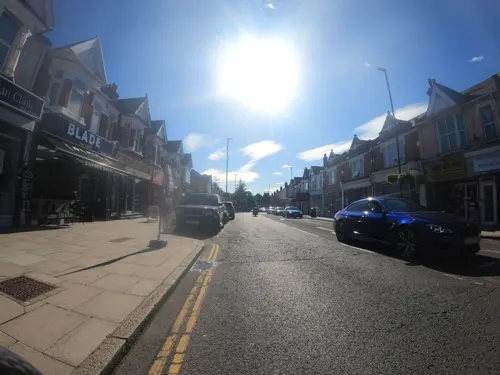
Da Shack
Restaurant · Hawaiian · 1.4 mi
156 South Ealing Road, London
Mo-Th 12:00-21:00; Fr-Sa 12:00-22:00; Su 12:00-20:00
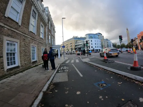
Express Tavern
Bar and pub · 0.5 mi
Pub located close to Kew bridge, large back garden, serves food and drink
56 Kew Bridge Road, London
Su-Th 11:00-23:00; Fr-Sa 11:00-24:00


158 more on the map.
More about Kew
Economy
The Craft Guild of Chefs, the main professional association for chefs in the UK, is based in Kew.
The fashion clothing retailer Jigsaw's headquarters, now at Water Lane, Richmond, were previously in Mortlake Road, Kew. A former industry in Kew was that of nameplate manufacturing, by the Caxton Name Plate Manufacturing Company, based on Kew Green. The company was founded in 1964 and folded in 1997. Boss & Co., a company that makes handcrafted guns, is now based at the building.
It was in Kew that viscose was first developed into rayon, in a laboratory near Kew Gardens station run by Cowey Engineering. Rayon was produced in a factory on South Avenue, off Sandycombe Road, before Courtaulds acquired the patents for rayon in 1904. Also on a site near Kew Gardens station, the engineering company F C Blake, now commemorated in the Kew street name Blake Mews, produced petrol-powered traction engines in the late 19th and early 20th centuries.
Kew Retail Park stands on the site of a former aircraft factory established in 1918 by Harry Whitworth, who owned Glendower Aircraft Ltd. The factory built Airco DH.4s and Sopwith Salamanders for the British government in the First World War.
Education
Darell Primary and Nursery School is on Darell Road and Niton Road. It opened in 1906, as the Darell Road Schools, at the southern end of what had been the Leyborne-Popham estate. It was Richmond Borough Council's first primary school and was built in the Queen Anne Revival style, in brick with white stone facings. Although it has been extended several times, it is now the only Richmond borough primary school still in its historic original pre-1914 building.
Kew Riverside Primary School, on Courtlands Avenue, opened in 2002.
From the Wikipedia article Kew, under CC BY-SA 4.0.
Notable people from Kew
 Milton JonesBritish comedianPhoto: Karla Gowlett, CC BY 3.0
 A. C. H. SmithBritish writer (born 1935)Photo: Stephen Morris, CC0
 Thomas Richmondpainter (1771-1837)Photo: Stephencdickson, CC BY-SA 4.0
- William Townsend AitonBritish botanist and horticulturist (1766-1849)
- John King DavisAustralian explorer (1884-1967)
- Thomas Gaskell TutinBritish botanist (1908-1987)
- Acton Smee AyrtonBritish barrister and Liberal Party politician (1816–1886)
- Conrad Noelpriest
- Michael GraydonRoyal Air Force air marshal
- George VassilaEnglish cricketer (1857-1915)
- Alfred LuffEnglish cricketer (1846-1933)
- Henry PrescottOfficer of the British Royal Navy (1783-1874)
Born in Kew, according to Wikidata (CC0). Each name links to its Wikipedia article.
Where to stay17
Churches and places of worship68
Cathedral of the Nativity of the Mother of God and the Holy Royal Martyrs
Church · Orthodox · 0.7 mi
57 Harvard Road, London
East Sheen Baptist Church
Church · Baptist · 1.4 mi
Temple Sheen Road, London
Shopping71
Gas and EV charging20
Schools, colleges and libraries42
Our Lady and St John's Catholic Primary School
School · Roman Catholic · 1.3 mi
Boston Park Road, Brentford
Healthcare30
HCA UK Chiswick Outpatients & Diagnostics Centre
Clinic and pharmacy · 1.1 mi
347-353 Chiswick High Road, London
Dumlers Pharmacy
Clinic and pharmacy · 1.4 mi
495-497 Upper Richmond Road West, London
Map of Kew
250 places. The map loads OpenStreetMap tiles when you open it.
Getting there and nearby towns
Heathrow Airport (LHR) is the nearest airport with scheduled flights listed in OpenStreetMap, 7 miles away.
- Richmond 2 mi southwest, about 3 min by car
- Sudbury 5 mi north, about 9 min by car
- Northolt 6 mi northwest, about 9 min by car
- London 7 mi east, about 12 min by car
- City of Westminster 7 mi east, about 11 min by car
- Harrow 7 mi north, about 11 min by car
- Worcester Park 7 mi south, about 12 min by car
- Sunbury-on-Thames 8 mi southwest, about 12 min by car
- Islington 9 mi northeast, about 14 min by car
- Archway 9 mi northeast, about 14 min by car
Drive times are estimates from straight-line distance, not routes.
Towns near Kew


Keep exploring
Local news
Headlines from INDB.
Reviews, tips and questions
Loading what members have shared...
Sources and licences
- GeoNames (CC BY 4.0): population, coordinates, regions and time zone
- Mapillary (see each image): photos
- OpenStreetMap contributors (ODbL 1.0): places, airports, map data
- Wikidata (CC0 1.0): elevation, founding date, time zone, website, landmarks and historic places
- Wikimedia Commons (see each image): photos
- Wikipedia (CC BY-SA 4.0): overview and history text
Photo credits
- St-Anne-church-Kew-5857, Patche99z, Public domain
- Bonsai House Kew Gardens, Eddie Johnston, CC BY-SA 4.0
- Kew Gardens Fungarium Specimen 19, Maparchives, CC0
- Kew Gardens Fungarium Specimen 20, Maparchives, CC0
- Kew Gardens Fungarium Specimen 24, Maparchives, CC0
- Kew Gardens Fungarium Specimen 23, Maparchives, CC0
- Kew Gardens Fungarium Specimen 21, Maparchives, CC0
- Kew Gardens Fungarium Specimen 22, Maparchives, CC0
- Kew Gardens Fungarium Specimen 25, Maparchives, CC0
- Kew Gardens Fungarium Specimen 14, Maparchives, CC0
- Kew Gardens Fungarium Specimen 10, Maparchives, CC0
- Kew Gardens Fungarium Specimen 01, Maparchives, CC0
- Kew Gardens Fungarium Specimen 03, Maparchives, CC0
- Kew Gardens Fungarium Specimen 07, Maparchives, CC0
- Kew Gardens Fungarium Specimen 08, Maparchives, CC0
- Kew Gardens Fungarium Specimen 35, Maparchives, CC0
- Kew Gardens Fungarium Specimen 09, Maparchives, CC0
- Kew Gardens Fungarium Specimen 05, Maparchives, CC0
- Kew Gardens Fungarium Specimen 16, Maparchives, CC0
- Kew Gardens Fungarium Specimen 28, Maparchives, CC0
- Kew Gardens Fungarium Specimen 12, Maparchives, CC0
- Kew Gardens Fungarium Specimen 11, Maparchives, CC0
- Kew Gardens Fungarium Specimen 17, Maparchives, CC0
- Kew Gardens Fungarium Specimen 13, Maparchives, CC0
- Hammersmith Apollo 2008 06 19, Alex.muller, CC BY-SA 3.0
- Kew Bridge in London 2007 Sept 21, Patche99z, CC BY 3.0
- Passmore Edwards Library Shepherds Bush, Alex Williams, CC BY-SA 3.0
- Richmond 018 Richmond Bridge TT panorama, Amandajm, CC BY-SA 3.0
- Richmond Lock from Isleworth,Middx looking SE, Unknown author, CC BY-SA 3.0
- Richmond Railway Bridge 333r1, Patche99z, CC BY 3.0
- Kew Palace (5942717068), xlibber, CC BY 2.0
- London Museum of Water & Steam entrance, Smurfy, CC0
- Boston manor front 2943, P.g.champion, CC BY-SA 2.0 uk
- Syon House West Aspect, Russ Hamer, CC BY-SA 3.0
- Bromhead memorial with wreaths, Robert Smith, CC BY-SA 4.0
- The Eel Pie Island Museum, Twickenham - London. (35192973221), Jim Linwood from London, CC BY 2.0
- Richmond Deer Park Obelisk, Amanda Slater from Coventry, West Midlands, UK, CC BY-SA 2.0
- London - April 2009 (3496483619), Cristian Bortes from Cluj-Napoca, Romania, CC BY 2.0
- Kew Baptist Church, Robert Smith, CC BY-SA 4.0
- Turnham Green Church 3, Armchair, CC0
- East Sheen Baptist Church, Robert Smith, CC BY-SA 4.0
- All Hallows Parish Church in Twickenham, Maxwell Hamilton, CC BY 2.0
- All Saints Petersham, Stevekeiretsu, CC BY-SA 4.0
- Chiswick House from SE, Michael Coppins, CC BY-SA 4.0
- Griffin Park aerial 2011, Photo: Andreas Praefcke, Public domain
- The Musical Museum, Brentford, London., Jim Linwood, CC BY 2.0
- King's House Sports Ground, Mx. Granger, CC0
- Gunnersbury Triangle 'Mangrove Swamp', Chiswick Chap, CC BY-SA 3.0
- Hogarths house 5832, Unknown author, Public domain
- The Barn Church, Kew, Robert Smith, CC BY-SA 3.0
- Old Pack Horse, Chiswick, W4 (2446507593), Ewan Munro from London, UK, CC BY-SA 2.0
- Russian Orthodox Cathedral, Gunnersbury - 1, The wub, CC BY-SA 4.0
- Attila The Hungarian Barman Doing His Thing Hilton London Syon Park, Jack Oughton, CC BY-SA 3.0
- Syon Park Lake, Russ Hamer, CC BY-SA 3.0
- Crown and Anchor, Chiswick, W4 (4802177647), Ewan Munro from London, UK, CC BY-SA 2.0
- Richmond lending library (36446003082), JuliaC2006 from Rochester, UK, CC BY 2.0
- Former Currys HQ and factory, Kto288, CC BY-SA 2.5
- Duke of Sussex Corner View, Ian Alexander, CC BY-SA 4.0
- Dome building, Richmond, Stevekeiretsu, CC BY-SA 4.0
- Ealing Fields High School 1, Katya H., CC BY-SA 4.0
- St Paul's CofE Primary School, Brentford (panorama), ZeevoX, CC BY-SA 4.0
- St Lawrence's Church, Brentford, London, Jim Linwood, CC BY 2.0
- Butterfly at Syon House, Keven Law from Los Angeles, USA, CC BY-SA 2.0
- Beatrice Lewisohn Q theatre programme 1935, Unknown author Unknown author, Public domain
- Long Wood, Norwood Green 1, Dudley Miles, CC BY-SA 3.0
- Richmond Theatre ceiling and chandelier, Gts-tg, CC BY-SA 4.0
- GOC Richmond 213 Orange Tree Theatre, Richmond (14700706386), Peter O'Connor aka anemoneprojectors, CC BY-SA 2.0
- Bush Theatre - Passmore Edwards plaque - 7 Uxbridge Road London W12 8LJ, Spudgun67, CC BY-SA 4.0
- The Kings Theatre (Hammersmith and Fulham Historic Buildings Group), Spudgun67, CC BY-SA 4.0
- St Anne Kew Green 4879crop, Patche99z, CC BY-SA 3.0
- Turnham Green, London Borough of Hounslow, W4 (2445299278), Ewan Munro from London, UK, CC BY-SA 2.0
- Ravenscourt Park 'baobab' Plane, Paulitzer, CC BY-SA 4.0
- Street-level photo, peterneubauer, CC BY-SA 4.0
- Street-level photo, milhouse, CC BY-SA 4.0
- Street-level photo, milhouse, CC BY-SA 4.0
- Street-level photo, milhouse, CC BY-SA 4.0
- Street-level photo, southglos, CC BY-SA 4.0
- Street-level photo, southglos, CC BY-SA 4.0
- Street-level photo, alexanderar, CC BY-SA 4.0
- Street-level photo, milhouse, CC BY-SA 4.0
- Street-level photo, southglos, CC BY-SA 4.0
- Street-level photo, milhouse, CC BY-SA 4.0
- Street-level photo, alexanderar, CC BY-SA 4.0
- Street-level photo, milhouse, CC BY-SA 4.0
- Street-level photo, southglos, CC BY-SA 4.0
- Street-level photo, milhouse, CC BY-SA 4.0
- Street-level photo, southglos, CC BY-SA 4.0
- Street-level photo, milhouse, CC BY-SA 4.0
- Street-level photo, milhouse, CC BY-SA 4.0
- Street-level photo, milhouse, CC BY-SA 4.0
- Street-level photo, ameanea, CC BY-SA 4.0
- Street-level photo, southglos, CC BY-SA 4.0
- Street-level photo, ecatmur, CC BY-SA 4.0
- Street-level photo, ecatmur, CC BY-SA 4.0
- Street-level photo, southglos, CC BY-SA 4.0
- Street-level photo, milhouse, CC BY-SA 4.0
- Street-level photo, southglos, CC BY-SA 4.0
- Street-level photo, milhouse, CC BY-SA 4.0


Page built November 10, 2026. Spotted a mistake? Tell us or suggest a place.