


Kirknewton, United Kingdom
Kirknewton is a town of 1,950 people in Scotland, United Kingdom.
Why visit Kirknewton
Townapedia lists 11 museums and landmarks, 2 parks and trails, 4 places to eat, 1 place to stay and 5 attractions in and around town.
Highlights include Almond Aqueduct, Almond Valley Viaduct, Jupiter Artland and Bonnington House.
Weather in Kirknewton
Forecast from MET Norway (CC BY 4.0). Full forecast
About Kirknewton
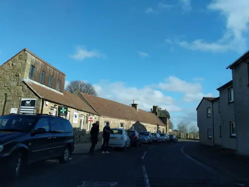
Kirknewton (Scots: Kirknewtoun, Scottish Gaelic: Eaglais a' Bhaile Ùir) is a village formerly in the county of Midlothian and, since 1975, in West Lothian, Scotland. The population of the Kirknewton Community Council district is 2200, which includes the village and surrounding areas. It lies south of the A71 from Edinburgh to Livingston, and north of the A70, the high-level road that runs along the north side of the Pentland Hills from Edinburgh to Carnwath and Lanark. Much of the village stands back from the B7031, which links the two main "A" roads.
From the Wikipedia article Kirknewton, West Lothian (this version), under CC BY-SA 4.0.
Photos of Kirknewton


Things to do5

Almond Aqueduct
Bridge · 2.3 mi
Navigable aqueduct in West Lothian/City of Edinburgh, Scotland

Almond Valley Viaduct
Bridge · 3.2 mi
Railway viaduct near Edinburgh, Scotland

Almondell Aqueduct
Bridge · 1.9 mi
Navigable aqueduct in West Lothian, Scotland
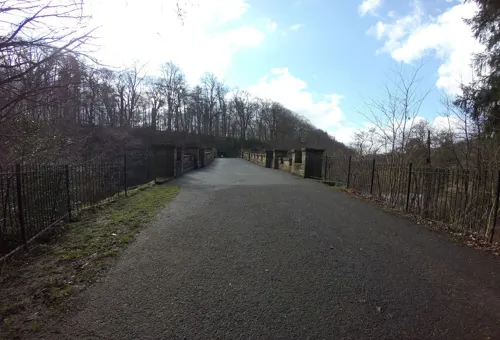
Almondell Bridge
Bridge · 1.9 mi
Road bridge in West Lothian, Scotland

Museums and landmarks11

Jupiter Artland
Museum · 1.2 mi
Sculpture garden and art gallery in the west of City of Edinburgh, Scotland, UK
Apr-Oct Mo-Su,PH 10:00-17:00; Nov-Mar Th-Su,PH 10:00-17:00; Jan off




Parks, trails and playgrounds2

Restaurants and cafes4


History
The earliest signs of settlement in the area are the remains of Iron Age forts on Kaimes Hill and Dalmahoy Hill, craggy summits about a mile east of Kirknewton. In slightly more recent times, Kirknewton House, which lies just to the south of the village, had its origins (as Meadowbank House) in the 17th century. The current house is a reworking of the original by the architect William Playfair for Alexander Maconochie, Lord Meadowbank in 1835. Kirknewton House is screened by trees from nearby roads and from the village itself. The most obvious evidence of its existence is the entrance lodge beside the start of the drive to the house at the south end of the village.
Ormiston House is a Scottish baronial mansion south of Kirknewton. It was built in 1851 for Archibald Wilkie, to a design by David Bryce.
Kirknewton stood at the south eastern corner of the large area of West Lothian which was transformed from the 1860s by the oil shale industry, with the nearest shale mine lying just to the north west of the village, between it and East Calder. Shale from here was taken to the huge oil shale works at Pumpherston for processing.
Read more of the history
During World War II, the Royal Air Force built a military airfield at Whitemoss, a mile south east of Kirknewton. RAF Kirknewton, as it was known, was home to a variety of units during the war and, like many other military airfields, fell quiet afterwards. In 1952 it became home to a number of small United States Air Force units tasked with providing mobile radio facilities to the USAF in Britain. The USAF left in 1966, and today Kirknewton airfield is home to a RAF(V) Gliding Unit, 661 (RAF Kirknewton) VGS.
From the History section of Kirknewton, West Lothian on Wikipedia, under CC BY-SA 4.0.
More about Kirknewton
Education
Kirknewton Primary School was built in 1924 and comprises a nursery and 7 primary classes. The school is located in the west of the village on Station Road.
From the Wikipedia article Kirknewton, West Lothian, under CC BY-SA 4.0.
Notable people from Kirknewton
- Thomas Braidwood Wilsonsurgeon and explorer (1792-1843)
- Thomas William HislopNew Zealand politician (1850–1925)
Born in Kirknewton, according to Wikidata (CC0). Each name links to its Wikipedia article.
Where to stay1
Churches and places of worship2
Shopping1
Schools, colleges and libraries1
Healthcare1
Map of Kirknewton
28 places. The map loads OpenStreetMap tiles when you open it.
Getting there and nearby towns
Edinburgh Airport (EDI) is the nearest airport with scheduled flights listed in OpenStreetMap, 5 miles away.
- Mid Calder 2 mi west, about 4 min by car
- Ratho 3 mi northeast, about 4 min by car
- Newbridge 3 mi north, about 5 min by car
- Broxburn 4 mi northwest, about 6 min by car
- Livingston 4 mi west, about 7 min by car
- Ratho Station 4 mi north, about 6 min by car
- West Calder 6 mi southwest, about 10 min by car
- Queensferry 7 mi north, about 12 min by car
- Seafield 7 mi west, about 11 min by car
- Edinburgh 10 mi northeast, about 16 min by car
Drive times are estimates from straight-line distance, not routes.
Towns near Kirknewton


Keep exploring
Local news
Headlines from INDB.
Reviews, tips and questions
Loading what members have shared...
Sources and licences
- GeoNames (CC BY 4.0): population, coordinates, regions and time zone
- Mapillary (see each image): photos
- OpenStreetMap contributors (ODbL 1.0): places, airports, map data
- Wikidata (CC0 1.0): elevation, founding date, time zone, website, landmarks and historic places
- Wikimedia Commons (see each image): photos
- Wikipedia (CC BY-SA 4.0): overview and history text
Photo credits
- Manse and Kirk at Kirknewton, mym, CC BY-SA 2.0
- 20 Main Street Kirknewton, Brewster d, CC BY-SA 4.0
- Union icicle, Citizenthom, CC BY-SA 3.0
- RathoViaduct06, Renata ( talk ), Public domain
- Love Bomb, Marc Quinn, subberculture, CC BY-SA 2.0
- Mid Calder Parish Church, Basilicofresco, CC BY-SA 4.0
- Bonnington House, Edinburgh, Coldupnorth, CC BY-SA 4.0
- Image from page 293 of "The castellated and domestic architecture of Scotland, from the twelfth to the eighteenth century" (1887) (14782842164), Internet Archive Book Images, No restrictions
- Maconochies Of Meadowbank Burial Enclosure, Brewster d, CC BY-SA 4.0
- William Cullen Burial Enclosure, Brewster d, CC BY-SA 4.0
- Almondell aqueduct from Camps viaduct, Kognos, CC BY-SA 4.0
- Street-level photo, ccbb7766, CC BY-SA 4.0
- Street-level photo, hobgoblin, CC BY-SA 4.0
- Street-level photo, hobgoblin, CC BY-SA 4.0
- Street-level photo, hobgoblin, CC BY-SA 4.0
- Street-level photo, hobgoblin, CC BY-SA 4.0
- Street-level photo, ccbb7766, CC BY-SA 4.0
Page built November 10, 2026. Spotted a mistake? Tell us or suggest a place.