


Seafield, United Kingdom
Seafield is a town of 1,330 people in Scotland, United Kingdom.
Why visit Seafield
Townapedia lists 21 museums and landmarks, 5 parks and trails, 8 places to eat, 4 places to stay and 4 attractions in and around town.
Highlights include Regal Community Theatre and Five Sisters Zoo.
Weather in Seafield
Forecast from MET Norway (CC BY 4.0). Full forecast
About Seafield
Seafield is a small village in West Lothian, Scotland. Seafield lies 1+1⁄4 miles (2.0 km) east of Blackburn, 2 miles (3.2 km) southeast of Bathgate (grid reference NT007660) and 3 miles (4.8 km) west of Livingston.
From the Wikipedia article Seafield, West Lothian (this version), under CC BY-SA 4.0.
Things to do4

Regal Community Theatre
Cinema and theater · 2.8 mi
Former theatre and cinema in Bathgate, Scotland


Museums and landmarks21

9 more on the map.
Parks, trails and playgrounds5


Restaurants and cafes8



History
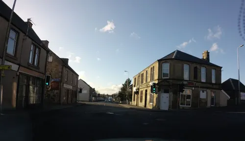
Seafield grew initially in the 1870s to 1900s to provide housing for coal and oil-shale mine workers, with three poorer-quality rows north of the road demolished but two later, well-built terraces of miners' rows on the south side now restored in the centre of the village. In the 1970s, new housing was laid out with Scandinavian style houses that have alternating mono-pitched roofs and slender chimneys.
The oil-shale works north of the village were cleared by the 1960s, leaving a large oil-shale bing (tip). The County Council then used the works site and the adjacent peat moss as its main domestic refuse tip until the 1980s. This generated serious water pollution problems, aggravated by outflow being east towards the New Town of Livingston. One of the last large-scale Scottish Enterprise-led land reclamation schemes, in the 1990s, utilised the spent shale (which is inert, having been retorted at high temperature) to blind over the tip, with full pollution control measures.
Read more of the history
Seafield Bing itself was remodelled to a design brief by West Lothian Planners, to resemble the natural basalt sills and lava flow landscapes of the Bathgate Hills and Fife, with a serrated crestline, and a proper summit now estimated at 198m asl in height, and renamed with approval of the Community Council "Seafield Law". Together with Easter Inch MosS, Seafield Law has a wooded setting that is designated as a 148 hectare local nature reserve and recreational area.
From the History section of Seafield, West Lothian on Wikipedia, under CC BY-SA 4.0.
More about Seafield
Geography
The village lies between the River Almond to the south and the M8 motorway to the north. The nearby Seafield Law is 198 metres.
From the Wikipedia article Seafield, West Lothian, under CC BY-SA 4.0.
Notable people from Seafield
- Archie Boydassociation football player
Born in Seafield, according to Wikidata (CC0). Each name links to its Wikipedia article.
Where to stay4
Shopping2
Gas and EV charging1
Schools, colleges and libraries4
Our Lady Of Lourdes Primary School
School · Roman Catholic · 1.5 mi
Hopefield Road, Blackburn
Map of Seafield
49 places. The map loads OpenStreetMap tiles when you open it.
Getting there and nearby towns
Edinburgh Airport (EDI) is the nearest airport with scheduled flights listed in OpenStreetMap, 10 miles away.
- Bathgate 3 mi northwest, about 4 min by car
- Livingston 3 mi northeast, about 5 min by car
- Whitburn 4 mi west, about 6 min by car
- Armadale 4 mi west, about 7 min by car
- Broxburn 6 mi northeast, about 10 min by car
- Linlithgow 7 mi north, about 11 min by car
- Newbridge 8 mi northeast, about 13 min by car
- Ratho 9 mi east, about 14 min by car
- Ratho Station 9 mi northeast, about 14 min by car
- Bo’ness 10 mi north, about 16 min by car
Drive times are estimates from straight-line distance, not routes.
Towns near Seafield


Keep exploring
Local news
Headlines from INDB.
Reviews, tips and questions
Loading what members have shared...
Sources and licences
- GeoNames (CC BY 4.0): population, coordinates, regions and time zone
- Mapillary (see each image): photos
- OpenStreetMap contributors (ODbL 1.0): places, airports, map data
- Wikidata (CC0 1.0): elevation, founding date, time zone, website, landmarks and historic places
- Wikimedia Commons (see each image): photos
- Wikipedia (CC BY-SA 4.0): overview and history text
Photo credits
- Seafield, West Lothian, Richard Webb, CC BY-SA 2.0
- Regal Community Theatre, Temppwdonly, CC BY-SA 3.0
- Street-level photo, hobgoblin, CC BY-SA 4.0
- Street-level photo, hobgoblin, CC BY-SA 4.0
- Street-level photo, hobgoblin, CC BY-SA 4.0
- Street-level photo, hobgoblin, CC BY-SA 4.0
- Street-level photo, hobgoblin, CC BY-SA 4.0
- Street-level photo, hobgoblin, CC BY-SA 4.0
- Street-level photo, hobgoblin, CC BY-SA 4.0
- Street-level photo, hobgoblin, CC BY-SA 4.0
- Street-level photo, hobgoblin, CC BY-SA 4.0
- Street-level photo, victuallers, CC BY-SA 4.0
- Street-level photo, hobgoblin, CC BY-SA 4.0
- Street-level photo, hobgoblin, CC BY-SA 4.0
- Street-level photo, hobgoblin, CC BY-SA 4.0
Page built November 10, 2026. Spotted a mistake? Tell us or suggest a place.