


Leek Wootton, United Kingdom
Leek Wootton is a town of 1,017 people in England, United Kingdom.
Why visit Leek Wootton
Townapedia lists 11 museums and landmarks, 13 parks and trails, 10 places to eat, 6 places to stay and 6 attractions in and around town.
Highlights include Castle Bridge, Loft Theatre, Fusilier Museum Warwick and Kenilworth Castle.
Weather in Leek Wootton
Forecast from MET Norway (CC BY 4.0). Full forecast
About Leek Wootton
Leek Wootton is a village and former civil parish, now in the parish of Leek Wootton and Guy's Cliffe, in the Warwick district, in the county of Warwickshire, England, approximately 2 miles (3.2 km) south of Kenilworth and 2.5 miles (4.0 km) north of Warwick. It lies in the triangle created by Kenilworth, Warwick and Leamington Spa. In 1961 the parish had a population of 671.
From the Wikipedia article Leek Wootton (this version), under CC BY-SA 4.0.
Photos of Leek Wootton


Things to do6


Loft Theatre
Cinema and theater · 2.9 mi
Theatre in Leamington Spa, England

Portobello Bridge
Bridge · 2.1 mi
Road bridge in Royal Leamington Spa, Warwick, Warwickshire, England, UK
Priory Theatre
Cinema and theater · 2.1 mi
Amateur theatre building and company in Kenilworth, UK

Remains Of Old Castle Bridge
Bridge · 2.7 mi
Bridge in Warwick, Warwick, Warwickshire, England, UK

Museums and landmarks11

Fusilier Museum Warwick
Museum · 2.4 mi
Regimental museum in Warwick, England, United Kingdom

Kenilworth Castle
Museum · 2.1 mi
Castle ruin in the town of Kenilworth, Warwickshire, England, UK

Royal Pump Rooms
Museum · 2.9 mi
Grade II listed building in Leamington Spa, Warwickshire, England, UK

St John's House Museum, Warwick
Museum · 2.4 mi
Museum in Warwickshire, England, UK

Stoneleigh Abbey
Museum · 2.4 mi
Country house in Stoneleigh, Warwickshire, England, UK

Warwick Castle
Museum · 2.7 mi
Medieval castle in Warwickshire, England, UK




Parks, trails and playgrounds13


Royal Pump Room Gardens
Park · 2.8 mi
Open space in centre of Leamington Spa, Warwickshire, England, UK


The Dell
Park · 2.3 mi
Urban park in Leamington Spa, Warwickshire, England

The Jephson Gardens
Park · 2.9 mi
Park in Royal Leamington Spa, Warwickshire, England, UK

Victoria Park
Park · 2.6 mi
Park in Royal Leamington Spa, Warwickshire, England, UK


St. Nicholas' Park
Park · 2.5 mi
Park in the centre of the town of Warwick, England

1 more on the map.
Restaurants and cafes10
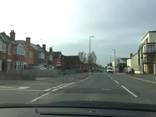

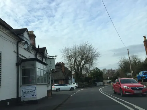
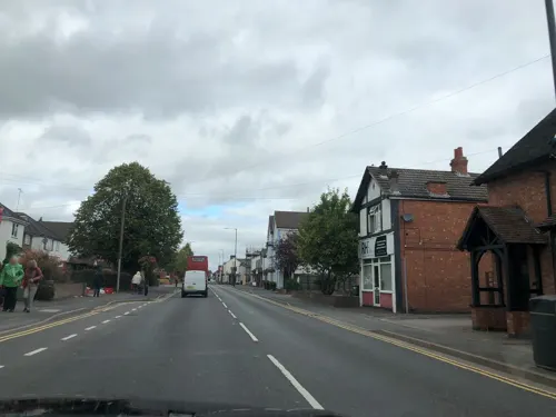
Chips & Fishes
Fast food · Fish And Chips · 1.3 mi
Th-Sa 11:45-13:30, Tu-Sa 16:30-20:30


History
Blacklow Hill is located south of the village, close to the A46 road. Its name comes from the fact the trees that partly cover it are very dark (black) and the Anglo-Saxon hlaew (burial mound). In 1971 an archaeological team found flints and hunting tools from the early Mesolithic period, around 9,000 B.C., and three graves of Anglo-Saxon origin.
The monument Gaveston's Cross is in the wood on the hill. It marks the point where Piers Gaveston was murdered. In 1308 Edward II travelled to Boulogne to marry Isabella, leaving Piers Gaveston, a Gascon knight to act as regent. Resentment against the king's rule and Gaveston's position of power grew, some barons began to demand the banishment of Gaveston. Edward could do little to prevent Gaveston being captured in 1312, under the orders of the Earl of Lancaster and his allies. He was captured first by the Earl of Warwick, whom he was seen to have offended, and handed over to two Welshmen. They took him to Blacklow Hill and murdered him; one ran him through the heart with his sword and the other beheaded him.
The railway bridge over the road, between Leek Wootton and Hill Wootton, on the Coventry to Leamington Line, collapsed in a railway accident on 11 June 1861, with the driver and fireman being killed.
On 1 April 1986 the parish was abolished and merged with Guy's Cliffe to form "Leek Wootton and Guy's Cliffe".
From the History section of Leek Wootton on Wikipedia, under CC BY-SA 4.0.
More about Leek Wootton
Geography
The civil parish of Leek Wootton and Guy's Cliffe, including the hamlets of Hill Wootton, Chesford, Goodrest, North and Middle Woodloes, has a population of approximately 1,100. The village is adjacent to the A46 dual-carriageway trunk road. The nearest railway station is Warwick town with Warwick Parkway further away. The nearest airport is Birmingham Airport (11.7 miles).
There are numerous public footpaths and walks in the parish, including the Tink-a-Tank, (believed to have been named because people used to use the path to walk to church and think about God and thank him for his blessings), several across the golf courses, a woodland walk between the Coventry Road (B4115), which crosses the A46 road and comes out at the north end of the village on the Warwick Road, and a small area of woodland to the north west of the village (accessed from Waller Close and the Recreation Ground). To the north of Leek Wootton is the Cattle Brook and just north of Hill Wootton this meets the much larger River Avon, which forms the south-eastern boundary of the Parish.
From the Wikipedia article Leek Wootton, under CC BY-SA 4.0.
Where to stay6
Churches and places of worship21
Gas and EV charging2
Schools, colleges and libraries4
Healthcare1
Map of Leek Wootton
74 places. The map loads OpenStreetMap tiles when you open it.
Getting there and nearby towns
Birmingham Airport (BHX) is the nearest airport with scheduled flights listed in OpenStreetMap, 12 miles away.
- Kenilworth 2 mi north, about 4 min by car
- Warwick 2 mi south, about 4 min by car
- Royal Leamington Spa 3 mi southeast, about 5 min by car
- Coventry 7 mi northeast, about 11 min by car
- Knowle 8 mi northwest, about 13 min by car
- Stratford-upon-Avon 10 mi southwest, about 17 min by car
- Solihull 11 mi northwest, about 17 min by car
- Bedworth 12 mi northeast, about 19 min by car
- Chelmsley Wood 13 mi northwest, about 21 min by car
- Rugby 14 mi east, about 22 min by car
Drive times are estimates from straight-line distance, not routes.
Towns near Leek Wootton


Keep exploring
Local news
Headlines from INDB.
Reviews, tips and questions
Loading what members have shared...
Sources and licences
- GeoNames (CC BY 4.0): population, coordinates, regions and time zone
- Mapillary (see each image): photos
- OpenStreetMap contributors (ODbL 1.0): places, airports, map data
- Wikidata (CC0 1.0): elevation, founding date, time zone, website, landmarks and historic places
- Wikimedia Commons (see each image): photos
- Wikipedia (CC BY-SA 4.0): overview and history text
Photo credits
- Leek wootton 4u07, Snowmanradio, CC BY-SA 3.0
- Variegated English Elm sucker leaves. Leek Wootton, Warwickshire 08, Tom elm, CC BY-SA 4.0
- Variegated English Elm sucker leaves. Leek Wootton, Warwickshire 07, Tom elm, CC BY-SA 4.0
- Variegated English Elm sucker leaves. Leek Wootton, Warwickshire 03, Tom elm, CC BY-SA 4.0
- Variegated English Elm sucker leaves. Leek Wootton, Warwickshire 06, Tom elm, CC BY-SA 4.0
- Variegated English Elm sucker leaves. Leek Wootton, Warwickshire 14, Tom elm, CC BY-SA 4.0
- Variegated English Elm sucker leaves. Leek Wootton, Warwickshire 05, Tom elm, CC BY-SA 4.0
- Variegated English Elm sucker leaves. Leek Wootton, Warwickshire 04, Tom elm, CC BY-SA 4.0
- Variegated English Elm sucker leaves. Leek Wootton, Warwickshire 13, Tom elm, CC BY-SA 4.0
- Variegated English Elm sucker leaves. Leek Wootton, Warwickshire 12, Tom elm, CC BY-SA 4.0
- Variegated English Elm sucker leaves. Leek Wootton, Warwickshire 11, Tom elm, CC BY-SA 4.0
- Loft Theatre, Cls14 ( talk ), CC BY-SA 3.0
- Old Castle Bridge, Warwick, DeFacto, CC BY-SA 4.0
- Royal Spa Centre, Royal Leamington Spa, J An, CC BY-SA 4.0
- St John's museum entrance 2, Fitzsimons, CC BY-SA 3.0
- Kenilworth Castle 2016, DeFacto, CC BY-SA 4.0
- Royal Pump Rooms and Baths, Leamington Spa, David Dixon, 4093142, David Dixon, CC BY-SA 2.0
- St John's House Museum, DeFacto, CC BY-SA 4.0
- Stoneleigh abbey 27j08, Snowmanradio, CC BY-SA 4.0
- Warwick Castle May 2016, DeFacto, CC BY-SA 4.0
- Kenilworth Abbey Fields, David Hunt, Public domain
- PumpRoomGardens, David Stowell, CC BY-SA 2.0
- Jephson Memorial, Charlie629, CC BY 3.0
- All Saints' Church Leamington Spa, from the churchyard 2012, Pauldecates, CC BY-SA 3.0
- Nave, facing West, St Mark's Church, Leamington Spa, Mum's taxi, CC BY-SA 3.0
- Lillington Free Church, Jamesichurch, CC BY-SA 4.0
- Lillington Church Warks, Rtaulbut, Public domain
- Guy's Cliffe House, Warwickshire depicted by Alexander Francis Lydon, Alexander Francis Lydon (1836-1917), Public domain
- Kenilworth St Johns - panoramio, Tanya Dedyukhina, CC BY 3.0
- Blackdown Hill, the site of Gaveston's Cross, Robert S Remie, CC BY-SA 4.0
- Stoneleigh park entrance 12n06, The original uploader was Snowmanradio at English Wikipedia . ( Original text: snowmanradio ), CC BY-SA 3.0
- TheDellLeamington, Cls14 at English Wikipedia, CC BY-SA 3.0
- Priory Park, Warwick, Robin Stott, CC BY-SA 2.0
- Long shot of the bench (OpenBenches 9356-1), Anonymous Unknown author, CC BY-SA 4.0
- View from the bench (OpenBenches 9357-2), Anonymous Unknown author, CC BY-SA 4.0
- Long shot of the bench (OpenBenches 9357-1), Anonymous Unknown author, CC BY-SA 4.0
- Castle Bridge southern approach, Fitzsimons, CC BY-SA 3.0
- Portobello Bridge north side, Fitzsimons, CC BY-SA 4.0
- Victoria Park Commonwealth Games, Sirhissofloxley, CC BY-SA 4.0
- Guy's Cliffe Walled Garden (41739291320), Amanda Slater from Coventry, West Midlands, UK, CC BY-SA 2.0
- Leek Wootton and Guy's Cliffe - The Saxon Mill Restaurant - 20221113102401, Feldonian, CC BY-SA 4.0
- Street-level photo, laye, CC BY-SA 4.0
- Street-level photo, laye, CC BY-SA 4.0
- Street-level photo, milkfloat, CC BY-SA 4.0
- Street-level photo, rob, CC BY-SA 4.0
- Street-level photo, laye, CC BY-SA 4.0
- Street-level photo, laye, CC BY-SA 4.0
- Street-level photo, laye, CC BY-SA 4.0
- Street-level photo, laye, CC BY-SA 4.0
- Street-level photo, laye, CC BY-SA 4.0
- Street-level photo, laye, CC BY-SA 4.0
- Street-level photo, laye, CC BY-SA 4.0
- Street-level photo, laye, CC BY-SA 4.0
- Street-level photo, laye, CC BY-SA 4.0
- Street-level photo, laye, CC BY-SA 4.0
- Street-level photo, laye, CC BY-SA 4.0
- Street-level photo, laye, CC BY-SA 4.0
- Street-level photo, laye, CC BY-SA 4.0
- Street-level photo, adam2, CC BY-SA 4.0


Page built November 10, 2026. Spotted a mistake? Tell us or suggest a place.