


Why visit Rugby
Townapedia lists 40 museums and landmarks, 20 parks and trails, 148 places to eat, 5 places to stay and 4 attractions in and around town.
Highlights include Rugby Theatre, Cineworld, Rugby Art Gallery and Museum and British Thomson-Houston Co Ltd War Memorial.
Weather in Rugby
Forecast from MET Norway (CC BY 4.0). Full forecast
About Rugby
Rugby is a market town in eastern Warwickshire, England, close to the River Avon. At the 2021 census, its population was 78,117, making it the second-largest town in Warwickshire. It is the main settlement within the larger Borough of Rugby, which had a population of 114,400 in 2021.
From the Wikipedia article Rugby, Warwickshire (this version), under CC BY-SA 4.0.
Travel tips from other travellers: Rugby on Wikivoyage (CC BY-SA 4.0).
Photos of Rugby


Things to do4


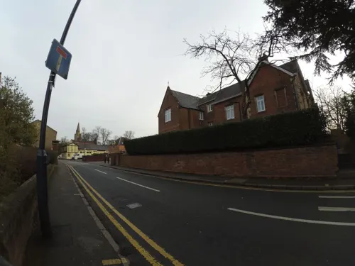
Macready Theatre
Cinema and theater
Building in Rugby, Warwickshire, England

Dow Bridge
Bridge · 3.1 mi
Bridge in Newton and Biggin, Rugby, Warwickshire, England, UK
Museums and landmarks40

Rugby Art Gallery and Museum
Museum
Art gallery and museum in the United Kingdom

British Thomson-Houston Co Ltd War Memorial
Monument and historic site · 0.9 mi



British Thomson-Houston Company War Memorial
Monument and historic site · 0.9 mi
War memorial in Warwickshire, England, UK

20th Anniversary Twinning between Rugby and Russelsheim 1977-1997
Monument and historic site · 0.4 mi
28 more on the map.
Parks, trails and playgrounds20


Newbold Quarry Park
Park · 1.3 mi
Nature reserve in Warwickshire, England






8 more on the map.
Restaurants and cafes148
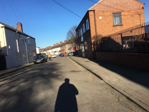
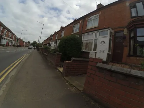
Dilruba Indian Restaurant Rugby
Restaurant · Indian · 0.5 mi
155-157 Railway Terrace, Rugby
Mo-Th 17:00-24:00, Fr-Sa 17:00-00:30, Su 17:00-24:00
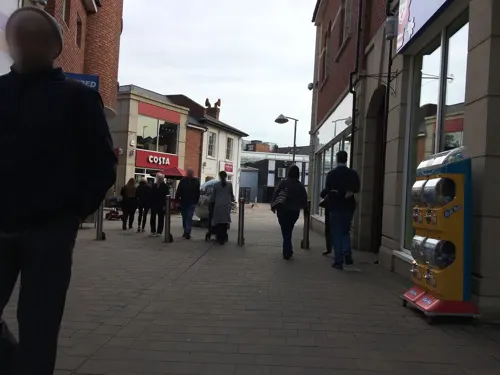
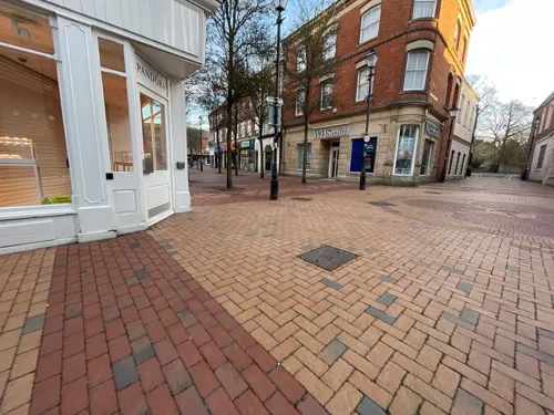
Ottoman
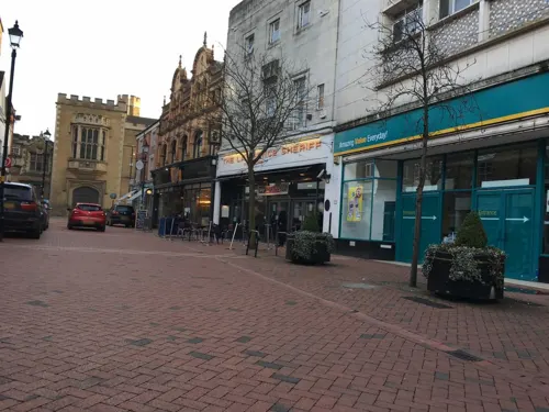
Restaurant · Turkish
10 High Street, Rugby
Mo-Th 08:00-22:30, Fr,Sa 08:00-24:00, Su 00:00-02:00


New Regent
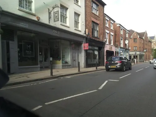
Restaurant · Chinese
48 Church Street, Rugby
Su,Mo,We,Th 17:00-23:00; Fr,Sa 17:00-23:30; Tu off

136 more on the map.
History
Early Iron Age settlement existed in the Rugby area: The River Avon formed a natural barrier between the Dobunni and Corieltauvi tribes, and it is likely that defended frontier settlements were set up on each side of the Avon valley. Rugby's position on a hill overlooking the Avon, made it an ideal location for a defended Dobunni watch settlement. During the Roman period the Roman town of Tripontium was established on the Watling Street Roman road around 3.4 miles (5.5 km) north-east of what is now Rugby, this was later abandoned when the Romans left Britain.
The small settlement at Rugby was taken over by the Anglo-Saxons around 560 AD, and it was mentioned in the Domesday Book of 1086 as Rocheberie; there are several theories about the origin of the name; one is that it is derived from an old Celtic name droche-brig meaning 'wild hilltop'. Another theory is that Rocheberie was a phonetic translation of the Old English name Hrocaberg meaning 'Hroca's hill fortification'; Hroca being an Anglo-Saxon man's name pronounced with a silent 'H', and berg being a name for a hill fortification, with the 'g' being pronounced as an 'ee' sound. The first part of the name may also be Old English hrōc (> "rook"). By the 13th century the name of the town was commonly spelt as Rokeby (or Rookby) before gradually evolving into the modern form by the 18th century.
Read more of the history
In 1140, the first recorded mention was made of St Andrew's Church, which was originally a chapel of ease to the mother church at Clifton-upon-Dunsmore, until Rugby was established as a parish in its own right in 1221, at which point it was elevated to the status of parish church. In 1255, the lord of the manor Henry de Rokeby obtained a charter to hold a weekly market in Rugby, which soon developed into a small country market town.
In the 12th century, Rugby was mentioned as having a castle at the location of what is now Regent Place. However, the nature of the 'castle' is unknown, and it was possibly little more than a fortified manor house. In any event, the 'castle' may have been short lived: It has been speculated that it was constructed early in the reign of King Stephen (1135–1154) during the period of civil war known as The Anarchy, and then, as a so-called adulterine castle, built without Royal approval, demolished in around 1157 on the orders of King Henry II. The earthworks for the castle were still clearly visible as late as the 19th century, but have since been built over. According to one theory, the stones from the castle were later used to construct the west tower of St Andrew's Church, which bears strong resemblance to a castle, and was probably intended for use in a defensive as well as a religious role.
The Rugby area has associations with the Gunpowder Plot of 1605: On the eve of the plot, the plotters stayed at the 'Lion Inn' (now a private residence called 'Guy Fawkes House') in nearby Dunchurch, convened by Sir Everard Digby, awaiting news of Guy Fawkes's attempt to blow up the Houses of Parliament. If he had been successful they planned to kidnap the King's daughter Princess Elizabeth from Coombe Abbey in the countryside between Rugby and Coventry.
During the English Civil War, one of the earliest armed confrontations of the conflict took place at the nearby village of Kilsby in August 1642. That same year, King Charles I passed through Rugby on his way to Nottingham, and 120 Cavalier Horse Troops reportedly stayed at the town, however the townsfolk were sympathetic to the Parliamentarian cause, and they were disarmed by the Cavalier soldiers. Later, in 1645, Rugby was strongly Parliamentarian, and Oliver Cromwell and two regiments of Roundhead soldiers stayed at Rugby in April that year, two months before the decisive Battle of Naseby, some 12 miles (19 km) to the east, in nearby Northamptonshire.
Rugby School was founded in 1567 with money left in the will of Lawrence Sheriff, a locally born man, who had moved to London and made his fortune as the grocer to Queen Elizabeth I. Sheriff had intended Rugby School to be a free grammar school for local boys, but by the 18th century it had acquired a national reputation and gradually became a mostly fee-paying private school, with most of its pupils coming from outside Rugby. The Lawrence Sheriff School was eventually founded in 1878 to continue Sheriff's original intentions.
Until the 19th century, Rugby was a small and relatively unimportant settlement, with only its school giving it any notability. Its growth was slow, due in part to the nearby markets at Dunchurch and Hillmorton which were better positioned in terms of road traffic. In 1663 Rugby was recorded as containing 160 houses with a population of around 650. By 1730 this had increased to 183 houses, with a population of around 900. Rugby's importance and population increased more rapidly during the late 18th and early 19th century due to the growing national reputation of Rugby School, which had moved from its original location at a (now long vanished) schoolhouse north of St Andrew's Church, to its present location south of the town centre by 1750. By the time of the first national census in 1801, Rugby had a population of 1,487 with 278 houses. By 1831 this had increased further to 2,501 in 415 houses. This growth was driven by parents who wished to send their boys to Rugby School, but were unable to afford the boarding fees and so took up residence in Rugby, this in turn attracted domestic staff and tradesmen to the town to service the needs of the newcomers.
From the History section of Rugby, Warwickshire on Wikipedia, under CC BY-SA 4.0.
More about Rugby
Geography
Most of Rugby sits around 400 feet (120 m) above sea level on an irregular shaped plateau which is situated between the valleys of the River Avon and Swift to the north, and the Rains Brook and River Leam to the south. During its modern growth, Rugby spread north across the Avon valley and enveloped the villages of Brownsover and Newbold, which are to the north of the Avon valley.
The county boundary between Warwickshire, Northamptonshire and Leicestershire to the east of Rugby is defined by the A5 road (the former Watling Street) around 3 miles (4.8 km) east of Rugby town centre. The three counties meet at Dow Bridge; the point where the A5 road crosses the River Avon, forming a tripoint. To the south-east of Rugby the county boundary with Northamptonshire is defined by the Rains Brook. Rugby is the easternmost town within Warwickshire (and the entire West Midlands region)
Places adjoining or adjacent to Rugby, but not part of the town itself:
Nearby towns: Bedworth, Daventry, Hinckley, Kenilworth, Leamington Spa, Lutterworth, Northampton, Nuneaton, Southam and Warwick.
Nearby villages: Barby, Braunston, Brinklow, Catthorpe, Harborough Magna, Kilsby, Lilbourne, Monks Kirby, Newton and Pailton.
Economy
For most of the 20th Century manufacturing was the largest employer in Rugby. Manufacturing employment peaked in the 1950s, and has gone into steady decline since, and service industries are now the largest source of employment.
In 2017 the average annual workplace wage in the Rugby borough was £29,059; above the Warwickshire (£28,513) and UK (£28,296) averages.
Arts and culture
The largest general purpose venue in Rugby is the Benn Hall which opened in 1961 as part of the town hall complex, Rugby has two theatres, a professional theatre, the Macready Theatre, and the amateur Rugby Theatre, both in the town centre. A nine-screen cinema run by Cineworld is located at a retail park north of the town centre.
The Rugby Art Gallery, Museum and Library which opened in 2000, hosts various temporary art exhibitions. The main collection, which is not on permanent display, is the nationally renowned Rugby Collection of 20th Century and Contemporary British Art, which comprises 170 artworks by artists including L. S. Lowry, Stanley Spencer, Paula Rego and Graham Sutherland. The museum displays Roman artefacts excavated from the nearby Romano-British town of Tripontium, as well as an exhibition of the social history of Rugby. The building also houses the town's library.
The Webb Ellis Rugby Football Museum, also in the town centre, hosts rugby memorabilia.
The poet Rupert Brooke was born and grew up in Rugby, and is commemorated in the town by a statue in Regent Place.
Education
Rugby College – which is a part of the Warwickshire College Group.
William Temple College (1954–71): an Anglican theological college.
From the Wikipedia article Rugby, Warwickshire, under CC BY-SA 4.0.
Notable people from Rugby
 Rupert BrookeEnglish poet (1887–1915)Photo: "From a photograph by Sherril..., Public domain
 Norman LockyerEnglish scientist and astronomer (1836–1920)Photo: Stereoscopic Co., Public domain
 James MorrisonBritish singerPhoto: CharlieTPhotographic, CC BY 2.0
 Chris WakelinEnglish snooker playerPhoto: Daniel King, CC BY-SA 4.0
 Margaret Louisa WoodsEnglish writer (1856–1945)Photo: not stated, Public domain
 Yahtzee CroshawBritish video game journalist and author (born 1983)Photo: David Jackmanson, CC BY 2.0
 Tom King, Baron King of BridgwaterBritish politician (born 1933)Photo: Chris McAndrew, CC BY 3.0
- Tim Pigott-SmithEnglish film and television actor and author (1946–2017)
- Rose MacaulayEnglish novelist and writer (1881–1958)
- M. John HarrisonEnglish author and critic
- Neil AdamsBritish judoka
- Arnold WolfendaleBritish physicist (1927–2020)
Born in Rugby, according to Wikidata (CC0). Each name links to its Wikipedia article.
Where to stay5
Churches and places of worship33
Shopping39
Gas and EV charging5
Schools, colleges and libraries30
St Andrew's Benn CofE (Voluntary Aided) Primary School
School · Anglican · 0.9 mi
Chester Street, Rugby
Healthcare18
Map of Rugby
250 places. The map loads OpenStreetMap tiles when you open it.
Getting there and nearby towns
Sywell Aerodrome (ORM) is the nearest airport with scheduled flights listed in OpenStreetMap, 21 miles away.
- Daventry 9 mi southeast, about 15 min by car
- Coventry 11 mi west, about 17 min by car
- Bedworth 11 mi northwest, about 18 min by car
- Kenilworth 14 mi west, about 22 min by car
- Earl Shilton 14 mi north, about 23 min by car
- Warwick 15 mi southwest, about 24 min by car
- Glen Parva 15 mi north, about 25 min by car
- Wigston Magna 16 mi northeast, about 26 min by car
- Market Harborough 16 mi northeast, about 26 min by car
- Northampton 18 mi southeast, about 29 min by car
Drive times are estimates from straight-line distance, not routes.
Towns near Rugby


Keep exploring
Local news
Headlines from INDB.
Reviews, tips and questions
Loading what members have shared...
Sources and licences
- GeoNames (CC BY 4.0): population, coordinates, regions and time zone
- Mapillary (see each image): photos
- OpenStreetMap contributors (ODbL 1.0): places, airports, map data
- Wikidata (CC0 1.0): elevation, founding date, time zone, website, landmarks and historic places
- Wikimedia Commons (see each image): photos
- Wikipedia (CC BY-SA 4.0): overview and history text
Photo credits
- Rugby town hall, G-Man at English Wikipedia, Public domain
- New Quad Buildings - Rugby School - Dunchurch Road, Rugby (33590770840), Elliott Brown from Birmingham, United Kingdom, CC BY-SA 2.0
- Rugby banner Rugby School and statue of William Webb Ellis, Elliott Brown from Birmingham, United Kingdom, CC BY-SA 2.0
- Rugby School - Dunchurch Road, Rugby - statue of William Webb Ellis (33132279464), Elliott Brown from Birmingham, United Kingdom, CC BY-SA 2.0
- Rugby School - Dunchurch Road, Rugby - statue of William Webb Ellis (33162872973), Elliott Brown from Birmingham, United Kingdom, CC BY-SA 2.0
- Rugby School - Dunchurch Road, Rugby - statue of William Webb Ellis (33818186902), Elliott Brown from Birmingham, United Kingdom, CC BY-SA 2.0
- Rugby School - Dunchurch Road, Rugby - statue of William Webb Ellis (33846142961), Elliott Brown from Birmingham, United Kingdom, CC BY-SA 2.0
- Rugby School - Dunchurch Road, Rugby - statue of William Webb Ellis (33162931103), Elliott Brown from Birmingham, United Kingdom, CC BY-SA 2.0
- 5 and 6, St Matthews Street, Rugby - Webb Ellis, Webb Ellis Museum, Rugby Tea Room and the Rugby Tap (33131128224), Elliott Brown from Birmingham, United Kingdom, CC BY-SA 2.0
- St Matthews Street, Rugby - World Rugby Hall of Fame (33130690814), Elliott Brown from Birmingham, United Kingdom, CC BY-SA 2.0
- Rugby Theatre 3.21, G-13114, CC BY-SA 4.0
- Dow Bridge (old drawing), W.H.G, Public domain
- Rugby Art Gallery, Museum & Library, G-Man at English Wikipedia, Public domain
- St Michael's Church, Brownsover, Hugh Craddock, CC BY-SA 2.0
- Rugby football museum, G-Man at English Wikipedia, Public domain
- St Andrew's Church, Rugby, G-Man, Public domain
- Rugby School 850, G-Man, Public domain
- Hospital of St Cross -Rugby -A&E-29Oct09, Snowmanradio, CC BY-SA 3.0
- Rugby Town Football Club on Butlin Road, Rugby, Warwickshire, Ian Rob, CC BY-SA 2.0
- St Mark's Church, Bilton, rear 7.20, G-13114, CC BY-SA 4.0
- Cineworld Cinema Rugby, Probinaries, CC BY-SA 3.0
- Benn Hall, Rugby, G-13114, CC0
- Newbold Quarry Park overview 10.22, G-13114, CC BY-SA 4.0
- British Thompson-Houston Company War Memorial (02), Harry Mitchell, CC BY 4.0
- St Andrew's Church, Rugby from north, G-13114, CC BY-SA 4.0
- Swift Valley Nature Reserve, old canal arm (1), G-13114, CC BY-SA 4.0
- Caldecott Park, Rugby (39852792695), Amanda Slater from Coventry, West Midlands, UK, CC BY-SA 2.0
- Street-level photo, gness, CC BY-SA 4.0
- Street-level photo, gness, CC BY-SA 4.0
- Street-level photo, gness, CC BY-SA 4.0
- Street-level photo, southglos, CC BY-SA 4.0
- Street-level photo, gness, CC BY-SA 4.0
- Street-level photo, gness, CC BY-SA 4.0
- Street-level photo, gness, CC BY-SA 4.0
- Street-level photo, gness, CC BY-SA 4.0
- Street-level photo, gness, CC BY-SA 4.0
- Street-level photo, gness, CC BY-SA 4.0
- Street-level photo, gness, CC BY-SA 4.0
- Street-level photo, gness, CC BY-SA 4.0
- Street-level photo, gness, CC BY-SA 4.0
- Street-level photo, gness, CC BY-SA 4.0
- Street-level photo, gness, CC BY-SA 4.0
- Street-level photo, gness, CC BY-SA 4.0
- Street-level photo, gness, CC BY-SA 4.0
- Street-level photo, gness, CC BY-SA 4.0


Page built November 10, 2026. Spotted a mistake? Tell us or suggest a place.