


Linlithgow, United Kingdom
Linlithgow is a town of 12,840 people in Scotland, United Kingdom.
Why visit Linlithgow
Townapedia lists 16 museums and landmarks, 26 parks and trails, 48 places to eat, 5 places to stay and 9 attractions in and around town.
Highlights include Avon Aqueduct, Avon Viaduct, Linlithgow Museum and Linlithgow Palace.
Weather in Linlithgow
Forecast from MET Norway (CC BY 4.0). Full forecast
About Linlithgow
Linlithgow ( lin-LITH-goh; Scots: Lithgae; Scottish Gaelic: Gleann Iucha) is a town and historic royal burgh in West Lothian, Scotland. It was historically West Lothian's county town, reflected in the county's historical name of Linlithgowshire. An ancient town, it lies in the Central Belt on a historic route between Edinburgh and Falkirk beside Linlithgow Loch. The town is situated approximately 20 miles (32 km) west of Edinburgh.
From the Wikipedia article Linlithgow (this version), under CC BY-SA 4.0.
Travel tips from other travellers: Linlithgow on Wikivoyage (CC BY-SA 4.0).
Photos of Linlithgow


Things to do9

Avon Aqueduct
Bridge · 2.2 mi
Navigable aqueduct between Falkirk and West Lothian, Scotland
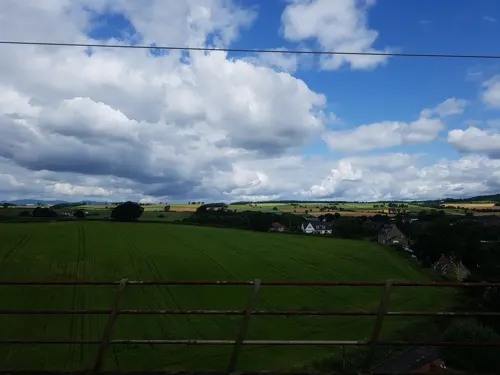
Avon Viaduct
Bridge · 1.2 mi
Railway viaduct in West Lothian, Scotland

Hippodrome Cinema, Bo'ness
Cinema and theater · 2.8 mi
Cinema in Bo'ness, Scotland

Museums and landmarks16


Museum of Scottish Railways
Museum · 2.9 mi
Railway museum in Falkirk, Scotland, United Kingdom


4 more on the map.
Parks, trails and playgrounds26

Muiravonside Country Park
Park · 2.3 mi
Park in Falkirk, Scotland, UK



14 more on the map.
Restaurants and cafes48
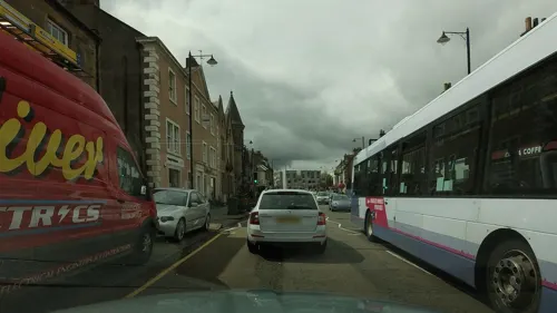
Du Vin Bouchers
Bar and pub
62 High Street, Linlithgow
Mo-Tu off; We-Th 17:00-22:00; Fr 15:00-23:00; Sa 14:00-23:00; Su...
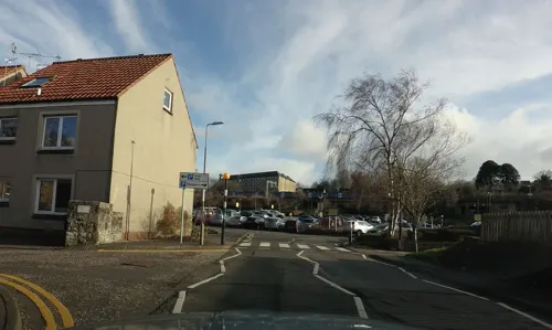
Nero (From Italy to Scotland)
Cafe · Italian · 0.4 mi
Unit 2 Blackness Road, Linlithgow
We,Th 12:00-21:30; Fr,Sa 12:00-22:00; Su 12:00-21:00; Mo,Tu 16:30-21:00
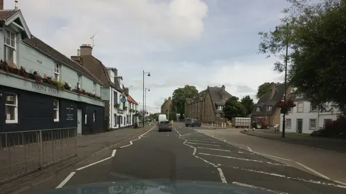
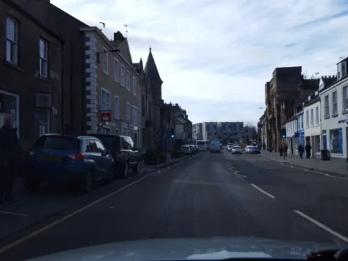
White Dove Coffee
Cafe · Coffee Shop
Blackness Road, Linlithgow
Mo-Sa 08:00-17:00; Su 09:00-17:00
Brunch & Tapas
Cafe
High Street, Linlithgow
Mo-Th 09:00-16:30; Fr-Sa 09:00-21:30; Su 09:00-20:30
36 more on the map.
History
The name Linlithgow comes from the Old Welsh lynn llaith cau meaning "lake in the moist hollow". Originally "Linlithgow" referred to the loch itself, the town being known as just "Lithgow" (hence the common surname). Folk etymology associated this name with the Gaelic liath-chù meaning "grey dog", likely the origin of the black bitch on the burgh arms. Evidence of Bronze Age and Iron Age settlements has been found around Linlithgow, in the form of Crannogs in Linlithgow Loch.
Linlithgow gained its royal status as a burgh in 1388 under a charter from Robert II of Scotland. Linlithgow developed in the Middle Ages as a royal residence for Scottish Kings on the raised hill beside the Loch, as the site was a logical stop between Edinburgh to the east and Stirling to the West. Linlithgow Palace remains the chief historic attraction of the town. The present palace was started (on an older site) in 1424 by James I of Scotland. It was attacked by Oliver Cromwell in 1650 and later burnt in 1746, and, whilst unroofed, it is still largely complete in terms of its apartments, though very few of the original furnishings survived. The palace was the birthplace of James V and Mary, Queen of Scots, and has been described as Scotland's finest surviving late medieval secular building. In the courtyard of the Palace, an elaborately carved hexagonal fountain and well survives.
Read more of the history
Besides the palace, a second attraction, standing adjacent, is the primarily 15th century construction of St. Michael's Church. Its western tower originally had a distinctive stone crown spire, of the type seen also on St Giles Cathedral in Edinburgh, and Newcastle Cathedral, but it was damaged in a storm in 1768 then removed in 1821. In 1964 a controversial replacement spire in aluminium in a modern style by Geoffrey Clarke, representing Christ's crown of thorns, was added to the tower. The church was used in the early 17th century as host for the General Assembly of the Church of Scotland and one of the national covenants was signed within. The church was extensively altered and renovated in the 19th century, with James Gillespie Graham demolishing the chancel arch and added fake-masonry plaster vaults, and then later Honeyman and Keppie rebuilding the chancel arch and added a choir vestry.
A Carmelite Friary was located in the southern part of town from the 13th century until 1559, when it was destroyed during the Scottish Reformation. The grounds of the friary are split between a public park (Rosemount Park and Friar's Well) and a private woodland (Rosemount woods) and estate, occupied by a 19th-century villa, Nether Parkley.
The first murder using a firearm in Scotland took place in the High Street of the town on 23 January 1570 when James Stewart, 1st Earl of Moray was assassinated by James Hamilton of Bothwellhaugh, a supporter of Queen Mary. As Moray was passing in a cavalcade in the main street below, Hamilton fatally wounded him with a carbine shot from a window of his uncle Archbishop Hamilton's house.
Many historic buildings line the High Street that follows the original route from the East (High and Low Ports) and West (Ports) Gates. On the south side, ground levels rise and several historic wynds and closes, as found in Edinburgh, still exist. The most prominent historical space is the Kirkgate, a processional route to the palace from the High Street. This contains the Cross Well of 1807 (redesigned by James Haldane) which is said to be replica of its 1628 predecessor.
North of the well stands the former civic home of the Burgh Council, the Town House of 1668 which was created under the direction of the master mason John Smith and now forms part of the complex known as the Burgh Halls. This replaced a previous hall or Tolbooth demolished by Oliver Cromwell's army in 1650. Much of its original interior was removed in a modernisation project of 1962. In June 1622 Katherine Rannald (alias Broun) from Kilpunt and her daughter Barbara Home (alias Winzet) were imprisoned in the Tolbooth on suspicion of witchcraft.
Linlithgow was also the site of the Battle of Linlithgow Bridge at the western edge of the town. The bridge no longer stands. The roadway to Linlithgow over the River Avon is described by scholars as a lifted road.
By 1799, Linlithgow was described as a large town with about 2300 inhabitants, whose primary industries included the tanning of leather, refining cotton cloth, the making of Tambour lace and Stockings, and shoemaking, as well as acting as a market town for the surrounding agriculture. From the 17th until the late 19th century, the two largest industries in Linlithgow were leathermaking and shoemaking.
In 1847, a pharmacist in the town, David Waldie is credited as being the first to produce a sample of chloroform for medical use, presenting it to James Young Simpson who later tested it and had it produced again on his return to Edinburgh, popularising its use as an anesthetic in medicine. In the mid 20th century, the chemists became a restaurant and is now the Four Mary's pub (a plaque records the history).
In December 1887 a new events venue was completed in a castle style with turrets and named the Victoria Hall. In 1956, the Hall was sold for use as a Ritz cinema and later was used as a theatre, before falling out of use in the 21st century and subsequently being demolished, despite a public effort to save the facade. Other prominent Victorian buildings in the town include the turreted Royal Bank (erected in 1959), the Star And Garter Hotel (converted in 1847) and the Scots revival styled St. Michael's Hotel (1886).
From the History section of Linlithgow on Wikipedia, under CC BY-SA 4.0.
More about Linlithgow
Geography
Linlithgow is located in the north-east of West Lothian, close to the border with the Falkirk Council area (historically part of Stirlingshire). It lies 20 miles (32 km) west of Edinburgh along the main railway route to Glasgow. Before the construction of the M8 and M9 motorways and the opening of the Forth Road Bridge, the town lay on the main road from Edinburgh to Stirling, Perth and Inverness, while the canal system linked the burgh to Edinburgh and Glasgow. The nearby village of Blackness once served as the burgh's port. Linlithgow is overlooked by its local hill, Cockleroi.
Economy
Linlithgow's rich history and central location make it a popular tourist destination, while many local people commute to Glasgow, Edinburgh or Stirling; this is made relatively easy by the town's railway station and its proximity to both the M8 and M9 motorways.
The town is served by four supermarkets and a retail park situated in Linlithgow Bridge. There are also a diverse range of local retailers in the High Street. In 2012, there were controversial proposals for a new retail and housing development to the east of the town which were opposed by several local groups. However, in November 2013, the planning application was rejected due to the effect it would have on the towns character.
Linlithgow is home to a major computing centre owned by Oracle and to the telecommunication company Calnex Solutions, founded in 2006 in the town and which floated on the AIM market in September 2020.
Former industries include the St. Magdalene's distillery, the Nobel explosives works, paper mills and many tanneries. The Regent Centre, now known as Nobel House, replaced the previous 1908 build Nobel Explosive Company Works Factory in 1983 and is home to a small shopping centre, with several shops and a bank.
Arts and culture
The Riding of the Marches, held in one form or another since the mid-16th century and nowadays celebrated on the first Tuesday after the second Thursday in June, involves young and old in the tradition of checking the burgh's perimeter, including the town's historic port of Blackness. Although today's activities are centred more on the colourful parades through the town that involve bands and floats decorated by local groups, the more ceremonial duties of the Marches are still performed, and a variety of local groups ensure that the traditions, old and new, are maintained.
There are many other events during the year such as the Children's Gala Day, the Linlithgow Folk Festival and a pre-Christmas Victorian Street Fayre, and since 2014, Party at the Palace which is a music festival held annually in August by the loch and has brought acts including Nile Rodgers, Kaiser Chiefs, Travis, Simple Minds, The Proclaimers, Texas and many others to play in the town. The Charlatans and Deacon Blue headlined Party at the Palace 2019. The sense of community is enhanced by many active local groups such as Linlithgow Amateur Musical Productions (LAMP), Lithca Lore, the Linlithgow Players and the 41 Club. The town also has its own weekly local newspaper, the Linlithgow Gazette.
The Linlithgow Union Canal Society runs a canal museum and operates narrowboat tours from Manse Road basin.
Education
Linlithgow has one Secondary school, Linlithgow Academy. The original Linlithgow Academy was housed in a purpose build sandstone building in East Port, designed in a Scots renaissance style with turrets by James Graham Fairley in 1900. The Academy moved to a new school complex on Braehead Road in 1968 towards the south-west of the town and the old academy buildings are now home to Low Port Primary School.
The town has five primary schools: Linlithgow Primary School, St Joseph's RC Primary School, Linlithgow Bridge Primary School, Low Port Primary School and Springfield Primary School.
Donaldson's School, Scotland's national school for the deaf, is based in the town, having relocated from Edinburgh to a new campus (the Sensational Learning Centre) in Linlithgow in 2008, designed by JM Architects. The school was built on the site of a former Signetics electronics factory that had opened in 1969 during the Silicon Glen period of development, which itself was built on an earlier Racal factory that produced defence radars and displays.
Linlithgow does not have a college in the town. The nearest colleges are West Lothian College in Livingston and Forth Valley College in Falkirk.
From the Wikipedia article Linlithgow, under CC BY-SA 4.0.
Notable people from Linlithgow
 Charles Wyville ThomsonScottish marine zoologist (1830-1882)Photo: William Abbott Herdman, Public domain
 Colin FlemingBritish tennis playerPhoto: Carine06 from UK, CC BY-SA 2.0
 Patrick HamiltonScottish clergyman and martyr; (1504–1528)Photo: John Scougal (Life time: 1730), Public domain
 Colin SteinScottish footballer (born 1947)Photo: Jack de Nijs for Anefo, CC BY-SA 3.0
 Cameron MasonBritish cyclist (born 2000)Photo: Camerooneymason, CC BY-SA 4.0
 Alexander FraserScottish landscape painter (1827-1899)Photo: Alexander Fraser RSA, Public domain
- Alex SalmondAlba Party leader and First Minister of Scotland 2007–2014 (1954–2024)
- Donald FordScottish footballer (born 1944)
- George AllanScottish footballer (1875–1899)
- John Macdonald KinneirBritish diplomat
- James GlenAmerican politician
- Iain MorrisonScottish rugby union footballer
Born in Linlithgow, according to Wikidata (CC0). Each name links to its Wikipedia article.
Where to stay5
Churches and places of worship9
St Michael's Roman Catholic Church
Church · Catholic · 0.4 mi
53 Blackness Road
Shopping14
Gas and EV charging2
Schools, colleges and libraries9
St Joseph's Primary School
School · Roman Catholic · 0.4 mi
Preston Road, Linlithgow
Healthcare3
Map of Linlithgow
141 places. The map loads OpenStreetMap tiles when you open it.
Getting there and nearby towns
Edinburgh Airport (EDI) is the nearest airport with scheduled flights listed in OpenStreetMap, 9 miles away.
- Rosyth 8 mi northeast, about 12 min by car
- Whitburn 8 mi south, about 13 min by car
- Edinburgh 16 mi east, about 25 min by car
- Stirling 16 mi northwest, about 26 min by car
- Penicuik 18 mi southeast, about 29 min by car
- Wishaw 19 mi southwest, about 30 min by car
- Mossend 19 mi southwest, about 30 min by car
- Motherwell 20 mi southwest, about 32 min by car
- Musselburgh 22 mi east, about 35 min by car
- Meikle Earnock 23 mi southwest, about 37 min by car
Drive times are estimates from straight-line distance, not routes.
Towns near Linlithgow


Keep exploring
Local news
Headlines from INDB.
Reviews, tips and questions
Loading what members have shared...
Sources and licences
- GeoNames (CC BY 4.0): population, coordinates, regions and time zone
- Mapillary (see each image): photos
- OpenStreetMap contributors (ODbL 1.0): places, airports, map data
- Wikidata (CC0 1.0): elevation, founding date, time zone, website, landmarks and historic places
- Wikimedia Commons (see each image): photos
- Wikipedia (CC BY-SA 4.0): overview and history text
Photo credits
- Am linlithgow palace and town, Unknown author, CC BY-SA 3.0
- Columba palumbus -Linlithgow, Scotland -nest-8, Gene Selkov, CC BY 2.0
- St Peter's Scottish Episcopal Church, Linlithgow 01, Auldcathy, CC BY-SA 4.0
- St Peter's Scottish Episcopal Church, Linlithgow 02, Auldcathy, CC BY-SA 4.0
- View of Linlithgow Loch from Linlithgow Palace 1, BenTanXiaoMing, CC BY-SA 4.0
- Bo'ness Hippodrome, Kim Traynor, CC BY-SA 3.0
- Museum of Scottish Railways exterior, Macfack, CC BY-SA 4.0
- Three Muiravonside teasels, Mike Smith, CC BY 2.0
- Linlithgow, High Street, St Peter's Episcopal Church - 20170923133941, Ammienoot, CC BY-SA 4.0
- Linlithgow, St Michael's Church, Ammienoot, CC BY-SA 4.0
- St Michaels Church Linlithgow, Stmichaelswebsite, Public domain
- Linlithgow Palace NW 03, Alex Sanz, CC BY 2.0
- Edinburgh Donaldson's School view from SE, AlasdairW, CC BY-SA 3.0
- Am linlithgow palace south, AlistairMcMillan, CC BY-SA 3.0
- St. Michael's Church Spire, Niall MacBride, CC BY-SA 2.5
- Avon Aqueduct alt1, Gunther Tschuch, CC BY-SA 4.0
- Cross Well Linlithgow - IMG 0015, Ammienoot, CC BY-SA 4.0
- Street-level photo, hobgoblin, CC BY-SA 4.0
- Street-level photo, hobgoblin, CC BY-SA 4.0
- Street-level photo, hobgoblin, CC BY-SA 4.0
- Street-level photo, hobgoblin, CC BY-SA 4.0
- Street-level photo, hobgoblin, CC BY-SA 4.0
- Street-level photo, hobgoblin, CC BY-SA 4.0
- Street-level photo, hobgoblin, CC BY-SA 4.0
- Street-level photo, hobgoblin, CC BY-SA 4.0
- Street-level photo, hobgoblin, CC BY-SA 4.0
- Street-level photo, hobgoblin, CC BY-SA 4.0
- Street-level photo, hobgoblin, CC BY-SA 4.0
- Street-level photo, hobgoblin, CC BY-SA 4.0
- Street-level photo, hobgoblin, CC BY-SA 4.0
- Street-level photo, ccbb7766, CC BY-SA 4.0
- Street-level photo, harris75, CC BY-SA 4.0
- Street-level photo, pbb, CC BY-SA 4.0
- Street-level photo, smsm1, CC BY-SA 4.0
- Street-level photo, hobgoblin, CC BY-SA 4.0
- Street-level photo, hobgoblin, CC BY-SA 4.0
- Street-level photo, hobgoblin, CC BY-SA 4.0
- Street-level photo, hobgoblin, CC BY-SA 4.0
- Street-level photo, hobgoblin, CC BY-SA 4.0
- Street-level photo, hobgoblin, CC BY-SA 4.0
- Street-level photo, ccbb7766, CC BY-SA 4.0
- Street-level photo, hobgoblin, CC BY-SA 4.0
- Street-level photo, hobgoblin, CC BY-SA 4.0
- Street-level photo, hobgoblin, CC BY-SA 4.0
- Street-level photo, hobgoblin, CC BY-SA 4.0
- Street-level photo, hobgoblin, CC BY-SA 4.0
- Street-level photo, hobgoblin, CC BY-SA 4.0
- Street-level photo, hobgoblin, CC BY-SA 4.0
- Street-level photo, hobgoblin, CC BY-SA 4.0
- Street-level photo, hobgoblin, CC BY-SA 4.0
- Street-level photo, hobgoblin, CC BY-SA 4.0


Page built November 10, 2026. Spotted a mistake? Tell us or suggest a place.