


Herne Bay, United Kingdom
Herne Bay is a town of 24,875 people in England, United Kingdom.
Why visit Herne Bay
Townapedia lists 11 museums and landmarks, 18 parks and trails, 96 places to eat, 7 places to stay and 4 attractions in and around town.
Highlights include King's Hall, Kavanagh Cinema, The Seaside Museum Herne Bay and Clock Tower.
Weather in Herne Bay
Forecast from MET Norway (CC BY 4.0). Full forecast
About Herne Bay
Herne Bay is a seaside town on the north coast of Kent in South East England. It is 6 miles (10 km) north of Canterbury and 4 miles (6 km) east of Whitstable. It neighbours the ancient villages of Herne and Reculver and is part of the City of Canterbury local government district, although it remains a separate town with countryside between it and Canterbury. Herne Bay's seafront is home to the world's first freestanding purpose-built Clock Tower, built in 1837.
From the Wikipedia article Herne Bay (this version), under CC BY-SA 4.0.
Things to do4



Museums and landmarks11

The Seaside Museum Herne Bay
Museum
Local history museum in Herne Bay, Kent, England, United Kingdom



Herne Bay Mini Golf
Monument and historic site · 0.5 mi
143-144 Central Parade, Herne Bay

Parks, trails and playgrounds18





6 more on the map.
Restaurants and cafes96
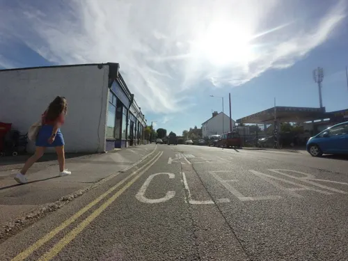
Copper Pottle
Bar and pub · 1.1 mi
84 Reculver Road, Herne Bay
Tu-Sa 12:00-14:00,18:00-21:00;Su 12:00-15:00
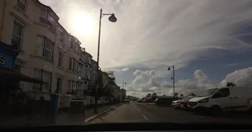
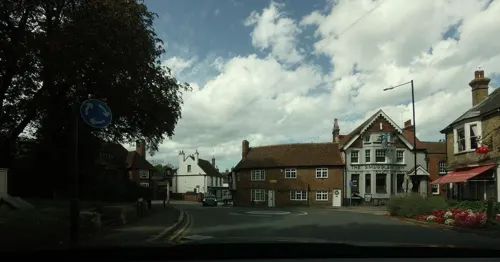
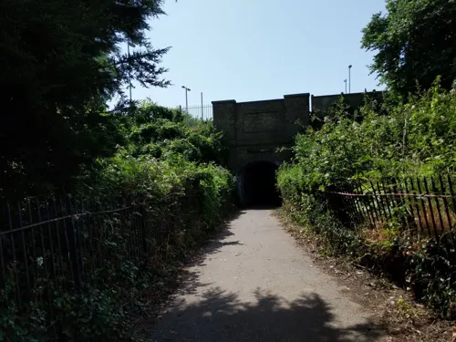


The Key
Cafe · Tea, Cake, Sandwich, Coffee Shop, Italian, Breakfast
24 William Street, Herne Bay
Mo,Tu,Th,Fr,Sa 08:30-16:00; We,Su 09:00-16:00

84 more on the map.
History
The town of Herne Bay took its name from the neighbouring village of Herne, two kilometres inland from the bay. The word herne, meaning a place on a corner of land, evolved from the Old English hyrne, meaning corner. The village was first recorded in around 1100 as Hyrnan. The corner may relate to the sharp turn in the minor Roman road between Canterbury and Reculver at Herne.
One of the oldest buildings in Herne Bay is the late 18th-century inn The Ship, which served as the focal point for the small shipping and farming community that first inhabited the town. During this time, passenger and cargo boats regularly ran between Herne Bay and London and boats carrying coal ran from Newcastle. From Herne, there was easy access by road to the city of Canterbury.
The 1801 census recorded Herne Bay, including Herne, as having a population of 1,232. During the early 19th century, a smugglers' gang operated from the town. The gang were regularly involved in a series of fights with the preventive services until finally being overpowered in the 1820s.
Read more of the history
In the 1830s, a group of London investors, who recognised Herne Bay's potential as a seaside resort, built a wooden pier and a promenade on the town's seafront. This and the subsequent building of a railway station led to the rapid expansion of the town; between 1831 and 1841 the town's population grew from 1,876 to 3,041. The London businessmen intended to rename the town St Augustine's, but the name was unpopular with residents and the name "Herne Bay" remained. An act of Parliament, the Herne Parish Improvement Act 1833 (3 & 4 Vict. c. cv), established Herne Bay and Herne as separate towns. Local landowner Sir Henry Oxenden donated a piece of ground for the site of the town's first church, Christ Church, which was opened in 1834. In 1837, Mrs Ann Thwaytes, a wealthy widow from London, donated around £4,000 to build a 75 feet (23 m) clock tower on the town's seafront. It is believed to be the first freestanding, purpose-built clock tower in the world.
During the 1840s, steamboats began running between Herne Bay and London. There was a type of beach boat unique to Herne Bay and nearby Thanet, known as the Thanet wherry, a narrow pulling boat about 18 feet (5 m) long. These boats were mainly used for fishing; however, with the advent of tourism and the decline of fishing, they became mainly used for pleasure trips. A document dated 1840 records the town as having the following schools, all of which are now defunct: Haddington (boarding school), Oxenden House, The British School, Prospect Place and Herne Street School. The village of Herne was often called Herne Street around this time. The same document also mentions the still-existing Rodney Head, The Ship and Upper Red Lion inns.
In 1912, the first "Brides in the Bath" murder by George Joseph Smith was committed in Herne Bay. BBC scriptwriter Anthony Coburn, who lived in the resort, was one of the people who conceived the idea of a police box as a time machine for Doctor Who. During World War II, a sea-fort was built off the coast of Herne Bay and Whitstable, which is still in existence. The coastal village of Reculver, to the east of Herne Bay, was the site of the testing of the bouncing bomb used by the "Dam Busters" during the war.
The original wooden pier had to be dismantled in 1871 after its owners went into liquidation and sea worms had damaged the wood. A shorter 100 metres (328 ft)-long iron pier with a theatre and shops at the entrance was built in 1873.
However, it was too short for steamboats to berth at. The pier proved to be unprofitable and in 1896 construction began on a replacement iron pier which would be longer and feature an electric tram. At 3,600 feet (1,097 m), this pier was the second longest in the country, behind only the pier at Southend-on-Sea.
The town's heyday as a seaside resort was during the late Victorian era; the population nearly doubled from 4,410 to 8,442 between 1881 and 1901. Much of the resulting late Victorian seafront architecture is still in existence today. In 1910, a pavilion was added to the landward end of the pier. By 1931, the town's population had grown to 14,533. At the beginning of World War II, the army cut two gaps between the landward end of the pier and the seaward terminal as a counter-invasion measure. The pier's two gaps were bridged for pedestrians after the war.
1963 marked the end of steamboat services from the pier. In 1970, a fire destroyed the pier's pavilion and plans were made to replace it with a sports centre, which was opened in 1976 by former Prime Minister Edward Heath. The centre section of the pier was torn down by a storm in 1978, leaving the end of the pier isolated in the sea. It has not been rebuilt due to the cost; however, residents and businesses in the town have campaigned for its restoration. The sports centre was demolished in 2012, leaving a bare platform.
From the History section of Herne Bay on Wikipedia, under CC BY-SA 4.0.
More about Herne Bay
Geography
Herne Bay is in north-east Kent, on the coast of the Thames Estuary. The town is situated 4.5 miles (7.2 km) east of Whitstable and 6.6 miles (10.6 km) north-north-east of the city of Canterbury. The village of Herne is about 1.5 miles (2.4 km) to the south and the village of Reculver is about 3 miles (4.8 km) to the east. The town's suburbs are Hampton, Greenhill and Studd Hill in the west, Eddington and Broomfield in the south, with Beltinge and Hillborough in the east. The drowned settlement of Hampton-on-Sea once existed beside what is now Hampton.
The landscape of the town has been largely influenced by the Plenty Brook, which flows northward through the centre of the town and into the North Sea. It is thought to have been a much larger stream in ancient times. The coastline has two distinct bays, separated by a jut of land created by silt from the outflow of the brook into the sea. The first buildings in the town were built along the east bay, a short distance from the brook outflow, where the road from Canterbury met the sea. The town has since spread across both bays, across the Plenty Brook valley and onto the relatively high land flanking both sides of the valley. The land to the east of the valley reaches a height of 25 metres (82 ft) above sea level and to the west reaches 10 metres (33 ft). Cliffs are formed where this high land meets the sea.
Economy
The advent of overseas travel and changes to holiday trends eventually caused the town's economy to decline after the 1960s; regular flooding of the Plenty Brook prevented redevelopment of the town centre. However, extensive seafront regeneration in the 1990s followed the creation of the Neptune's Arm sea defence jetty. The jetty has created a small harbour used by leisure boats and from where tourists can take sailing yacht trips to a seal-watching site in the Thames estuary. The Victorian gardens on the seafront were then able to be fully restored. The Central Bandstand, built in 1924, was refurbished after years of disrepair and closure to the public. A swimming pool and cinema were added to the town centre in the early 1990s. In 2005, a wind-farm with thirty 2.75 MW wind turbines was built 5 miles (8 km) off the coast of Herne Bay and Whitstable, generating a total of 82.5 MW of electricity. The recent upgrades by the Council have helped improve the image of the town and raise its profile. It is hoped this will attract new investment in tourism and business by the private sector, and lead to the regeneration of the town's economy.
Arts and culture
Herne Bay Festival happens every August with ten days of almost every event being free, including live music, performance, creative commissions, cultural treats, family fun, workshops, competitions, walks, talks, exhibitions and family entertainment.
Other summer events include Happy Days, a programme of bandstand concerts and family entertainment, Herne Bay Carnival through the town centre, a travelling funfair at the Memorial Park and Herne Bay Bus Rally. Each summer, the council runs a gardening competition, "Herne Bay in Bloom", which encourages residents and businesses to keep the town looking well presented.
Education
Herne Bay's secondary school is the modern Herne Bay High. It is a mixed ability foundation school with about 1,500 students. In 2002, Herne Bay High was designated a specialist school and Sports College. In 2005, 14% of the school's pupils gained at least five GCSEs at grades A*–C including English and maths, ranking it 107th out of Kent's 120 secondary schools. Many students commute to schools in other nearby towns, especially to the grammar schools in Faversham, Ramsgate and Canterbury.
Herne Bay Junior School, situated in the town centre, has about 500 students. It was originally established in the late Victorian era and was formerly joined with the neighbouring Herne Bay Infant school. In 2006, Herne Bay Junior School's Key Stage 2 results ranked 139th out of Kent's 386 state primary schools.
The village schools are Herne Primary School, Herne Church of England Junior School, Herne Church of England Infant and Nursery School, Briary Primary School in Greenhill, Hampton Primary School and Reculver Church of England Primary School. The Church of England schools are voluntary controlled (that is, owned by the church) but, like the other schools, are run by Kent County Council. In 2006, Reculver Church of England Primary School achieved the best Key Stage 2 performances of the schools in the Herne Bay area, ranking 133rd out of Kent's 386 state primary schools.
From the Wikipedia article Herne Bay, under CC BY-SA 4.0.
Notable people from Herne Bay
 Kevin AyersEnglish singer-songwriter, record producer (1944–2013)Photo: TimDuncan, CC BY 3.0
 Richard SinclairBritish bassistPhoto: Jaak123 at Dutch Wikipedia, CC BY-SA 3.0
 Rusty GoffeBritish actorPhoto: Rusty Goffe, CC BY-SA 3.0
 Harold Eric Gough20th-century librarian and historianPhoto: Unknown author Unknown author Anonymous., Public domain
 Tom Armstrong BowesEnglish general practitioner (1869-1954)Photo: B & W Fisk-Moore Ltd Photographers...., Public domain
 Harry Wellsrecipient of the Victoria Cross (1888–1915)Photo: John Collison, CC BY-SA 4.0
- Dave SinclairBritish musician
- Richard CoughlanEnglish musician (1947-2013)
- Paul Andersonsailor (1935–2022)
- Fabia DrakeBritish actress (1904-1990)
- Ivor McIntyreAustralian Air Force pilot
- Nicki ChapmanEnglish television presenter
Born in Herne Bay, according to Wikidata (CC0). Each name links to its Wikipedia article.
Where to stay7
Churches and places of worship19
St. Bartholomew's Church
Church · Anglican · 0.7 mi
King Edward Avenue, Herne Bay
Herne Bay United Church
Church · Methodist, United Reformed
141-145 High Street, Herne Bay
Shopping23
Gas and EV charging2
Schools, colleges and libraries9
Healthcare10
Map of Herne Bay
199 places. The map loads OpenStreetMap tiles when you open it.
Getting there and nearby towns
Manston Airport (MSE) is the nearest airport with scheduled flights listed in OpenStreetMap, 9 miles away.
- Whitstable 5 mi west, about 7 min by car
- Saint Peters 12 mi east, about 20 min by car
- Sheerness 16 mi west, about 26 min by car
- Southend-on-Sea 21 mi northwest, about 34 min by car
- Hythe 21 mi south, about 34 min by car
- Rochford 23 mi northwest, about 37 min by car
- Gillingham 25 mi west, about 40 min by car
- Maidstone 27 mi west, about 44 min by car
- Rayleigh 27 mi northwest, about 43 min by car
- Rochester 27 mi west, about 43 min by car
Drive times are estimates from straight-line distance, not routes.
Towns near Herne Bay


Keep exploring
Local news
Headlines from INDB.
Reviews, tips and questions
Loading what members have shared...
Sources and licences
- GeoNames (CC BY 4.0): population, coordinates, regions and time zone
- Mapillary (see each image): photos
- OpenStreetMap contributors (ODbL 1.0): places, airports, map data
- Wikidata (CC0 1.0): elevation, founding date, time zone, website, landmarks and historic places
- Wikimedia Commons (see each image): photos
- Wikipedia (CC BY-SA 4.0): overview and history text
Photo credits
- Herne Bay in Kent - aerial image (33123717208), John Fielding from Norwich, UK, CC BY 2.0
- Herne Bay - Sept 2010 - Nice Paint Job, Boys, Gareth Williams, CC BY 2.0
- Curtis Wood 7, Dudley Miles, CC BY-SA 4.0
- Herne Bay Museum 002, Linda Spashett Storye_book, CC BY 3.0
- Herne Bay (35040491065), Alex Liivet from Chester, United Kingdom, CC0
- Kings Hall 017, Linda Spashett Storye book, CC BY-SA 2.5
- Canterbury - 17, William Street - 20220105105612, DaveWalsh1562, CC BY-SA 4.0
- A Long Way from the Arctic - Flickr - Charlie From Bristol, Charlie Marshall from Bristol UK, United Kingdom, CC BY 2.0
- Herne bay pier oct 2026, Scribwik, CC0
- Street-level photo, tallguy, CC BY-SA 4.0
- Street-level photo, tallguy, CC BY-SA 4.0
- Street-level photo, tallguy, CC BY-SA 4.0
- Street-level photo, jkingsleya, CC BY-SA 4.0
- Street-level photo, tallguy, CC BY-SA 4.0
- Street-level photo, tallguy, CC BY-SA 4.0
- Street-level photo, tallguy, CC BY-SA 4.0
- Street-level photo, tallguy, CC BY-SA 4.0
- Street-level photo, tallguy, CC BY-SA 4.0
- Street-level photo, tallguy, CC BY-SA 4.0
- Street-level photo, gregorywilliams, CC BY-SA 4.0
- Street-level photo, tallguy, CC BY-SA 4.0
- Street-level photo, tallguy, CC BY-SA 4.0
- Street-level photo, tallguy, CC BY-SA 4.0
- Street-level photo, tallguy, CC BY-SA 4.0
- Street-level photo, tallguy, CC BY-SA 4.0
- Street-level photo, tallguy, CC BY-SA 4.0
- Street-level photo, jjhaslanded, CC BY-SA 4.0
- Street-level photo, paulbiv, CC BY-SA 4.0
- Street-level photo, tallguy, CC BY-SA 4.0
- Street-level photo, tallguy, CC BY-SA 4.0
- Street-level photo, tallguy, CC BY-SA 4.0
Page built November 10, 2026. Spotted a mistake? Tell us or suggest a place.