
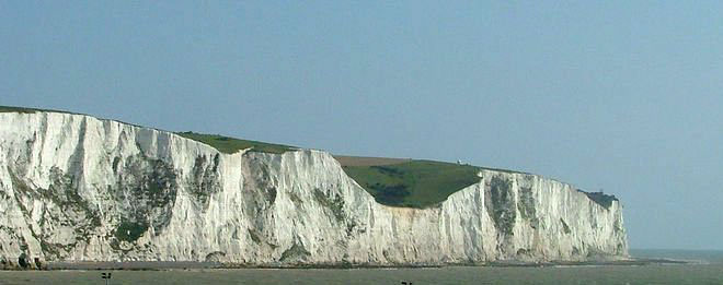


Why visit Dover
Townapedia lists 52 museums and landmarks, 19 parks and trails, 92 places to eat, 20 places to stay and 9 attractions in and around town.
Highlights include Dubris Pharos, South Foreland Lower Lighthouse, Dover Castle and Knights Templar Church.
Weather in Dover
Forecast from MET Norway (CC BY 4.0). Full forecast
About Dover
Dover is a town, major ferry port and civil parish in Kent, England. It faces France across the Strait of Dover, the narrowest part of the English Channel at 33 kilometres (21 mi) from Cap Gris-Nez in France. It lies southeast of Canterbury and east of Maidstone. The town is the administrative centre of the Dover District and home of the Port of Dover.
From the Wikipedia article Dover (this version), under CC BY-SA 4.0.
Travel tips from other travellers: Dover on Wikivoyage (CC BY-SA 4.0).
Photos of Dover


Things to do9


South Foreland Lower Lighthouse
Lighthouse · 2.9 mi
Lighthouse in St. Margaret's At Cliffe, Dover, Kent, England, UK




Museums and landmarks52


Dover Museum and Bronze Age Boat Gallery
Museum
Local history museum in Dover, England, United Kingdom

Dubris
Monument and historic site · 0.5 mi
Ancient port in Roman Britain, in Dover, Kent

HMS Codrington
Monument and historic site · 0.9 mi
1929 A-class destroyer

HMS Glatton
Monument and historic site · 0.6 mi
1914 Gorgon-class monitor

Buckland Anglo-Saxon cemetery
Monument and historic site · 1.1 mi
Archaeological site in the United Kingdom
Dover Marine War Memorial
Monument and historic site · 0.9 mi
Statue in Dover, England
Langdon Bay Wreck
Monument and historic site · 1.4 mi
Shipwreck east of Dover, Kent, England, UK

40 more on the map.
Parks, trails and playgrounds19



Dover Western Heights
Park · 0.7 mi
Fortification complex in Kent, UK


7 more on the map.
Restaurants and cafes92
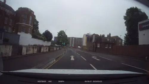
The White Horse
Bar and pub · Regional, Burger, Curry, Pie
Dover's oldest pub
St James Street, Dover
Mo-Th 12:00-22:00; Fr-Sa 12:00-23:00; Su 12:00-21:00,12:00-22:00
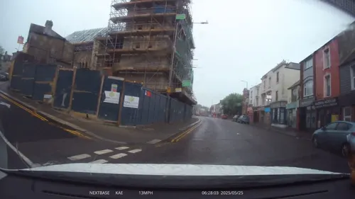

Calcutta Port
Restaurant · Indian, Asian
24 High Street, Dover
Sa-We 12:00-14:00, 17:00-23:00


Brunch... café
Restaurant · Breakfast
22 Biggin Street, Dover
Mo-Fr 08:00-16:30; Sa 08:00-17:00; Su 10:00-15:00

Vinoteq
Bar and pub
1 Cannon Street, Dover
Mo-Tu closed; We 18:00+ "event nights only"; Th 18:00-22:00; Fr...
Buffers Sandwich shop
Cafe · Local
13A Priory Gate Road, Dover
Mo-Fr 06:00-14:30; Sa 07:00-14:00
80 more on the map.
History
Archaeological finds have shown that there were Stone Age people in the area, and that some Iron Age finds also exist. During the Roman period, the area became part of the Roman communications network. It was connected by road to Canterbury and Watling Street and it became Portus Dubris, a fortified port. Dover has a partly preserved Roman lighthouse (the tallest surviving Roman structure in Britain) and the remains of a villa with preserved Roman wall paintings. Dover later figured in the Domesday Book (1086).
Forts were built above the port and lighthouses were constructed to guide passing ships. It is one of the Cinque Ports. and has served as a bastion against various attackers: notably the French during the Napoleonic Wars and Germany during the Second World War.
During the Cold War, a regional seat of government was located within the White Cliffs beneath Dover Castle. This is omitted from the strategic objects appearing on the Soviet 1:10,000 city plan of Dover that was produced in 1974. The port would have served as an embarkation point for sending reinforcements to the British Army of the Rhine in the event of a Soviet ground invasion of Europe.
Read more of the history
In 1974, a discovery was made at Langdon Bay off the coast near Dover. It contained bronze axes of French design and is probably the remainder of the cargo of a sunken ship. At the same time, this find also shows that trade routes across the Channel between England and France existed already in the Bronze Age, or even earlier. In 1992, the so-called Dover boat from the Bronze Age was discovered in six metres depth underwater. This is one of the oldest finds of a seaworthy boat. Using the radiocarbon method of investigation, the boat's construction was dated to approximately 1550 BC.
First recorded in its Latinised form of Portus Dubris, the name derives from the Brythonic word for water (dwfr in Middle Welsh, dŵr in Modern Welsh apart from 'dwfrliw' (Watercolour) which has retained the old Welsh spelling, dour in Breton). The same element is present in the town's French name Douvres and the name of the river, Dour, which is also evident in other English towns such as Wendover. However, the modern Modern Welsh name Dofr is an adaptation of the English name Dover.
The current name was in use at least by the time of Shakespeare's King Lear (between 1603 and 1606), in which the town and its cliffs play a prominent role.
Louis VIII of France landed his army, seeking to depose King Henry III, on Dover's mainland beach. Henry III ambushed Louis' army with approximately 400 bowmen atop The White Cliffs of Dover and his cavalry attacking the invaders on the beach. However, the French slaughtered the English cavalry and made their way up the cliffs to disperse the bowmen. Louis' army seized Dover village, forcing the English back to Canterbury. French control of Dover lasted for three months after which English troops pushed back, forcing the French to surrender and return home.
From the History section of Dover on Wikipedia, under CC BY-SA 4.0.
More about Dover
Geography
Dover is in the south-east corner of Britain. From South Foreland, the nearest point to the European mainland, Cap Gris Nez is 34 kilometres (21 mi) away across the Strait of Dover.
The site of its original settlement lies in the valley of the River Dour, sheltering from the prevailing south-westerly winds. This has led to the silting up of the river mouth by the action of longshore drift. The town has been forced into making artificial breakwaters to keep the port in being. These breakwaters have been extended and adapted so that the port lies almost entirely on reclaimed land.
The higher land on either side of the valley – the Western Heights and the eastern high point on which Dover Castle stands – has been adapted to perform the function of protection against invaders. The town has gradually extended up the river valley, encompassing several villages in doing so. Little growth is possible along the coast, since the cliffs are on the sea's edge. The railway, being tunnelled and embanked, skirts the foot of the cliffs.
Economy
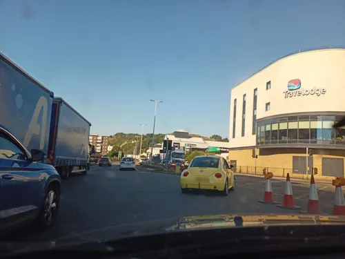
The town's main shopping streets are the High Street, Biggin Street, Market Square, Cannon Street, Pencester Road and Castle Street. The Castleton Retail Park is to the north-west of the town centre. The new St James' Retail and Leisure Park opened in 2018 and is a southern extension of the town centre; it consists of shops, restaurants, a Travelodge Hotel and a Cineworld Cinema.
The Dover Harbour Board is the responsible authority for the running of the Port of Dover. The English Channel, here at its narrowest point in the Straits of Dover, is the busiest shipping lane in the world. Ferries crossing between here and the Continent have to negotiate their way through the constant stream of shipping crossing their path. The Dover Strait Traffic Separation Scheme allots ships separate lanes when passing through the Strait. The Scheme is controlled by the Channel Navigation Information Service based at Maritime Rescue Co-ordination Centre Dover. MRCC Dover is also charged with co-ordination of civil maritime search and rescue within these waters.
The Port of Dover is also used by cruise ships. The old Dover Marine railway station building houses one passenger terminal, together with a car park. A second, purpose-built, terminal is located further out along the pier.
The ferry lines using the port are (number of daily sailings in parentheses):
Arts and culture
There are three museums: the main Dover Museum, the Dover Transport Museum and the Roman Painted House. The town has two cinemas, the Silver Screen Cinema located at the Dover Museum and the Cineworld Cinema opened in 2018 as part of the St James' Retail and Leisure complex. A former cinema King's Hall, dating from 1911 and now a bingo club, is in Biggin Street.
The Discovery Centre located off the Market Square houses Dover's library, Dover Museum, Silver Screen Cinema, the Roundhouse Community Theatre as well as adult education facilities. The Charlton Shopping Centre off the High Street has retail units, the Dover Local community hub, leisure facilities and the studios of Dover Community Radio.
The White Cliffs Theatre opened in 2001 is based at Astor College. There is also a community theatre based at St Edmund's Catholic School
Education
Dover College is a mixed public school founded in 1871 by a group of local business men.
There are two single-sex grammar schools and a mixed military school in Dover.
Both grammar schools require the Dover Test or the Kent Test for admission to Year 7.
Duke of York's Royal Military School is a selective secondary school with academy status and England's only military boarding school for children of service personnel (co-education ages 11–18), located next to the former site of Connaught Barracks.
There are 3 ex-secondary modern mixed schools in Dover, all with academy status.
Astor Secondary School federated with St Radigunds Primary School (then renamed White Cliffs Primary College for the Arts) to form the Dover Federation for the Arts (DFA). Subsequently, Barton Junior School and Shatterlocks Nursery and Infant School joined the DFA. In 2014, the DFA was warned by the Department for Education about "unacceptably low standards of performance of pupils ".
St Edmund's Catholic School federated with St Richards Catholic Primary School to form the Dover Federation of Catholic Schools.
Dover Christ Church Academy is located in Whitfield, 4 miles north of Dover.
Dover Technical College is part of the East Kent College (EKC) group.
In addition, 16 primary schools and two special schools add to the educational offering.
From the Wikipedia article Dover, under CC BY-SA 4.0.
Notable people from Dover
 Joss StoneEnglish singer, songwriter, and actress (born 1987)Photo: Ice Boy Tell, CC BY-SA 4.0
 Albert Frederick MummeryEnglish mountaineer and author (1855–1895)Photo: Martin Jacolette phot., Public domain
 Julian BagginiBritish philosopher, author and journalist (born 1968)Photo: Vera de Kok, CC BY-SA 4.0
 Donald Lynden-BellEnglish astrophysicist (1935–2018)Photo: Institute of Astronomy, University..., CC BY-SA 4.0
 Edward Pellew, 1st Viscount ExmouthRoyal Navy admiral (1757-1833)Photo: James Northcote, Public domain
 Philip Yorke, 1st Earl of HardwickeEnglish lawyer and politician who served as Lord Chancellor (1690-1764)Photo: William Hoare, Public domain
 John RedwoodBritish politician (born 1951)Photo: Richard Townshend, CC BY 3.0
 Bob BolderEnglish footballer (born 1958)Photo: Timmy96, CC0
- M. R. James20th century British author, medievalist scholar and provost (1862–1936)
- Wally HammondEnglish cricket player (1903-1965)
- Cuthbert OttawayEnglish sportsman (1850–1878)
- Shane TaylorBritish actor
Born in Dover, according to Wikidata (CC0). Each name links to its Wikipedia article.
Where to stay20
Dover Marina Hotel & Spa, Tapestry Collection by Hilton
Motel and hotel
Waterfront, Waterloo Crescent, Dover
Churches and places of worship18
Shopping16
Gas and EV charging3
Schools, colleges and libraries21
Healthcare4
Map of Dover
250 places. The map loads OpenStreetMap tiles when you open it.
Getting there and nearby towns
Manston Airport (MSE) is the nearest airport with scheduled flights listed in OpenStreetMap, 16 miles away.
- Folkestone 7 mi southwest, about 11 min by car
- Hythe 11 mi west, about 17 min by car
- Ramsgate 15 mi north, about 24 min by car
- Saint Peters 17 mi north, about 28 min by car
- Broadstairs 17 mi north, about 27 min by car
- Margate 18 mi north, about 29 min by car
- Herne Bay 19 mi northwest, about 30 min by car
- Whitstable 20 mi northwest, about 33 min by car
- Faversham 23 mi northwest, about 36 min by car
- Sittingbourne 29 mi northwest, about 47 min by car
Drive times are estimates from straight-line distance, not routes.
Towns near Dover


Keep exploring
Local news
Headlines from INDB.
Reviews, tips and questions
Loading what members have shared...
Sources and licences
- GeoNames (CC BY 4.0): population, coordinates, regions and time zone
- Mapillary (see each image): photos
- OpenStreetMap contributors (ODbL 1.0): places, airports, map data
- Wikidata (CC0 1.0): elevation, founding date, time zone, website, landmarks and historic places
- Wikimedia Commons (see each image): photos
- Wikipedia (CC BY-SA 4.0): overview and history text
Photo credits
- White cliffs of dover 09 2004, https://www.flickr.com/people/fanny/, CC BY-SA 2.0
- The Eight Bells, Dover, UK, Gerd Fahrenhorst, CC BY 4.0
- Tower of the Church of St Mary the Virgin, Dover - May 2026, Mertbiol, CC0
- Saint Marys Church in Dover, England, UK (8392403324), Swedish National Heritage Board from Sweden, Public domain
- FC position and Old Lighthouse, St Margaret's, Nilfanion, CC BY-SA 4.0
- View South from Dover Castle keep, Nilfanion, CC BY-SA 4.0
- HMS Codrington, Royal Navy official photographer, Public domain
- HMS Glatton, Surgeon Oscar Parkes, Public domain
- High Meadow 12, Dudley Miles, CC BY-SA 4.0
- Nemo Down 2, Dudley Miles, CC BY-SA 4.0
- Old Park Hill 8, Dudley Miles, CC BY-SA 4.0
- Dover St Edmunds Chapel, Colinward1970, Public domain
- DoverCastle-lighthouse-2004-10-03, Chris McKenna ( Thryduulf ( talk )), CC BY-SA 4.0
- Dover Museum, Dover, Nessy-Pic, CC BY-SA 4.0
- DoverTemplarChurch CMOKT, Gabirro, Public domain
- St Mary in Castro, Dover, Michael Coppins, CC BY-SA 4.0
- Dover St. Mary the virgin, -- Rensi 20:14, 14. Okt. 2009 (CEST), Public domain
- Crabble09, ChrisTheDude at English Wikipedia, CC BY 3.0
- School Hall, Dover College, N Chadwick, CC BY-SA 2.0
- Lighthouse in Dover, Eluveitie, CC BY-SA 3.0
- Dover-lighthouse-20040910-006, Gary Houston, CC0
- Dover Breakwater Knuckle light-4042, Raimond Spekking, CC BY-SA 4.0
- 1 dover castle aerial panorama 2017, Chensiyuan, CC BY-SA 4.0
- DoverMuseum, Neddyseagoon at English Wikipedia, Public domain
- Ste Mary Virgin Church, beggin street - panoramio, Jean Marc Gfp, CC BY 3.0
- Street-level photo, lamaar639, CC BY-SA 4.0
- Street-level photo, xdTAGCLAN, CC BY-SA 4.0
- Street-level photo, xdTAGCLAN, CC BY-SA 4.0
- Street-level photo, lamaar639, CC BY-SA 4.0
- Street-level photo, essexboy, CC BY-SA 4.0
- Street-level photo, lamaar639, CC BY-SA 4.0
- Street-level photo, lamaar639, CC BY-SA 4.0
- Street-level photo, lamaar639, CC BY-SA 4.0
- Street-level photo, xdTAGCLAN, CC BY-SA 4.0
- Street-level photo, petermead, CC BY-SA 4.0
- Street-level photo, rocketshot, CC BY-SA 4.0
- Street-level photo, lamaar639, CC BY-SA 4.0


Page built November 10, 2026. Spotted a mistake? Tell us or suggest a place.