


Faversham, United Kingdom
Faversham is a town of 23,024 people in England, United Kingdom.
Why visit Faversham
Townapedia lists 11 museums and landmarks, 11 parks and trails, 70 places to eat, 3 places to stay and 6 attractions in and around town.
Highlights include Macknade Food Hall, National Fruit Collection, Maison Dieu and Faversham Stone Chapel.
Weather in Faversham
Forecast from MET Norway (CC BY 4.0). Full forecast
About Faversham
Faversham is a market town in Kent, England. It is located 8 miles (13 km) from Sittingbourne, 48 miles (77 km) from London and 10 miles (16 km) from Canterbury; it lies next to the Swale, a strip of sea separating mainland Kent from the Isle of Sheppey in the Thames Estuary. The town is close to the A2, used by the Romans and the Anglo-Saxons, which follows an ancient British trackway now known as Watling Street.
From the Wikipedia article Faversham (this version), under CC BY-SA 4.0.
Travel tips from other travellers: Faversham on Wikivoyage (CC BY-SA 4.0).
Photos of Faversham


Things to do6

Macknade Food Hall
Farm and orchard · 0.9 mi
Selling Road, Faversham
Mo-We,Sa 09:00-18:00; Th,Fr 09:00-20:00; Su 10:00-16:00


Museums and landmarks11
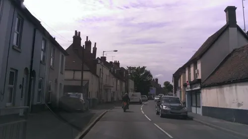


Memorials to the victims of the 1916 Faversham Munitions Explosion
Monument and historic site · 0.7 mi
Memorial in Faversham, Swale, Kent, England, UK

Parks, trails and playgrounds11
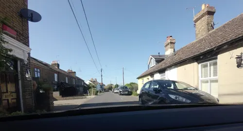

Mount Ephraim Gardens
Park · 3.2 mi
Historic house and gardens, near Faversham, in Hernhill, Swale, Kent, England, UK


Restaurants and cafes70
The Castle
Bar and pub · 1.1 mi
2 The Street
Mo off; Tu 12:00-19:00; We-Sa 12:00-22:00; Su 12:00-18:00



The Refinery
Cafe · Coffee Shop
West Street, Faversham
Su-Tu 09:00-16:00; We off; Th 09:00-16:00; Fr 09:00-17:00; Sa 09:00-21:00
58 more on the map.
History
Faversham was established as a settlement before the Roman conquest of Britain. The Romans established several towns in Kent including Faversham, with traffic through the Saxon Shore ports of Reculver, Richborough, Dover and Lympne converging on Canterbury before heading up Watling Street to London. The town was less than 10 miles (16 km) from Canterbury, and consequently Faversham had become established on this road network by 50 AD following the initial conquest by Claudius in 43 AD. Numerous remains of Roman buildings have been discovered in and around Faversham, including under St Mary of Charity Church where coins and urns were discovered during reconstruction of the western tower in 1794. In 2013, the remains of a 2,000-year-old Roman theatre, able to accommodate some 12,000 people, were discovered at a hillside near the town. The cockpit-style outdoor auditorium, the first of its kind found in Britain, was a style the Romans used elsewhere in their empire on the Continent.
Read more of the history
There is archaeological evidence to suggest that Faversham was a summer capital for the kings of Kent. The King's Field Treasure indicates that a significant burial site was located in the south-west of the town during the late sixth and early seventh centuries. The cemetery was located roughly between Stone Street to the north, London Road to the south, the Mall to the east and St Ann's Road and Upper St Ann's Road to the west. The site was uncovered during the construction of the Chatham–Dover railway line in 1858. Artefacts from King's Field are now dispersed among several collections, notably the British Museum in London, the Metropolitan Museum of Art in New York and the Ashmolean Museum in Oxford alongside other British collections. Excavations beneath the Market Inn in 2018–19 unearthed a probable sunken-featured building (SFB), which provides evidence for contemporaneous settlement to the east of the King's Field burial site. This is the first secure archaeological evidence of early medieval settlement in Faversham.
The presence of Frankish pottery at the Market Inn settlement, together with Frankish-style grave goods at King's Field, suggests close connections between early medieval Faversham and the broader Merovingian world. The marriage of Æthelberht of Kent to the Frankish princess Bertha of Kent (great-granddaughter of Clovis I) provides a broader historical context for the close ties between the early medieval Kingdom of Kent and Francia, though the exact nature of this relationship is debated. Faversham was held in royal demesne in 811, and is further cited in a charter granted by Coenwulf, the King of Mercia. Coenwulf described the town as 'the King's little town of Fefresham', while it was recorded in the Domesday Book as Favreshant. The town had established itself as a seaport by the Middle Ages, and became part of the Confederation of the Cinque Ports in the 13th century, providing a vessel to Dover. The Gough Map of Britain, printed in 1360, shows the Swale as an important shipping channel for trade.
The manor was recorded as Terra Regis, meaning it was part of the ancient royal estates. King Stephen gave it to his chief lieutenant, William of Ypres, but soon made him swap it with Lillechurch (now Higham) so that the manor of Faversham could form part of the endowment of Faversham Abbey. Stephen established the abbey in 1148, and is buried there with his consort Matilda of Boulogne, and his son, Eustace, the Count of Boulogne. Stephen favoured the town because of the abbey, and so it was historically important during his reign. King John tried to give the church to Simon of Wells in 1201, but it was owned by the monks of St Augustine's Abbey at Canterbury, who appealed to Rome and the request was denied. Abbey Street was constructed about this time in order to provide an appropriate approach to the abbey from the town. It still houses timber-framed buildings and has been described as "the finest medieval street in south-east England".
Thomas Culpeper was granted Faversham Abbey by Henry VIII during the Dissolution of the Monasteries in 1538. Most of the abbey was demolished, and the remains of Stephen were rumoured to have been thrown into Faversham Creek. An excavation of the abbey in 1964 uncovered the empty graves. The entrance gates survived the demolition and lasted until the mid-18th century, but otherwise only a small section of outer wall survived. The abbey's masonry was taken to Calais to reinforce defence of the town, then in British possession, against the French army. In 1539, the ground upon which the abbey had stood, along with nearby land, passed to Sir Thomas Cheney, Lord Warden of the Cinque Ports.
Among the few surviving buildings of Faversham Abbey are the two barns at Abbey Farm. Minor Barn was built about 1425; Major Barn, the larger of the two, dates from 1476. Next to the barns is the Abbey Farmhouse, part of which dates from the 14th century. The Abbey Guest house, on the east side of the Abbey's Outer Gateway, has survived as Arden's House. This house, now a private residence in Abbey Street, was the location of the murder of Thomas Arden in 1551. The Faversham Almshouses were founded and endowed by Thomas Manfield in 1614, with additional houses built by Henry Wright in 1823.
The poor quality of roads in the Middle Ages meant travel by sea was an important transport corridor. Richard Tylman (or Tillman), mayor in 1581, expanded the port at Faversham, building two wharfs. He became a key figure in exporting corn, wheat and malt to London from the town.
From the History section of Faversham on Wikipedia, under CC BY-SA 4.0.
More about Faversham
Geography
The town lies roughly equidistant between Sittingbourne and Canterbury. It lies 48 miles (77 km) south-east of London, 18 miles (29 km) east of Maidstone and 14 miles (23 km) north from Ashford. Nearby villages include Oare across Oare Creek to the north, Luddenham, Mockbeggar and Ospringe.
Arts and culture
Arden of Feversham is a play about the murder of Thomas Arden written around 1590, possibly by William Shakespeare or Canterbury-born Christopher Marlowe. It gives its name to the modern Arden Theatre in the town, Local theatre groups perform in the theatre as part of the Canterbury Festival each autumn.
The Royal Cinema is based near the town square. It opened in 1936 and is now Grade II listed. It is one of only two mock Tudor cinemas to survive in the UK.
The Faversham Society was established in 1962, and is one of the oldest civic societies in the UK. It owns and manages the Fleur de Lis Heritage Centre as its headquarters. The Centre hosts a large museum depicting the town's history and culture and hosts the town's Visitor Information Centre, including a bookshop.
The Maison Dieu ('House of God'), located on the A2 to the south-west of the town centre, is a hospital, monastery, hostel, retirement home and Royal lodge commissioned by Henry III in 1234 and now in the care of English Heritage. It is now managed by the Maison Dieu Trust and closely associated to the Faversham Society as a museum of Roman artefacts from the surrounding area.
Davington Priory lies to the north-west of the town centre and was founded in the mid 12th century. It is currently owned and occupied by musician and activist Bob Geldof.
Education
There has been a school in Faversham since the twelfth century; archival evidence has shown this had become a grammar school by 1420. In 1526, John Cole, chaplain to Henry VII and Henry VIII and Warden of All Souls College, Oxford, established a new grammar school on the estate of Ewell Farm. The property fell into disuse after the dissolution of the abbey, and a replacement grammar school was not established until 1587. The Wreights School, a commercial school, was founded in 1856, while a corresponding girls' school, the Gibbs School was established in 1883. The two boys' schools were amalgamated in 1920, forming Queen Elizabeth's Grammar School. The current school dates from 1967, when the boys and girls schools were merged, forming the first co-educational grammar school in Kent.
The Abbey School is a Business and Enterprise Academy formed in September 1983 by the amalgamation of the Ethelbert Road Boys School and Lady Capel School for Girls. It has over 1,000 pupils and is located in the south of the town, beside the A2 London Road.
From the Wikipedia article Faversham, under CC BY-SA 4.0.
Notable people from Faversham
 Augustus Volney WallerBritish neurophysicist (1816–1870)Photo: Unknown author Unknown author, Public domain
 Edward RiouRoyal Navy officerPhoto: Samuel Shelley, Public domain
 John WilsonEnglish composer, lutenist and teacherPhoto: Gerald England, CC BY-SA 2.0
 Thomas CharnockEnglish alchemist and occultistPhoto: Cornelis Pietersz Bega, Public domain
 Thomas Alfred WiseAmerican actor (1865-1928)Photo: Unknown author Unknown author, Public domain
 Herbert MarshBritish bishopPhoto: John Ponsford, Public domain
- George FinlayScottish historian (1799-1875)
- Jack WardEnglish pirate
- Philip NeameVictoria Cross recipient (1888–1978)
- Albert E. SmithAmerican stage magician, film director and producer (1875-1958)
- David SmithBritish film director (1872–1930)
- Adam HollowayBritish soldier, journalist and Conservative Party politician (born 1965)
Born in Faversham, according to Wikidata (CC0). Each name links to its Wikipedia article.
Where to stay3
Churches and places of worship15
Our Lady of Mount Carmel and The Shrine of St. Jude
Church · Roman Catholic
Shopping11
Gas and EV charging2
Schools, colleges and libraries9
Healthcare8
Map of Faversham
146 places. The map loads OpenStreetMap tiles when you open it.
Getting there and nearby towns
Rochester Airport (RCS) is the nearest airport with scheduled flights listed in OpenStreetMap, 17 miles away.
- Whitstable 7 mi northeast, about 11 min by car
- Sheerness 10 mi northwest, about 16 min by car
- Herne Bay 11 mi east, about 18 min by car
- Gillingham 16 mi west, about 25 min by car
- Maidstone 16 mi west, about 26 min by car
- Southend-on-Sea 17 mi northwest, about 28 min by car
- Rochester 17 mi west, about 28 min by car
- Hythe 19 mi southeast, about 30 min by car
- Snodland 19 mi west, about 31 min by car
- Rochford 20 mi northwest, about 32 min by car
Drive times are estimates from straight-line distance, not routes.
Towns near Faversham


Keep exploring
Local news
Headlines from INDB.
Reviews, tips and questions
Loading what members have shared...
Sources and licences
- GeoNames (CC BY 4.0): population, coordinates, regions and time zone
- Mapillary (see each image): photos
- OpenStreetMap contributors (ODbL 1.0): places, airports, map data
- Wikidata (CC0 1.0): elevation, founding date, time zone, website, landmarks and historic places
- Wikimedia Commons (see each image): photos
- Wikipedia (CC BY-SA 4.0): overview and history text
Photo credits
- Faversham Market (6110526770), Ed Webster, CC BY 2.0
- From Faversham, Kent (5975113667), Randi Hausken from Bærum, Norway, CC BY-SA 2.0
- Ospringe church, OhNoPeedyPeebles at English Wikipedia, Public domain
- Faversham library (6136403101), JuliaC2006 from Rochester, UK, CC BY 2.0
- 1995 Ford Escort RS Mk.5, hugh llewelyn, CC BY-SA 4.0
- 1980 Ford Escort RS2000 Mk.2, hugh llewelyn, CC BY-SA 4.0
- 1967 Ford Mustang Shelby GT350, hugh llewelyn, CC BY-SA 4.0
- 1987 Ford Sierra Cosworth, hugh llewelyn, CC BY-SA 4.0
- 1967 Ford Mustang Shelby GT350 - 55332512813, hugh llewelyn, CC BY-SA 4.0
- Oare Gunpowder Works, Dr Astrid Stilma, CC BY-SA 4.0
- Street-level photo, paulbiv, CC BY-SA 4.0
- Street-level photo, paulbiv, CC BY-SA 4.0
- Street-level photo, paulbiv, CC BY-SA 4.0
- Street-level photo, paulbiv, CC BY-SA 4.0
- Street-level photo, paulbiv, CC BY-SA 4.0
- Street-level photo, paulbiv, CC BY-SA 4.0
- Street-level photo, paulbiv, CC BY-SA 4.0
- Street-level photo, paulbiv, CC BY-SA 4.0
- Street-level photo, petermead, CC BY-SA 4.0
- Street-level photo, tallguy, CC BY-SA 4.0
Page built November 10, 2026. Spotted a mistake? Tell us or suggest a place.