


Why visit Llanrwst
Townapedia lists 5 museums and landmarks, 1 park or trail, 20 places to eat, 9 places to stay and 10 attractions in and around town.
Highlights include Fairy Falls, Pont Fawr, Gwydir Castle and Trefriw Woollen Mill.
Weather in Llanrwst
Forecast from MET Norway (CC BY 4.0). Full forecast
About Llanrwst
Llanrwst (Welsh for 'church or parish of Saint Grwst'; Welsh pronunciation: [ɬanˈruːst]) is a market town and community in Conwy County Borough, Wales. It is on the east bank of the River Conwy and the A470 road, and lies within the historic county boundaries of Denbighshire. It developed around the wool trade and became known also for the making of harps and clocks. Today, less than one mile (two kilometres) from the edge of Snowdonia, its main industry is tourism.
From the Wikipedia article Llanrwst (this version), under CC BY-SA 4.0.
Travel tips from other travellers: Llanrwst on Wikivoyage (CC BY-SA 4.0).
Photos of Llanrwst


Things to do10

Fairy Falls
Waterfall · 1.6 mi
Waterfall in Trefriw, Conwy County Borough, Wales, UK


Swallow Falls
Waterfall · 3.4 mi
Waterfall in Conwy County Borough, Wales, UK

Grey Mare's Tail
Waterfall · 0.8 mi
Waterfall in Snowdonia National Park, Wales

Museums and landmarks5

Gwydir Castle
Museum · 0.6 mi
Grade I listed building in Conwy County Borough


Parks, trails and playgrounds1

Restaurants and cafes20

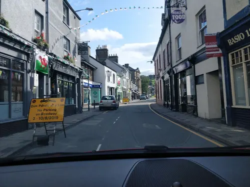
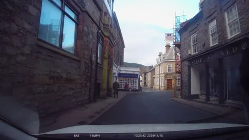
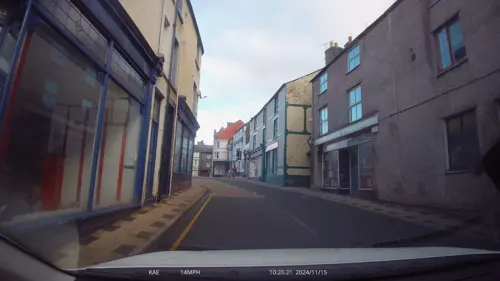

Ty Asha Balti House
Restaurant · Indian
4-6 Heol Ddinbych, Llanrwst
Mo-Th 17:00-22:30; Fr-Su 17:00-23:00
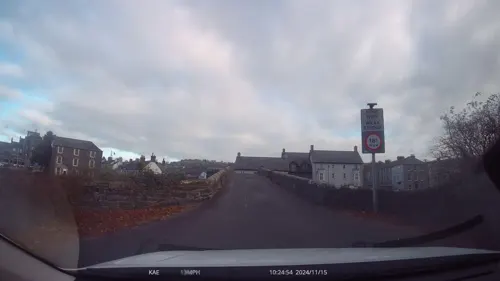


Caffi Doti
Cafe · Coffee Shop · 1.4 mi
Glanrafon Stores, Trefriw
Mo-Tu 09:00-16:00; Fr-Sa 09:00-16:00; Su 10:00-16:00


8 more on the map.
History
Llanrwst takes its name from Saint Grwst, a 6th-century saint. The first church dedicated to him at Llanrwst was on a site now occupied by Seion Methodist Chapel, between Station Road and Cae Llan. A second church of St Grwst was built on a new site a short distance south of its predecessor, on the banks of the Conwy. The site was donated for the purpose in about 1170 by Rhun ap Nefydd Hardd, a member of the royal family of Gwynedd. The second church was replaced by the current building on the same site in the late 15th century.
Llanrwst developed around the wool trade, and for a long time the price of wool for the whole of Britain was set here. The growth of the village in the 13th century was considerably aided by an edict by Edward I of England (who built Conwy Castle) prohibiting any Welshman from trading within 10 miles (16 km) of the town of Conwy. Llanrwst, located some 13 miles (21 km) from that town, was strategically placed to benefit from this.
Read more of the history
During the 13th century wars between the Welsh and English rulers, Llanrwst was for a time a border town, with the River Conwy serving as a boundary between English and Welsh rule in the 1240s and 1250s, and again in the 1270s and 1280s. The town's ambiguous status during this time gave rise to the local saying "Cymru, Lloegr a Llanrwst" (Wales, England and Llanrwst). The saying was used as the title of a 1989 song by local band, Y Cyrff.
The parish was also contested between different ecclesiastical jurisdictions; whilst the Conwy was generally the boundary between the dioceses of Bangor and St Asaph, the parish of Llanrwst straddled the river. In 1276, Llywelyn ap Gruffudd, Prince of Wales, claimed the whole parish for the Bangor diocese as part of trying to assert Welsh rule over the area. This was disputed by the bishop of St Asaph, who appealed to the Archbishop of Canterbury and the Pope. Matters resolved after Llywelyn's death in 1282 and the subsequent conquest of the Welsh territories by the English crown. The parish of Llanrwst was thereafter allowed to straddle the two dioceses, with the part east of the Conwy (including the town and parish church) being in the diocese of St Asaph, and the part west of the Conwy (including Gwydir Forest) being in the diocese of Bangor.
In a survey in 1334, Llanrwst was described as one of three boroughs in the Lordship of Denbigh, with the others being Denbigh and Abergele. Boroughs were towns with certain trading rights and judicial powers. Some boroughs were subordinate only to the monarch rather than any intervening lord of the manor; these were sometimes termed 'free boroughs', and included places such as Caernarfon and Conwy. Modern writers sometimes claim that Llanrwst was a free borough. The origins and extent of Llanrwst's claim to borough status are unclear, but it appears to have been already in decline by the time of the 1334 survey, and Llanrwst's borough status did not endure.
In 1610 Sir John Wynn of Gwydir had the historic Llanrwst Almshouses built to house poor people of the parish. These closed in 1976, but were restored in 1996 with the aid of Heritage Lottery funding, reopening as a museum of local history and community focal point. It held a collection of over 100 items relating largely to the rural Conwy valley, and a number associated with the renowned Llanrwst Bards of the late 19th century. It closed as a museum in 2011.
The Grade I-listed Pont Fawr, a narrow, three-arched stone bridge said to have been designed by Inigo Jones, was built in 1636 by Sir Richard Wynn (son of Sir John Wynn) of Gwydir Castle. It links the town with Gwydir, a manor house dating from 1492, a 15th-century courthouse known as Tu Hwnt i'r Bont, and a road from nearby Trefriw. North of the village is the site of a house, Plas Madoc, which was the home of Colonel John Higson. A friend of Henry Pochin of Bodnant, Higson developed a garden at Plas Madoc which may have had input from, or been influenced by, Henry Ernest Milner. The house has been demolished but the garden remain and are listed at Grade II on the Cadw/ICOMOS Register of Parks and Gardens of Special Historic Interest in Wales.
Llanrwst hosted the National Eisteddfod in 1951, 1989 and 2019.
It is sometimes said that Llanrwst sought to join the United Nations in 1946 or 1947 as an independent state. No contemporary evidence confirming such a bid has been found. The earliest published version found of the story is a mention in a newspaper article from 1992, which gave no dates or further detail, but mentioned that Llanrwst "once discussed applying for membership of the United Nations". Various versions of the claim have been made since 1992. At the 2019 Eisteddfod, a local arts group handed out mock passports for the "Free Borough of Llanrwst" to visitors.
From the History section of Llanrwst on Wikipedia, under CC BY-SA 4.0.
More about Llanrwst
Geography
Llanrwst lies between 10 and 50 metres (33 and 160 ft) above sea level on the eastern bank of the River Conwy. The A470 trunk route between North and South Wales runs through the town, joined by the A548 main road from Rhyl, Prestatyn and Chester. To the south-west is Gwydir Forest. On the hills above is Moel Maelogan wind farm; the power generated by its turbines is fed to the town sub-station.
In 1830 the local doctor and naturalist John Williams published a work Faunula Grustensis ('Plants of Grwst') which described the fauna, geography and pathologies in and around Llanrwst.
Education
Ysgol Dyffryn Conwy, previously Llanrwst Grammar School, is a bilingual secondary school with about 790 pupils. According to the latest inspection report by Estyn, it has a GCSE pass rate of 71 per cent (based on five GCSEs, grades A–C), putting the school in equal 24th place, just outside the top 10 per cent of secondary schools in Wales. It is also the second best-performing secondary school in Conwy, behind Eirias High School in Colwyn Bay.
There is a Christian-based youth club in Seion Chapel called Clwb Cyfeillion.
From the Wikipedia article Llanrwst, under CC BY-SA 4.0.
Notable people from Llanrwst
 Myrddin ap DafyddWelsh editor and writerPhoto: Els Pam Pels, CC0
- Kai OwenWelsh actor
- Peter Thomas, Baron Thomas of GwydirBritish politician (1920-2008)
- R. G. BerryWelsh Independent minister, author and playwright
- T. Glynne DaviesWelsh writer, poet and broadcaster
- N. E. Yorke DavisBritish physician and medical columnist
- J. Lloyd WilliamsWelsh botanist and music writer (1854-1945)
- John WilliamsWelsh cleric and schoolteacher, died 1826
- Evan Owen AllenWelsh writer; (1805-1852)
- Andy PuddleWelsh cricketer
- Dwynwen BerryWelsh scriptwriter and actress
Born in Llanrwst, according to Wikidata (CC0). Each name links to its Wikipedia article.
Where to stay9
Churches and places of worship12
Catholic Church of the Good Shepherd
Church · Catholic
Ffordd Tal y Bont, Llanrwst
Shopping7
Gas and EV charging1
Schools, colleges and libraries4
Healthcare1
Map of Llanrwst
70 places. The map loads OpenStreetMap tiles when you open it.
Getting there and nearby towns
RAF Valley - Anglesey Airport (VLY) is the nearest airport with scheduled flights listed in OpenStreetMap, 32 miles away.
- Penmaenmawr 10 mi northwest, about 17 min by car
- Colwyn Bay 11 mi north, about 18 min by car
- Llandudno 13 mi north, about 21 min by car
- Abergele 13 mi northeast, about 21 min by car
- Tregarth 13 mi west, about 20 min by car
- Bangor 15 mi northwest, about 24 min by car
- Menai Bridge 17 mi west, about 27 min by car
- Saint Asaph 17 mi northeast, about 27 min by car
- Rhuddlan 17 mi northeast, about 27 min by car
- Rhyl 18 mi northeast, about 28 min by car
Drive times are estimates from straight-line distance, not routes.
Towns near Llanrwst


Keep exploring
Local news
Headlines from INDB.
Reviews, tips and questions
Loading what members have shared...
Sources and licences
- GeoNames (CC BY 4.0): population, coordinates, regions and time zone
- Mapillary (see each image): photos
- OpenStreetMap contributors (ODbL 1.0): places, airports, map data
- Wikidata (CC0 1.0): elevation, founding date, time zone, website, landmarks and historic places
- Wikimedia Commons (see each image): photos
- Wikipedia (CC BY-SA 4.0): overview and history text
Photo credits
- First Welsh Black Cattle Society sale at Llanrwst (1558365), Geoff Charles, CC BY-SA 4.0
- First Welsh Black Cattle Society sale at Llanrwst (1558355), Geoff Charles, CC BY-SA 4.0
- First Welsh Black Cattle Society sale at Llanrwst (1558353), Geoff Charles, CC BY-SA 4.0
- First Welsh Black Cattle spring sale and show held at Llanrwst, 14 May 1974 (1565097), Geoff Charles, CC BY-SA 4.0
- First Welsh Black Cattle spring sale and show held at Llanrwst, 14 May 1974 (1565063), Geoff Charles, CC BY-SA 4.0
- First Welsh Black Cattle Society sale at Llanrwst (1558359), Geoff Charles, CC BY-SA 4.0
- First Welsh Black Cattle spring sale and show held at Llanrwst, 14 May 1974 (1565064), Geoff Charles, CC BY-SA 4.0
- Gwytherin ram sale at Llanrwst (1550808), Geoff Charles, CC BY-SA 4.0
- Pont Fawr Bridge, Llanrwst, Mark Warren 1973, CC BY-SA 4.0
- Gwydir Castle - view from SE, Tom Parnell, CC BY-SA 4.0
- Llanddoged Church (8067221656), Geoffrey Williams from West Chester, USA, CC BY 2.0
- Eglwys y Santes Fair, Trefriw, St Mary's church, Trefriw, Conwy, Cymru Wales 02, Llywelyn2000, CC BY-SA 4.0
- Ysgol Gynradd Bro Gwydir, Llanrwst, Sionk, CC BY-SA 4.0
- Y Llew Coch, Llanrwst, Sionk, CC BY-SA 4.0
- Yr Hen Long, User:Hogyn Lleol, Public domain
- Fairy Falls Trefriw after heavy rainfall, Hogyn Lleol, CC BY-SA 4.0
- Rhyl National Eisteddfod, 1985 (1512963), Geoff Charles, CC BY-SA 4.0
- Rhyl National Eisteddfod, 1985 (1512961), Geoff Charles, CC BY-SA 4.0
- Rhyl National Eisteddfod, 1985 (1512962), Geoff Charles, CC BY-SA 4.0
- Rhyl National Eisteddfod, 1985 (1512959), Geoff Charles, CC BY-SA 4.0
- Rhyl National Eisteddfod, 1985 (1512958), Geoff Charles, CC BY-SA 4.0
- Swallow Falls July 25, Annaaash, CC BY-SA 4.0
- Caffi Contessa, Llanrwst, Sionk, CC BY-SA 4.0
- Street-level photo, davidsong, CC BY-SA 4.0
- Street-level photo, lamaar639, CC BY-SA 4.0
- Street-level photo, lamaar639, CC BY-SA 4.0
- Street-level photo, lamaar639, CC BY-SA 4.0
- Street-level photo, lamaar639, CC BY-SA 4.0
- Street-level photo, trigpoint, CC BY-SA 4.0
- Street-level photo, davidsong, CC BY-SA 4.0
- Street-level photo, lamaar639, CC BY-SA 4.0
- Street-level photo, lamaar639, CC BY-SA 4.0
- Street-level photo, lamaar639, CC BY-SA 4.0
- Street-level photo, lamaar639, CC BY-SA 4.0
- Street-level photo, davidsong, CC BY-SA 4.0
- Street-level photo, davidsong, CC BY-SA 4.0
- Street-level photo, lamaar639, CC BY-SA 4.0
- Street-level photo, lamaar639, CC BY-SA 4.0
- Street-level photo, lamaar639, CC BY-SA 4.0
- Street-level photo, lamaar639, CC BY-SA 4.0


Page built November 10, 2026. Spotted a mistake? Tell us or suggest a place.