


Mayfield, United Kingdom
Mayfield is a town of 13,690 people in Scotland, United Kingdom.
Why visit Mayfield
Townapedia lists 13 museums and landmarks, 9 parks and trails, 13 places to eat, 1 place to stay and 2 attractions in and around town.
Highlights include Newbattle Viaduct, National Mining Museum Scotland, Crichton Castle and Vogrie Country Park.
Weather in Mayfield
Forecast from MET Norway (CC BY 4.0). Full forecast
About Mayfield
Mayfield is a community in Midlothian, Scotland, located just south of Dalkeith near Edinburgh between the A68 and the A7 south. It had an estimated population of
From the Wikipedia article Mayfield, Midlothian (this version), under CC BY-SA 4.0.
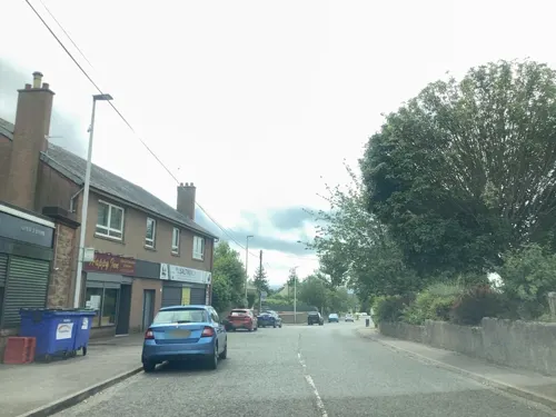
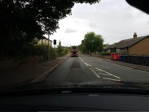
Photos of Mayfield

Things to do2

Newbattle Viaduct
Bridge · 1.5 mi
Railway bridge in Midlothian, Scotland, UK

Museums and landmarks13


Crichton Castle
Monument and historic site · 2.9 mi
Archaeological site in Midlothian, Scotland, UK


Elginhaugh
Monument and historic site · 2.4 mi
Archaeological site in Midlothian, Scotland, UK
1 more on the map.
Parks, trails and playgrounds9

Vogrie Country Park
Park · 2.1 mi
Country park in Midlothian, Scotland, UK

Restaurants and cafes13
Morelli Fast Food
Fast food · Fish And Chips, Italian Pizza · 0.7 mi
45 Easthouses Road
Mo-Su 16:00-23:00

MAEDT Pavilion, Community Cafe and Garden
Cafe
14-15 Bogwood Road, Dalkeith
Mo 11:00-13:00; Tu-Fr 10:00-14:00

1 more on the map.
Where to stay1
Churches and places of worship8
Shopping3
Gas and EV charging3
Schools, colleges and libraries14
Healthcare2
Map of Mayfield
68 places. The map loads OpenStreetMap tiles when you open it.
Getting there and nearby towns
Edinburgh Airport (EDI) is the nearest airport with scheduled flights listed in OpenStreetMap, 14 miles away.
- Dalkeith 2 mi northwest, about 3 min by car
- Bonnyrigg 3 mi west, about 4 min by car
- Musselburgh 5 mi north, about 8 min by car
- Tranent 6 mi northeast, about 10 min by car
- Edinburgh 8 mi northwest, about 13 min by car
- Penicuik 8 mi west, about 13 min by car
- Broxburn 17 mi west, about 28 min by car
- Kirkcaldy 18 mi north, about 28 min by car
- Livingston 19 mi west, about 30 min by car
- Rosyth 19 mi northwest, about 31 min by car
Drive times are estimates from straight-line distance, not routes.
Towns near Mayfield


Keep exploring
Local news
Headlines from INDB.
Reviews, tips and questions
Loading what members have shared...
Sources and licences
- GeoNames (CC BY 4.0): population, coordinates, regions and time zone
- Mapillary (see each image): photos
- OpenStreetMap contributors (ODbL 1.0): places, airports, map data
- Wikidata (CC0 1.0): elevation, founding date, time zone, website, landmarks and historic places
- Wikimedia Commons (see each image): photos
- Wikipedia (CC BY-SA 4.0): overview and history text
Photo credits
- Lothianbridge viaduct01 2000-05-28, User:Klaus with K, CC BY-SA 3.0
- Crichton Castle, near Pathhead, Midlothian, Kim Traynor, CC BY-SA 3.0
- Cockpen and Carrington Church 345, RHaworth, CC BY 2.5
- Collegiate church of crichton, Jimmydenham, Public domain
- St. David's Roman Catholic Church, Dalkeith by Owen Proudfoot, Owen Proudfoot, CC BY-SA 2.0
- Newbattle Abbey, Kim Traynor, CC BY-SA 3.0
- Alucita hexadactyla 91063904, clapwing, CC BY 4.0
- National Mining Museum Scotland, gate, Drkirstyross, CC BY-SA 4.0
- Street-level photo, lucagm, CC BY-SA 4.0
- Street-level photo, lucagm, CC BY-SA 4.0
- Street-level photo, lucagm, CC BY-SA 4.0
- Street-level photo, lucagm, CC BY-SA 4.0
- Street-level photo, lucagm, CC BY-SA 4.0
- Street-level photo, lucagm, CC BY-SA 4.0
- Street-level photo, toho, CC BY-SA 4.0
- Street-level photo, lucagm, CC BY-SA 4.0
- Street-level photo, lucagm, CC BY-SA 4.0
- Street-level photo, toho, CC BY-SA 4.0
- Street-level photo, lucagm, CC BY-SA 4.0
- Street-level photo, lucagm, CC BY-SA 4.0
- Street-level photo, lucagm, CC BY-SA 4.0
- Street-level photo, lucagm, CC BY-SA 4.0
- Street-level photo, lucagm, CC BY-SA 4.0
- Street-level photo, lucagm, CC BY-SA 4.0
- Street-level photo, iain_mcnicol, CC BY-SA 4.0
- Street-level photo, Palemerk, CC BY-SA 4.0
- Street-level photo, iain_mcnicol, CC BY-SA 4.0
- Street-level photo, lucagm, CC BY-SA 4.0
- Street-level photo, iain_mcnicol, CC BY-SA 4.0
- Street-level photo, lucagm, CC BY-SA 4.0
- Street-level photo, southglos, CC BY-SA 4.0
Page built November 10, 2026. Spotted a mistake? Tell us or suggest a place.