


Middle Rasen, United Kingdom
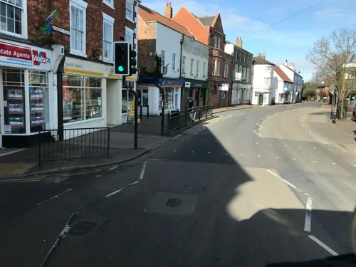
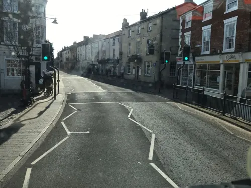
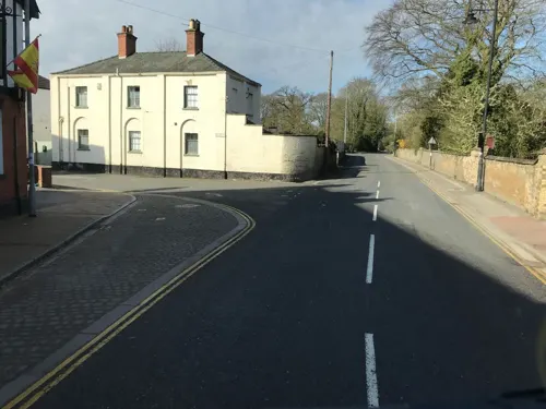
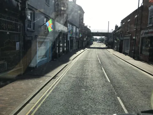
Middle Rasen is a town of 1,174 people in England, United Kingdom.
Why visit Middle Rasen
Townapedia lists 3 parks and trails and 7 places to eat in and around town.
Weather in Middle Rasen
Forecast from MET Norway (CC BY 4.0). Full forecast
About Middle Rasen
Middle Rasen is a village and civil parish in the West Lindsey district of Lincolnshire, England, located about 1.5 miles (2.4 km) west from the town of Market Rasen. The population of the civil parish at the 2011 census was 2,043.
From the Wikipedia article Middle Rasen (this version), under CC BY-SA 4.0.
Parks, trails and playgrounds3
Bell Park
Park · 1.2 mi
Park known as "Bell Park", complete with a play area, seating areas and woodland.

Restaurants and cafes7

Aston Arms
Bar and pub · 1.0 mi
18 Market Place, Market Rasen
Mo-Th 11:00-23:00; Fr-Sa 11:00-23:30; Su 12:00-23:00
Churches and places of worship8


Blessed Lady And St Joseph Chapel And House
Church · 2.4 mi
Chapel in Osgodby, West Lindsey, Lincolnshire, England, UK
St Michael's Church, Buslingthorpe
Church · 2.5 mi
Church in Buslingthorpe, Lincolnshire, England, UK
St Peter's Church, Kingerby
Church · 3.1 mi
Church in Kingerby, Lincolnshire, England, UK
Shopping2

Lincolnshire Co-op
Grocery · 1.0 mi
John Street, Market Rasen
Mo-Sa 07:00-22:00; Su 10:00-16:00
History
Rasen is mentioned in Domesday Book of 1086, but West Rasen, Middle Rasen and Market Rasen are indistinguishable. In its entirety the list includes ten separate references to Rasen, which as a whole consists of 144 households.
Today's village results from the merger of the two historic villages of Middle Rasen Drax and Middle Rasen Tupholme.
Middle Rasen has had two churches. A church dedicated to St Paul Middle Rasen Drax took part of its name from the parent house of Drax Priory in Yorkshire. In 1846 St Paul's comprised a nave, chancel, South aisle and western tower, with the probable remains of a demolished north aisle and north chapel. – it was demolished in 1860, with parts of its fabric used to restore of the church of St Peter. Grade II* listed St Peter's church dates from the 12th century, with later alterations and additions, and an 1861 restoration by Pearson Bellamy and John Spence Hardy, of Lincoln.
Read more of the history
In 1885 Kelly's Directory noted village Wesleyan, Primitive Methodist, and Reformed Wesleyan chapels. It described a parish land of sand and clay, with a clay subsoil, on which wheat, barley and turnips were grown, and with pasture. Parish area was 3,550 acres (14 km2), supporting an 1881 population of 928. There were 17 farmers listed, four of whom had added trades, variously a miller, cattle dealer, butcher & cattle dealer, and machine owner. Other occupations were a blacksmith, beer retailer & blacksmith, millwright, grocer, shopkeeper, wheelwright, carrier, grocer & draper, butcher & cattle dealer, miller, publican, and dressmaker, and a shoemaker who also ran the post office.
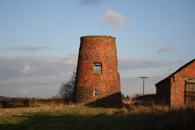
A tower windmill, built in 1827 for the grinding of cereal, ceased working permanently in 1925, and is now used as a store. A previous three storey red-brick watermill dated from the late 18th century, with 1827 remodelling – its remaining wheelhouse is Grade II listed.
Middle Rasen Primary School was built in 1875 to replace a charity school founded through a bequest by John Wilkinson, who died in 1720. In 1878 the school became a Board School, and in 1903 the Middle Rasen Council School. The charity still supports the current school.
From the History section of Middle Rasen on Wikipedia, under CC BY-SA 4.0.
Schools, colleges and libraries2
Healthcare1
Map of Middle Rasen
23 places. The map loads OpenStreetMap tiles when you open it.
Getting there and nearby towns
Humberside Airport (HUY) is the nearest airport with scheduled flights listed in OpenStreetMap, 13 miles away.
- Wragby 8 mi south, about 12 min by car
- Lincoln 13 mi southwest, about 21 min by car
- Scawby 13 mi northwest, about 21 min by car
- North Thoresby 14 mi northeast, about 22 min by car
- Louth 15 mi east, about 24 min by car
- Grimsby 17 mi northeast, about 27 min by car
- Gainsborough 17 mi west, about 27 min by car
- Immingham 17 mi north, about 27 min by car
- Scunthorpe 18 mi northwest, about 29 min by car
- Cleethorpes 18 mi northeast, about 29 min by car
Drive times are estimates from straight-line distance, not routes.
Towns near Middle Rasen


Keep exploring
Local news
Headlines from INDB.
Reviews, tips and questions
Loading what members have shared...
Sources and licences
- GeoNames (CC BY 4.0): population, coordinates, regions and time zone
- Mapillary (see each image): photos
- OpenStreetMap contributors (ODbL 1.0): places, airports, map data
- Wikidata (CC0 1.0): elevation, founding date, time zone, website, landmarks and historic places
- Wikimedia Commons (see each image): photos
- Wikipedia (CC BY-SA 4.0): overview and history text
Photo credits
- Middle Rasen, Richard Croft, CC BY-SA 2.0
- Aston Arms, Market Rasen, Richard Croft, CC BY-SA 2.0
- Market Rasen, St Thomas' church interior (24410082114), Jules & Jenny from Lincoln, UK, CC BY 2.0
- Street-level photo, ricorico, CC BY-SA 4.0
- Street-level photo, ricorico, CC BY-SA 4.0
- Street-level photo, ricorico, CC BY-SA 4.0
- Street-level photo, ricorico, CC BY-SA 4.0
- Street-level photo, ricorico, CC BY-SA 4.0
- Street-level photo, ricorico, CC BY-SA 4.0
- Street-level photo, ricorico, CC BY-SA 4.0
- Street-level photo, ricorico, CC BY-SA 4.0
Page built November 10, 2026. Spotted a mistake? Tell us or suggest a place.