


North Thoresby, United Kingdom
North Thoresby is a town of 1,068 people in England, United Kingdom.
Why visit North Thoresby
Townapedia lists 1 museum or landmark and 2 places to eat in and around town.
Highlights include North Ormsby Priory.
Weather in North Thoresby
Forecast from MET Norway (CC BY 4.0). Full forecast
About North Thoresby
North Thoresby is a village and civil parish in the East Lindsey district of Lincolnshire, England. It is situated between Louth and Grimsby, approximately 7.5 miles (12 km) from each. and has a village population of 1,068 (2011) Some 50.5% of the population is older than 60 years.
From the Wikipedia article North Thoresby (this version), under CC BY-SA 4.0.
Museums and landmarks1

North Ormsby Priory
Monument and historic site · 3.3 mi
Gilbertine priory in Lincolnshire, England, UK
Restaurants and cafes2

Churches and places of worship7

Church of St Peter
Church · 2.7 mi
Church in Holton-le-Clay, Lincolnshire, England, UK

St Martin's Church
Church · 1.5 mi
Church in Waithe, Lincolnshire, England, UK



St Helen's Church, North Thoresby
Church
Church in North Thoresby, Lincolnshire, England, UK
Shopping1

History
Researchers believe they found archeological evidence, just outside the village, that grapes were grown in the area by the Romans during their occupation. This claim has been contested. The Village lies on a Roman road from Cadeby to North Coates, believed to have been a route of salt transportation from the coast to Lincoln.
North Thoresby is listed in the same Domesday entry as Autby, and in 1416 it was combined into Thoresby-cum-Autby parish, following the desertion of Autby and the loss of the village church.
The Anglican parish church, St Helen's, occupies a site where Christian worship has continued for more than 1,000 years. Like most churches of its age it has seen many alterations from an original simple room to a 15th-century edifice with north and south aisles. The south aisle was demolished in Elizabethan times but remains of it survive inside the church. The church includes part of a Saxon grave cover, Tudor bench-ends and Restoration plaques which record the work tradesman such as "putty makers". There is also a memorial tablet to Francis Bond (1852-1918), the late 19th-century authority on Gothic architecture, who was born in the village. Historically the parish was within Haverstoe, the south division of the Bradley-Haverstoe wapentake, in the North Riding of Lindsey.
Read more of the history
North Thoresby was enclosed in 1839, its Tithe barn still stands having been converted into a private dwelling standing to the east of the rectory.
Wesleyans and Primitive Methodists each had a chapel here prior to 1900. The Methodist chapel, school and school house, were built in the mid-19th century. In 1985 the school and house were converted into a community centre, The Wesley Centre, when the primary school relocated to a new building on High Street.
During the Second World War, on 4 October 1943, an RAF Avro Lancaster ED583 crashed in the village during a test flight from RAF Waltham, killing the crew. A memorial was dedicated to them on 4 September 2005.
From the History section of North Thoresby on Wikipedia, under CC BY-SA 4.0.
Gas and EV charging1
Schools, colleges and libraries1
Map of North Thoresby
13 places. The map loads OpenStreetMap tiles when you open it.
Getting there and nearby towns
Humberside Airport (HUY) is the nearest airport with scheduled flights listed in OpenStreetMap, 14 miles away.
- Tetney 2 mi northeast, about 4 min by car
- Cleethorpes 7 mi north, about 11 min by car
- Grimsby 7 mi north, about 11 min by car
- Louth 7 mi south, about 12 min by car
- Stallingborough 10 mi northwest, about 16 min by car
- Immingham 12 mi northwest, about 20 min by car
- Mablethorpe 16 mi southeast, about 25 min by car
- Wragby 16 mi southwest, about 26 min by car
- Hedon 20 mi north, about 32 min by car
- Kingston upon Hull 22 mi northwest, about 36 min by car
Drive times are estimates from straight-line distance, not routes.
Towns near North Thoresby


Keep exploring
Local news
Headlines from INDB.
Reviews, tips and questions
Loading what members have shared...
Sources and licences
- GeoNames (CC BY 4.0): population, coordinates, regions and time zone
- Mapillary (see each image): photos
- OpenStreetMap contributors (ODbL 1.0): places, airports, map data
- Wikidata (CC0 1.0): elevation, founding date, time zone, website, landmarks and historic places
- Wikimedia Commons (see each image): photos
- Wikipedia (CC BY-SA 4.0): overview and history text
Photo credits
- Holton-Le-Clay Church Tower, Dornsby, CC0
- StNicholasGrainsby, Richard Croft, CC BY-SA 2.0
- St. Martin's Church, Waithe - Post Restoration, Wideload123, CC0
- East Window St Helen North Thoresby, Jack1956, CC BY-SA 4.0
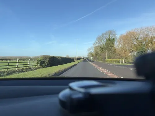
- Street-level photo, MarcelM005, CC BY-SA 4.0
Page built November 10, 2026. Spotted a mistake? Tell us or suggest a place.