


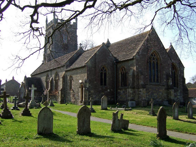


Milborne Port, United Kingdom
Milborne Port is a town of 2,802 people in England, United Kingdom.
Why visit Milborne Port
Townapedia lists 4 museums and landmarks, 6 parks and trails and 5 places to eat in and around town.
Highlights include Old St Cuthbert's Chancel, Sherborne Castle and Ven House.
Weather in Milborne Port
Forecast from MET Norway (CC BY 4.0). Full forecast
About Milborne Port
Milborne Port is a village, electoral ward and civil parish in Somerset, England, east of Sherborne, and in the South Somerset district. It has a population of 2,802. The parish includes the hamlets of Milborne Wick and Kingsbury Regis.
From the Wikipedia article Milborne Port (this version), under CC BY-SA 4.0.
Museums and landmarks4


Sherborne Castle
Museum · 2.2 mi
Grade I listed historic house museum in Sherborne, United Kingdom


Parks, trails and playgrounds6



Restaurants and cafes5



Churches and places of worship11
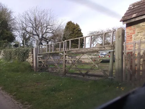
Milborne Wick Mission Church
Church · Anglican · 1.4 mi
Church building in Milborne Port, South Somerset, England, UK

Church of St John the Evangelist, Milborne Port
Church
Church in Milborne Port, Somerset, England, UK

Church of St Mary, Abbas and Templecombe
Church · 3.2 mi
Church in South Somerset, England, UK

Church of St Nicholas
Church · 3.0 mi
Church in South Somerset, England, UK
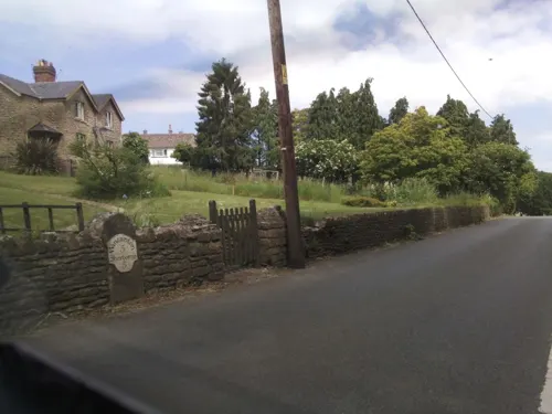
Church of St Peter and St Paul
Church · 2.9 mi
Church in Charlton Horethorne, Somerset, England, UK
Old St Cuthbert's Church, Oborne
Church · 1.5 mi
Church in Oborne, Dorset, England, UK
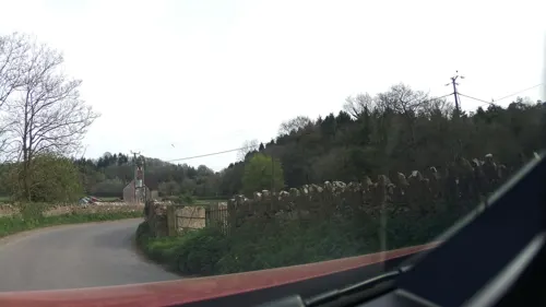

Parish Church of Sts Peter and Paul
Church · 3.3 mi
Church building in Caundle Marsh, West Dorset, England, UK
History
The nearby Laycock Railway Cutting is the best single exposure of the Bathonian ’Fuller's Earth Rock' in South Somerset. Ammonites indicating the Morrisi and Subcontractus zones of the Middle Bathonian are frequent. Miller's Hill is a geological Site of Special Scientific Interest which is an important and historically famous locality for studies of Middle Jurassic (Bajocian) stratigraphy and palaeontology.
Prehistoric features and finds have been located on the Iron Age hill fort on Barrow Hill, in the north of the parish.
In the Saxon period Milborne Port was important as a mint town, between 997 and 1035. It is one of at least nineteen mint towns which were neither an Alfredian borough nor an eleventh-century shire town, but a minster site. The market was the most profitable in Somerset in 1086, and the town was eighth in the county tax collection in 1340.
The "port" in the towns name signifies an important market town and was first recorded in 1249. The parish was part of the hundred of Horethorne.
Read more of the history
Milborne Port Town Hall, which was commissioned as a market house, was completed in 1720. In 1770, the town hall was the site of events involving an exploding squib at the local fair that would result in a landmark case for the development of modern tort (personal injury) law. The case of Scott v. Shepherd helped establish the principles of remoteness, foreseeability, and intervening cause in modern common law torts. Shepherd tossed a lit squib into a crowded market in the town, where it landed on the table of a gingerbread merchant named Yates. Willis, a bystander, grabbed the squib and threw it across the market to protect himself and the gingerbread. Unfortunately, the squib landed in the goods of another merchant named Ryal. Ryal immediately grabbed the squib and tossed it away, accidentally hitting Scott in the face just as the squib exploded. The explosion put out one of Scott's eyes. Shepherd was found to be fully liable, because, said De Gray CJ, "I do not consider [the intermediaries] as free agents in the present case, but acting under a compulsive necessity for their own safety and self-preservation."
"MILBORN PORT, (Som.) bor. dist. from London 113 m. 7 f. [furlongs] situated on a branch of the river Parret, and may be considered as divided into three parts, viz. Milborn Port, Kingsbury Regis, and Milborn Wyke; however, the borough and Kingsbury lie in many places promiscuously intermixed together, both in the main town, and at Milborn Wyke; Milborn Wyke being as a village 1 m. N.... In Kingsbury is an annual court-baron held, wherein lord's rents are paid, presentments are made, and a constable, tythingman, and hayward, are appointed, for the year ensuing... Number of actual voters, 9, nominally 114. The church has a square tower, 6 bells, a clock, and chimes; one dissenting meeting-house, and upwards of 1000 inhabitants. The manufactures are dowlas, tick, white baize, linsey, stockings, and shoes. No market, but is supposed to have had one formerly. Fairs, 5 June, and 23 Oct., for cattle and toys. The post is despatched to Sherborne every day at 1 o'clock, and one arrives from thence at the same hour. Near it, on the left, is the seat of William Coles Medlecot, esq."
Under the Reform Act 1832, the town lost its status as a Parliamentary constituency, due to the gerrymandering activities of both parties in preceding elections.
In April 1873 a local shepherd, William Osmond, was victimised and sent to jail with six months hard labour for organising agricultural labourers in the area (inspired by George Mitchell, Somerset leader of the National Agricultural Labourers Union). On his release in January 1874 over 2,000 supporters marched through Milborne Port in his support. The farmer Charles Bugg, who victimised Osmond, died it is said of "shame" in January 1874.
The village was a thriving leather and leather glove manufacturing area. In 1826, The Earl of Ilchester presented a petition to Parliament for them, against the importation of leather. The last factory closed in 1970.
Ven House with its orangery, entrance gateway, pavilions, terrace, stabling & other outbuildings was built in 1730 by Richard Grange and Decimus Burton. It is a grade I listed building.
From the History section of Milborne Port on Wikipedia, under CC BY-SA 4.0.
Notable people from Milborne Port
- Robert EnsorBritish writer and historian (1877–1958)
- Colin TizzardBritish racehorse trainer
Born in Milborne Port, according to Wikidata (CC0). Each name links to its Wikipedia article.
Gas and EV charging1
Schools, colleges and libraries2
Healthcare1
Map of Milborne Port
30 places. The map loads OpenStreetMap tiles when you open it.
Getting there and nearby towns
Royal Naval Air Station Yeovilton (YEO) is the nearest airport with scheduled flights listed in OpenStreetMap, 9 miles away.
- Templecombe 3 mi northeast, about 5 min by car
- Stalbridge 4 mi east, about 6 min by car
- Sturminster Newton 7 mi east, about 12 min by car
- Yetminster 7 mi southwest, about 11 min by car
- Yeovil 8 mi west, about 12 min by car
- Redlynch 9 mi north, about 15 min by car
- Ilchester 10 mi west, about 16 min by car
- West Coker 10 mi west, about 17 min by car
- Child Okeford 10 mi east, about 17 min by car
- Shillingstone 11 mi southeast, about 17 min by car
Drive times are estimates from straight-line distance, not routes.
Towns near Milborne Port


Keep exploring
Local news
Headlines from INDB.
Reviews, tips and questions
Loading what members have shared...
Sources and licences
- GeoNames (CC BY 4.0): population, coordinates, regions and time zone
- Mapillary (see each image): photos
- OpenStreetMap contributors (ODbL 1.0): places, airports, map data
- Wikidata (CC0 1.0): elevation, founding date, time zone, website, landmarks and historic places
- Wikimedia Commons (see each image): photos
- Wikipedia (CC BY-SA 4.0): overview and history text
Photo credits
- Sherborne Castle, Dorset (42017852592), JackPeasePhotography, CC BY 2.0
- St Marys Church, Abbas Combe, Ben Harris, CC BY-SA 2.0
- Henstridge church, Mike Searle, CC BY-SA 2.0
- Milborne Port Church1, Mike Searle, CC BY-SA 2.0
- Oborne old church 02, BishopHerman, Public domain
- Ven House, Mike Searle, CC BY-SA 2.0
- Cross House 20210607 123141 Milborne Port, Dcs57, CC BY-SA 4.0
- The Tippling Philosopher 20210607 123517 Milborne Port, Dcs57, CC BY-SA 4.0
- The Famous Gainsborough Arms - panoramio, dan kearney, CC BY-SA 3.0
- Street-level photo, southglos, CC BY-SA 4.0
- Street-level photo, southglos, CC BY-SA 4.0
- Street-level photo, southglos, CC BY-SA 4.0
- Street-level photo, southglos, CC BY-SA 4.0
- Street-level photo, southglos, CC BY-SA 4.0
- Street-level photo, southglos, CC BY-SA 4.0
- Street-level photo, southglos, CC BY-SA 4.0
Page built November 10, 2026. Spotted a mistake? Tell us or suggest a place.