


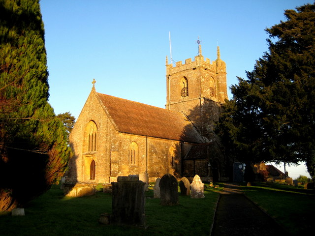


Why visit Yeovil
Townapedia lists 11 museums and landmarks, 19 parks and trails, 74 places to eat, 8 places to stay and 4 attractions in and around town.
Highlights include Cineworld, Old Stables, Jack the Treacle Eater and Ninesprings.
Weather in Yeovil
Forecast from MET Norway (CC BY 4.0). Full forecast
About Yeovil
Yeovil is a town and civil parish in Somerset, England. It is close to the county's southern border with Dorset, 126 miles (203 km) west of London, 42 miles (68 km) south of Bristol, 6 miles (10 km) west of Sherborne and 28 miles (45 km) east of Taunton. At the 2021 census, the parish had a population of 31,633, and the built-up area, which extends into the neighbouring parishes of Brympton, West Coker, and Yeovil Without, had a population of 50,170.
From the Wikipedia article Yeovil (this version), under CC BY-SA 4.0.
Travel tips from other travellers: Yeovil on Wikivoyage (CC BY-SA 4.0).
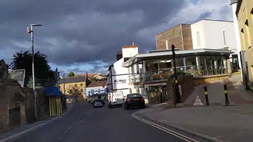
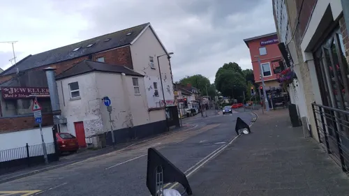
Photos of Yeovil

Things to do4

Museums and landmarks11




Parks, trails and playgrounds19

Ninesprings
Park · 0.5 mi
Country park near Yeovil, Somerset, England

Yeovil Golf Club
Golf course · 1.1 mi
18 hole Par 71 Old Course + 18 hole Par 68 Newton Course
Sherborne Road, Yeovil


7 more on the map.
Restaurants and cafes74
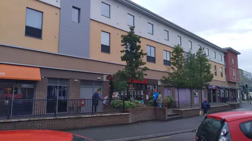
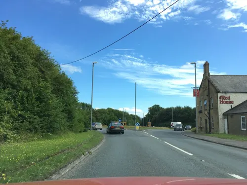
The Red House
Bar and pub · 1.3 mi
Payvotts Lane, Yeovil
Tu-Sa 12:00-14:30,17:30-23:00; Su 12:00-17:00
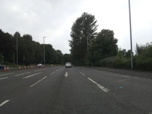
Costa
Cafe · Coffee Shop · 0.8 mi
Lysander Road, Yeovil
Mo-Sa 06:30-20:00; Su 07:00-19:00



Amrit
Restaurant · Indian
Tu-Sa 12:00-14:00, 17:00-22:30; Su 12:00-13:00, 17:00-22:00
62 more on the map.
History
Archaeological surveys have yielded Palaeolithic burial and settlement sites mainly to the south of the modern town, particularly in Hendford, where a Bronze Age golden torc (twisted collar) was found.
Yeovil is on the main Roman road from Dorchester to the Fosse Way at Ilchester. The route of the old road is aligned with the A37 from Dorchester, Hendford Hill, Rustywell, across the Westland site, to Larkhill Road and Vagg Lane, rejoining the A37 at the Halfway House pub in the Ilchester Road. The Westland site has evidence of a small Roman town. There were several Roman villas (estates) in the area. Finds have been made at East Coker, West Coker and Lufton.
Yeovil was first named in a Saxon charter dated 880 as Gifle. It derives from the Common Brittonic river-name gifl "forked river", an earlier name of the River Yeo.
The estate was bequeathed in the will of King Alfred the Great to his youngest son Aethelweard. It was recorded in the Domesday Book as Givele, a thriving market community. The parish of Yeovil was part of the Stone Hundred. After the Norman Conquest, the manor, later known as Hendford, was granted to the Count of Eu and his tenant Hugh Maltravers, whose descendants became Earls of Arundel and held the lordship until 1561. In 1205 it was granted a charter by King John. By the 14th century, the town had gained the right to elect a portreeve.
Read more of the history
The Black Death exacted a heavy toll, killing about half the population.
In 1499, a major fire destroyed many wooden, thatch-roofed buildings in the town. Yeovil suffered further fires in 1620 and 1643.
After the dissolution of the monasteries, the lord of the manor was the family of John Horsey of Clifton Maybank from 1538 to 1610, followed by the Phelips family until 1846, when it passed to the Harbins of Newton Surmaville. Babylon Hill across the River Yeo to the south east of the town was the site of a minor skirmish, the Battle of Babylon Hill, during the Civil War, which resulted in the Earl of Bedford's Roundheads forcing back Sir Ralph Hopton's Cavaliers to Sherborne.
In the 1800s, Yeovil was a glove-making centre and the population grew quickly. In the mid-19th century it became linked to the rest of Britain by a complex of railway lines, with competition between the 7 ft (2,134 mm) broad gauge lines of the Great Western Railway (GWR) and the 4 ft 8+1⁄2 in (1,435 mm) standard gauge lines of the London and South Western Railway (LSWR).
The town's first railway was a branch line from the Bristol and Exeter Railway near Taunton to a terminus at Hendford on the western side of the town, which opened on 1 October 1853; as an associate of the GWR, this was a broad-gauge line. The GWR itself opened Yeovil Pen Mill railway station, on the east side of the town as part of its route from London on 1 September 1856, extended to Weymouth on 1 January 1857), and the original line from Taunton connected with this. The LSWR route from London reached Hendford on 1 June 1860, but a month later the town was by-passed by an extension of the LSWR to Exeter. A new station at Yeovil Junction was provided south of the town from where passengers could catch a connecting service to Hendford. On 1 June 1861, passenger trains were withdrawn from Hendford and transferred to a new, more central, Yeovil Town railway station.
In the early 20th century, Yeovil had around 11,000 inhabitants and was dominated by the defence industry, making it a target of German raids during World War II. The worst bombing was in 1940 and continued until 1942. During that time 107 high-explosive bombs fell on the town, 49 people died, 68 houses were totally destroyed and 2,377 damaged.
Industrial businesses developed around the Hendford railway goods station to such a degree that a small Hendford Halt was opened on 2 May 1932 for passengers, but the growth of road transport and a desire to rationalise the rail network led to half of the railway stations in Yeovil being closed in 1964. First to go was Hendford Halt, closed on 15 June along with the line to Taunton, then Yeovil Town closed on 2 October. Long-distance trains from Pen Mill were withdrawn on 11 September 1961, leaving only Yeovil Junction with a service to London, but the service between there and Pen Mill, the two remaining stations, was also withdrawn from 5 May 1968.
As a former centre of Britain's leather industry, the town is post-industrial in character. Journalist John Harris, for instance, described the towns Taunton, Yeovil and Bridgwater as a "post-industrial, hardscrabble place that contain[s] 19 of the council wards in the 20% of English areas classed as the most deprived."
From the History section of Yeovil on Wikipedia, under CC BY-SA 4.0.
More about Yeovil
Geography
Yeovil is in the south of Somerset, close to the border with Dorset and in the centre of the Yeovil Scarplands, a natural region of England. The suburbs include Summerlands, Hollands, Houndstone, Preston Plucknett, Penn Mill, New Town, Hendford, Old Town, Forest Hill, Abbey Manor, Great Lyde. Outlying villages include East Coker, West Coker, Hardington Mandeville, Evershot, Halstock, Stoford, Barwick, Sutton Bingham, Mudford and Yetminster. Other nearby villages include Bradford Abbas, Thornford Corscombe, Montacute (with Montacute House) and Pendomer. The village of Brympton, now almost a suburb of Yeovil, contains the medieval manor of Brympton d'Evercy. Tintinhull, also close to Yeovil, features the National Trust-owned Tintinhull House and Gardens.
Ninesprings Country Park is in the south-east near Penn Hill, linked by a cycle way along the route of the old railway to Riverside Walk, Wyndham Hill and Summerhouse Hill, forming the 40-hectare (99-acre) Yeovil Country Park.
Economy
Leonardo manufactures helicopters in Yeovil, and Honeywell Aerospace, formerly Normalair Garratt, builder of aircraft oxygen systems, is also based there.
Yeovil's role as a centre of the aircraft and defence industries continued into the 21st century, despite attempts to diversify and the creation of industrial estates. In January 1986, a proposed sale of Westland Helicopters to the US Sikorsky Aircraft group led to the Westland affair, a crisis in the Thatcher government, the resignation of Michael Heseltine as Secretary of State for Defence, and, two weeks later, the resignation of Secretary of State for Trade and Industry Leon Brittan, who admitted leaking a governmental law officer's letter harshly critical of Heseltine. Leonardo, formerly AgustaWestland, created through the acquisition of Westland by Finmeccanica in 2000, remains the main employer in Yeovil.
Yeovil Aerodrome (ICAO: EGHG), (sometimes known as Yeovil/Westland "Judwin", to avoid confusion with nearby RNAS Yeovilton), is 1 nautical mile (1.9 km) west of the town centre. British defence giant BAE Systems also runs a site producing high-integrity networked software, mainly for the armed forces.
Education
Further education in Yeovil is mainly provided by Yeovil College, with land-based studies available at a Yeovil centre of Bridgwater College, and some provision through private providers. The town also has a higher education centre, University Centre Yeovil, whose main degree-awarding body is Bournemouth University, with University of the West of England offering some courses.
Secondary education in Yeovil is provided by three schools: Westfield Academy, on Stiby Road; Preston School; and Bucklers Mead Academy.
From the Wikipedia article Yeovil, under CC BY-SA 4.0.
Notable people from Yeovil
 Heather StanningBritish rowerPhoto: Richard Gillin from St Albans, UK, CC BY-SA 2.0
 Martin CranieEnglish association football player (born 1986)Photo: Jon Candy from Cardiff, Wales, CC BY-SA 2.0
 Vanessa WhiteBritish singer and songwriterPhoto: See Li, CC BY 2.0
 Hugh BantonBritish musicianPhoto: Smkphotos, CC BY-SA 3.0
 Marlie Packerrugby union playerPhoto: Marlie Packer, CC BY-SA 4.0
 Christopher WheeldonBritish contemporary ballet choreographerPhoto: The Tony Awards, CC BY 3.0
 Jamie DaviesEnglish racing driverPhoto: Sp33dyWon, CC0
 Debbie GoogeEnglish musicianPhoto: Bene Riobó, CC BY-SA 4.0
 Catherine RowettProfessor of Philosophy at the University of East Anglia (born 1956)Photo: Joseph John Casey, CC BY-SA 4.0
 Chris Wealefootballer (born 1982)Photo: joncandy, CC BY-SA 2.0
 Jim CreganEnglish rock guitarist and bassistPhoto: Mark Kieve, CC BY 2.0
- Sarah ParishEnglish actress
Born in Yeovil, according to Wikidata (CC0). Each name links to its Wikipedia article.
Where to stay8
Churches and places of worship27
Shopping22
Gas and EV charging4
Schools, colleges and libraries22
Healthcare10
Abbey Manor Medical Practice
Clinic and pharmacy · 1.5 mi
Abbey Manor Park, Yeovil
Map of Yeovil
201 places. The map loads OpenStreetMap tiles when you open it.
Getting there and nearby towns
Royal Naval Air Station Yeovilton (YEO) is the nearest airport with scheduled flights listed in OpenStreetMap, 5 miles away.
- Street 13 mi north, about 22 min by car
- Chard 15 mi west, about 25 min by car
- Bridport 15 mi south, about 25 min by car
- Dorchester 18 mi southeast, about 29 min by car
- Shepton Mallet 18 mi north, about 28 min by car
- Wells 18 mi north, about 30 min by car
- Blandford Forum 21 mi east, about 34 min by car
- Frome 24 mi northeast, about 39 min by car
- Midsomer Norton 25 mi north, about 40 min by car
- Burnham-on-Sea 26 mi northwest, about 42 min by car
Drive times are estimates from straight-line distance, not routes.
Towns near Yeovil


Keep exploring
Local news
Headlines from INDB.
Reviews, tips and questions
Loading what members have shared...
Sources and licences
- GeoNames (CC BY 4.0): population, coordinates, regions and time zone
- Mapillary (see each image): photos
- OpenStreetMap contributors (ODbL 1.0): places, airports, map data
- Wikidata (CC0 1.0): elevation, founding date, time zone, website, landmarks and historic places
- Wikimedia Commons (see each image): photos
- Wikipedia (CC BY-SA 4.0): overview and history text
Photo credits
- Church of St John the Baptist, Yeovil - Mike Smith, Mike Smith, CC BY-SA 2.0
- Yeovilstjohns, Chris McMillan, CC BY-SA 2.0
- Chilthorne Domer church, Stevekeiretsu, CC BY-SA 4.0
- Odcombe church, Sarah Smith, CC BY-SA 2.0
- Over compton church, BishopHerman, Public domain
- Yeovil hospital A&E, Jakebradley55, CC BY-SA 3.0
- Judas Iscariot in Stained Glass Depiction, GadgetSteve, CC BY-SA 4.0
- Barwick and Stoford - Jack The Treacle Eater - 20220429154931, Howard Inst, CC BY-SA 4.0
- Lake at Ninesprings Country Park, Marley Sexton, CC0
- Street-level photo, southglos, CC BY-SA 4.0
- Street-level photo, tonys999, CC BY-SA 4.0
- Street-level photo, tonys999, CC BY-SA 4.0
- Street-level photo, southglos, CC BY-SA 4.0
- Street-level photo, southglos, CC BY-SA 4.0
- Street-level photo, southglos, CC BY-SA 4.0
- Street-level photo, southglos, CC BY-SA 4.0
- Street-level photo, tonys999, CC BY-SA 4.0
- Street-level photo, tonys999, CC BY-SA 4.0
- Street-level photo, tonys999, CC BY-SA 4.0
- Street-level photo, tonys999, CC BY-SA 4.0
- Street-level photo, southglos, CC BY-SA 4.0
- Street-level photo, southglos, CC BY-SA 4.0
- Street-level photo, southglos, CC BY-SA 4.0
Page built November 10, 2026. Spotted a mistake? Tell us or suggest a place.