


Yetminster, United Kingdom
Yetminster is a town of 1,105 people in England, United Kingdom.
Why visit Yetminster
Townapedia lists 1 museum or landmark, 2 places to eat and 1 attraction in and around town.
Weather in Yetminster
Forecast from MET Norway (CC BY 4.0). Full forecast
About Yetminster
Yetminster is a village and civil parish in the English county of Dorset. It lies 4 miles (6.4 km) south-west of Sherborne. It is sited on the River Wriggle, a tributary of the River Yeo, and is built almost entirely of honey-coloured limestone, which gives the village an appearance reminiscent of Cotswold villages. In the 2011 census the civil parish had a population of 1,105.
From the Wikipedia article Yetminster (this version), under CC BY-SA 4.0.
Things to do1

Museums and landmarks1

Restaurants and cafes2

Churches and places of worship9
Parish Church of St Peter
Church · 1.8 mi
Church in Chetnole, Dorset, England, UK

St Edwold's Church, Stockwood
Church · 2.5 mi
Church in Stockwood, Dorset, England, UK

Church of All Saints
Church · 2.8 mi
Church in Sutton Bingham, Somerset, England, UK
Church of All Saints, Closworth
Church · 1.9 mi
Church in Somerset, England, UK
Church of Saint Mary Magdalene
Church · 2.9 mi
Church in South Somerset, England, UK
Parish Church of St Osmond
Church · 2.2 mi
Church in Melbury Osmond, Dorset, England, UK
History
In 1086 in the Domesday Book Yetminster was recorded as Etiminstre; it had 76 households, 26 ploughlands, 42 acres (17 ha) of meadow and 2 mills. It was in Yetminster Hundred and the tenant-in-chief was the Bishop of Salisbury.
The parish church of St Andrew has Saxon origins, though only part of a 10th-century standing cross remains from that period; the current building dates mostly from the mid-15th century, though the chancel was built around 1300 and the whole church was restored in 1890 and several times subsequently.
In 1300 the bishop of Salisbury founded a weekly market and three-day annual fair in the village. Records do not state whether the market thrived, but the fair continued until the 19th century. It was revived in the 20th century, and today takes place on the second Saturday in July.
Robert Boyle, pioneer of modern chemistry who is best known for Boyle's law, left an endowment for the provision of a school for poor boys in the district; the building was constructed in 1697 and functioned as a school between 1711 and 1945.
In the early 19th century, several buildings in the village accommodated a thriving dowlas industry. Records from 1848 indicate Yetminster's degree of self-sufficiency as a community; nearly 20 trades and crafts were conducted in the village, including a glazier, a saddler, several shoe and boot makers, a tailor and a maltster.
Read more of the history
In 1857 the Wilts, Somerset and Weymouth Railway between Weymouth and Westbury opened; it passed through Yetminster and a station was built for the village.
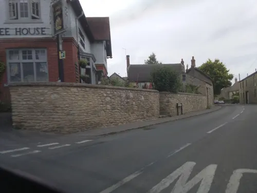
Many of the buildings still standing in the village were built from the local limestone between the end of the 16th and the middle of the 18th centuries, resulting in an unusually unified architectural appearance. Writing in 1905 Sir Frederick Treves described the village as "probably the most consistent old-world village or townlet in the county", in 1965 Ralph Wightman stated that "Yetminster [...] is the nearest Dorset equivalent to the stone building of the Cotswold country", and in 1980 Roland Gant wrote that "little has come since to spoil this largish village."
From the History section of Yetminster on Wikipedia, under CC BY-SA 4.0.
More about Yetminster
Geography
Measured directly, Yetminster village is about 4 miles (6.4 km) southwest of Sherborne, 4 miles (6.4 km) southeast of Yeovil, 13.5 miles (21.7 km) northeast of Bridport and 14 miles (23 km) north-northwest of Dorchester.
The geology of the parish comprises a narrow central band of Middle Jurassic cornbrash limestone and Forest Marble that crosses the parish from west to east, with Upper Jurassic Oxford clay to the north and south. In the southeast and northeast the Oxford clay is overlain by Quaternary undifferentiated head deposits. The village is sited on the cornbrash.
From the Wikipedia article Yetminster, under CC BY-SA 4.0.
Notable people from Yetminster
 Bryan "Badger" GossBritish motorcycle racerPhoto: Eric Miles, CC BY 2.0
- Godfrey LagdenBritish colonial administrator (1851-1934)
Born in Yetminster, according to Wikidata (CC0). Each name links to its Wikipedia article.
Schools, colleges and libraries1
Map of Yetminster
14 places. The map loads OpenStreetMap tiles when you open it.
Getting there and nearby towns
Royal Naval Air Station Yeovilton (YEO) is the nearest airport with scheduled flights listed in OpenStreetMap, 8 miles away.
- Yeovil 4 mi northwest, about 6 min by car
- Bridport 14 mi southwest, about 22 min by car
- Dorchester 14 mi southeast, about 22 min by car
- Chard 17 mi west, about 27 min by car
- Street 17 mi northwest, about 28 min by car
- Blandford Forum 18 mi east, about 30 min by car
- Weymouth 20 mi south, about 32 min by car
- Shepton Mallet 20 mi north, about 33 min by car
- Wells 22 mi north, about 35 min by car
- Taunton 24 mi west, about 39 min by car
Drive times are estimates from straight-line distance, not routes.
Towns near Yetminster


Keep exploring
Local news
Headlines from INDB.
Reviews, tips and questions
Loading what members have shared...
Sources and licences
- GeoNames (CC BY 4.0): population, coordinates, regions and time zone
- Mapillary (see each image): photos
- OpenStreetMap contributors (ODbL 1.0): places, airports, map data
- Wikidata (CC0 1.0): elevation, founding date, time zone, website, landmarks and historic places
- Wikimedia Commons (see each image): photos
- Wikipedia (CC BY-SA 4.0): overview and history text
Photo credits
- Yetminster High Street in 2001, Chris Downer, CC BY-SA 2.0
- Stockwood Church, BishopHerman, Public domain
- Street-level photo, southglos, CC BY-SA 4.0
- Street-level photo, southglos, CC BY-SA 4.0
Page built November 10, 2026. Spotted a mistake? Tell us or suggest a place.