


Why visit Staveley
Townapedia lists 3 museums and landmarks, 1 park or trail, 11 places to eat, 6 places to stay and 9 attractions in and around town.
Highlights include Reston Scar, Staveley Roundhouse Theatre and Williamson's Monument.
Weather in Staveley
Forecast from MET Norway (CC BY 4.0). Full forecast
About Staveley
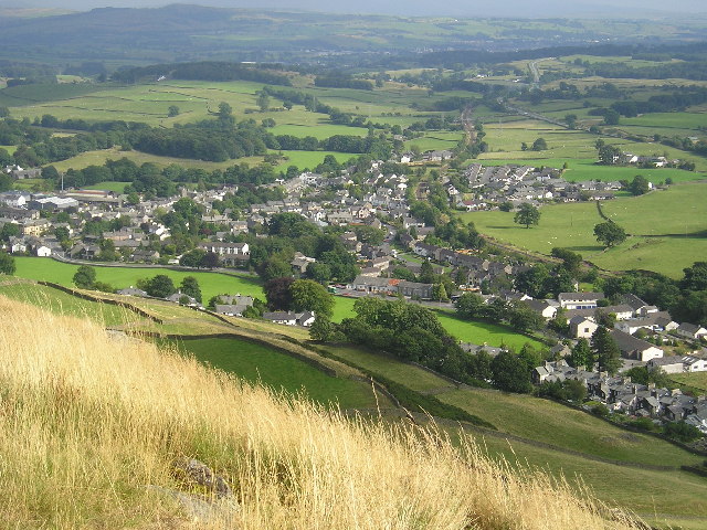
Staveley (grid reference SD469981) is a village in the Westmorland and Furness Unitary Authority, in Cumbria, England. Historically part of Westmorland, it is situated 4 miles (6 km) northwest of Kendal where the River Kent is joined by its tributary the Gowan. It is also known as Staveley-in-Westmorland and Staveley-in-Kendal to distinguish it from Staveley-in-Cartmel (a small village near Newby Bridge which is now in Cumbria but was previously in Lancashire). There are three civil parishes – Nether Staveley, Over Staveley and Hugill (part).
From the Wikipedia article Staveley, Cumbria (this version), under CC BY-SA 4.0.
Things to do9



Museums and landmarks3

Hugill Hall
Monument and historic site · 1.5 mi
Birth place of Peter Collinson, naturalist
Parks, trails and playgrounds1

Restaurants and cafes11
Pret A Manger
Fast food · Sandwich · 1.4 mi
Mo-Fr 06:00-17:00; Sa 07:00-17:00; Su 07:00-16:00
Staveley Chippy
Fast food · Fish And Chips
3 Main Street, Staveley



History
The area has been inhabited since around 4000 BC (evidence of which can be seen close to High Borrans) when ancient Britons established farms.
It has been suggested that the Romans built a road near Staveley to link the Roman forts at Kendal (Alauna) and Ambleside (Galava). However, the existence of any Roman road in the immediate vicinity of Kendal is not confirmed. On the other hand, the Roman road at High Street (a few miles north of Staveley) is well evidenced.
Weekly markets and a three-day annual fair were held from 1329 when the village was granted a market charter.
In the 18th century a turnpike road from Kendal to Ambleside was constructed through Staveley. In Dorothy Wordsworth's journal for 1802 there are references to an inn at Staveley (possibly the Eagle and Child). She wrote:
"I am always glad to see Stavel(e)y; it is a place I dearly love to think of"
Since the 1840s Staveley has had a railway station on the Windermere Branch Line from Windermere to Oxenholme. It is one of only a few locations in the Lake District National Park to have a station, but in the 19th century most tourists continued their journey to the railhead at Windermere. Staveley remained relatively unaffected by mass tourism until the 20th century.
Read more of the history
Another 19th-century project built through Staveley is the Thirlmere Aqueduct, commissioned in 1894. On its way to Manchester, the aqueduct passes under the River Kent at Staveley. Although the Staveley section of the aqueduct was constructed underground (via "cut-and-cover" and tunnelling techniques), some of the infrastructure associated with it is visible.
In the Middle Ages, the mills at Staveley produced woollen cloth. During the Industrial Revolution there was cotton production at Staveley, and there is an 18th-century mill building from this time. The cotton industry shifted to Lancashire, and the Staveley mills were converted to work wood. By 1850 bobbin turning was the main industry in the valley.
While there is no longer any bobbin production, there are a carpentry businesses in the village including Peter Hall.
At the weir by Wilf's Cafe visitors can see water being drawn from the River Kent, which originally powered a waterwheel, replaced in 1902 with turbines.
From the History section of Staveley, Cumbria on Wikipedia, under CC BY-SA 4.0.
More about Staveley
Geography
The village is strategically placed at the junction of the rivers Kent and Gowan, at the mouth of the Kentmere Valley. Three hills overlook the village; Reston Scar on the north side on which much of the village is built, Piked Howe to the northeast known to the locals as Craggy Wood and Lily Fell to the south in the direction of the village of Crook on the opposite side of the A591 bypass. Piked Howe and Reston Scar sit either side of the opening into the Kentmere Valley. Both mark the beginning of a larger horseshoe chain of hills known as the Kentmere Round.
The nearest village to the west is Ings, a small settlement which now shares schools and parish minister with Staveley.
To the south of the village is Crook, and to the north Kentmere which can only be accessed by road via Staveley village centre, meaning that the two villages have had a close relationship with each other for many centuries. But the village which had the strongest links to Staveley in more recent years is arguably Burneside which is the next stop on the railway line to the east on the way to Kendal. National Cycle Route 6 and the Dales Way footpath run through Burneside and Staveley.
Education
Staveley CE Primary School was founded in 1755 and moved to its present position at Brow Lane on Reston Scar in 1840. A new building was built 30 years ago to house the infant classes. The school also caters for children from the nearby villages of Crook, Kentmere and Ings. Before the modern-day school that exists now, the school used to be housed in a small cottage on Main Street next to St. Margaret's Tower.
The intimate (48 seat capacity) Staveley Roundhouse (a former gas holder) provides year-round entertainment in the form of plays, art exhibitions, music and quiz nights.
From the Wikipedia article Staveley, Cumbria, under CC BY-SA 4.0.
Notable people from Staveley
- John BrookesEnglish footballer (born 1943)
Born in Staveley, according to Wikidata (CC0). Each name links to its Wikipedia article.
Where to stay6
Churches and places of worship4
Shopping9
Gas and EV charging2
Schools, colleges and libraries1
Healthcare1
Map of Staveley
47 places. The map loads OpenStreetMap tiles when you open it.
Getting there and nearby towns
Walney Aerodrome (BWF) is the nearest airport with scheduled flights listed in OpenStreetMap, 25 miles away.
- Burneside 3 mi southeast, about 5 min by car
- Kendal 4 mi southeast, about 7 min by car
- Ulverston 17 mi southwest, about 27 min by car
- Penrith 20 mi north, about 32 min by car
- Morecambe 21 mi south, about 34 min by car
- Lancaster 23 mi south, about 37 min by car
- Heysham 23 mi south, about 37 min by car
- Barrow in Furness 25 mi southwest, about 40 min by car
- Fleetwood 32 mi south, about 52 min by car
- Whitehaven 33 mi west, about 53 min by car
Drive times are estimates from straight-line distance, not routes.
Towns near Staveley


Keep exploring
Local news
Headlines from INDB.
Reviews, tips and questions
Loading what members have shared...
Sources and licences
- GeoNames (CC BY 4.0): population, coordinates, regions and time zone
- Mapillary (see each image): photos
- OpenStreetMap contributors (ODbL 1.0): places, airports, map data
- Wikidata (CC0 1.0): elevation, founding date, time zone, website, landmarks and historic places
- Wikimedia Commons (see each image): photos
- Wikipedia (CC BY-SA 4.0): overview and history text
Photo credits
- Staveley from Reston Scar, Richard Swales, CC BY-SA 2.0
- 195126 Staveley, Sexy Simon, CC BY-SA 4.0
- Reston Scar above Staveley from across the valley, David Edgar, CC BY-SA 4.0
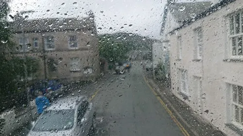
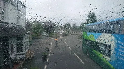
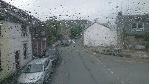
- Street-level photo, skifans, CC BY-SA 4.0
- Street-level photo, skifans, CC BY-SA 4.0
- Street-level photo, skifans, CC BY-SA 4.0
- Street-level photo, skifans, CC BY-SA 4.0
- Street-level photo, OrangeHurst97, CC BY-SA 4.0
- Street-level photo, skifans, CC BY-SA 4.0
- Street-level photo, skifans, CC BY-SA 4.0
- Street-level photo, skifans, CC BY-SA 4.0
- Street-level photo, OrangeHurst97, CC BY-SA 4.0
- Street-level photo, skifans, CC BY-SA 4.0
- Street-level photo, OrangeHurst97, CC BY-SA 4.0
- Street-level photo, OrangeHurst97, CC BY-SA 4.0
- Street-level photo, OrangeHurst97, CC BY-SA 4.0
- Street-level photo, OrangeHurst97, CC BY-SA 4.0
Page built November 10, 2026. Spotted a mistake? Tell us or suggest a place.