


Craigavon, United Kingdom
Craigavon is a town of 59,236 people in Northern Ireland, United Kingdom, founded in 1965.
Why visit Craigavon
Townapedia lists 5 museums and landmarks, 3 parks and trails, 14 places to eat, 1 place to stay and 2 attractions in and around town.
Highlights include Town Hall Theatre, Portadown, Craigavon Omniplex, Barn Museum and Oxford Island.
Weather in Craigavon
Forecast from MET Norway (CC BY 4.0). Full forecast
About Craigavon
Craigavon is a town in north County Armagh, Northern Ireland. It was a planned settlement, begun in 1965, and named after the first Prime Minister of Northern Ireland: James Craig, 1st Viscount Craigavon. It was intended to be the heart of a new linear city incorporating Lurgan and Portadown, but this plan was mostly abandoned and later described as having been flawed. Locally, "Craigavon" refers to the urban area between the two towns.
From the Wikipedia article Craigavon (this version), under CC BY-SA 4.0.
Things to do2

Town Hall Theatre, Portadown
Cinema and theater · 2.8 mi
Town hall in Portadown, County Armagh, Northern Ireland
Museums and landmarks5


Parks, trails and playgrounds3

Restaurants and cafes14
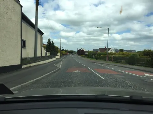
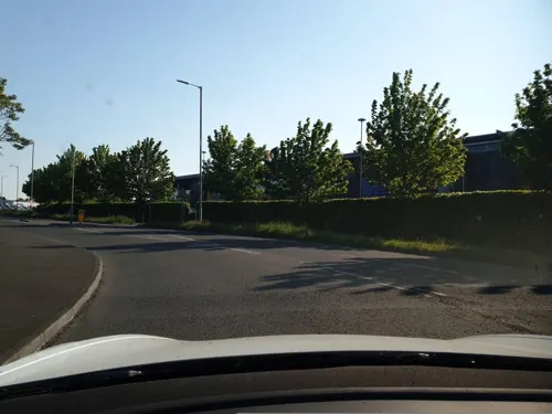




2 more on the map.
History
Craigavon was planned as a 'new city' for Northern Ireland that would mirror towns such as Cumbernauld and, later, Milton Keynes in Great Britain. It was conceived as a linear city that would link the towns of Lurgan and Portadown to create a single urban area and identity. The argument for a new town was based on projections indicating population increases over the following decades that would require large-scale house building. Similar projects successfully attracting economic growth had been successfully completed in Great Britain, so it was in some ways a symbol of Northern Ireland as both modern and a part of the British mainstream. The Craigavon Development Commission was appointed in October 1965 to develop the 'new city'.
Read more of the history
About 6,000 acres of land between Lurgan and Portadown was vested from farmers at £6 an acre. Several reasons have been suggested for the suitability of the site including the existing population centres, industrial base, nearness to Belfast and the belief that Craigavon would help spread development away from Belfast. It was hoped that residents of Belfast would be attracted by the suburban nature of Craigavon's design and that business would see it as an interesting alternative. Cash incentives were offered to some families moving to Craigavon. The M1 motorway was built to link the new city with Belfast and there were plans to replace the Lurgan and Portadown railway stations with a single high speed terminal in central Craigavon. The Craigavon Area Hospital was built to replace small hospitals in the two towns.
The design of Craigavon was based on Modernism and imbued with the spirit of the age. The design team was headed by the Scottish architect James Moffatt Aitken, formerly Chief Architect to the Ministry of Health and then Chief Planner for the Ministry of Development in Northern Ireland. The plan separated motor vehicles from pedestrians and cyclists wherever possible, creating a network of paths allowing residents to travel across Craigavon without encountering traffic. The road network for motor vehicles used roundabouts instead of traffic lights at junctions, giving the planners the ability to easily increase the number of lanes if it became necessary. Electricity and other cables were placed underground and street lighting was standard throughout. The planners clustered the housing developments around small 'village centres' with associated retail space, leisure facilities, post offices, primary schools, pharmacies, community centres and other civic amenities. All estates were built with security in mind, with one vehicle entry/exit point. Single-use zoning was part of the design; there was a total separation of industrial land-use from all other uses.
Craigavon was designed to be a very child-friendly environment with small playgrounds dotted throughout the residential areas. There was an emphasis on providing green space in the housing estates and safe paths to cycle on. National Cycle Route 9 passes through the town. The new town was also provided with many civic amenities including a leisure centre, library, shopping centre, civic centre, a large park with artificial lakes, playing fields, a petting zoo, public gardens and an artificial ski slope. Craigavon Civic Centre was built at a cost of £3 million and was officially opened by the Duke of Abercorn in April 1983.
There was controversy over the decision to build a 'new city' in the mainly Protestant/unionist east rather than to develop the mainly Catholic city of Derry. There was also controversy over the decision to name it after the James Craig, 1st Viscount Craigavon (1871–1940), a Protestant unionist leader. Some unionists also felt the decision was unwise and counterproductive to building cross-community relations. Knockmena (a corruption of the townland name, Knockmenagh) was the preferred name nationalists hoped would be used, and which might have attracted broad acceptance on both sides. On 6 July 1965, it was announced that the new city would be named Craigavon after Craig. A noted nationalist, Joseph Connellan, interrupted the announcement with the comment, "A Protestant city for a Protestant people". Irish Labour MP Gerry Fitt described the naming of the new city as "a calculated insult" and Nationalist MP for East Tyrone Austin Currie said "To call this new city after someone who is looked upon by over one-third of the population as an arch-bigot is something that ought to be abhorred."
Problems began to come to light when it emerged that some housing estates had been built with materials and techniques that had not been fully tested, with the result that insulation, sound-proofing and durability were lacking. This was compounded by the outbreak of 'the Troubles' in the late 1960s, which resulted in sectarian violence and segregation. Investment into Northern Ireland dried up and emigration rose. The Craigavon Development Commission was wound up in 1973 and Craigavon Borough Council created. The area's main employer, Goodyear, had a large fan-belt factory in the Silverwood industrial estate, and at the time it was Europe's largest factory. However, the plant failed to make money on a consistent basis, and had to shut in 1983.
From the History section of Craigavon on Wikipedia, under CC BY-SA 4.0.
More about Craigavon
Geography
Craigavon lies on an area of flat land near the southeastern shore of Lough Neagh. The surrounding settlements (listed clockwise) are Aghacommon (north), Lurgan (northeast), Corcreeny (east), Bleary (southeast) and Portadown (southwest). It is separated from these surrounding settlements mostly by fields.
Craigavon is built beside two artificial lakes called Craigavon Lakes. The Portadown–Lurgan railway line runs between the two lakes, and further north is the M1 motorway, which runs parallel with the railway line. The area around Craigavon Lakes is a public park and wildlife haven made up of woodland with walking trails. In 2017 it was awarded the best park in Northern Ireland by Fields in Trust. Recent plans to build in the park, beginning with a college campus, have met opposition from some locals.
Much of Craigavon is within the civil parish of Seagoe. The following is a list of townlands within Craigavon's urban area (excluding Lurgan, Portadown and Bleary), along with their likely etymologies:
Crossmacahilly (from Cros Mhic Eachmhilidh meaning "McAughley's crossroads")
Drumnagoon (from Dromainn Uí Dhubháin meaning "O'Doone's ridge")
Legaghory or Legahory (from Log a' Choire meaning "hollow of the cauldron")
Monbrief (historically also Moybreefe, perhaps from Má Bhreagh meaning "plain of the rising ground" or Má Bhréach, "plain of wolves")
Education
Tullygally Primary School (Controlled) - a mixed religion school. It has about 100 pupils at any one time. It was built by the government with the original founding of Craigavon and was part of the library board. The size of the primary school was reduced in recent years and half of it now accommodates an adult learning centre. There are many more primary and secondary schools in the wider Craigavon areas of Lurgan, Portadown, etc.
Local secondary schools include Craigavon Integrated College (Controlled), which was one of the first integrated secondary schools in Northern Ireland. Lismore College (Catholic maintained) is also in the area.
There are also plans to build a Southern Regional College campus beside Craigavon Lake. The plans have met opposition from some locals, as it would involve the destruction of woodland which is home to endangered wildlife.
From the Wikipedia article Craigavon, under CC BY-SA 4.0.
Notable people from Craigavon
 Rory BestIrish rugby union playerPhoto: Warwick Gastinger, CC BY 2.0
 Iain HendersonIrish rugby union playerPhoto: Stefano Delfrate, CC BY-SA 2.0
 Thomas StewartNorthern Irish footballerPhoto: Splitfire1000, CC BY-SA 3.0
 Niall HendersonEnglish footballer (born 1988)Photo: Mattythewhite, CC BY-SA 3.0
 Jack CarsonIrish cricketerPhoto: Dave Morton, Public domain
 Eimear McGeownIrish traditional and classical flautistPhoto: Werlieae, CC0
- Paul BerryNorthern Ireland politician (born 1976)
- Kirsty BarrNorthern Irish trap shooter
- James McCollumcricketer
- Lee NelsonIrish cricketer
- Ciarán TonerNorthern Irish footballer (born 1981)
- Jason McKayBritish boxer
Born in Craigavon, according to Wikidata (CC0). Each name links to its Wikipedia article.
Where to stay1
Churches and places of worship11
Shopping12
Gas and EV charging7
Schools, colleges and libraries11
St Anthony's Primary School
School · Roman Catholic · 0.8 mi
Tullygally Road, Craigavon
Healthcare3
Map of Craigavon
69 places. The map loads OpenStreetMap tiles when you open it.
Getting there and nearby towns
Belfast International Airport (BFS) is the nearest airport with scheduled flights listed in OpenStreetMap, 16 miles away.
- Portadown 3 mi southwest, about 5 min by car
- Banbridge 8 mi southeast, about 13 min by car
- Armagh 13 mi southwest, about 21 min by car
- Lisburn 15 mi east, about 24 min by car
- Dungannon 16 mi west, about 25 min by car
- Newry 19 mi south, about 30 min by car
- Antrim 20 mi north, about 32 min by car
- Cookstown 20 mi northwest, about 32 min by car
- Belfast 21 mi northeast, about 34 min by car
- Newtownabbey 24 mi northeast, about 39 min by car
Drive times are estimates from straight-line distance, not routes.
Towns near Craigavon


Keep exploring
Local news
Headlines from INDB.
Reviews, tips and questions
Loading what members have shared...
Sources and licences
- GeoNames (CC BY 4.0): population, coordinates, regions and time zone
- Mapillary (see each image): photos
- OpenStreetMap contributors (ODbL 1.0): places, airports, map data
- Wikidata (CC0 1.0): elevation, founding date, time zone, website, landmarks and historic places
- Wikimedia Commons (see each image): photos
- Wikipedia (CC BY-SA 4.0): overview and history text
Photo credits
- Craigavon Lakes - panoramio (7), Gfox228, CC BY 3.0
- Craigavon Lakes - panoramio (10), Gfox228, CC BY 3.0
- Craigavon Lakes - panoramio (13), Gfox228, CC BY 3.0
- Craigavon Lakes - panoramio (1), Gfox228, CC BY 3.0
- Drumcree Church 2018-07-26 - 1, August Schwerdfeger, CC BY 4.0
- Rushmere (01), August 2009, Ardfern, CC BY-SA 3.0
- Street-level photo, yannakis, CC BY-SA 4.0
- Street-level photo, yannakis, CC BY-SA 4.0
- Street-level photo, mackerski, CC BY-SA 4.0
- Street-level photo, yannakis, CC BY-SA 4.0
- Street-level photo, yannakis, CC BY-SA 4.0
- Street-level photo, yannakis, CC BY-SA 4.0
- Street-level photo, yannakis, CC BY-SA 4.0
- Street-level photo, mackerski, CC BY-SA 4.0
- Street-level photo, mackerski, CC BY-SA 4.0
Page built November 10, 2026. Spotted a mistake? Tell us or suggest a place.