


Armagh, United Kingdom
Armagh is a town of 14,801 people in Northern Ireland, United Kingdom.
Why visit Armagh
Townapedia lists 19 museums and landmarks, 8 parks and trails, 53 places to eat, 3 places to stay and 3 attractions in and around town.
Highlights include Armagh Omniplex, Royal Irish Fusiliers Museum, Armagh County Museum and The Mall.
Weather in Armagh
Forecast from MET Norway (CC BY 4.0). Full forecast
About Armagh
Armagh ( ar-MAH; Irish: Ard Mhacha, IPA: [ˌaːɾˠd̪ˠ ˈwaxə], "Macha's height") is a city and the county town of County Armagh, in Northern Ireland, as well as a civil parish. It is the ecclesiastical capital of Ireland – the seat of the Archbishops of Armagh, the Primates of All Ireland for both the Roman Catholic Church and the Church of Ireland. In ancient times, nearby Navan Fort (Eamhain Mhacha) was a pagan ceremonial site and one of the great royal capitals of Gaelic Ireland. Today, Armagh is home to two cathedrals (both named after Saint Patrick) and the Armagh Observatory, and is known for its Georgian architecture.
From the Wikipedia article Armagh (this version), under CC BY-SA 4.0.
Travel tips from other travellers: Armagh on Wikivoyage (CC BY-SA 4.0).
Photos of Armagh


Things to do3

Museums and landmarks19
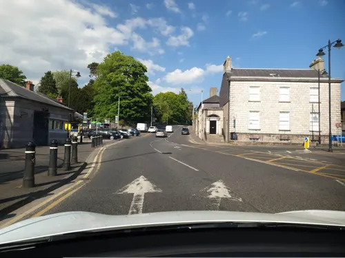
Royal Irish Fusiliers Museum
Museum · 0.6 mi
Museum in Armagh, County Armagh, Northern Ireland
The Mall, Armagh


Navan Fort
Monument and historic site · 2.1 mi
Archaeological site in County Armagh, Northern Ireland, UK
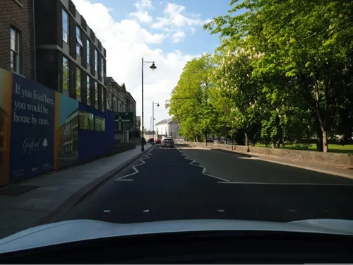
Crimean Cannon
Monument and historic site · 0.6 mi
Cannon captured in 1854 from the Russians in the Crimean War.
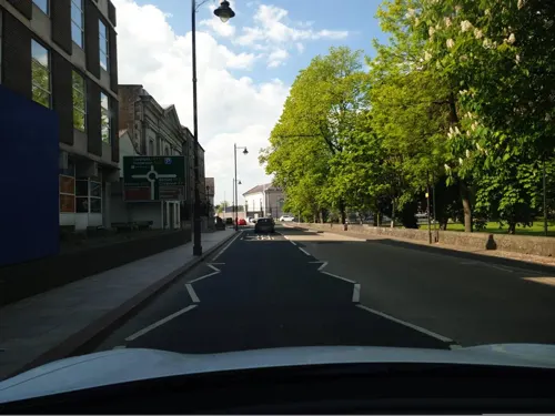


King's Stables
Monument and historic site · 1.8 mi
Archaeological site in Northern Ireland
7 more on the map.
Parks, trails and playgrounds8


BOX-IT Athletic Grounds
Sports field and stadium · 0.5 mi
Dalton Park, Armagh



Restaurants and cafes53

Caffè Nero
Cafe · Coffee Shop · 0.6 mi
58 Scotch Street, Armagh
Mo-Fr 07:00-18:00; Sa 07:30-19:00; Su 08:00-18:00

Caife Mhacha
Cafe · Irish, Sandwich, Drinks, Coffee Shop, Coffee, Tea, Cake · 0.4 mi
74-76 Upper English Street, Armagh

41 more on the map.
History
Eamhain Mhacha (or Navan Fort), at the western edge of Armagh, was an ancient pagan ritual or ceremonial site. According to Irish mythology it was one of the great royal sites of Gaelic Ireland and the capital of Ulster. It appears to have been largely abandoned after the 1st century. In the 3rd century, a ditch and bank was dug around the top of Cathedral Hill, the heart of what is now Armagh. Its circular shape matches the modern street layout. Evidence suggests that it was a pagan sanctuary and the successor to Navan. Like Navan, it too was named after the goddess Macha: Ard Mhacha, meaning "Macha's height". This name was later anglicised as Ardmagh, which eventually became Armagh. Navan and Armagh were linked by an ancient road which passes over Mullacreevie hill.
Read more of the history
After Christianity spread to Ireland, the pagan sanctuary was converted into a Christian one, and Armagh became the site of an important church and monastery. According to tradition, Saint Patrick founded his main church there in the year 445, and it eventually became the head church of Ireland. Muirchú writes that a pagan chieftain named Dáire would not let Patrick build a church on the hill of Ard Mhacha, but instead gave him lower ground to the east. One day, Dáire's horses died after grazing on the church land. He told his men to kill Patrick, but was himself struck down with illness. They begged Patrick to heal him, and Patrick's holy water revived both Dáire and his horses. Dáire rewarded Patrick with a great bronze cauldron and gave him the hill of Ard Mhacha to build a church. Dáire has similarities with the Irish god the Dagda.
By the 7th century, Armagh had become the site of the most important church, monastery and monastic school in the north of Ireland. The Book of Armagh was produced in the monastery in the early 9th century and contains some of the oldest surviving specimens of Old Irish.
Armagh was at the heart of the kingdom of the Airthir, a part of the Airgíalla federation. The church at Armagh looked to both the Airthir and neighbouring Uí Néill for patronage. The Uí Néill High King, Niall Caille (Niall of the Callan), was buried at Armagh in 846 after drowning in the River Callan. His son, High King Áed Findliath, had a house at Armagh.
The first Viking raids on Armagh were recorded in 832, with three in one month, and it suffered at least ten Viking raids over the following century. A hoard seemingly lost by Vikings in the River Blackwater shows the high quality of metalwork being made in Armagh at this time.
Brian Boru, High King of Ireland, visited Armagh in 1004, acknowledging it as the head church of Ireland and bestowing it a large sum of gold. Brian was buried at Armagh cathedral after his death at the Battle of Clontarf in 1014. Armagh's claim to being the head church of Ireland was formally acknowledged at the Synod of Ráth Breasail in 1111. The 1171 Council of Armagh freed all Englishmen and women who were enslaved in Ireland.
Following the Anglo-Norman invasion of Ireland, Armagh was attacked by Anglo-Normans led by Philip de Worcester in 1185 and by John de Courcy in 1189. It was also raided by Ruaidrí mac Duinn Sléibe of Ulaid in 1196 and 1199.
Archbishop Máel Patraic Ua Scannail rebuilt Armagh cathedral in 1268 and founded a Franciscan friary, whose remains can still be seen. There was also a small Culdee community in Armagh until the 16th century.
During the 16th century Tudor conquest of Ireland, Armagh suffered greatly in the conflict between the English and the O'Neills. Armagh was strategically important as it lay between the English Pale and the O'Neill heartland of Tyrone, and the town changed hands many times during the wars. In the 1560s, English troops under Thomas Radclyffe occupied and fortified the town, which was then attacked and largely destroyed by Shane O'Neill. After the Battle of the Yellow Ford in 1598, the routed English army took refuge at Armagh before surrendering to Hugh O'Neill. By the end of the Nine Years' War, Armagh lay in ruins, as shown on Richard Bartlett's 1601 map.
Following the Nine Years' War, Armagh came under English dominance and the cathedral came under the control of the Protestant Church of Ireland. The cathedral was rebuilt under Archbishop Christopher Hampton and the town began to be settled by Protestants from Britain, as part of the Plantation of Ulster. During the Irish Rebellion of 1641, many British settlers fled to Armagh cathedral for safety. After negotiations with the besieged settlers, Catholic rebels under Felim O'Neill occupied the town. In May 1642, following several rebel defeats and massacres by settlers elsewhere, the rebels in Armagh seized the settlers' property and set fire to the town.
The parliamentary borough of Armagh was a two-seat constituency in the Irish House of Commons prior to 1801. It continued as a one-seat constituency in the United Kingdom House of Commons from 1801 to 1885. It had a municipal corporation which was abolished under the Municipal Corporations (Ireland) Act 1840.
Armagh has been an educational centre since the time of Saint Patrick, and thus it has been referred to as "the city of saints and scholars". The educational tradition continued with the foundation of the Royal School in 1608, St Patrick's College in 1834 and the Armagh Observatory in 1790. The Observatory was part of Archbishop Lord Rokeby's plan to have a university in the city. This ambition was finally fulfilled, albeit briefly, in the 1990s when Queen's University of Belfast opened an outreach centre in the former hospital building.
From the History section of Armagh on Wikipedia, under CC BY-SA 4.0.
Notable people from Armagh
 Colin MorganNorthern Irish actorPhoto: Colinsdimple, CC BY-SA 4.0
 Saint MalachyIrish Roman Catholic abbot, archbishop and saint (1094-1148)Photo: Andreas F. Borchert, CC BY-SA 4.0
 John LennoxNorthern Irish mathematician and philosopher of science (b. 1943)Photo: Christliches Medienmagazin pro, CC BY-SA 2.0
 Patrick MageeNorthern Irish actor (1922–1982)Photo: Francis Ford Coppola / Roger Corman..., Public domain
 Seamus McGarveyIrish cinematographerPhoto: Unknown author, Public domain
 Brian KirkIrish film and television directorPhoto: Walid Farouk, CC BY-SA 4.0
 Jim Nicholson (Northern Ireland politician)British politician (born 1945)Photo: Foto-AG Gymnasium Melle, CC BY-SA 3.0
 Francis JohnstonIrish architectPhoto: Henry Hoppner Meyer / After Thomas..., Public domain
 John TaylorBritish life peerPhoto: Roger Harris, CC BY 3.0
- Ian Paisleypolitician and former church minister (1926-2014)
- Charles WoodIrish composer
- Christopher VokesCanadian general (1904–1985)
Born in Armagh, according to Wikidata (CC0). Each name links to its Wikipedia article.
Where to stay3
Churches and places of worship15
Saint Patrick's Cathedral (Roman Catholic)
Church · Roman Catholic · 0.4 mi
Cathedral Road, Armagh
Shopping21
Gas and EV charging8
Schools, colleges and libraries18
Healthcare8
Map of Armagh
156 places. The map loads OpenStreetMap tiles when you open it.
Getting there and nearby towns
Belfast International Airport (BFS) is the nearest airport with scheduled flights listed in OpenStreetMap, 28 miles away.
- Portadown 10 mi northeast, about 17 min by car
- Dungannon 11 mi north, about 18 min by car
- Banbridge 15 mi east, about 25 min by car
- Newry 18 mi southeast, about 29 min by car
- Cookstown 20 mi north, about 33 min by car
- Lisburn 28 mi northeast, about 45 min by car
- Omagh 31 mi northwest, about 49 min by car
- Belfast 34 mi northeast, about 55 min by car
- Newtownabbey 37 mi northeast, about 1 h by car
- Ballymena 39 mi northeast, about 1 h by car
Drive times are estimates from straight-line distance, not routes.
Towns near Armagh


Keep exploring
Local news
Headlines from INDB.
Reviews, tips and questions
Loading what members have shared...
Sources and licences
- GeoNames (CC BY 4.0): population, coordinates, regions and time zone
- Mapillary (see each image): photos
- OpenStreetMap contributors (ODbL 1.0): places, airports, map data
- Wikidata (CC0 1.0): elevation, founding date, time zone, website, landmarks and historic places
- Wikimedia Commons (see each image): photos
- Wikipedia (CC BY-SA 4.0): overview and history text
Photo credits
- Armagh 2013 09 24, Andreas F. Borchert, CC BY-SA 4.0
- Armagh Roman Catholic Cathedral of St. Patrick West Transept North Wall Window Sts. Mel and Brigid Lower Scene 2013 09 24, Andreas F. Borchert, CC BY-SA 4.0
- Armagh Roman Catholic Cathedral of St. Patrick West Transept North Wall Window Sts. Mel and Brigid 2013 09 24, Andreas F. Borchert, CC BY-SA 4.0
- Armagh Roman Catholic Cathedral of St. Patrick West Transept South Wall Window St. Malachy 2013 09 24, Andreas F. Borchert, CC BY-SA 4.0
- Armagh Roman Catholic Cathedral of St. Patrick Statue of Daniel McGettigan by Pietro Lazzerini II 2013 09 24, Andreas F. Borchert, CC BY-SA 4.0
- Armagh's Catholic cathedral - panoramio, Keith Ruffles, CC BY 3.0
- Armagh Roman Catholic Cathedral of St. Patrick West Aisle Window 01 Upper Lights St. Patrick receiving his mission 2013 09 24, Andreas F. Borchert, CC BY-SA 4.0
- Armagh Roman Catholic Cathedral of St. Patrick Statue of Daniel McGettigan by Pietro Lazzerini Crop 2013 09 24, Andreas F. Borchert, CC BY-SA 4.0
- Armagh Roman Catholic Cathedral of St. Patrick Statue of Daniel McGettigan by Pietro Lazzerini 2013 09 24, Andreas F. Borchert, CC BY-SA 4.0
- Armagh Roman Catholic Cathedral of St. Patrick West Aisle Window 01 St. Patrick's receives his mission – St. Patrick's death 2013 09 24, Andreas F. Borchert, CC BY-SA 4.0
- Armagh Roman Catholic Cathedral of St. Patrick West Aisle Window 02 St. Dympna 2013 09 24, Andreas F. Borchert, CC BY-SA 4.0
- Armagh Roman Catholic Cathedral of St. Patrick West Aisle Window 02 Upper Lights Flight of St. Dympna 2013 09 24, Andreas F. Borchert, CC BY-SA 4.0
- Armagh Roman Catholic Cathedral of St. Patrick West Transept West Wall Window Assumption and General Council of Ephesus 2013 09 24, Andreas F. Borchert, CC BY-SA 4.0
- Armagh Roman Catholic Cathedral of St. Patrick West Aisle Window 02 Lower Lights Martyrdom of St. Dympna 2013 09 24, Andreas F. Borchert, CC BY-SA 4.0
- MuseumArmagh (2), Notafly, CC BY-SA 3.0
- Armagh Public Library (01), November 2009, Ardfern, CC BY-SA 3.0
- Navan, Jon Sullivan, Public domain
- StPatsRCCathedralArmagh, original uploader was Baronplantagenet at en.wikipedia, CC BY-SA 3.0
- 01 Armagh Cathedral West Facade, NateBergin, CC BY 4.0
- Gary Wales Stand Up To Cancer, Brian2483, CC BY-SA 4.0
- The Mall, Armagh, Kenneth Allen, CC BY-SA 2.0
- Street-level photo, yannakis, CC BY-SA 4.0
- Street-level photo, yannakis, CC BY-SA 4.0
- Street-level photo, yannakis, CC BY-SA 4.0
- Street-level photo, yannakis, CC BY-SA 4.0
- Street-level photo, yannakis, CC BY-SA 4.0
- Street-level photo, yannakis, CC BY-SA 4.0
- Street-level photo, debigc, CC BY-SA 4.0
- Street-level photo, yannakis, CC BY-SA 4.0
- Street-level photo, yannakis, CC BY-SA 4.0


Page built November 10, 2026. Spotted a mistake? Tell us or suggest a place.