


Why visit Monmouth
Townapedia lists 22 museums and landmarks, 11 parks and trails, 45 places to eat, 4 places to stay and 13 attractions in and around town.
Highlights include Monnow Bridge, Savoy Theatre, Shire Hall and Monmouth War Memorial.
Weather in Monmouth
Forecast from MET Norway (CC BY 4.0). Full forecast
About Monmouth
Monmouth ( MON-məth or MUN-; Welsh: Trefynwy, lit. 'Town on the Monnow') is a market town and community in Monmouthshire, Wales, situated on where the River Monnow joins the River Wye, two miles (three kilometres) from the Wales–England border. The population in the 2011 census was 10,508, rising from 8,877 in 2001. Monmouth was the county town of historic Monmouthshire, although Abergavenny is the largest settlement and Monmouthshire County Council has its main offices at Rhadyr, just outside Usk. Monmouth is in the UK Parliament constituency of Monmouthshire and the Senedd constituency of Monmouth.
From the Wikipedia article Monmouth (this version), under CC BY-SA 4.0.
Travel tips from other travellers: Monmouth on Wikivoyage (CC BY-SA 4.0).
Photos of Monmouth


Things to do13


Biblins Bridge
Bridge · 2.7 mi
Bridge in Wye Valley, spanning England and Wales, UK


Penallt Viaduct
Bridge · 2.5 mi
Former railway bridge over the River Wye between England and Wales

Savoy Theatre, Monmouth
Cinema and theater
Theatre and cinema in Monmouth, Wales

Wye Bridge, Monmouth
Bridge
Grade II listed bridge in Monmouth. The principal entry to Monmouth from the south and east.


Redbrook Incline Bridge
Bridge · 2.4 mi
Tram bridge crossing the England–Wales border

1 more on the map.
Museums and landmarks22

Shire Hall
Monument and historic site
Agincourt Square, Monmouth
Mo-Tu 11:00-16:00; We Off; Th-Su 11:00-16:00

Monmouth War Memorial
Monument and historic site
War memorial in Monmouth, Wales

Blestium
Monument and historic site
Archaeological site in Monmouth, Wales, UK



Monmouth Castle & Regimental Museum
Museum
Castle Hill, Monmouth
Jan-Mar Mo-Su "by appointment"; Apr-Oct Mo-Su 14:00-17:00; Nov-Dec...
Castle and Regimental Museum, Monmouth
Museum
Military museum in Monmouth, Wales, United Kingdom

War Memorial of the Royal Monmouthshire Royal Engineers
Monument and historic site
War memorial in Monmouth, Wales
10 more on the map.
Parks, trails and playgrounds11

Vauxhall Fields, Monmouth
Park · 0.4 mi
Park in Monmouth, United Kingdom



Lady Park Wood National Nature Reserve
Park · 2.5 mi
Fforest and nature park mostly in Monmouthshire, Wales (part in England)
Monmouth Petanque Club terrain
Park · 0.7 mi
Terrain, or playing area, for the game of petanque
Restaurants and cafes45

The Punch House
Bar and pub
4 Agincourt Square, Monmouth
Mo-Th 10:00-23:00; Fr-Sa 10:00-00:00; Su 10:00-23:00
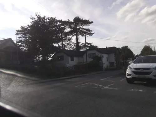

Old Nags Head
Bar and pub
Granville Street, Monmouth
Mo-Fr 14:00-00:00; Sa 12:00-00:00; Su 12:00-23:00
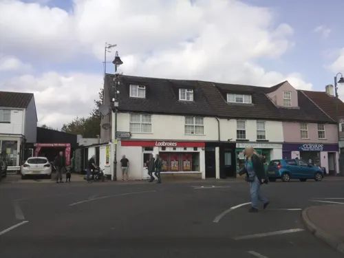
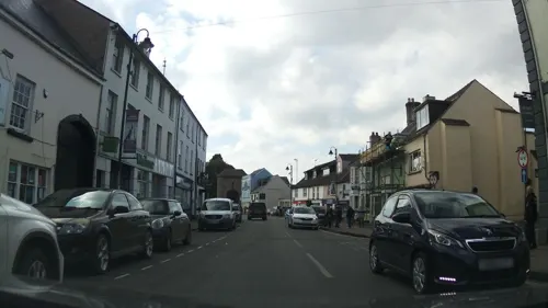
Himalayan Lounge
Restaurant · Indian
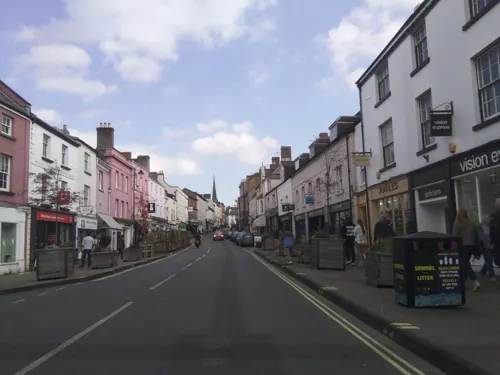
107 Monnow Street, Monmouth
Mo Off; Tu-Th 17:00-22:30; Fr-Sa 17:00-23:00; Su 17:00-22:30
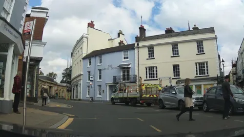
Indian Summer
Restaurant · Indian
1, Monmouth
Mo 17:00-23:00; Tu Off; We-Sa 17:00-23:00; Su 17:00-22:30
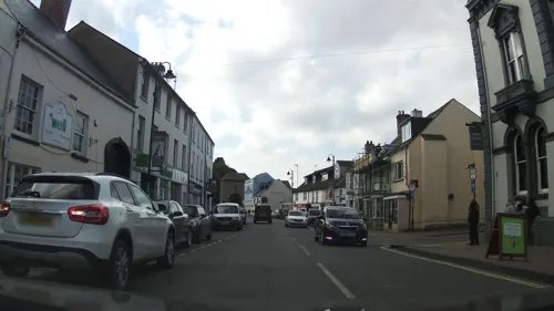
La Piccola Italia
Restaurant · Italian
100 Monnow Street, Monmouth
Mo-Sa 12:00-15:00,17:00-22:30; Su 12:00-21:30

The Club
Bar and pub
Whitecross Street, Monmouth
Mo-Sa 12:00-23:00; Su 12:00-22:30


Misbah Tandoori
Restaurant · Indian
9 Priory Street, Monmouth
Mo 17:00-22:00; Tu Off; We-Su 17:00-22:00
33 more on the map.
History
Excavations undertaken by the Monmouth Archaeological Society on sites along Monnow Street have uncovered details of the early history of the town. The Council for British Archaeology has designated Monmouth as one of the top ten towns in Britain for archaeology.
Evidence of a Bronze Age boat building community, including three 100-foot-long (30-metre) channels adjoining the site of a now-vanished lake, was discovered in September 2013, during archaeological investigations by the Monmouth Archaeological Society of the Parc Glyndwr housing development site, immediately north-west of the town.
The excavations later revealed the remains of a Neolithic dwelling. The dwelling was constructed on stilts on a human-made island away from the lake shore in water up to 10 ft (3 m) deep. Oak timbers had been "skillfully" cut with stone or flint axes to form stilts, of posts and poles, which "probably" rested on three parallel fully-grown tree 'sleeper beams', up to 3 feet 3 inches (1 m) wide, laid horizontally on the lakebed. Timbers from the structure were radiocarbon dated to 4867 years before present (BP).
Read more of the history
The first recorded settlement at Monmouth was the small Roman fort of Blestium, one of a network of military bases established on the frontiers of the Roman occupation. This was connected by road to the larger Roman towns at Glevum (Gloucester) and Isca Augusta (Caerleon). Archaeologists have found Roman pottery and coins within the modern town centre. During the later Roman period, between the 2nd and late 4th centuries, it appears to have been a centre for iron working, using the local iron ores and charcoal also worked at nearby Gobannium (Abergavenny) and Ariconium (near Ross-on-Wye).
After the end of Roman rule in Britain, the area was at the southern edge of the Welsh kingdom of Ergyng. The only evidence of continuing settlement at Monmouth is a record of a 7th-century church, at an unknown location within the town, dedicated to the Welsh saint Cadoc. In 1056, the area was devastated by the Welsh prince Gruffydd ap Llywelyn, on his way with an army of Welsh, Saxons and Danes to defeat Ralph, Earl of Hereford, and sack the Saxon burh at Hereford, 18 miles (29 km) to the north.
Following the Norman conquest of England in 1066, the Earldom of Hereford was given to William FitzOsbern of Breteuil, Normandy, one of King William's closest allies, who was responsible for defending the area against the Welsh. A new castle was built at Monmouth, holding commanding views over the surrounding area from a sound defensive site and exerting control over both river crossings and the area's important resources of farmland, timber and minerals. Initially it would have been a motte and bailey castle, later rebuilt in stone, and refortified and developed over time. A town grew up around it, and a Benedictine priory was established around 1075 by Withenoc, a Breton who became lord of Monmouth after Roger, the son of William fitzOsbern, was disgraced. The priory may have once been the residence of the monk Geoffrey of Monmouth, who was born around 1100 and is best known for writing the chronicle Historia Regum Britanniae ("History of the Kings of Britain").
The town was recorded in the Domesday Book as part of Herefordshire, and expanded thereafter. There was early burgage development along Monnow Street, and the suburb of Overmonnow, west of the river and protected by a defensive moat called the Clawdd-du or Black ditch, began to develop by the 12th century. Charters from the period refer to the town's trade in iron, and to forges making use of local ore and charcoal. The cinders produced by the forges formed heaps, and were used in building foundations; the name of Cinderhill Street in Overmonnow dates from this period.
During the period of turmoil between the supporters of King Henry III and the barons who sought to curtail his power, the town was the scene of a major battle in 1233, in which the king's forces were routed by the troops of Richard Marshal, Earl of Pembroke. Later, the castle was extended by Henry's son Edmund Crouchback, after he became Earl of Lancaster in 1267. In about 1300, town walls were built, and the Monnow Bridge was fortified. The bridge, now pedestrianised, remains in place, the only such fortified bridge in Britain and reputedly one of only three similar crossings in Europe.
King Edward II was briefly imprisoned at Monmouth Castle in 1326 after being overthrown by his wife Isabella and her lover Roger Mortimer. In the mid 14th century, the castle and town came into the possession of the House of Lancaster through the marriage of John of Gaunt to Blanche of Lancaster. John of Gaunt strengthened the castle, adding the great hall, and the castle became a favourite residence of the House of Lancaster. In 1386, John of Gaunt's grandson was born to Mary de Bohun, in the Queen's Chamber within the gatehouse of Monmouth Castle, while his father Henry Bolingbroke was hunting in the area. The boy was known as Henry of Monmouth before his coronation as Henry V; supported by longbowmen from the area, he won the Battle of Agincourt in 1415. Monmouth's links with Henry are commemorated in the naming of the main town square, Agincourt Square, and in the statue of Henry on the front of the Shire Hall.
From the 14th century onwards, the town became noted for the production of woollen Monmouth caps. The hill of Craig-y-dorth, 1 mile south-west of Monmouth, was the site of a battle in 1404 between Owain Glyndŵr's army and English forces. According to the Annals of Owain Glyn Dwr, "There the English were killed for the most part and they were pursued up to the gates of the town" (of Monmouth). Monmouth, as a border town and administrative centre, suffered after nearby areas, including Usk and Grosmont, were devastated through attacks by supporters of Owain Glyndŵr after the battle and during 1405.
From the History section of Monmouth on Wikipedia, under CC BY-SA 4.0.
More about Monmouth
Geography
Monmouth is in an area of Devonian age Old Red Sandstone, at the point where the River Wye is joined by its tributary, the River Monnow, and immediately north of the point at which the smaller River Trothy flows into the Wye from the west. Immediately to the south, the Wye enters a valley, incised into sandstone and, in particular, Carboniferous Limestone. The town is surrounded by wooded hills to its north, east and south, including Buckholt Wood (230 m or 750 ft), The Kymin (260 m or 850 ft), and The Graig (258 m or 846 ft), with more gently undulating terrain to the west. The town centre itself is sited on a low-lying spur between the floodplains of the Wye and Monnow, and has frequently suffered from severe flooding. The water-meadows to the north and south of the town centre, known respectively as Vauxhall Fields and Chippenham Mead, have generally remained free of development.
In climatic terms, the town is located between those areas around the Severn Estuary which show a maritime influence, and the cooler and drier conditions of the English Midlands further inland. The nearby Ross-on-Wye weather station shows average daily maximum temperatures ranging from 7.3 °C (45.1 °F) in January to 22.0 °C (71.6 °F) in July, with 1504 hours of sunshine per year, and an average annual rainfall of 706 millimetres (27.8 in).
Economy
Monmouth developed primarily as a market town, and agricultural centre, rather than as a centre of industry. The wool industry was important in its early growth, and the town was a centre for the production of the very popular knitted and felted Monmouth caps, from the 15th century onwards. Historically, Monmouth also had iron and tinplate works, together with paper and corn mills. The town was also an important river port, with warehouses and wharves along the Wye later removed for the building of the A40 relief road.
Monmouth is now primarily a centre for service industries and tourism, and its good road communications have encouraged commuting to larger centres in the West Midlands, South Wales, and Bristol. The Monmouth and District Chamber of Trade and Commerce represents businesses in the town and aims to support and encourage their development.
Arts and culture
The Savoy Theatre, on Church Street, is the oldest working theatre in Wales. Monmouth is also home to the Blake Theatre, which opened in 2004. Local performance groups include the Off Centre Theatre Company, Monmouth Operatic Society, Monmouth Choral Society, and the Merlin Society, one of the largest music societies in the country. The Monmouthshire Show (formerly the Monmouth Show) has been held each year, traditionally on the last Thursday of August, since 1919, though its history can be traced back to 1857. Prior to that there had been an agricultural society in the town dating back to the 1790s, which held ploughing competitions. The show, now held on the third Saturday in July, is the largest one-day agricultural show in Wales, with over 350 trade stands.
Education
There are three primary schools in the town: Kymin View, Osbaston, and Overmonnow.
The secondary schooling needs of the town are served by Monmouth Comprehensive School which had over 1,600 pupils in 2012. Welsh medium secondary education is provided at Ysgol Gyfun Gwynllyw in Pontypool. In 2024 a Welsh- medium primary school opened at Ysgol Gymraeg Trefynwy, sharing premises with the Overmonnow primary school. Monmouth also has independent schooling including; the Monmouth Schools, a group of four boarding and day schools. Monmouth University of the Third Age (U3A) offers educational and leisure activities for retired and semi-retired people.
From the Wikipedia article Monmouth, under CC BY-SA 4.0.
Notable people from Monmouth
 Geoffrey of MonmouthHistorian and Bishop of St Asaph, Wales (c.1095–1155)Photo: Colin Cheesman, CC BY-SA 2.0
 Reginald Brooks-KingBritish archer (1861-1938)Photo: Indghx, CC BY-SA 4.0
 George Vaughan Maddoxnineteenth-century British architect and builderPhoto: KJP1, CC BY-SA 3.0
 George Robert Wythen BaxterBritish writerPhoto: not stated, Public domain
 Henry FoxallAmerican politician, industrialist and preacher (1758–1823)Photo: Unknown author Unknown author, Public domain
 Thomas Tudorland agent and artist (1785-1885)Photo: Thomas Tudor, Public domain
 George Lawrence DavisChristian missionaryPhoto: Unknown author Unknown author, Public domain
 Robert JonesWelsh composer, organist and choirmasterPhoto: Adippold, CC BY-SA 4.0
- Richard PearsonEnglish actor (1918–2011)
- Philip EvansWelsh Jesuit missionary to England and Wales, Roman Catholic martyr
- Richard Bagnall-OakeleyBritish archer (1865–1947)
- Saul DavidBritish military historian
Born in Monmouth, according to Wikidata (CC0). Each name links to its Wikipedia article.
Where to stay4
Churches and places of worship17
St Mary's Roman Catholic Church
Church · Protestant
St Mary's Street, Monmouth
Shopping20
Gas and EV charging1
Schools, colleges and libraries9
Healthcare2
Map of Monmouth
144 places. The map loads OpenStreetMap tiles when you open it.
Getting there and nearby towns
Gloucestershire Airport (GLO) is the nearest airport with scheduled flights listed in OpenStreetMap, 24 miles away.
- Cinderford 9 mi east, about 15 min by car
- Ross on Wye 10 mi northeast, about 15 min by car
- Pontypool 16 mi southwest, about 26 min by car
- Thornbury 16 mi southeast, about 26 min by car
- Hereford 17 mi north, about 27 min by car
- Dursley 18 mi southeast, about 29 min by car
- Newport 20 mi southwest, about 32 min by car
- Gloucester 20 mi east, about 33 min by car
- Stroud 22 mi east, about 36 min by car
- Bristol 25 mi south, about 41 min by car
Drive times are estimates from straight-line distance, not routes.
Towns near Monmouth


Keep exploring
Local news
Headlines from INDB.
Reviews, tips and questions
Loading what members have shared...
Sources and licences
- GeoNames (CC BY 4.0): population, coordinates, regions and time zone
- Mapillary (see each image): photos
- OpenStreetMap contributors (ODbL 1.0): places, airports, map data
- Wikidata (CC0 1.0): elevation, founding date, time zone, website, landmarks and historic places
- Wikimedia Commons (see each image): photos
- Wikipedia (CC BY-SA 4.0): overview and history text
Photo credits
- Monmouth Conservative Association, John Grayson, CC BY-SA 2.0
- The Griffin - Whitecross Street, Monmouth (19158142335), Elliott Brown from Birmingham, United Kingdom, CC BY-SA 2.0
- Whitecross Street, Monmouth - banner - Birthplace of Henry V, Motoring pioneer Charles Rolls (18537337273), Elliott Brown from Birmingham, United Kingdom, CC BY-SA 2.0
- Priory Church of St Mary, Monmouth, KJP1, CC BY-SA 4.0
- The Angel Inn plaque 1 St Mary s Street Monmouth NP25 3DB, Spudgun67, CC0
- Formerly the The Angel Inn 1 St Mary s Street Monmouth NP25 3DB, Spudgun67, CC0
- Former Firehouse in Whitecross Street Monmouth, Anthony Cope, CC BY-SA 3.0
- Monmouth Vauxhall Fields Inglis Bridge, Anthony Cope, CC BY-SA 3.0
- Monmouth Masonic Hall 1, KJP1, CC BY-SA 3.0
- Bridge at Redbrook - panoramio, Matt Prosser, CC BY-SA 3.0
- Blestium plaque, Monmouth - December 2013, Pasicles, CC0
- Vauxhall Fields from the Air, Anthony Cope, CC BY-SA 3.0
- Monmouth Baptist Church, Ethan Doyle White, CC BY-SA 4.0
- St.SwithinGanarew01, Martinevans123, CC BY-SA 3.0
- St Cenedlon's Church, Rockfield, Monmouth 2, John Cummings, CC BY-SA 4.0
- Monmouth - Monnow Bridge, Bob Crowther, CC BY 2.0
- The Punch House, Monmouth IMG 4895 - panoramio, Paul Lakin, CC BY 3.0
- Archway, Henry Burton Court, Monmouth 2660997 5f51d1f5, John Grayson, CC BY-SA 2.0
- Priory House is a Grade II Listed building in Monmouth, Wales. 2, Anthony Cope, CC BY-SA 3.0
- 8 Great Castle House HTsmall, Philbly, CC BY-SA 3.0
- The Old Nag's Head, Monmouth 2, KJP1, CC BY-SA 3.0
- Fidler's Elbow 1, Zangar, CC BY-SA 3.0
- High School Monmouth - 1905, Unknown - Copyright expired as the postcard is over 70 years old, Public domain
- Monmouth School, David P Howard, CC BY-SA 2.0
- Rolls Stat, buckholt, Public domain
- The Blake Theatre, Jimbobgames + )(, CC BY-SA 3.0
- Shire Hall Monmouth, ShireHallMonmouth, CC BY-SA 3.0
- Savoy Theatre, Church Street, Monmouth 1, KJP1, CC BY-SA 3.0
- Chippenham Park Gardens 24-06-2012 (7797016004), Karen Roe from Bury St Edmunds, Suffolk, UK, United Kingdom, CC BY 2.0
- Whitecross Street carving 3 (9859828944), Siaron James from Caernarfon, Wales, CC BY 2.0
- Whitecross Street carving 1 (9859729576), Siaron James from Caernarfon, Wales, CC BY 2.0
- Whitecross Street carving 8 (9859786194), Siaron James from Caernarfon, Wales, CC BY 2.0
- Whitecross Street carving 2 (9859937053), Siaron James from Caernarfon, Wales, CC BY 2.0
- Whitecross Street carving 5 (9859835066), Siaron James from Caernarfon, Wales, CC BY 2.0
- Whitecross Street carving 7 (9859817946), Siaron James from Caernarfon, Wales, CC BY 2.0
- Whitecross Street carving 4 (9859820314), Siaron James from Caernarfon, Wales, CC BY 2.0
- Whitecross Street carving 6 (9859801264), Siaron James from Caernarfon, Wales, CC BY 2.0
- Reginald Arthur Ferneyhough (1903-1999), Unknown author Unknown author, Public domain
- Biblins Bridge in November 2013 - panoramio, Forester2009, CC BY-SA 3.0
- Savoy Theatre in Monmouth at night, Rlwjones, CC BY-SA 4.0
- Wye Bridge - Monmouth, John Grayson, CC BY-SA 2.0
- Monmouth War Memorial 2 (9843146794), Siaron James from Caernarfon, Wales, CC BY 2.0
- Ruins of Monmouth Castle, Ethan Doyle White, CC BY-SA 4.0
- Monmouth Golf Course, John Grayson, CC BY-SA 2.0
- Street-level photo, southglos, CC BY-SA 4.0
- Street-level photo, southglos, CC BY-SA 4.0
- Street-level photo, southglos, CC BY-SA 4.0
- Street-level photo, southglos, CC BY-SA 4.0
- Street-level photo, southglos, CC BY-SA 4.0
- Street-level photo, southglos, CC BY-SA 4.0
- Street-level photo, southglos, CC BY-SA 4.0
- Street-level photo, adam2, CC BY-SA 4.0
- Street-level photo, southglos, CC BY-SA 4.0
- Street-level photo, southglos, CC BY-SA 4.0
- Street-level photo, southglos, CC BY-SA 4.0
- Street-level photo, southglos, CC BY-SA 4.0
- Street-level photo, southglos, CC BY-SA 4.0
- Street-level photo, southglos, CC BY-SA 4.0
- Street-level photo, southglos, CC BY-SA 4.0
- Street-level photo, southglos, CC BY-SA 4.0
- Street-level photo, adam2, CC BY-SA 4.0
- Street-level photo, adam2, CC BY-SA 4.0
- Street-level photo, southglos, CC BY-SA 4.0
- Street-level photo, southglos, CC BY-SA 4.0
- Street-level photo, southglos, CC BY-SA 4.0
- Street-level photo, southglos, CC BY-SA 4.0
- Street-level photo, southglos, CC BY-SA 4.0


Page built November 10, 2026. Spotted a mistake? Tell us or suggest a place.