


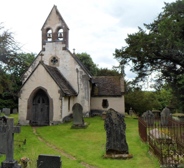


Pontypool, United Kingdom
Pontypool is a town of 35,686 people in Wales, United Kingdom.
Why visit Pontypool
Townapedia lists 5 museums and landmarks, 7 parks and trails, 43 places to eat, 4 places to stay and 3 attractions in and around town.
Highlights include Plums & Roses, Congress Theatre, Torfaen Museum and Hanbury Arms Haunted Hotel & Museum.
Weather in Pontypool
Forecast from MET Norway (CC BY 4.0). Full forecast
About Pontypool
Pontypool (Welsh: Pont-y-pŵl [ˌpɔntəˈpuːl]) is a town and the administrative centre of the county borough of Torfaen, within the historic boundaries of Monmouthshire in South Wales. As of 2021, it has a population of 29,062.
From the Wikipedia article Pontypool (this version), under CC BY-SA 4.0.
Travel tips from other travellers: Pontypool on Wikivoyage (CC BY-SA 4.0).
Things to do3

Plums & Roses
Farm and orchard
Pontypool Indoor Market, Pontypool
Mo 09:00-14:00; Tu-Sa 09:00-16:00; Su off

Congress Theatre
Cinema and theater · 3.4 mi
Theatre in Cwmbran, Torfaen, Wales

Museums and landmarks5

Torfaen Museum
Museum
Local museum in Pontypool, Torfaen, Wales, United Kingdom
Park Road, Pontypool
Mo off; Tu-Th 10:00-16:00; Fr off; Sa-Su 13:00-16:00; PH 13:00-16:00


Parks, trails and playgrounds7


Woodland Road Park
Park · 3.3 mi
Park in Croesyceiliog, Torfaen, Wales, UK

Tirpentwys Nature Reserve
Hiking and trails · 1.9 mi
Former site of opencast mine and tip.
Restaurants and cafes43
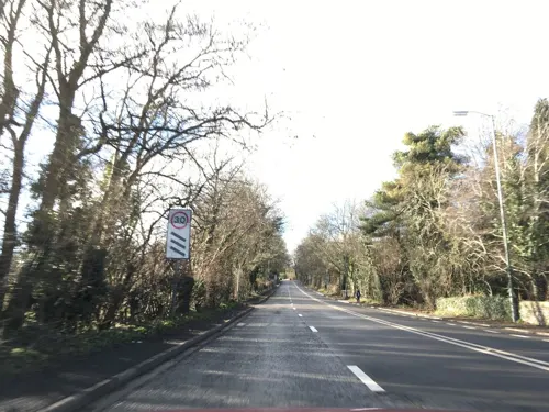
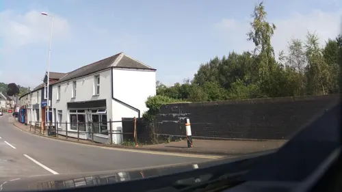
Pegasus
Bar and pub · 0.8 mi
14 Hill Street, Pontypool
Mo-Th 07:00-00:00; Fr 16:00-00:00; Sa 12:00-00:00; Su...
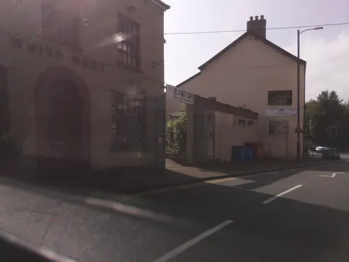
White Hart
Bar and pub · 1.7 mi
2 Broad Street, Abersychan
Mo-Th 12:00-00:00; Fr 15:00-00:00; Sa 00:00-01:00,15:00-00:00; Su...


Iron Duke
Bar and pub
130-131 Osborne Road, Pontypool
Mo-Th 10:00-23:00; Fr 10:00-00:00; Sa 00:00-01:00,10:00-00:00; Su...
The Sally Inn
Bar and pub · 0.4 mi
Tranch Road, Pontypool
Mo off; Tu off; We-Th 18:00-23:00; Fr-Su 12:00-23:00
The Unicorn
Bar and pub
Albion Road, Pontypool
Mo off; Tu-Th 12:30-23:00; Fr 12:30-24:00; Sa 12:30-24:00; Su 12:30-21:00
Lee's Kitchen
Restaurant · Chinese
4 Market Street, Pontypool
Mo 17:00-23:00; Tu off; We-Su 17:00-23:00
New Inn
Bar and pub · 1.8 mi
130 High Street, Abersychan
Mo-We off; Th 16:30-23:00; Fr 15:30-23:00; Sa 16:00-23:00; Su...

Rachels Cafe
Cafe · Breakfast, British, Roasted Chicken, Meat
Pontypool Indoor Market, Pontypool
Mo 09:00-14:00; Tu-Fr 09:00-16:00; Sa 09:00-15:00; Su off
31 more on the map.
History
The name of the town in Welsh – Pont-y-pŵl – originates from a bridge ('pont') associated with a pool in the Afon Lwyd. The Welsh word pŵl is a borrowing from English pool and is found in other place-names in Gwent. Pontypool is an anglicised form of the Welsh name.
Pontypool has a notable history as one of the earliest industrial towns in Wales. The town and its immediate surroundings were home to significant industrial and technological innovations, with links to the iron industry dating back to the early fifteenth century when a bloomery furnace was established at Pontymoile. During the sixteenth century, largely due to the influence of the Hanbury family, the area developed its association with the iron industry and continued to consolidate its position in the seventeenth century, when the development of the town began in earnest. Throughout the eighteenth and nineteenth centuries, the metallurgical and extractive industries of the area, along with the development of the canals and railways, provided the impetus to the expansion of Pontypool and its surrounding villages and communities.
Read more of the history
The Afon Lwyd valley, in which Pontypool is situated, provided an abundance of resources for the manufacturing of iron, including coal, iron ore, charcoal and waterpower. The wider technological developments of the Tudor period, such as the utilisation of blast furnaces to produce iron, allowed for the greater exploitation of the mineral resources of south Wales. A blast furnace was in use at Monkswood, near Pontypool, from as early as 1536 and was followed by the erection of other blast furnaces in the area surrounding Pontypool. An ironworks was established in what later became Pontypool Park in c. 1575. Forges, where cast iron could be converted into wrought iron, were also developed and included Town Forge within Pontypool, which was in operation during the last quarter of the sixteenth century, and the Osborne Forge, near Pontnewynydd, which produced the renowned Osmond iron.
Richard Hanbury of Worcestershire, a notable entrepreneur, developed interests within the Pontypool area during the 1570s, acquiring and developing forges and furnaces in Monkswood, Cwmffrwdoer, Trosnant, Llanelly and Abercarn. Hanbury acquired leases and rights to utilise the raw materials of the wider area, including a large expanse of woodland to produce charcoal and some 800 acres of land to extract coal and iron-ore at Panteg, Pontymoile and Mynyddislwyn. Furthermore, he secured the rights to extract coal and iron-ore on Lord Abergavenny's Hills in and around Blaenavon. The Hanburys were also active at Cwmlickey, Lower Race and Blaendare during the seventeenth century as the demand for coal was met.
Major John Hanbury (1664–1734) acquired a reputation as an industrial pioneer and through the endeavours of Hanbury and his leading agents, Thomas Cooke, William Payne and Thomas Allgood, significant developments within the British tinplate industry were made in Pontypool, including the introduction of the world's first rolling for the production of iron sheets and blackplate at the Pontypool Park works in 1697. Tinplate was being produced at Pontypool from c. 1706, with an important tin mill in operation at Pontymoile during the early eighteenth century.
During the 1660s, Thomas Allgood of Northamptonshire was appointed manager of the Pontypool Ironworks. Allgood developed the Pontypool 'japanning' process, whereby metal plate could be treated in a way that generated a lacquered and decorative finish. Thomas Allgood died in 1716, having been unable to commence production of his Pontypool Japanware but the increased creation of tinplate at Pontypool from the early eighteenth century allowed for japanning to enter large-scale manufacture. There was a growing demand for these artistic, luxury products and Allgood's sons, Edward and Thomas, established a japanworks in Pontypool, which was producing large quantities of Japanware by 1732. The brothers produced a range of products, including decorative bread baskets, tea trays, dishes and other items, and were renowned for their high-quality work. Following the death of Edward Allgood in 1761, there was a family quarrel between his two sons and a rival japanning factory was established in Usk. Both the Pontypool and Usk concerns had ceased production by the early 1820s.
From the mid to late eighteenth century, as the Industrial Revolution took hold, there was a massive expansion in the economic development of south Wales. Iron-making flourished in emerging towns and settlements, notably at Merthyr Tydfil, Tredegar and Blaenavon. By the early nineteenth century, south Wales was the most important centre of iron production in the world. Whilst Pontypool was not as competitive as some of the larger ironworks towns, it retained a niche in the metallurgical market, producing specialist tinplate. The japanning industry of Pontypool continued to decline and had ceased by the mid-nineteenth century, by which time the economy of the Pontypool area relied on the iron and coal industries, the tinplate industry and the production of iron rails. The twentieth century witnessed a decline in the heavy industries of south Wales and this had a direct impact on the economy of Pontypool and its district.
The growth of Pontypool accompanied the development of industry. Originally a dispersed, rural settlement, the first centres of growth took place in the hamlets of Trosnant and Pontymoile. However, as the focus of industry and investment became increasingly centred on Pontypool, the town began to emerge as a focal point for the wider, scattered community.
From the History section of Pontypool on Wikipedia, under CC BY-SA 4.0.
More about Pontypool
Education
Abersychan School; West Monmouth School (formerly Jones' West Monmouth Grammar School for Boys); St. Alban's R.C. High School; and Ysgol Gymraeg Gwynllyw, a Welsh-medium education school teaching students between 3 and 19 years old.
Trevethin Community School was closed at the end of the 2007 academic year. This was formerly the Pontypool Grammar School for Girls (also known as 'The County'), although at one time the sole campus was where the Welsh-medium school Ysgol Gymraeg Gwynllyw now stands. Trevethin Community School was also the original site of the Welsh Baptist College.
Having been kept open as a vaccination centre during the COVID outbreak of 2020, Pontypool Campus Coleg Gwent (formerly known as Pontypool College) permanently closed in 2023. The local borough council is now considering the former campus as a potential housing site.
Crownbridge Special School was based in Pontypool; however, in 2012, the school moved to new facilities in Cwmbran.
From the Wikipedia article Pontypool, under CC BY-SA 4.0.
Notable people from Pontypool
 Luke EvansWelsh actor and singerPhoto: Colleen Sturtevant, CC BY-SA 4.0
 James Dean BradfieldWelsh singer, songwriter and musicianPhoto: Markus Unger, CC BY 2.0
 Gwyneth JonesWelsh operatic sopranoPhoto: Menerbes (Fabian Gastellier), CC BY-SA 3.0
 Sean MooreWelsh musicianPhoto: Markus Unger, CC BY 2.0
 Eben UptonBritish computer scientistPhoto: TechCrunch, CC BY 2.0
 William JonesWelsh- Australian political radical and Chartist (1809–1873)Photo: Unknown author Unknown author, Public domain
- Jane ArdenBritish film director, actress, screenwriter, playwright, active from the 1940s to the 1970s
- Thomas BarkerWelsh painter (1769-1847)
- Joan RuddockWelsh politician (born 1943)
- Peredur ap GwyneddWelsh guitarist
- Jennifer DanielBritish actress (1936-2017)
- Ian GoughWelsh rugby union player
Born in Pontypool, according to Wikidata (CC0). Each name links to its Wikipedia article.
Where to stay4
Churches and places of worship17
Lighthouse Community Church
Church · Pentecostal · 1.7 mi
48 Hawthorn Road, Pontypool
Snatchwood Road Methodist Church
Church · Methodist · 1.6 mi
Snatchwood Road, Abersychan
Shopping12
Gas and EV charging4
Schools, colleges and libraries14
Healthcare4
Map of Pontypool
113 places. The map loads OpenStreetMap tiles when you open it.
Getting there and nearby towns
Cardiff Airport (CWL) is the nearest airport with scheduled flights listed in OpenStreetMap, 25 miles away.
- Risca 7 mi south, about 11 min by car
- Newport 8 mi south, about 13 min by car
- Tredegar 10 mi northwest, about 16 min by car
- Treharris 12 mi west, about 19 min by car
- Whitchurch 15 mi southwest, about 24 min by car
- Cardiff 16 mi south, about 26 min by car
- Rhondda 18 mi west, about 28 min by car
- Portishead 19 mi southeast, about 31 min by car
- Clevedon 20 mi southeast, about 32 min by car
- Bristol 26 mi southeast, about 41 min by car
Drive times are estimates from straight-line distance, not routes.
Towns near Pontypool


Keep exploring
Local news
Headlines from INDB.
Reviews, tips and questions
Loading what members have shared...
Sources and licences
- GeoNames (CC BY 4.0): population, coordinates, regions and time zone
- Mapillary (see each image): photos
- OpenStreetMap contributors (ODbL 1.0): places, airports, map data
- Wikidata (CC0 1.0): elevation, founding date, time zone, website, landmarks and historic places
- Wikimedia Commons (see each image): photos
- Wikipedia (CC BY-SA 4.0): overview and history text
Photo credits
- Pontypool - SPAR, Tiia Monto, CC BY-SA 3.0
- Pontypool Museum, Jaggery, CC BY-SA 2.0
- Pontypool Park rugby ground, Jaggery, CC BY-SA 2.0
- St Illtyd's Church, Mamhilad, Jaggery, CC BY-SA 2.0
- Pontrhydyrun Baptist Church and Churchyard, WelshDave, CC BY-SA 4.0
- County Hospital South Entrance, Pwimageglow, CC BY-SA 3.0
- Street-level photo, southglos, CC BY-SA 4.0
- Street-level photo, southglos, CC BY-SA 4.0
- Street-level photo, southglos, CC BY-SA 4.0
- Street-level photo, southglos, CC BY-SA 4.0
- Street-level photo, laye, CC BY-SA 4.0
- Street-level photo, southglos, CC BY-SA 4.0
- Street-level photo, southglos, CC BY-SA 4.0
- Street-level photo, southglos, CC BY-SA 4.0
Page built November 10, 2026. Spotted a mistake? Tell us or suggest a place.