


Why visit Morley
Townapedia lists 8 museums and landmarks, 13 parks and trails, 127 places to eat and 4 places to stay in and around town.
Highlights include Bagshaw Museum, Oakwell Hall, Middleton Park and Wilton Park, Batley.
Weather in Morley
Forecast from MET Norway (CC BY 4.0). Full forecast
About Morley
Morley is a market town and a civil parish within the City of Leeds metropolitan borough, in West Yorkshire, England. Morley is the largest town in the borough after Leeds itself. Morley forms part of the Heavy Woollen District.
From the Wikipedia article Morley, West Yorkshire (this version), under CC BY-SA 4.0.
Museums and landmarks8
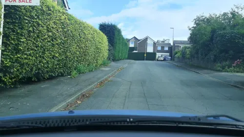
Bagshaw Museum
Museum · 2.1 mi
Local museum in Batley, West Yorkshire, United Kingdom

Oakwell Hall
Museum · 3.0 mi
Grade I listed historic house museum in Kirklees, West Yorkshire, England, UK


Morley War Memorial, Scatcherd Park
Monument and historic site · 0.6 mi
War memorial in Morley, West Yorkshire, England, UK

Parks, trails and playgrounds13


Wilton Park, Batley
Park · 2.2 mi
A public park in West Yorkshire, England


1 more on the map.
Restaurants and cafes127



115 more on the map.
Where to stay4

History
Morley was mentioned in the Domesday Book in 1086 as Morelege, Morelei and Moreleia. Morley means "open ground by a moor", from Old English mōr "moor, clearing, pasture" + lēah "open ground, clearing". It gave its name to Morelei Wapentac, a wapentake which probably met at Tingley.
Howley Hall was built during the 1580s by Sir John Savile, a member of the great Yorkshire landowners, the Savile family. The house was besieged during the English Civil War in 1643 before the Battle of Adwalton Moor but appears to have sustained no serious damage. It continued to be occupied during the 17th century but fell into disrepair. The hall was demolished in 1730 but ruins exist including the cellars of its great hall.
The town became famous for its textile industry, notably the cloth, shoddy, which was worn by both sides in the American Civil War.
It was a significant coal mining area. On 7 October 1872, 34 people were killed in an explosion at the Morley Main Colliery.
From the History section of Morley, West Yorkshire on Wikipedia, under CC BY-SA 4.0.
More about Morley
Education
There are numerous primary schools in Morley including Morley Newlands Academy, Churwell Primary, Seven Hills Primary School, Morley Victoria Primary School, Asquith Primary, Fountain Primary and St Francis Catholic Primary School. It also has an independent preparatory school; Queenswood School.
Three secondary schools serve pupils from Morley: The Morley Academy (formerly Morley High and Morley Grammar), Bruntcliffe Academy and Woodkirk Academy (formerly Woodkirk High and technically in West Ardsley, but has a large proportion of students from Morley due to its catchment area).
A new grassroots music school and venue called Morley Live CIC (Community Interest Company) opened in 2026, in a former high-street bank building in Beryl Burton Gardens.
A new facility called the Morley Learning and Skills Centre will offer courses for adults in the Grade II listed St Mary's in the Wood Church building. The centre will be operated by Leeds City College and will be ready in late 2026.
From the Wikipedia article Morley, West Yorkshire, under CC BY-SA 4.0.
Notable people from Morley
 H. H. AsquithBritish politician; Prime Minister of the United Kingdom from 1908 to 1916 (1852–1928)Photo: Bain News Service, Public domain
 Beverley CallardBritish actressPhoto: Man Alive!, CC BY 2.0
 Vera Scarth-JohnsonBritish-Australian botanist and botanical illustrator (1912–1999)Photo: Unknown author Unknown author, CC BY-SA 3.0
 Arthur CharlesworthFootballer (1898-1966)Photo: User:Robertsckemp, CC BY-SA 3.0
 Ernest SmithEnglish county cricketer (1869-1945)Photo: Unknown author Unknown author, Public domain
 Nick ScrutonEnglish rugby league footballerPhoto: Fleets, CC BY-SA 4.0
- Helen FieldingEnglish novelist and screenwriter (born 1958)
- Jonny HowsonEnglish association football player (born 1988)
- Brian BedfordBritish actor (1935–2016)
- Titus SaltEnglish industrialist and philanthropist (1803-1876)
- Henry AinleyEnglish stage actor (1879-1945)
- Craig WhiteEnglish Test and County cricketer
Born in Morley, according to Wikidata (CC0). Each name links to its Wikipedia article.
Churches and places of worship23
Shopping7
Gas and EV charging8
Schools, colleges and libraries13
Healthcare7
Map of Morley
210 places. The map loads OpenStreetMap tiles when you open it.
Getting there and nearby towns
Leeds Bradford Airport (LBA) is the nearest airport with scheduled flights listed in OpenStreetMap, 9 miles away.
- Leeds 4 mi northeast, about 7 min by car
- Heckmondwike 4 mi southwest, about 6 min by car
- Lofthouse 4 mi east, about 7 min by car
- Ossett 4 mi south, about 7 min by car
- Pudsey 5 mi northwest, about 7 min by car
- Liversedge 5 mi southwest, about 7 min by car
- Cleckheaton 5 mi west, about 8 min by car
- Wakefield 6 mi southeast, about 9 min by car
- Horbury 6 mi south, about 9 min by car
- Mirfield 6 mi southwest, about 10 min by car
Drive times are estimates from straight-line distance, not routes.
Towns near Morley


Keep exploring
Local news
Headlines from INDB.
Reviews, tips and questions
Loading what members have shared...
Sources and licences
- GeoNames (CC BY 4.0): population, coordinates, regions and time zone
- Mapillary (see each image): photos
- OpenStreetMap contributors (ODbL 1.0): places, airports, map data
- Wikidata (CC0 1.0): elevation, founding date, time zone, website, landmarks and historic places
- Wikimedia Commons (see each image): photos
- Wikipedia (CC BY-SA 4.0): overview and history text
Photo credits
- Morley Town Hall, Steve Partridge, CC BY-SA 2.0
- Oakwell Hall, Nigel Homer, CC BY-SA 2.0
- Lake In Middleton Park, J3Mrs ( talk ), CC BY-SA 3.0
- Church St Peters Birstall 05-02-2018 11-44-24 (41140679685), Mark Stevenson, CC BY 2.0
- Scatcherd Mausoleum (33502042024), Mark Stevenson, CC BY 2.0
- St Mary's Church, Woodkirk, West Yorkshire (Taken by Flickr user 16th March 2013), Flickr user:Tim Green aka atouch, CC BY 2.0
- Queen Hotel (2675331360), Tim Green from Bradford, UK, CC BY 2.0
- Street-level photo, adam2, CC BY-SA 4.0
- Street-level photo, cuttlebug, CC BY-SA 4.0
- Street-level photo, Jackisback123, CC BY-SA 4.0
- Street-level photo, cuttlebug, CC BY-SA 4.0
- Street-level photo, cuttlebug, CC BY-SA 4.0
- Street-level photo, adam2, CC BY-SA 4.0
- Street-level photo, cuttlebug, CC BY-SA 4.0
- Street-level photo, cuttlebug, CC BY-SA 4.0
- Street-level photo, adam2, CC BY-SA 4.0
- Street-level photo, adam2, CC BY-SA 4.0
- Street-level photo, cuttlebug, CC BY-SA 4.0
- Street-level photo, cuttlebug, CC BY-SA 4.0
- Street-level photo, cuttlebug, CC BY-SA 4.0
- Street-level photo, humez, CC BY-SA 4.0
Page built November 10, 2026. Spotted a mistake? Tell us or suggest a place.