


Nettleham, United Kingdom
Nettleham is a town of 3,437 people in England, United Kingdom.
Why visit Nettleham
Townapedia lists 13 museums and landmarks, 11 places to eat and 3 attractions in and around town.
Highlights include High Bridge, Lincoln, The Lawn, Lincoln, Lincoln Castle and Lincoln Museum.
Weather in Nettleham
Forecast from MET Norway (CC BY 4.0). Full forecast
About Nettleham
Nettleham is a village and civil parish within the West Lindsey district of Lincolnshire, England, 4 miles (6.4 km) north-east of Lincoln between the A46 and A158.
From the Wikipedia article Nettleham (this version), under CC BY-SA 4.0.
Things to do3

High Bridge, Lincoln
Bridge · 3.4 mi
Grade I listed bridge in Lincoln, England

The Lawn, Lincoln
Cinema and theater · 3.1 mi
Building in Lincoln, UK

New Theatre Royal, Lincoln
Cinema and theater · 3.2 mi
Theatre in Lincoln, England
Museums and landmarks13

Lincoln Castle
Museum · 3.0 mi
Grade I listed building in Lincolnshire, England, UK

Lincoln Museum
Museum · 3.1 mi
Museum and gallery in Lincoln, England, United Kingdom

Lindum Colonia
Monument and historic site · 3.0 mi
Roman settlement in Lincoln, United Kingdom

Usher Gallery
Museum · 3.1 mi
Art museum in Lincoln, Lincolnshire, England

Lincoln Medieval Bishop's Palace
Museum · 3.0 mi
Grade I listed building and scheduled monument in Lincoln, England
Museum of Lincolnshire Life
Museum · 3.0 mi
Museum in Lincoln, United Kingdom

1 more on the map.
Restaurants and cafes11



The Tea Cosy
Cafe · Tearoom
10 The Stable Yard, The Green, Lincoln
We-Fr 09:30-14:00

Franky's Fish Bar
Fast food · Fish And Chips
5 Church Street, Lincoln
Tu-Th,Sa 11:00-13:30, 16:30-20:30; Fr 11:30-13:30, 16:30-21:00;...
Churches and places of worship22

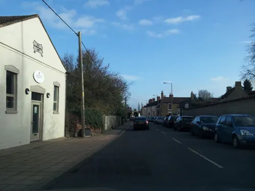
Methodist Church
Church · 2.9 mi
Church in Washingborough, North Kesteven, Lincolnshire, England

St Benedict's Church, Lincoln
Church · 3.4 mi
Church in Lincoln, England, UK

All Saints in Hungate Church
Church · 3.3 mi
Former church in Lincoln, Lincolnshire, England
All Saints' Church, Lincoln
Church · 2.9 mi
Parish church building in Lincoln, Lincolnshire, England, UK
Baptist Chapel, Lincoln
Church · 3.3 mi
Church in Lincolnshire, England
Church of St Giles
Church · 2.0 mi
Church building in Lincoln, Lincolnshire, England, UK
Church of St John the Evangelist
Church · 3.0 mi
Church in Washingborough, Lincolnshire, England, UK
Church of St Michael On The Mount
Church · 3.0 mi
Church building in Lincoln, Lincolnshire, England, UK
Holy Trinity in Clasketgate Church
Church · 3.2 mi
Former church in Lincoln, Lincolnshire, England
New Life Christian Fellowship
Church · 3.4 mi
Church in Lincoln, Lincolnshire, England, UK
10 more on the map.
History
The now-demolished Bishop's Manor House at Nettleham was the property of Edith of Wessex, wife of Edward the Confessor and later Empress Matilda, daughter of King Henry I, before passing into the possession of the Bishops of Lincoln, who enlarged it to create a Bishop's Palace appropriate to one of the country's most important Sees. On 7 February 1301 King Edward I was staying in the Bishop's Palace when he created his son Edward (later King Edward II) as the first Prince of Wales. The building was damaged during the Lincolnshire Rising of 1536 and completely demolished by 1650, only traces of foundations remaining on the site now called Bishop's Palace Field.
The parish church of All Saints dates from the Saxon period, with medieval and 19th century additions. It is now in the benefice of Nettleham with Riseholme and Grange de Lings.
Within the church's graveyard is a headstone in memory of Thomas Gardiner, a post-boy murdered hereabouts by two highway robbers in January 1733. The inscription declares he was 'barbarously murdered' aged 19. The robbers - two brothers by the name of Hallam - committed another murder near Faldingworth before being arrested. They were convicted of murder at Lincoln and executed at the site of their crimes. (Thomas Gardiner's headstone declares he was killed on 3 January 1732 since at the time Britain used the Julian Calendar.)
Read more of the history
The Royal Society for Nature Conservation (RSNC) had been based in Nettleham but moved to Newark-on-Trent in 1999. The site became the home of the WATCH Trust for Environmental Conservation, but this also moved to Newark a few years later.
From the History section of Nettleham on Wikipedia, under CC BY-SA 4.0.
More about Nettleham
Geography
The parish boundary meets Greetwell on the A158 Horncastle/Wragby road. It follows the A15 Wragby Road into Lincoln for about 110 yards (100.6 m) where it meets Lincoln, and skirts the edge of the housing estate (Glebe Park) next to the bypass; the Lincoln bypass (A158) from the A46 to the A158 is in the parish. The boundary crosses Nettleham Road (B1182, former A46), south of the bypass roundabout, and follows south of the A46 bypass for about 550 yards (502.9 m) and meets Riseholme (south of the bypass). The bypass passes northwards skirting, the edge of the University of Lincoln's Riseholme College. 550 yards north of Nettleham Hall, it meets Grange de Lings, and borders this parish along a farm track until the A46, where it meets Scothern just north of Nettleham Heath Farm. It crosses Scothern Beck north of Skelton House Farm, passes south, and at Nettleham Beck it meets Sudbrooke, crossing Sudbrooke Lane east of Richmond Farm. North of Manor Farm, it meets Reepham on the A158 Roman road and follows the A158 to North Greetwell, where it meets Greetwell.
From the Wikipedia article Nettleham, under CC BY-SA 4.0.
Notable people from Nettleham
- Simon Jonesfootballer
Born in Nettleham, according to Wikidata (CC0). Each name links to its Wikipedia article.
Shopping2
Gas and EV charging1
Schools, colleges and libraries4
Healthcare1
Map of Nettleham
57 places. The map loads OpenStreetMap tiles when you open it.
Getting there and nearby towns
RAF Waddington (WTN) is the nearest airport with scheduled flights listed in OpenStreetMap, 7 miles away.
- Lincoln 3 mi southwest, about 5 min by car
- Reepham 3 mi southeast, about 5 min by car
- Skellingthorpe 6 mi west, about 9 min by car
- Bardney 8 mi southeast, about 13 min by car
- Wragby 8 mi east, about 13 min by car
- Middle Rasen 10 mi northeast, about 16 min by car
- North Collingham 13 mi southwest, about 22 min by car
- Gainsborough 14 mi northwest, about 23 min by car
- Sutton on Trent 14 mi southwest, about 23 min by car
- Newark on Trent 19 mi southwest, about 31 min by car
Drive times are estimates from straight-line distance, not routes.
Towns near Nettleham


Keep exploring
Local news
Headlines from INDB.
Reviews, tips and questions
Loading what members have shared...
Sources and licences
- GeoNames (CC BY 4.0): population, coordinates, regions and time zone
- Mapillary (see each image): photos
- OpenStreetMap contributors (ODbL 1.0): places, airports, map data
- Wikidata (CC0 1.0): elevation, founding date, time zone, website, landmarks and historic places
- Wikimedia Commons (see each image): photos
- Wikipedia (CC BY-SA 4.0): overview and history text
Photo credits
- High Bridge, High Street, Lincoln, Brian from UK, CC BY-SA 2.0
- Lincoln, UK - panoramio (49), Dmitrij M, CC BY 3.0
- The Collection, Lincoln (51407522170), John Lord from Edinburgh, Scotland, CC BY 2.0
- Newport Arch, Marek69, CC BY-SA 4.0
- Lincoln, St John the Baptist church (23973779674), Jules & Jenny from Lincoln, UK, CC BY 2.0
- St Benedict's,Lincoln, Samuel Hieronymus Grimm, Public domain
- Bishop Grosseteste University, Paul Stainthorp, CC BY-SA 2.0
- The Lawn, Lincoln (112813775), Brian from Lincoln, UK, CC BY-SA 2.0
- Satsuma Jar Usher Gallery, Catlemur, CC BY-SA 4.0
- Street-level photo, jethro10, CC BY-SA 4.0
- Street-level photo, jethro10, CC BY-SA 4.0
- Street-level photo, gness, CC BY-SA 4.0
- Street-level photo, gness, CC BY-SA 4.0
- Street-level photo, adam2, CC BY-SA 4.0

Page built November 10, 2026. Spotted a mistake? Tell us or suggest a place.