


Why visit Bardney
Townapedia lists 4 museums and landmarks, 2 parks and trails and 4 places to eat in and around town.
Highlights include Tupholme Abbey, Bardney Abbey and Snakeholme Pit.
Weather in Bardney
Forecast from MET Norway (CC BY 4.0). Full forecast
About Bardney
Bardney is a village and civil parish in the West Lindsey district of Lincolnshire, England. The population of the civil parish was 1,643 at the 2001 census increasing to 1,848 (including Southrey) at the 2011 census. The village sits on the east bank of the River Witham, 9 miles (14 km) east of Lincoln.
From the Wikipedia article Bardney (this version), under CC BY-SA 4.0.
Museums and landmarks4
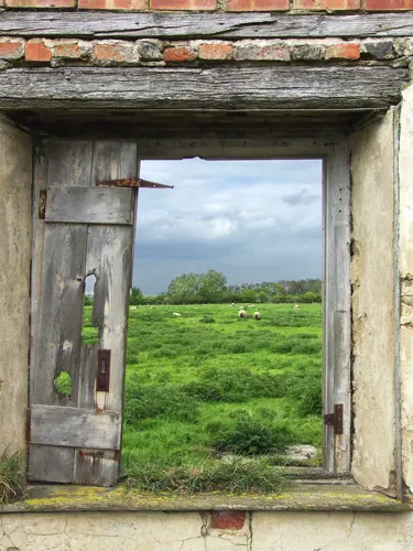
Tupholme Abbey
Monument and historic site · 1.7 mi
Monastery ruins in Tupholme, East Lindsey, Lincolnshire, England, UK


Parks, trails and playgrounds2

Snakeholme Pit
Park · 1.4 mi
Nature reserve in Lincolnshire, England, United Kingdom

Restaurants and cafes4

Churches and places of worship5

Church of St Lawrence
Church
Grade I listed church, West Lindsey, United Kingdom
Church of St. Margaret, Bucknall
Church · 3.0 mi
Church in Bucknall, Lincolnshire, England, UK
Methodist Church
Church
Church in Bardney, West Lindsey, Lincolnshire, England
Salvation Army Chapel
Church
Chapel in Bardney, West Lindsey, Lincolnshire, England
History
Two Roman artefacts have been found in Bardney: a gemstone and a coin. Nearby villages show evidence of Roman settlement, particularly Potterhanworth Booths and Branston Booths.
The place-name is Old English in origin, and means "island of a man called Bearda". It occurs in the Anglo-Saxon Chronicle, under the year 716, as "Bearddanig", and in the Domesday Book of 1086 as "Bardenai".
Once the site of a mediaeval abbey, ruined in Henry VIII's dissolution of the monasteries, the village became prosperous through agricultural improvement in the 19th century. Improved transport, first on the river and then with the arrival of several railways, caused considerable expansion between the traditional centre of the village and the former riverside settlement of Bardney Ferry. In 1894 the ferry was replaced by the present bridge. A British Sugar factory, built in 1927, survived the closure of the railways but ceased processing on 9 February 2001.
Bardney Abbey was founded before 679, perhaps as a double house of monks and nuns, and perhaps as a minster. It was destroyed by the Danes circa 860. Refounded 1087 as a priory, it became a Benedictine Abbey in 1115, and was dissolved in 1538.
Near the Abbey is the site of the deserted medieval village of Butyate, which was demolished in 1959, and converted to farmland.
Read more of the history
Another abandoned village, north of modern Bardney, is associated with the former chapels of St Lawrence and St Andrew.
From the History section of Bardney on Wikipedia, under CC BY-SA 4.0.
More about Bardney
Geography
Bardney lies between 7 and 17 metres above sea level, on the edge of the present-day Lincolnshire Fens, but its name indicates that before the fens were drained for agriculture (from the 17th century onwards) it was surrounded with wet fenland. Nowadays the Lincolnshire Fens are mostly unflooded, very flat and very productive arable farmland. Wildlife observed on the fens near Bardney includes barn owl, red fox and hemlock.
Bardney is surrounded by ancient woodlands composed primarily of lime trees, known collectively as Bardney Limewoods. Lime forests are rare in the United Kingdom, where oak is generally the dominant climatic climax species. The flora of the woodlands is indicative of ancient woodland, including Allium ursinum, Hyacinthoides non-scripta and Circaea lutetiana, as well as several species of wild orchids. Wildlife in the limewoods includes deer, Eurasian jay, European hornet and purple hairstreak butterfly.
In 2017 a white-billed diver was observed on the River Witham at Bardney. This is an Arctic species which seldom visits the United Kingdom.
From the Wikipedia article Bardney, under CC BY-SA 4.0.
Notable people from Bardney
- Thomas DrakesEnglish cricketer (1908-1974)
Born in Bardney, according to Wikidata (CC0). Each name links to its Wikipedia article.
Shopping2
Schools, colleges and libraries1
Bardney Church of England and Methodist Primary School
School · Anglican, Methodist · 0.4 mi
Henry Lane, Lincoln
Map of Bardney
18 places. The map loads OpenStreetMap tiles when you open it.
Getting there and nearby towns
RAF Waddington (WTN) is the nearest airport with scheduled flights listed in OpenStreetMap, 9 miles away.
- Wragby 5 mi north, about 8 min by car
- Lincoln 9 mi west, about 14 min by car
- Middle Rasen 12 mi north, about 20 min by car
- Cranwell 13 mi southwest, about 21 min by car
- Leasingham 13 mi south, about 22 min by car
- Sleaford 15 mi south, about 24 min by car
- Louth 17 mi northeast, about 27 min by car
- Boston 20 mi southeast, about 33 min by car
- Gainsborough 22 mi northwest, about 35 min by car
- Newark on Trent 23 mi southwest, about 37 min by car
Drive times are estimates from straight-line distance, not routes.
Towns near Bardney


Keep exploring
Local news
Headlines from INDB.
Reviews, tips and questions
Loading what members have shared...
Sources and licences
- GeoNames (CC BY 4.0): population, coordinates, regions and time zone
- Mapillary (see each image): photos
- OpenStreetMap contributors (ODbL 1.0): places, airports, map data
- Wikidata (CC0 1.0): elevation, founding date, time zone, website, landmarks and historic places
- Wikimedia Commons (see each image): photos
- Wikipedia (CC BY-SA 4.0): overview and history text
Photo credits
- Bardney, St Lawrence, Stained glass window (21264878136), Jules & Jenny from Lincoln, UK, CC BY 2.0
- Bardney, St Lawrence, Stained glass window (21264936546), Jules & Jenny from Lincoln, UK, CC BY 2.0
- A lidar view of Bardney Abbey in Lincolnshire, Dr John Wells, CC BY 4.0
- Street-level photo, coljay72, CC BY-SA 4.0
- Street-level photo, adam2, CC BY-SA 4.0
- Street-level photo, adam2, CC BY-SA 4.0
- Street-level photo, adam2, CC BY-SA 4.0
- Street-level photo, adam2, CC BY-SA 4.0
- Street-level photo, gness, CC BY-SA 4.0
Page built November 10, 2026. Spotted a mistake? Tell us or suggest a place.