


Saint Cyrus, United Kingdom
Saint Cyrus is a town of 1,060 people in Scotland, United Kingdom.
Why visit Saint Cyrus
Townapedia lists 8 museums and landmarks, 2 parks and trails, 2 places to eat, 3 places to stay and 3 attractions in and around town.
Highlights include Lower North Water Bridge, Stone of Morphie and St Cyrus National Nature Reserve.
Weather in Saint Cyrus
Forecast from MET Norway (CC BY 4.0). Full forecast
About Saint Cyrus
St Cyrus or Saint Cyrus (Scots: Saunt Ceerus), formerly Ecclesgreig (from Scottish Gaelic: Eaglais Chiric) is a village in the far south of Aberdeenshire, Scotland.
From the Wikipedia article St Cyrus (this version), under CC BY-SA 4.0.
Things to do3

Lower North Water Bridge
Bridge · 2.2 mi
Bridge in Aberdeenshire, Scotland

Museums and landmarks8
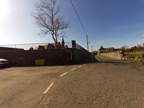

Stone of Morphie
Monument and historic site · 2.3 mi
Standing stone in Aberdeenshire, Scotland, UK
Graveyard Watch House
Monument and historic site · 0.6 mi
Old graveyard watch house built around 17th-19th century to deter grave robbers & body snatchers.

Parks, trails and playgrounds2


Restaurants and cafes2


History
The remains of the Kaim of Mathers is located on rock pinnacles on the northernmost part of the beach. Built by the Berkeley (or Barclay) family, it was used as a refuge by David de Berkeley from the vengeance of the king when, around 1420, he was part of a group who murdered the local sheriff, John Melville of Glenbervie.
The ruins of Old St Cyrus Church lie in the churchyard and are used as a burial vault for the Porteous family. The manse dates from the early 18th century and was remodelled at ground floor in the late 19th century. The current parish church dates from 1787 but was heavily remodelled around 1870 (including a spire).
The old schoolhouse (run by the church and next to the manse) dates from around 1800. This was replaced by a new school south of the church in the early 20th century.
St Cyrus railway station was on the Montrose to Inverbervie branch line of the North British Railway. Freight traffic was withdrawn from this line in 1966 as part of the Beeching cuts but the passenger service had ceased in 1951 ten years before Dr Beeching joined British Railways. Evidence for the line can still be seen in the viaduct over the North Esk river to the south of St Cyrus and the remains of some railway embankments and road bridges to the north.
Read more of the history
A Chain Home Low radar station was once situated on the cliffs immediately to the south of the village. A blockhouse can still be seen at its location.
Alexander Keith, D.D. (1791–1880), Church of Scotland and Free Church minister
From the History section of St Cyrus on Wikipedia, under CC BY-SA 4.0.
Notable people from Saint Cyrus
- Thomas KeithBritish surgeon and photographer (1827-1895)
- George BeattieScottish poet
- Charles Abercrombie Smithscientist, politician and civil servant, Cape Colony (1834-1919)
Born in Saint Cyrus, according to Wikidata (CC0). Each name links to its Wikipedia article.
Where to stay3
Churches and places of worship1
Schools, colleges and libraries1
Map of Saint Cyrus
20 places. The map loads OpenStreetMap tiles when you open it.
Getting there and nearby towns
Aberdeen International Airport (ABZ) is the nearest airport with scheduled flights listed in OpenStreetMap, 30 miles away.
- Montrose 4 mi southwest, about 7 min by car
- Stonehaven 15 mi northeast, about 24 min by car
- Arbroath 16 mi southwest, about 26 min by car
- Forfar 20 mi southwest, about 32 min by car
- Carnoustie 22 mi southwest, about 35 min by car
- Westhill 27 mi north, about 43 min by car
- Aberdeen 28 mi northeast, about 45 min by car
- Dundee 30 mi southwest, about 48 min by car
- Saint Andrews 33 mi southwest, about 54 min by car
- Inverurie 35 mi north, about 57 min by car
Drive times are estimates from straight-line distance, not routes.
Towns near Saint Cyrus


Keep exploring
Local news
Headlines from INDB.
Reviews, tips and questions
Loading what members have shared...
Sources and licences
- GeoNames (CC BY 4.0): population, coordinates, regions and time zone
- Mapillary (see each image): photos
- OpenStreetMap contributors (ODbL 1.0): places, airports, map data
- Wikidata (CC0 1.0): elevation, founding date, time zone, website, landmarks and historic places
- Wikimedia Commons (see each image): photos
- Wikipedia (CC BY-SA 4.0): overview and history text
Photo credits
- St Cyrus Ancient Nether Kirkyard at Dusk, Russ Hamer, CC BY-SA 3.0
- St Cyrus Church Montrose, Russ Hamer, CC BY-SA 3.0
- The North Water Viaduct and Lower North Water Bridge, Thomas Fuhrmann, CC BY-SA 4.0
- Street-level photo, smsm1, CC BY-SA 4.0
- Street-level photo, smsm1, CC BY-SA 4.0
Page built November 10, 2026. Spotted a mistake? Tell us or suggest a place.