



Newtown St Boswells, United Kingdom
Newtown St Boswells is a town of 1,330 people in Scotland, United Kingdom.
Why visit Newtown St Boswells
Townapedia lists 18 museums and landmarks, 5 parks and trails, 6 places to eat, 2 places to stay and 6 attractions in and around town.
Highlights include Dryburgh Abbey Bridge, Mertoun Bridge, Melrose Abbey and Trimontium.
Weather in Newtown St Boswells
Forecast from MET Norway (CC BY 4.0). Full forecast
About Newtown St Boswells
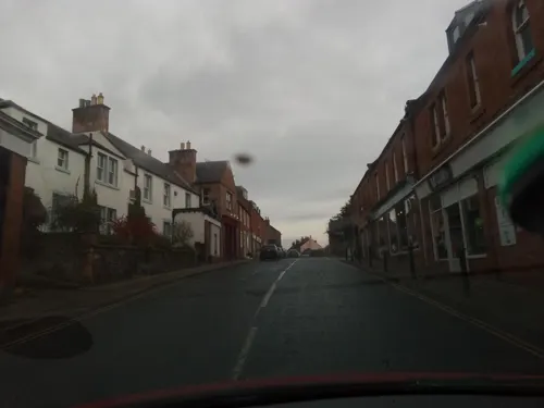
Newtown St Boswells (Scots: Newtoon; Scottish Gaelic: Baile Ùr Bhoisil [ˈpaləˈuːɾˈvɔʃɪl]) is a village in the Scottish Borders council area, in south-east Scotland. The village lies south of the Eildon Hills on the Sprouston and Newtown burns, approximately 40 miles (64 km) south-east of Edinburgh. It is the administrative centre of the Scottish Borders, and was historically in the county of Roxburghshire.
From the Wikipedia article Newtown St Boswells (this version), under CC BY-SA 4.0.
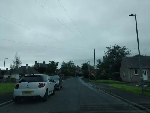
Photos of Newtown St Boswells


Things to do6

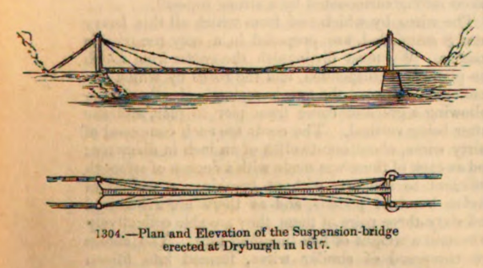
Dryburgh Abbey Bridge
Bridge · 0.6 mi
1817-1818 footbridge in Scottish Borders, Scotland, UK, carries a footpath across River Tweed
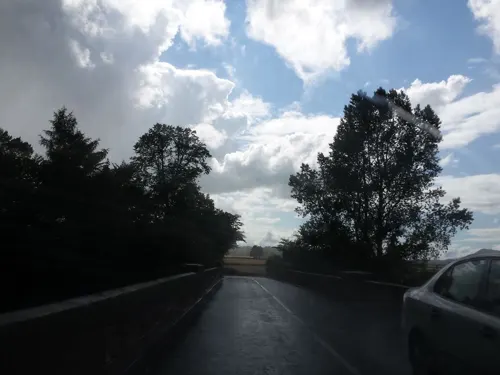
Mertoun Bridge
Bridge · 1.9 mi
Bridge at Mertoun Mill, Scottish Borders, Scotland, UK, carrying the B6404 road across the River Tweed
Old Bridge, Drygrange
Bridge · 1.7 mi
Road bridge in Scottish Borders

Scott's View
Monument and historic site · 1.7 mi
Scenic viewpoint in Scottish Borders, Scotland, UK

Dryburgh Bridge
Bridge · 0.6 mi
Refers to two different footbridges erected near Dryburgh Abbey, Scottish Borders, Scotland, UK, across River Tweed

Museums and landmarks18

Melrose Abbey
Monument and historic site · 2.4 mi
Partly ruined monastery in Melrose, Scotland

Trimontium
Monument and historic site · 1.7 mi
Archaeological site in Scottish Borders, Scotland, UK


6 more on the map.
Parks, trails and playgrounds5



Restaurants and cafes6

History
Newtown St Boswells is an old settlement, well-established by the 16th century. The town has been known at various times as Newtoun, Newton, Newtown of Eildon and Newtown of Dryburgh. It lies split between the civil parishes of Melrose and St Boswells.
Historically, Newtown St Boswells was a centre for milling grain, with watermills on its burns. In the 19th century, the development of the railway made the village a regional centre for transporting agricultural produce and livestock, with St Boswells station becoming a large junction station with facilities for loading cattle. The railway closed in 1968.
Roxburghshire County Council established offices at Newtown St Boswells in 1896, and subsequently moved its meeting place there from Jedburgh in 1930. A large new building was added to the site in 1968. From 1975 to 1996, the offices served as the administrative centre for Borders Regional Council. Since the 1996 the offices have been the headquarters of Scottish Borders Council and known as the Council Headquarters.
From the History section of Newtown St Boswells on Wikipedia, under CC BY-SA 4.0.
More about Newtown St Boswells
Education
The village is served by Newtown Primary School, which is a feeder school to Earlston High School, about 5 miles (8.0 km) away in Earlston. The primary school also has nursery provision for preschool-aged children. A Borders College campus at the southeastern tip of the village specialises in agricultural education.
From the Wikipedia article Newtown St Boswells, under CC BY-SA 4.0.
Notable people from Newtown St Boswells
 George Mathers, 1st Baron MathersBritish politician (1886-1965)Photo: Rs-nourse, CC BY 4.0
Born in Newtown St Boswells, according to Wikidata (CC0). Each name links to its Wikipedia article.
Where to stay2
Churches and places of worship2
St Boswells Parish Church
Church · Church Of Scotland · 1.0 mi
Main Street, St Boswells
Shopping3
Schools, colleges and libraries3
Map of Newtown St Boswells
45 places. The map loads OpenStreetMap tiles when you open it.
Getting there and nearby towns
Edinburgh Airport (EDI) is the nearest airport with scheduled flights listed in OpenStreetMap, 37 miles away.
- Saint Boswells 1 mi southeast, about 2 min by car
- Galashiels 6 mi northwest, about 10 min by car
- Hawick 12 mi southwest, about 19 min by car
- Mayfield 25 mi northwest, about 40 min by car
- Bonnyrigg 26 mi northwest, about 43 min by car
- Dalkeith 27 mi northwest, about 43 min by car
- Penicuik 28 mi northwest, about 45 min by car
- Tranent 28 mi northwest, about 44 min by car
- Musselburgh 29 mi northwest, about 47 min by car
- Edinburgh 33 mi northwest, about 53 min by car
Drive times are estimates from straight-line distance, not routes.
Towns near Newtown St Boswells


Keep exploring
Local news
Headlines from INDB.
Reviews, tips and questions
Loading what members have shared...
Sources and licences
- GeoNames (CC BY 4.0): population, coordinates, regions and time zone
- Mapillary (see each image): photos
- OpenStreetMap contributors (ODbL 1.0): places, airports, map data
- Wikidata (CC0 1.0): elevation, founding date, time zone, website, landmarks and historic places
- Wikimedia Commons (see each image): photos
- Wikipedia (CC BY-SA 4.0): overview and history text
Photo credits
- Scottish Borders Council Regional Headquarters, Walter Baxter, CC BY-SA 2.0
- Scottsview3.1, Ruy Lestrade (www.flickr.com/semi-detached), CC BY-SA 3.0
- +1136 wurde Das Zisterienserkloster Melrose gegründet. 03, Holger Uwe Schmitt, CC BY-SA 4.0
- Trimontium, Unknown author, CC BY-SA 2.0 de
- Dryburgh Abbey Bridge 1817-1818, Charles Knight 1791-1873, Public domain
- Wallace Statue, Dryburgh - general view, Tom Parnell, CC BY-SA 4.0
- Newton St Boswells, inside Auction Mart, Livestock Ring, Victuallers, CC BY-SA 4.0
- Taynuilt Including Garage, Gatepiers and Boundary Walls, Tweedside Road, Newton St Boswells, Victuallers, CC BY-SA 4.0
- Taynuilt Garage, Gatepiers and Boundary Walls, Tweedside Road, Newton St Boswells, Victuallers, CC BY-SA 4.0
- Scottish Borders - Dryburgh Abbey - 20230724151227, LornaMCampbell, CC BY-SA 4.0
- Street-level photo, victuallers, CC BY-SA 4.0
- Street-level photo, rudolfmayer, CC BY-SA 4.0
- Street-level photo, victuallers, CC BY-SA 4.0
- Street-level photo, ccbb7766, CC BY-SA 4.0
- Street-level photo, victuallers, CC BY-SA 4.0
- Street-level photo, victuallers, CC BY-SA 4.0
- Street-level photo, victuallers, CC BY-SA 4.0
- Street-level photo, victuallers, CC BY-SA 4.0
- Street-level photo, plexi32, CC BY-SA 4.0
- Street-level photo, iain_mcnicol, CC BY-SA 4.0
- Street-level photo, iain_mcnicol, CC BY-SA 4.0
- Street-level photo, iain_mcnicol, CC BY-SA 4.0
- Street-level photo, victuallers, CC BY-SA 4.0
- Street-level photo, victuallers, CC BY-SA 4.0
- Street-level photo, victuallers, CC BY-SA 4.0
- Street-level photo, victuallers, CC BY-SA 4.0
- Street-level photo, plexi32, CC BY-SA 4.0
Page built November 10, 2026. Spotted a mistake? Tell us or suggest a place.