



Saint Boswells, United Kingdom
Saint Boswells is a town of 1,400 people in Scotland, United Kingdom.
Why visit Saint Boswells
Townapedia lists 17 museums and landmarks, 4 parks and trails, 5 places to eat, 3 places to stay and 6 attractions in and around town.
Highlights include Dryburgh Abbey Bridge, Mertoun Bridge, Monteath Mausoleum and Trimontium.
Weather in Saint Boswells
Forecast from MET Norway (CC BY 4.0). Full forecast
About Saint Boswells
St Boswells (Scots: Bosels / Bosells [ˈboːzəɫz]; Scottish Gaelic: Cille Bhoisil [ˈçiʎəˈvɔʃɪl]) is a village on the south side of the River Tweed in the Scottish Borders, about 1 mile (2 kilometres) southeast of Newtown St Boswells on the A68 road. It lies within the boundaries of the historic county of Roxburghshire.
From the Wikipedia article St Boswells (this version), under CC BY-SA 4.0.
Photos of Saint Boswells


Things to do6

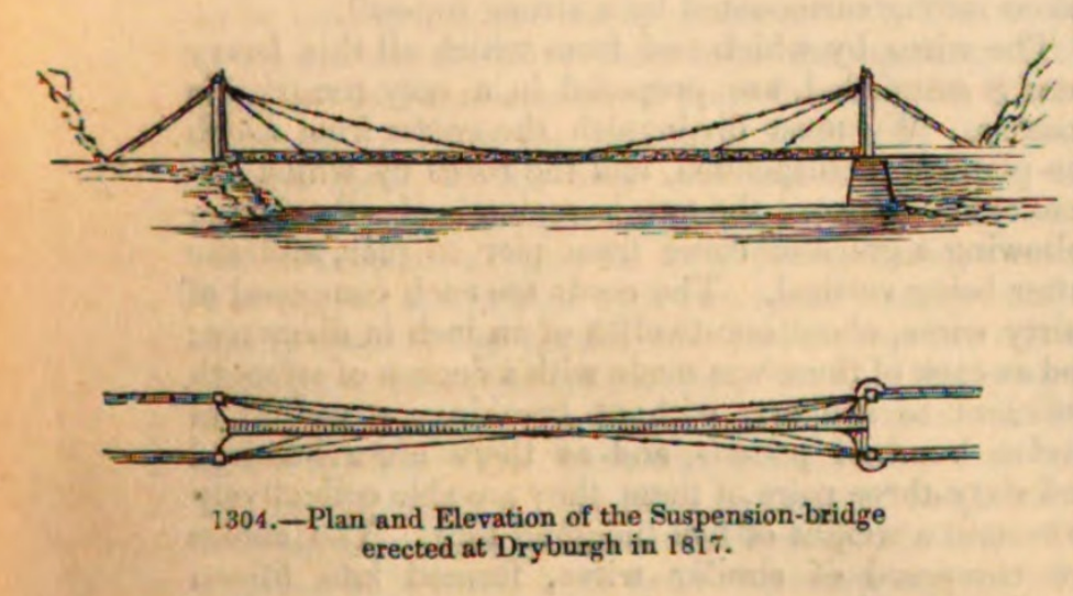
Dryburgh Abbey Bridge
Bridge · 0.7 mi
1817-1818 footbridge in Scottish Borders, Scotland, UK, carries a footpath across River Tweed
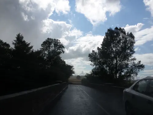
Mertoun Bridge
Bridge · 1.1 mi
Bridge at Mertoun Mill, Scottish Borders, Scotland, UK, carrying the B6404 road across the River Tweed
Old Bridge, Drygrange
Bridge · 2.5 mi
Road bridge in Scottish Borders

Scott's View
Monument and historic site · 1.8 mi
Scenic viewpoint in Scottish Borders, Scotland, UK

Dryburgh Bridge
Bridge · 0.7 mi
Refers to two different footbridges erected near Dryburgh Abbey, Scottish Borders, Scotland, UK, across River Tweed

Museums and landmarks17

Monteath Mausoleum
Monument and historic site · 2.9 mi
Mausoleum on Gersit Law north of Jedburgh

Trimontium
Monument and historic site · 2.6 mi
Archaeological site in Scottish Borders, Scotland, UK



5 more on the map.
Parks, trails and playgrounds4


Restaurants and cafes5
History
The Romans came to this area almost two thousand years ago, leaving Dere Street and the nearby fort of Trimontium as evidence of their occupation. Following the departure of the Romans, the area came under the sway of the Anglian kingdom of Northumbria.
In the 7th century Northumbria was ruled by the pagan leader Oswald who, upon converting to Christianity, established, with the help of St Aidan, a monastery at Lindisfarne. Under his leadership a monastery was built at Old Melrose. One of the monks from this new religious centre was Boisil, and it was he who gave his name to the village and parish of Saint Boswells. It is suggested that some of the dwellings were on the flat haugh below Benrig - a good site but prone to flooding, which may explain why they eventually moved to the higher ground at Lessudden (the place of Aidan) and the present site of St Boswells.
St Boswells gave its name to a settlement in southwest Saskatchewan, Canada. The settlement was founded in the early 20th century, and flourished up to the mid-1930s. With depopulation after World War Two it failed in the 1960s and is no longer in existence.
From the History section of St Boswells on Wikipedia, under CC BY-SA 4.0.
Notable people from Saint Boswells
- Andrew DallmeyerScottish actor, director and playwright (1945-2017)
- Jimmie JohnstonScottish rugby union footballer (1925-2003)
- Charlie DrummondScottish rugby union player
Born in Saint Boswells, according to Wikidata (CC0). Each name links to its Wikipedia article.
Where to stay3
Churches and places of worship3
Shopping2
Schools, colleges and libraries3
Map of Saint Boswells
43 places. The map loads OpenStreetMap tiles when you open it.
Getting there and nearby towns
Edinburgh Airport (EDI) is the nearest airport with scheduled flights listed in OpenStreetMap, 38 miles away.
- Galashiels 7 mi northwest, about 11 min by car
- Hawick 12 mi southwest, about 19 min by car
- Wooler 25 mi east, about 40 min by car
- Mayfield 26 mi northwest, about 41 min by car
- Bonnyrigg 27 mi northwest, about 44 min by car
- Dalkeith 28 mi northwest, about 44 min by car
- Berwick-Upon-Tweed 28 mi northeast, about 46 min by car
- Tranent 28 mi northwest, about 46 min by car
- Penicuik 29 mi northwest, about 46 min by car
- Edinburgh 34 mi northwest, about 55 min by car
Drive times are estimates from straight-line distance, not routes.
Towns near Saint Boswells


Keep exploring
Local news
Headlines from INDB.
Reviews, tips and questions
Loading what members have shared...
Sources and licences
- GeoNames (CC BY 4.0): population, coordinates, regions and time zone
- Mapillary (see each image): photos
- OpenStreetMap contributors (ODbL 1.0): places, airports, map data
- Wikidata (CC0 1.0): elevation, founding date, time zone, website, landmarks and historic places
- Wikimedia Commons (see each image): photos
- Wikipedia (CC BY-SA 4.0): overview and history text
Photo credits
- Scottsview3.1, Ruy Lestrade (www.flickr.com/semi-detached), CC BY-SA 3.0
- Sir Thomas Monteath Douglas Mausoleum, Sid Tudnall, CC BY-SA 3.0
- Trimontium, Unknown author, CC BY-SA 2.0 de
- Mertoun House, John Vigar, CC BY-SA 2.0
- Dryburgh Abbey Bridge 1817-1818, Charles Knight 1791-1873, Public domain
- Wallace Statue, Dryburgh - general view, Tom Parnell, CC BY-SA 4.0
- Braeheads House, St Boswells, Mainlymazza, CC BY-SA 4.0
- Engine house, Braeheads House, St Boswells, Mainlymazza, CC BY-SA 4.0
- 02590 St Boswell's Church of Scotland, St Boswell's 007, WeeHolly, CC BY-SA 4.0
- 02590 St Boswell's Church of Scotland, St Boswell's 012, WeeHolly, CC BY-SA 4.0
- 02590 St Boswell's Church of Scotland, St Boswell's 008, WeeHolly, CC BY-SA 4.0
- 02590 St Boswell's Church of Scotland, St Boswell's 009, WeeHolly, CC BY-SA 4.0
- 02590 St Boswell's Church of Scotland, St Boswell's 004, WeeHolly, CC BY-SA 4.0
- 02590 St Boswell's Church of Scotland, St Boswell's 014, WeeHolly, CC BY-SA 4.0
- 02590 St Boswell's Church of Scotland, St Boswell's 011, WeeHolly, CC BY-SA 4.0
- 02590 St Boswell's Church of Scotland, St Boswell's 006, WeeHolly, CC BY-SA 4.0
- Scottish Borders - Dryburgh Abbey - 20230724151524, LornaMCampbell, CC BY-SA 4.0
- Street-level photo, victuallers, CC BY-SA 4.0
- Street-level photo, rudolfmayer, CC BY-SA 4.0
- Street-level photo, ccbb7766, CC BY-SA 4.0
- Street-level photo, victuallers, CC BY-SA 4.0
- Street-level photo, victuallers, CC BY-SA 4.0
- Street-level photo, victuallers, CC BY-SA 4.0
- Street-level photo, victuallers, CC BY-SA 4.0
- Street-level photo, victuallers, CC BY-SA 4.0
- Street-level photo, victuallers, CC BY-SA 4.0
- Street-level photo, victuallers, CC BY-SA 4.0
- Street-level photo, victuallers, CC BY-SA 4.0
- Street-level photo, iain_mcnicol, CC BY-SA 4.0
- Street-level photo, iain_mcnicol, CC BY-SA 4.0
- Street-level photo, iain_mcnicol, CC BY-SA 4.0
- Street-level photo, plexi32, CC BY-SA 4.0


Page built November 10, 2026. Spotted a mistake? Tell us or suggest a place.