


North Newbald, United Kingdom
North Newbald is a town of 1,115 people in England, United Kingdom.
Why visit North Newbald
Townapedia lists 1 museum or landmark, 3 parks and trails, 2 places to eat and 1 place to stay in and around town.
Highlights include North Cave Wetlands.
Weather in North Newbald
Forecast from MET Norway (CC BY 4.0). Full forecast
About North Newbald
North Newbald is a village and former civil parish, now in the parish of Newbald, in the East Riding of Yorkshire, England. The village is situated approximately 13 miles (20 km) north-west of Hull city centre, 3 miles (5 km) north of South Cave and 3.5 miles (6 km) south of Market Weighton. It lies to the east of the A1034 road.
From the Wikipedia article North Newbald (this version), under CC BY-SA 4.0.
Museums and landmarks1

Parks, trails and playgrounds3

North Cave Wetlands
Park · 2.7 mi
Nature reserve at North Cave, East Riding of Yorkshire, England, managed by the Yorkshire Wildlife Trust

Restaurants and cafes2

Where to stay1

History
The name Newbald derives from the Old English nīwebōðl meaning 'new dwelling'.
In 1823 North Newbald was a village and civil parish in the Wapentake of Harthill and the Liberty of St Peter's. The North Newbald civil parish contained the hamlet of South Newbald. A stretch of land was purchased to provide a rental which was "distributed every New Year's Day to 20 resident parishioners, who have never received parochial relief". Population at the time was 543, with occupations including six farmers, two blacksmiths, two bricklayers, two shopkeepers, and a tailor, and the public house landlords of The Tiger; The New Inn, who was also a butcher; and The Rose & Crown, who was also a corn miller. Resident in the village were fourteen yeomen, and the schoolmaster who was a collector of taxes. A carrier operated between the village and Hull twice a week, and Market Weighton and Beverley once a week.
From the History section of North Newbald on Wikipedia, under CC BY-SA 4.0.
Churches and places of worship4
Schools, colleges and libraries1
Map of North Newbald
12 places. The map loads OpenStreetMap tiles when you open it.
Getting there and nearby towns
Humberside Airport (HUY) is the nearest airport with scheduled flights listed in OpenStreetMap, 20 miles away.
- Little Weighton 5 mi east, about 8 min by car
- Walkington 5 mi east, about 8 min by car
- Brough 6 mi south, about 10 min by car
- Skidby 7 mi east, about 11 min by car
- Beverley 8 mi east, about 13 min by car
- Winteringham 9 mi south, about 14 min by car
- Tickton 10 mi east, about 16 min by car
- Barton upon Humber 11 mi southeast, about 18 min by car
- Kingston upon Hull 13 mi southeast, about 20 min by car
- Goole 13 mi southwest, about 21 min by car
Drive times are estimates from straight-line distance, not routes.
Towns near North Newbald


Keep exploring
Local news
Headlines from INDB.
Reviews, tips and questions
Loading what members have shared...
Sources and licences
- GeoNames (CC BY 4.0): population, coordinates, regions and time zone
- Mapillary (see each image): photos
- OpenStreetMap contributors (ODbL 1.0): places, airports, map data
- Wikidata (CC0 1.0): elevation, founding date, time zone, website, landmarks and historic places
- Wikimedia Commons (see each image): photos
- Wikipedia (CC BY-SA 4.0): overview and history text
Photo credits
- Village Green, North Newbald, Roger Gilbertson, CC BY-SA 2.0
- St Nicholas Church North Newbald, JThomas, CC BY-SA 2.0
- St Nicholas Church North Newbald 1900 (PO-1-101-5) (32363158284), East Riding Archives, CC0
- North Cave Wetlands from main hide, Andy Mabbett, CC BY-SA 3.0
- All Saints Church North Cave, martin dawes, CC BY-SA 2.0
- St Oswalds Church Hotham 1, Stephen Horncastle, CC BY-SA 2.0
- Tiger Inn North Newbald, JThomas, CC BY-SA 2.0
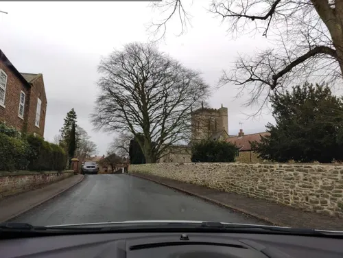
- Street-level photo, aidan573, CC BY-SA 4.0
Page built November 10, 2026. Spotted a mistake? Tell us or suggest a place.