


North Shields, United Kingdom
North Shields is a town of 39,747 people in England, United Kingdom.
Why visit North Shields
Townapedia lists 41 museums and landmarks, 33 parks and trails, 288 places to eat, 18 places to stay and 18 attractions in and around town.
Highlights include Blue Reef Aquarium Tynemouth, Customs House, South Shields, Tynemouth Priory and Castle and South Shields Museum & Art Gallery.
Weather in North Shields
Forecast from MET Norway (CC BY 4.0). Full forecast
About North Shields
North Shields is a town in the borough of North Tyneside in Tyne and Wear, England. It is 8 miles (13 km) north-east of Newcastle upon Tyne and borders nearby Wallsend and Tynemouth. The population of North Shields at the 2021 census was 6,137.
From the Wikipedia article North Shields (this version), under CC BY-SA 4.0.
Photos of North Shields


Things to do18


Customs House, South Shields
Cinema and theater · 1.5 mi
Theatre, cinema and art gallery in South Shields, England

Fish Quay Old Low Light
Lighthouse · 0.8 mi
Lighthouse in Tyne and Wear, England

Herd Groyne Light
Lighthouse · 1.2 mi
Lighthouse in South Tyneside, Tyne and Wear, England, UK


Spanish City
Monument and historic site · 2.2 mi
Permanent funfair in Whitley Bay, a seaside town in North Tyneside, Tyne & Wear, England

Tyne South Pier light
Lighthouse · 1.9 mi
Lighthouse in Tyne and Wear, England

Fish Quay Low Light
Lighthouse · 0.8 mi
Lighthouse in Tyne and Wear, England

Fish Quay Old High Light
Lighthouse · 0.7 mi
Lighthouse in Tyne and Wear, England
New High Light
Lighthouse · 0.7 mi
Architectural structure in North Tyneside, Tyne and Wear, England, UK
Playhouse, Whitley Bay
Cinema and theater · 2.1 mi
Theatre in Whitley Bay, England
6 more on the map.
Museums and landmarks41

Tynemouth Priory and Castle
Monument and historic site · 1.2 mi
Pier Road, North Shields
Mar 28-Sep 30 Mo-Su 10:00-18:00; Oct 01-Nov 01 Mo-Su 10:00-16:00;...
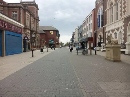

Admiral Lord Collingwood Monument
Monument and historic site · 1.2 mi

Arbeia
Monument and historic site · 1.1 mi
Roman fort and museum in South Shields, United Kingdom

Jarrow Hall
Museum · 2.5 mi
Museum in Jarrow, England, United Kingdom


Stephenson Railway Museum
Museum · 1.9 mi
Railway museum in North Shields, United Kingdom
Tynemouth Castle and Priory
Museum · 1.2 mi
Historic coastal site in north-eastern England

Collingwood Monument
Monument and historic site · 1.2 mi
Monument in Tynemouth, England

Arbeia Roman Fort Museum
Museum · 1.1 mi
Mar 25-Sep 29 Mo-Fr 10:00-17:00; Mar 25-Sep 29 Sa 11:00-16:00; Mar...
29 more on the map.
Parks, trails and playgrounds33



Northumberland Park
Park · 0.6 mi
Public park in North Shields, Tyne and Wear, England, UK
Rising Sun Country Park
Park · 3.2 mi
Country park in North Tyneside, England





The Family Hub
Playground · 0.6 mi
Bedford Street, North Shields
21 more on the map.
Restaurants and cafes288
Caffè Nero
Cafe · Coffee Shop · 1.4 mi
21 King Street, South Shields
Mo-Sa 07:00-18:00; Su 08:30-17:30
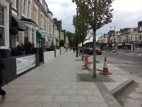
Colmans
Restaurant · Fish And Chips · 1.5 mi
176-186 Ocean Road, South Shields
Mo-Sa 11:00-19:00; Su 11:00-18:00
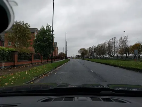
Miller & Carter
Restaurant · Steak · 0.7 mi
Preston North Road, North Shields
Mo-We 09:00-22:00; Th-Sa 09:00-23:00; Su 09:00-22:00


Cassia Sambuca
Restaurant · Italian · 0.7 mi
52 Bell Street, North Shields
Mo-Su 12:00-21:00; Fr,Sa 12:00-22:00
Border Terrier
Bar and pub · 0.8 mi
Hartington Road, North Shields
Mo-Th 12:00-23:00; Fr-Sa 12:00-24:00; Su 12:00-23:00


Cullercoats Coffee
Cafe · Coffee Shop · 1.4 mi
22a-24 John Street, North Shields
Mo-Sa 07:00-16:00; Su 08:00-16:00
Cullercoats Coffee Co
Cafe · Coffee Shop · 1.0 mi
69 Front Street, North Shields
Mo-Fr 07:00-14:00; Sa-Su 07:00-16:00
Deep North
Cafe · Coffee Shop, Donut · 1.0 mi
34 Front Street, Tynemouth
Mo-Fr 08:30-16:30; Sa-Su 08:30-17:00
Low Lights Tavern
Bar and pub · Pie · 0.7 mi
Brewhouse Bank, North Shields
276 more on the map.
History
North Shields is first recorded in 1225, when the Prior of Tynemouth, Germanus, decided to create a fishing port to provide fish for the Priory which was situated on the headland at the mouth of the River Tyne. He also supplied ships anchored near the priory. A number of rudimentary houses or 'shiels' were erected at the mouth of the Pow Burn where the stream enters the Tyne, as well as wooden quays which were used to unload the fishing boats. The quays were also used to ship coal from local collieries owned by the Priory. Soon the population of the new township numbered 1,000. The burgesses of Newcastle upon Tyne were determined to preserve the custom rights that they had enjoyed up till then, which covered the whole length of the river. They successfully petitioned the king in 1290 and managed to suspend trade from the new settlement. It was forbidden to victual ships or to load and unload cargoes at North Shields. The opposition of the Newcastle burgesses remained for a considerable time but despite this, North Shields continued to develop as a centre for fishing and exporting salt, produced at local saltpans. For a considerable period the Newcastle burgesses, known as the Hostmen, who controlled the export of coal from the Tyne, resisted the export of this commodity from North Shields.
Read more of the history
The town was originated on a narrow strip of land alongside the river (around the present-day Clive Street) because of the steep bank which hemmed it in. Eventually becoming overcrowded, in the 18th century buildings began to be erected on the plateau 60 feet (20 m) above the old unsanitary dwellings alongside the river. Prosperous businessmen and shipowners occupied the new town whereas working people remained in the lower part of town. The low, riverside part of the town was linked to the newer, higher part of the town by a series of stairs. These stairs were initially surrounded by slum dwellings, and although the houses have since been cleared the stairs remain.
One of the first developments of the new town was Dockwray Square, built in 1763, a set of elegant town houses that was populated by wealthy families. Due to the poor provision of water and drainage facilities, however, the wealthy families soon moved to the more central part of the new town, and particularly the new Northumberland Square. Dockwray Square eventually deteriorated into slums. In the early twentieth century Stan Laurel lived at a house in Dockwray Square for a few years, before he became famous. The square has since been re-developed, initially in the 1960s, and again in the 1990s. A statue of Laurel stands in the middle to commemorate his stay there.
The land on which the new town was built was largely owned by the Earl of Carlisle. In 1796, John Wright produced plans that included a grand processional way, now Howard Street, leading to the Georgian Northumberland Square. A railway tunnel, built in the 1840s, left the west and south sides of the square largely unfinished, until a 1960s library building was constructed, somewhat out of keeping with the rest of the architecture. In 1844–45, John Dobson built the town hall, on the corner of Howard and Saville Streets.
From the History section of North Shields on Wikipedia, under CC BY-SA 4.0.
More about North Shields
Geography
The town is bounded to the north by Whitley Bay and to the south by the River Tyne. The town of Tynemouth is to its east and the A19 road marks the boundary between North Shields and Wallsend to the west of the town. It is part of the North Tyneside conurbation.
Over the years, North Shields has grown from a small fishing village to incorporate the nearby areas of Chirton, Preston, Billy Mill, Percy Main, East Howdon and Marden estate.
The 2011 definition of the town of Tynemouth includes North Shields, which means a population figure can only be given as a combination of wards rather than as a USD.
In September 2020, the North Tyneside Council published prospective plans for regeneration of the town centre, which include developing a distinctive route to the Fish Quay, pedestrianisation of key streets, consolidation of retail units, creation of a town square, renovation of Northumberland Square and the establishment of a transport hub. At the time of publication, the plan was not financed and the council sought the views of local residents and business owners.
In summer 2020, work was being completed on the refurbishment of the terraced row to the north of Northumberland Square, as well as the development of a newly built row of homes on nearby Albion Road. The newly restored Wooden Dolly was also returned to the Square.
Economy
YMCA North Tyneside was founded in 1870 and was originally known as The Borough of Tynemouth YMCA. After an inaugural meeting on 7 June 1879, weekly meetings followed in the Sons of Temperance Hall, Norfolk Street, North Shields. The YMCA grew in popularity. Within a year, larger premises were needed. Meetings moved to 53 Tyne Street, North Shields and in 1879 to Camden Street, North Shields. In 1920 the YMCA moved to a building in Bedford Street (which is still owned by the YMCA and now occupied by the Citizens Advice Bureau) where it remained until 1938, when it moved to the present building and the current registered office at Church Way, North Shields.
Between 1987 and 2001, a community festival was organised on the fish quay, during which the fleet of fishing boats would be blessed and various local talents would entertain the crowds. At its peak, the festival attracted 600,000 visitors. A smaller-scale family festival, in order to save costs, was held annually between 2002 and 2006, before it too was scrapped as a money-saving measure.
A significant part of the town centre is pedestrianised and it is dominated by the Beacon, a partly-covered shopping mall which was constructed in the late 1970s and originally named The Bedford Centre.
Arts and culture
In 2009, seating inspired by Plasticine, the inventor of which was born in North Shields, was installed on Bedford Street in the town centre. The seats proved unpopular as their shape prevented rainwater draining off, so they were replaced by more traditional metal benches and moved to the Royal Quays Marina in 2011.
Fiddler's Green, a steel sculpture by artist Ray Lonsdale that serves as a memorial to fishermen lost at sea, was unveiled in 2017. In 2023, The Herring Girl, also by Lonsdale, was unveiled as a monument to the work of women in the fishing trade.
A number of pieces were installed as part of the Royal Quays development. Located in Chirton Dene, Redburn Dene, by the marina, and near the shopping outlet, they include works by Richard Broderick, Graham Robinson, Linda France, Alec Peever, Gilly Rogers, Mark di Suvero, Perminder Kaur and Andy Plant.
In 2025, a statue of Mary Ann Macham, who made her home in the town having escaped slavery and torture in the USA, was installed.
As part of the 800th anniversary celebrations, a number of murals were painted around the town.
Dream On (1991) was produced by Amber Films and filmed on location in Meadow Well. Its original release was around the time of the Meadow Well riots.
From the Wikipedia article North Shields, under CC BY-SA 4.0.
Notable people from North Shields
 Tony ScottBritish film director and producer (1944–2012)Photo: PH2 Michael D.P. Flynn, U.S. Navy, Public domain
 Alan YoungBritish actor (1919–2016)Photo: NBC Radio, Public domain
 Neil TennantEnglish musicianPhoto: Raph_PH, CC BY 2.0
 Sam FenderEnglish singer-songwriter (born 1994)Photo: Raph_PH, CC BY 2.0
 Anthony PattersonEnglish footballerPhoto: Timmy96, CC0
 Adam CampbellEnglish footballer (born 1995)Photo: Poolie22, CC0
 Katy CavanaghEnglish actressPhoto: Ian Smith, CC BY-SA 2.0
- Sean LongstaffEnglish association football player (born 1997)
- Hilton ValentineBritish guitarist (1943–2021)
- Michael BridgesEnglish footballer (born 1978)
- Robert WestallEnglish writer (1929–1993)
- Tim PalmerBritish record producer
Born in North Shields, according to Wikidata (CC0). Each name links to its Wikipedia article.
Where to stay18
Churches and places of worship34
Saint Hilda Marden with Preston Grange
Church · Anglican · 0.7 mi
Stanton Road, North Shields
Shopping50
Gas and EV charging4
Schools, colleges and libraries27
Star of the Sea Catholic Primary School
School · Roman Catholic · 1.2 mi
Seatonville Road, Whitley Bay
Healthcare23
Apta Vita - Physiotherapy & Sports Injury Clinic
Clinic and pharmacy · 0.4 mi
Church Way, North Shields
Morrisons Family Pharmacy
Clinic and pharmacy · 0.6 mi
Preston North Road, North Shields
Map of North Shields
250 places. The map loads OpenStreetMap tiles when you open it.
Getting there and nearby towns
Newcastle International Airport (NCL) is the nearest airport with scheduled flights listed in OpenStreetMap, 10 miles away.
- Tynemouth 1 mi east, about 2 min by car
- South Shields 1 mi southeast, about 2 min by car
- Whitley Bay 2 mi north, about 3 min by car
- Jarrow 3 mi southwest, about 5 min by car
- Wallsend 4 mi southwest, about 6 min by car
- Hebburn 4 mi southwest, about 6 min by car
- The Boldons 5 mi south, about 8 min by car
- Newcastle upon Tyne 7 mi southwest, about 12 min by car
- Gosforth 7 mi west, about 11 min by car
- Sunderland 8 mi south, about 13 min by car
Drive times are estimates from straight-line distance, not routes.
Towns near North Shields


Keep exploring
Local news
Headlines from INDB.
Reviews, tips and questions
Loading what members have shared...
Sources and licences
- GeoNames (CC BY 4.0): population, coordinates, regions and time zone
- Mapillary (see each image): photos
- OpenStreetMap contributors (ODbL 1.0): places, airports, map data
- Wikidata (CC0 1.0): elevation, founding date, time zone, website, landmarks and historic places
- Wikimedia Commons (see each image): photos
- Wikipedia (CC BY-SA 4.0): overview and history text
Photo credits
- Old Low Light, North Shields, Barabbas1312, CC BY-SA 4.0
- Phare Herd Groyne South Shields South Tyneside 7, Chabe01, CC BY-SA 4.0
- Jarrow Bridge3, MSGJ, CC BY-SA 4.0
- Spanish City, Whitley Bay, September 2010, Original author was Adam G. Bell, CC BY 3.0
- Phare Jetée Sud Tyne South Shields South Tyneside 3, Chabe01, CC BY-SA 4.0
- Jarrow Hall, Jarrow, Tyne and Wear (4535471011), Orangeaurochs from Sandy, Bedfordshire, United Kingdom, CC BY 2.0
- E4 in the Stephenson Railway Museum, Robby George, CC0
- P&GCobalt, Andy Connolly, Public domain
- Readhead Park, MSGJ, CC BY-SA 4.0
- St Peter's Church, Wallsend, CramptonHodnet, CC BY-SA 4.0
- Église St Oswin Tynemouth North Tyneside 1, Chabe01, CC BY-SA 4.0
- Jarrow, Xaphire at Dutch Wikipedia, CC BY-SA 3.0
- Arbeia, Agnete, CC BY-SA 4.0
- TynemouthCastle-2005-03-08, Chris McKenna ( user:Thryduulf ), CC BY-SA 4.0
- North Tyneside General Hospital, Stevenfruitsmaak, CC BY 3.0
- Église St Hilda South Shields South Tyneside 4, Chabe01, CC BY-SA 4.0
- Grand Hotel, Tynemouth, Irina Guy, CC BY-SA 4.0
- Monument morts Afrique Sud Tynemouth North Tyneside 1, Chabe01, CC BY-SA 4.0
- St.Stephan SouthShields, Agnete, CC BY-SA 4.0
- Tynemouth Priory Aerial, Thenorthmannn, CC BY-SA 4.0
- Arbeia Roman Fort reconstructed gateway, Chris McKenna ( user:Thryduulf ), CC BY-SA 4.0
- St. Hilda's Church at South Shields, [2], CC BY-SA 2.0
- Collingwood Monument 2, Q23c, CC BY-SA 4.0
- Blue Reef Aquarium Tynemouth Tank 01, TheArmchairSoldier, CC BY-SA 4.0
- The Customs House, South Shields - blue plaque, South Tyneside Council, CC BY-SA 4.0
- Street-level photo, livingwithdragons, CC BY-SA 4.0
- Street-level photo, livingwithdragons, CC BY-SA 4.0
- Street-level photo, livingwithdragons, CC BY-SA 4.0
- Street-level photo, livingwithdragons, CC BY-SA 4.0
- Street-level photo, floatingboater, CC BY-SA 4.0
- Street-level photo, floatingboater, CC BY-SA 4.0
- Street-level photo, floatingboater, CC BY-SA 4.0
- Street-level photo, floatingboater, CC BY-SA 4.0
- Street-level photo, floatingboater, CC BY-SA 4.0
- Street-level photo, livingwithdragons, CC BY-SA 4.0
- Street-level photo, livingwithdragons, CC BY-SA 4.0
- Street-level photo, livingwithdragons, CC BY-SA 4.0
- Street-level photo, livingwithdragons, CC BY-SA 4.0


Page built November 10, 2026. Spotted a mistake? Tell us or suggest a place.