


South Shields, United Kingdom
South Shields is a town of 83,655 people in England, United Kingdom.
Why visit South Shields
Townapedia lists 49 museums and landmarks, 31 parks and trails, 342 places to eat, 19 places to stay and 18 attractions in and around town.
Highlights include Customs House, South Shields, Fish Quay Old Low Light, Tynemouth Priory and Castle and South Shields Museum & Art Gallery.
Weather in South Shields
Forecast from MET Norway (CC BY 4.0). Full forecast
About South Shields
South Shields is a coastal port town in South Tyneside, Tyne and Wear, England; it lies on the south bank of the mouth of the River Tyne. The town was known in Roman times as Arbeia and as Caer Urfa by the Early Middle Ages. It is the fourth largest settlement in Tyne and Wear, after Newcastle upon Tyne, Sunderland and Gateshead; in 2021, it had a population of 75,337.
From the Wikipedia article South Shields (this version), under CC BY-SA 4.0.
Photos of South Shields


Things to do18

Customs House, South Shields
Cinema and theater · 0.4 mi
Theatre, cinema and art gallery in South Shields, England

Fish Quay Old Low Light
Lighthouse · 0.8 mi
Lighthouse in Tyne and Wear, England

Herd Groyne Light
Lighthouse · 0.7 mi
Lighthouse in South Tyneside, Tyne and Wear, England, UK


Tyne South Pier light
Lighthouse · 1.5 mi
Lighthouse in Tyne and Wear, England

Tynemouth North Pier light
Lighthouse · 1.6 mi
Lighthouse in Tyne and Wear, England

Fish Quay Low Light
Lighthouse · 0.7 mi
Lighthouse in Tyne and Wear, England

Fish Quay Old High Light
Lighthouse · 0.8 mi
Lighthouse in Tyne and Wear, England
New High Light
Lighthouse · 0.7 mi
Architectural structure in North Tyneside, Tyne and Wear, England, UK
Playhouse, Whitley Bay
Cinema and theater · 3.4 mi
Theatre in Whitley Bay, England
6 more on the map.
Museums and landmarks49

Tynemouth Priory and Castle
Monument and historic site · 1.5 mi
Pier Road, North Shields
Mar 28-Sep 30 Mo-Su 10:00-18:00; Oct 01-Nov 01 Mo-Su 10:00-16:00;...
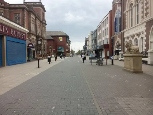

Admiral Lord Collingwood Monument
Monument and historic site · 1.2 mi

Arbeia
Monument and historic site · 0.4 mi
Roman fort and museum in South Shields, United Kingdom

Jarrow Hall
Museum · 2.0 mi
Museum in Jarrow, England, United Kingdom


Stephenson Railway Museum
Museum · 2.9 mi
Railway museum in North Shields, United Kingdom
Tynemouth Castle and Priory
Museum · 1.4 mi
Historic coastal site in north-eastern England

Collingwood Monument
Monument and historic site · 1.2 mi
Monument in Tynemouth, England

Arbeia Roman Fort Museum
Museum · 0.4 mi
Mar 25-Sep 29 Mo-Fr 10:00-17:00; Mar 25-Sep 29 Sa 11:00-16:00; Mar...
37 more on the map.
Parks, trails and playgrounds31



Northumberland Park
Park · 1.3 mi
Public park in North Shields, Tyne and Wear, England, UK



The Family Hub
Playground · 0.9 mi
Bedford Street, North Shields
19 more on the map.
Restaurants and cafes342
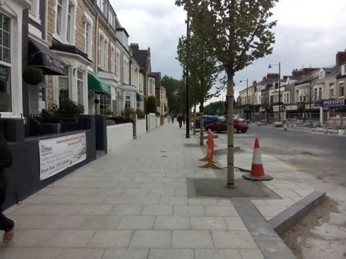
Colmans
Restaurant · Fish And Chips
176-186 Ocean Road, South Shields
Mo-Sa 11:00-19:00; Su 11:00-18:00
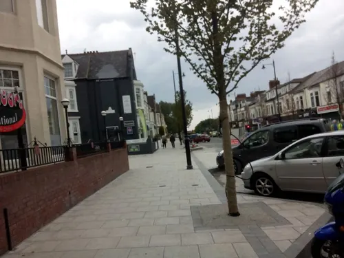


Cassia Sambuca
Restaurant · Italian · 0.7 mi
52 Bell Street, North Shields
Mo-Su 12:00-21:00; Fr,Sa 12:00-22:00


Cullercoats Coffee Co
Cafe · Coffee Shop · 1.3 mi
69 Front Street, North Shields
Mo-Fr 07:00-14:00; Sa-Su 07:00-16:00
Deep North
Cafe · Coffee Shop, Donut · 1.4 mi
34 Front Street, Tynemouth
Mo-Fr 08:30-16:30; Sa-Su 08:30-17:00
Low Lights Tavern
Bar and pub · Pie · 0.8 mi
Brewhouse Bank, North Shields
Platform 2
Bar and pub · 1.3 mi
Station Terrace, North Shields
Mo-Th 15:00-22:30; Fr-Sa 12:00-23:00; Su 12:00-22:30
Regular Jo's
Cafe · Coffee Shop · 1.4 mi
6B Percy Park Road, North Shields
Mo-Fr 07:00-16:00; Sa-Su 08:00-15:00
The County
Bar and pub · 1.0 mi
34 Sunderland Road, South Shields
Mo-Th 12:00-23:00; Fr-Su 11:00-23:00
330 more on the map.
History
Evidence of human inhabitation at South Shields dates from the Late Mesolithic. The first evidence of a settlement within what is now the town of South Shields dates from pre-historic times. Stone Age arrow heads and an Iron Age round house have been discovered on the site of Arbeia Roman Fort. The Roman garrison built a fort here around AD 160 and expanded it around AD 208 to help supply their soldiers along Hadrian's Wall as they campaigned north beyond the Antonine Wall. Divisions living at the fort included Tigris bargemen (from Persia and modern day Iraq), infantry from Iberia and Gaul, and Syrian archers and spearmen. The fort was abandoned as the Roman Empire declined in the fourth century AD. Many ruins still exist today and some structures have been rebuilt as part of a modern museum and popular tourist attraction.
There is evidence that the site was used in the early post-Roman period as a British settlement. It is believed it became a royal residence of King Osric of Deira; records show that his son Oswin was born within 'Caer Urfa', by which name the fort is thought to be known after the Romans left. Furthermore, Bede records Oswin giving a parcel of land to St Hilda for the foundation of a monastery here in c. 647; the present-day church of St Hilda, by the Market Place, is said to stand on the monastic site.
Read more of the history
In the ninth century, Scandinavian peoples made Viking raids on monasteries and settlements all along the coast, and later conquered the Anglian Kingdoms of Northumbria, Mercia and East Anglia, who hailed from Angeln in Denmark (modern day Germany). It is said in local folklore that a Viking ship was wrecked at Herd Sands in South Shields in its attempts to disembark at a cove nearby. Other Viking ships were uncovered in South Shields Denmark Centre and nearby Jarrow.
The current town was founded in 1245 and developed as a fishing port. The name South Shields developed from the 'Schele' or 'Shield', which was a small dwelling used by fishermen. Another industry that was introduced was that of salt-panning, later expanded upon in the 15th century, polluting the air and surrounding land. In 1864, a Tyne Commissioners dredger brought up a nine-pounder breech-loading cannon; more cannonballs have been found in the sands beside the Lawe; these artifacts belonged to the English civil war. At the outbreak of the war in 1642, the North, West and Ireland supported the King; the South East and Presbyterian Scotland supported Parliament. In 1644 Parliament's Scottish Covenanter allies, in a lengthy battle, seized the town and its Royalist fortification, the fortification was close to the site of the original Roman fort. They also seized the town of Newburn. These raids were done to aid their ongoing siege of the heavily fortified Newcastle upon Tyne, and in a bid to control the River Tyne, and the North, and the Shields siege helped cause their battalions to maneuver south to York; this may have also led to a brief winter skirmish on the outskirts of Boldon, though the topography is not favourable for a battle.
In the 19th century, coal mining, alkaline production and glass making led to a boom in the town. The population increased from 12,000 in 1801 to 75,000 by the 1860s, bolstered by economic migration from Ireland, Scotland and other parts of England. These industries played a fundamental part in creating wealth both regionally and nationally. In 1832, with the Great Reform Act, South Shields and Gateshead were each given their own Member of Parliament and became boroughs, resulting in taxes being paid to the Government instead of the Bishops of Durham. However, the rapid growth in population brought on by the expansion of industry made sanitation a problem, as evident by Cholera outbreaks and the building of the now-listed Cleadon Water Tower to combat the problem. In the 1850s 'The Tyne Improvement Commission' began to develop the river, dredging it to make it deeper and building the large, impressive North and South Piers to help prevent silt build up within the channel. Shipbuilding (along with coal mining), previously a monopoly of the Freemen of Newcastle, became another prominent industry in the town, with John Readhead & Sons Shipyard the largest.
During World War I, German Zeppelin airships bombed South Shields in 1916. Later, during World War II, the German Luftwaffe repeatedly attacked the town and caused massive damage to industries which supported the war effort. It killed many innocent residents, including in a bomb shelter in the market place where the deceased were commemorated in a cobblestone of the British flag; the bodies were controversially removed and interred elsewhere.
Gradually, throughout the late 20th century, the coal and shipbuilding industries were closed, due to competitive pressures from more cost-effective sources of energy (including workers) and more efficient shipbuilding elsewhere in Eastern Europe (e.g. Poland) and in South East Asia. In the 21st century, the local economy primarily includes port-related, ship repair and offshore industries, manufacturing, retail (at nearby Newcastle, Durham, Washington and Sunderland), the public sector and the ever-increasing role of tourism. This is illustrated by the new multi-million Haven centre, Dunes centre and seaside improvements in the coastal area and a new multimillion-pound library The Word.
From the History section of South Shields on Wikipedia, under CC BY-SA 4.0.
More about South Shields
Geography
South Shields is situated in a peninsula setting, where the river Tyne meets the North Sea. It has six miles of coastline and three miles of river frontage, dominated by the massive North and South Piers at the mouth of the Tyne. These are best viewed from the Lawe Top, which also houses two replicas of cannon captured from the Russians during the Crimean War, the originals having been melted down during World War II.
The town slopes gently from Cleadon Hills down to the river. Cleadon Hills are made conspicuous by the Victorian Cleadon Water Tower and pumping station (opened in 1860 to improve sanitation) and a now derelict windmill, both of which are listed and can be seen from many miles away and also out at sea.
South Shields boasts extensive beaches, sand dunes and coves, as well as dramatic Magnesian Limestone cliffs with grassy areas above known as The Leas, which cover three miles of the coastline and are a National Trust protected area. Marsden Bay, with its famous Marsden Rock and historic Grotto public house and restaurant set in the cliffs, is home to one of the largest seabird colonies in Britain.
Economy
The last shipbuilder, John Readhead & Sons, closed in 1984 and the last pit, Westoe Colliery, closed in 1993. Today, the town relies largely on service industries, whilst many residents commute to work in nearby Newcastle upon Tyne, Gateshead, North Tyneside and Sunderland.
Despite a skilled local workforce, South Tyneside had the highest unemployment rate in mainland Britain for many years, although, between December 2002 and December 2008, unemployment in South Shields fell by 17.8% and that of South Tyneside by 17.7%, the best performance in the North East region over that time period.
The Guardian reported the unemployment rate in January 2011 to be 6.5% and at 7.5% in October 2011.
The Port of Tyne is one of the UK's most important and is further developing its freight and passenger activities. In 2007, it imported two million tonnes of coal. Manufacturing and ship repair/engineering are other significant sectors.
South Shields benefits from significant public and private sector investment. More recently, this has included primarily the town centre, riverside and foreshore areas, given the decline of once-traditional heavy industries with the town's growing importance as a major commercial centre and tourist destination.
Education
South Shields is home to South Tyneside College, one of the two leading maritime training centres in the UK; it has facilities including a marine safety training centre and a simulated ship's bridge for the training of deck officers. The college was also home to the only planetarium in the region, and to an observatory; and in its time was a popular visitor attraction for local schools and visitors in general. The observatory was used for 20 years and in 2008 it was deemed redundant to the future curriculum needs of the college. The domed room that housed the planetarium is now a mosque. The college provides a wide range of other flexible vocational and training courses.
Local schooling is generally regarded as being very good, which is reflected in continuing improvements to school results and independent inspections.
In 2007, Brinkburn Comprehensive and King George V Comprehensive merged forming South Shields Community School. The new school was built at a cost of £19 million on the King George V School site and was opened in September 2011. However this school closed in 2020.
From the Wikipedia article South Shields, under CC BY-SA 4.0.
Notable people from South Shields
 Ridley ScottEnglish filmmaker (born 1937)Photo: Raph_PH, CC BY 4.0
 Ernest Thompson SetonBritish/American author, artist and naturalist, and one of the founders of the scouting movement (1860–1946)Photo: Miscellaneous Items in High Demand,..., Public domain
 John N. GrayBritish political philosopher (born 1948)Photo: Vera de Kok, CC BY-SA 4.0
 Joe McElderryEnglish recording artist; singer, television personalityPhoto: David Wright, CC BY-SA 2.0
 Phil BrownEnglish association football player and manager (born 1959)Photo: Bilde-Philbrown01.jpg :..., CC BY-SA 3.0
 Jade ThirlwallBritish singer-songwriterPhoto: Soccer Aid for UNICEF, CC BY 3.0
 William FoxPremier of New Zealand in the 19th century, company agent, explorer and artist (1812–1893)Photo: Herman John Schmidt, Public domain
- Eric IdleBritish comedian, actor and writer (born 1943)
- Frank Williamsfounder of Williams Grand Prix Engineering (1942–2021)
- Flora RobsonEnglish actress (1902-1984)
- Catherine CooksonBritish writer (1906–1998)
- Stan MortensenEnglish footballer and manager (1921-1991)
Born in South Shields, according to Wikidata (CC0). Each name links to its Wikipedia article.
Where to stay19
Churches and places of worship40
St Jude’s Church Rekendyke
Church · Anglican · 0.8 mi
Alice Street, Laygate, South Shields
Shopping58
Gas and EV charging2
Schools, colleges and libraries22
Healthcare21
Apta Vita - Physiotherapy & Sports Injury Clinic
Clinic and pharmacy · 1.0 mi
Church Way, North Shields
Map of South Shields
250 places. The map loads OpenStreetMap tiles when you open it.
Getting there and nearby towns
Newcastle International Airport (NCL) is the nearest airport with scheduled flights listed in OpenStreetMap, 11 miles away.
- Tynemouth 1 mi north, about 2 min by car
- Jarrow 2 mi southwest, about 4 min by car
- Whitley Bay 3 mi north, about 5 min by car
- Hebburn 4 mi southwest, about 6 min by car
- Wallsend 4 mi west, about 7 min by car
- The Boldons 4 mi south, about 6 min by car
- Sunderland 7 mi south, about 11 min by car
- Newcastle upon Tyne 7 mi west, about 12 min by car
- Gosforth 7 mi west, about 12 min by car
- Washington 8 mi southwest, about 12 min by car
Drive times are estimates from straight-line distance, not routes.
Towns near South Shields


Keep exploring
Local news
Headlines from INDB.
Reviews, tips and questions
Loading what members have shared...
Sources and licences
- GeoNames (CC BY 4.0): population, coordinates, regions and time zone
- Mapillary (see each image): photos
- OpenStreetMap contributors (ODbL 1.0): places, airports, map data
- Wikidata (CC0 1.0): elevation, founding date, time zone, website, landmarks and historic places
- Wikimedia Commons (see each image): photos
- Wikipedia (CC BY-SA 4.0): overview and history text
Photo credits
- Phare Jetée Sud Tyne South Shields South Tyneside 3, Chabe01, CC BY-SA 4.0
- Old Low Light, North Shields, Barabbas1312, CC BY-SA 4.0
- Phare Herd Groyne South Shields South Tyneside 7, Chabe01, CC BY-SA 4.0
- Jarrow Bridge3, MSGJ, CC BY-SA 4.0
- Souter Lighthouse, Marsden, Tyne and Wear 2, Glenn Scott at English Wikipedia, Public domain
- Jarrow Hall, Jarrow, Tyne and Wear (4535471011), Orangeaurochs from Sandy, Bedfordshire, United Kingdom, CC BY 2.0
- E4 in the Stephenson Railway Museum, Robby George, CC0
- P&GCobalt, Andy Connolly, Public domain
- Readhead Park, MSGJ, CC BY-SA 4.0
- St Peter's Church, Wallsend, CramptonHodnet, CC BY-SA 4.0
- Église St Oswin Tynemouth North Tyneside 1, Chabe01, CC BY-SA 4.0
- Jarrow, Xaphire at Dutch Wikipedia, CC BY-SA 3.0
- Arbeia, Agnete, CC BY-SA 4.0
- TynemouthCastle-2005-03-08, Chris McKenna ( user:Thryduulf ), CC BY-SA 4.0
- Église St Hilda South Shields South Tyneside 4, Chabe01, CC BY-SA 4.0
- Monument morts Afrique Sud Tynemouth North Tyneside 1, Chabe01, CC BY-SA 4.0
- St.Stephan SouthShields, Agnete, CC BY-SA 4.0
- A fairground at sunset (7938746880), Jimmy McIntyre - Editor HDR One Magazine, CC BY-SA 2.0
- Tynemouth Priory Aerial, Thenorthmannn, CC BY-SA 4.0
- Arbeia Roman Fort reconstructed gateway, Chris McKenna ( user:Thryduulf ), CC BY-SA 4.0
- St. Hilda's Church at South Shields, [2], CC BY-SA 2.0
- Collingwood Monument 2, Q23c, CC BY-SA 4.0
- The Customs House, South Shields - blue plaque, South Tyneside Council, CC BY-SA 4.0
- Tynemouth North Pier Light, Schminnte, CC BY-SA 4.0
- Street-level photo, livingwithdragons, CC BY-SA 4.0
- Street-level photo, livingwithdragons, CC BY-SA 4.0
- Street-level photo, livingwithdragons, CC BY-SA 4.0
- Street-level photo, livingwithdragons, CC BY-SA 4.0
- Street-level photo, livingwithdragons, CC BY-SA 4.0
- Street-level photo, livingwithdragons, CC BY-SA 4.0
- Street-level photo, livingwithdragons, CC BY-SA 4.0
- Street-level photo, livingwithdragons, CC BY-SA 4.0


Page built November 10, 2026. Spotted a mistake? Tell us or suggest a place.